Although the dryline and outflow boundary in northern Oklahoma seemed to be better targets on this one, I chose to begin my chase further north in Kansas. I was concerned that the Oklahoma boundary storms would track into difficult chase territory, and that storms further south on the dryline would enter dense, I-35 urban areas. No tornadoes for me. But some great supercell intercepts.
Setup/Chase Video
Watch video >
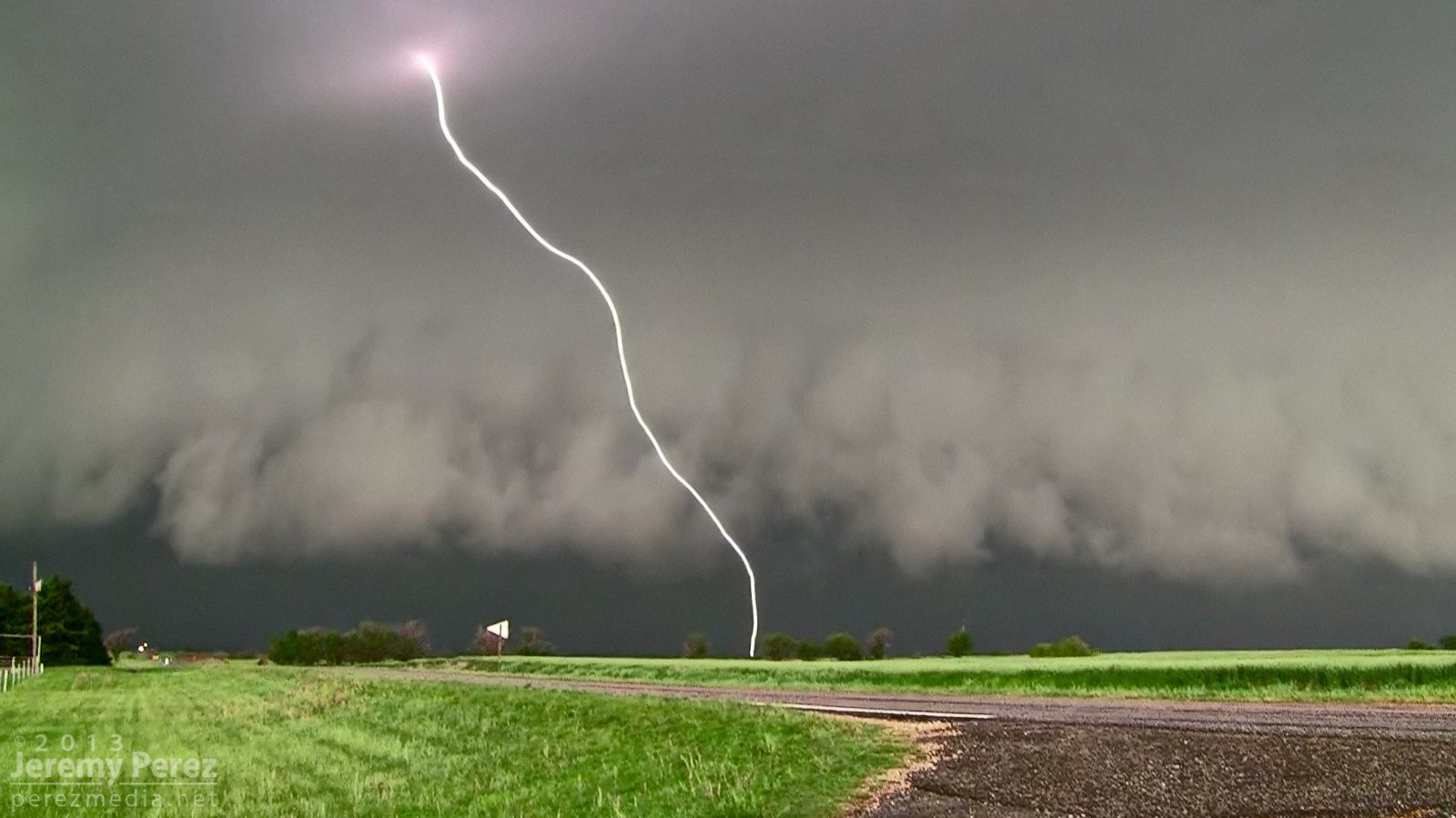
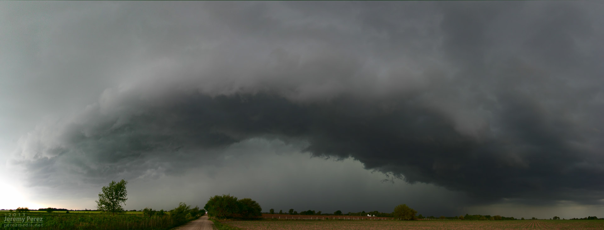
As storms matured, I made my way toward a cell approaching Oxford, Kansas. By the time I was positioned east of Oxford, the storm was HP and had a tornado warning. The look of the storm was incredibly menacing. The forward flank was lofting a ragged, low shelf that had the train-like appearance of an inflow tail as it led into the sealed notch between forward and rear flanks. Positive lightning strikes were landing just ahead of it and casting off great canon-shots of thunder.
Positive charge lightning strike, ahead of the Oxford HP Supercell (~2135Z)
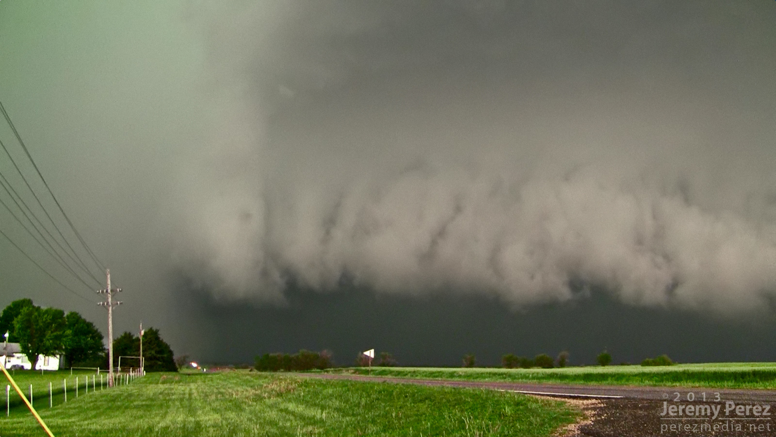
 Green rear flank rolls northeastward along the heavy forward flank of the Oxford cell

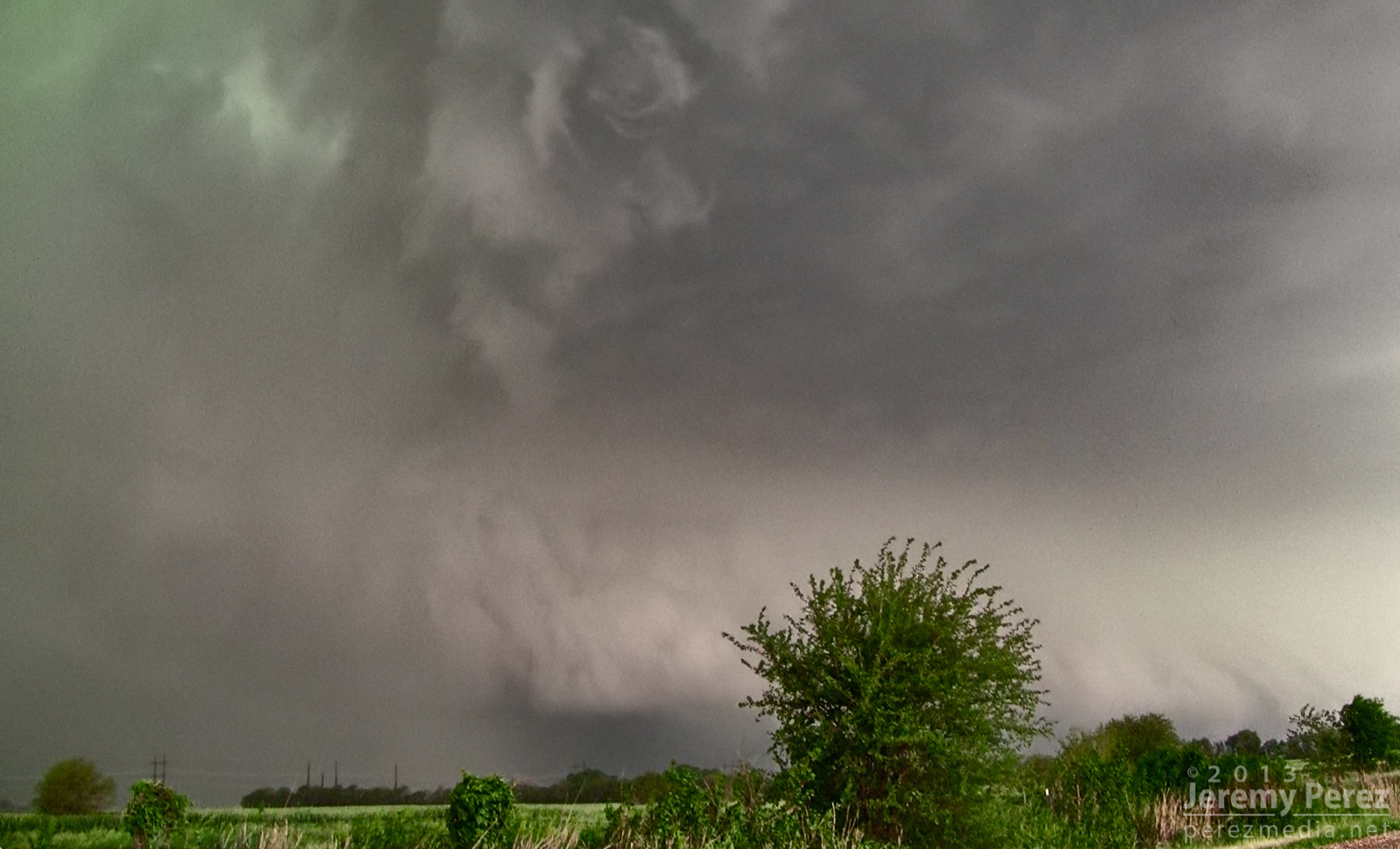
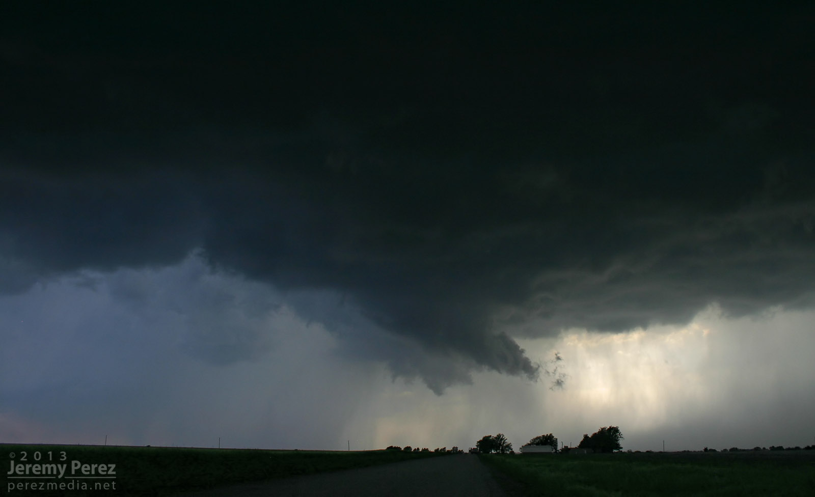
As the green RFD curtain approached, like it was rolling along the gears of the forward flank, I repositioned three miles further east. From this new spot, I witnessed rapid circulation developing in the rain free base just ahead of the FFD/RFD notch as a new RFD seemed to push out, trying to get ahead of the occlusion. The established RFD was moving in quick, so I had to abandon that spot and drive east to stay ahead. So I wasn't in position to see the tornado that was reported 6 minutes later about 6 miles northeast of that spot.
Circulation developing in the rain free base just ahead of the Oxford cell

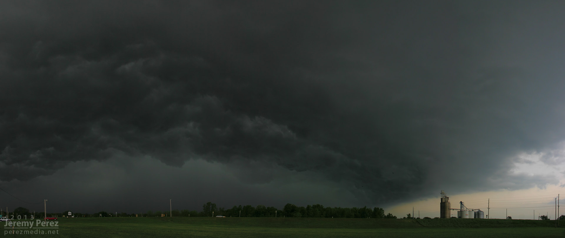
About that time, the Oxford storm started to congeal with others into a squall line. This convinced me to work my way southward to stay out of the mess and look for opportunities with any isolated storms on the tail end. I had some pretty impressive views of the advancing line as I headed south.
Gust front from Windfield, Kansas (2158Z)
 Another gust front further south near Arkansas City, Kansas (2242Z)

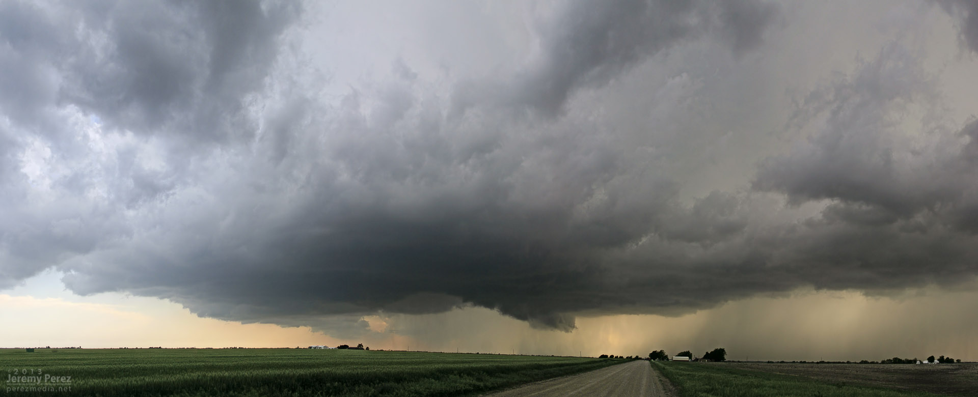
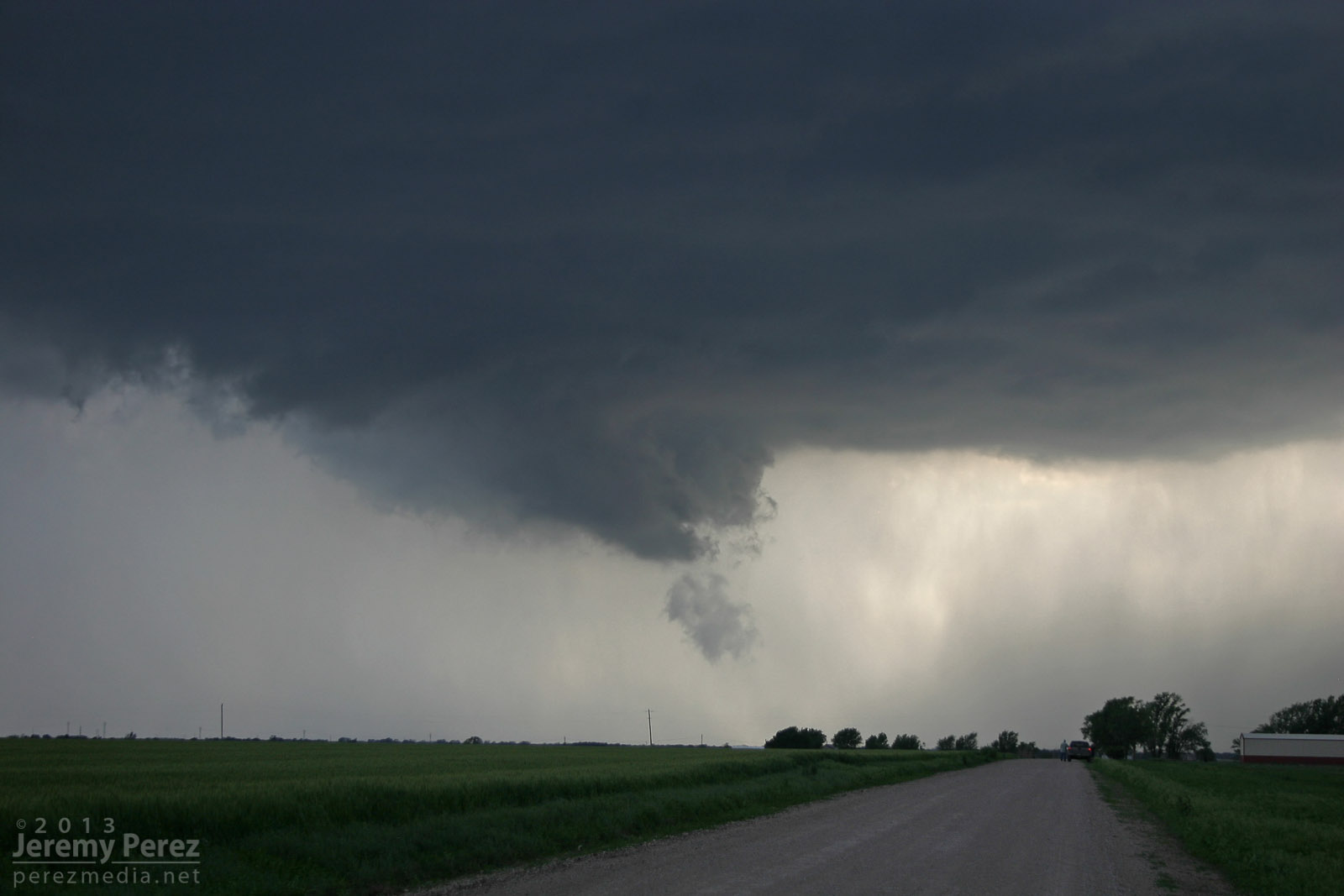
I eventually wound up on an isolated supercell near Newkirk, Oklahoma. I was able to hang out for a half hour in that spot and watch it approach. RFD was working its way into the base and encouraging a slender wall cloud to inhale scud, but it just wasn't strengthening. I was also concerned about the quality of roads to my east, so I let it go.
It picked up a tornado warning not long after.
RFD cuts into the rain free base of an isolated supercell 3 miles north of Newkirk, Oklahoma (2311Z)
 Scud rises into an anemic wall cloud on the Newkirk storm (2313Z)


Since new development was still trying to get going, I decided to give the farm roads to the east a shot. They were a lot better than I thought--pretty rocky actually--so I spent over an hour navigating north and east as I watched a very thin line of convection do pretty much nothing exciting stormwise, but did make for an excellent sunset display.
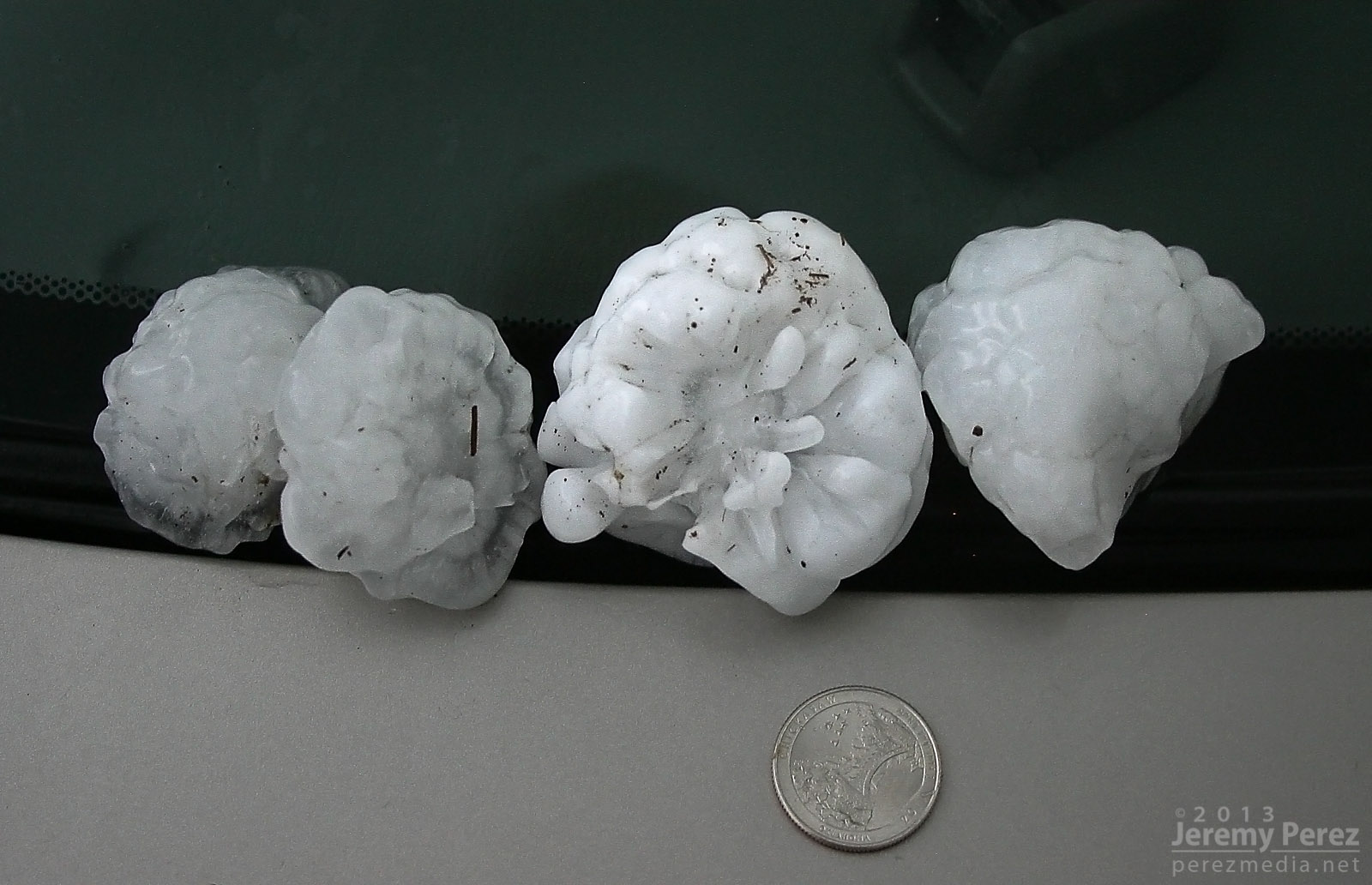
After finally getting back onto a paved road, back into Kansas, I noticed a severe-warned storm, moving up out of Oklahoma. I tried racing south to get ahead of it, but couldn't manage it. After it passed, I did get to sift through its wake and picked up hail as large as 3 inches along the roadside about 7 miles east of Maple City, Kansas.
Collection of large hail up to 3 inches (0130Z)


So, no tornadoes, but definitely some awesome sights on this chase, and on a Rozel-high from the day before. The dynamics near Oxford were unforgettable, and even though I missed seeing the tornado, I had an amazing perspective on that storm.
Full report here:
Oxford-Newkirk-Maple City, Kansas-Oklahoma, Supercells - May 19, 2013


")