2/24/07 FCST: OH/KY/TN/IA/KS/MO/TX/LA/OK/IL/AR

Not to be a doomsday prophet, but taking into consideration the time of year this system is occuring, the overall extremely volatile atmospheric setup, a forecast strong LLJ which would allow the storms to remain tornadic well after sunset, low storm/tornado visibility due to darkness/topography and recent fatal events during the overnight hours in this area, I believe we will see a significant number of fatalities from this outbreak if it all comes together as forecasted. Having examined recent fatal overnight tornado outbreaks with significant fatalities make me suspect this outbreak will be no different. In fact, due to the lack of severe weather awareness at this time of year and the potential severity of this outbreak, it may possibly be much worse in terms of fatalities

I sincerely hope this isn't the case, and although my comments tend to "stir up the stink," I still just don't see this as becoming a dooms-day, end of the world outbreak. Yes, I do see the models just as everyone else, but I'm also going on a little history, climatology, time of year, and overall speed of this system.

Almost a mirror of last year, to me it appears the system will kick out very fast and too far east of the traditional alley, so there goes your good chase terrain - at least traditional chase terrain of years ago. Second, it looks this could be a nocturnal event with screaming squalls throughout the evening. Third, with the recent cold air intrusions all the way to the Gulf, even with several days recovery, I'm still somewhat skeptical on TRUE gulf moisture getting far enough north where the better dynamics are forecast. And finally, limited surface heating due to widespread cloud cover due to streaming moisture ahead of the low. A stratus deck is very typical for these early-season systems with this type of flow and associated moisture overrunning dormant vegetation/terrain.

Again, these are just my thoughts. As stated before, there's nothing more I'd prefer than an active season starting early and giving everyone a great wealth of photogenic storms. All I'm saying is, BEFORE talking about fatalities, widespread tornadoes and an outbreak for the record books, there's more to it than just model forecasts. We've seen a lot of these early systems do the very same thing, so I'll remain skeptical until 1-2 days out.
 
Last edited by a moderator:
I will say this, 6 days out I have rarely seen a storm track take the same one that is indicated. More often then not, the track is *much* different, and dynamics are usually different too. A slight shift right now in the Pacific can change everything. Speaking from experience, we need to really watch this yes, but things rarely pan out exactly as 6 day model runs indicate.

The set up now looks juicy, the proof of all this will be if the runs can MAINTAIN their consistency. If I see one major shift or wobble in model thinking, or they suddenly go all over the dartboard, I'm not counting on any of this to actually pan out. Just my thinking at this time.
 
Almost a mirror of last year, to me it appears the system will kick out very fast and too far east of the traditional alley, so there goes your good chase terrain - at least traditional chase terrain of years ago. Second, it looks this could be a nocturnal event with screaming squalls throughout the evening. Third, with the recent cold air intrusions all the way to the Gulf, even with several days recovery, I'm still somewhat skeptical on TRUE gulf moisture getting far enough north where the better dynamics are forecast. And finally, limited surface heating due to widespread cloud cover due to streaming moisture ahead of the low. A stratus deck is very typical for these early-season systems with this type of flow and associated moisture overrunning dormant vegetation/terrain.


Some very good points there. I think if the system verifies close to the way it looks now, there will still be an outbreak at least in the southern states. Deeper moisture, slower storm speeds, and greater insolation prior to storm development would make this area much more ideal. To the north there'll likely be more linear squalls, and elevated hailers moving at very high speeds. The upper winds down south are more veered too, which is nice. As others have stated, the mid and upper level winds up north are highly backed, so I think supercells are much less likely up there.

Still all early speculation, but it's fun.
 
Almost a mirror of last year, to me it appears the system will kick out very fast and too far east of the traditional alley, so there goes your good chase terrain - at least traditional chase terrain of years ago. Second, it looks this could be a nocturnal event with screaming squalls throughout the evening. Third, with the recent cold air intrusions all the way to the Gulf, even with several days recovery, I'm still somewhat skeptical on TRUE gulf moisture getting far enough north where the better dynamics are forecast. And finally, limited surface heating due to widespread cloud cover due to streaming moisture ahead of the low. A stratus deck is very typical for these early-season systems with this type of flow and associated moisture overrunning dormant vegetation/terrain.

Again, these are just my thoughts. As stated before, there's nothing more I'd prefer than an active season starting early and giving everyone a great wealth of photogenic storms. All I'm saying is, BEFORE talking about fatalities, widespread tornadoes and an outbreak for the record books, there's more to it than just model forecasts. We've seen a lot of these early systems do the very same thing, so I'll remain skeptical until 1-2 days out.

We had systems to even kick out last year? LOL. They all kicked out the same? Guess I don't get how it can mirror a year as a whole. I guess I never thought of the problem being the speed they were kicking out.

Chase terrain. Since when is KS bad chase terrain?

It's going to be nocturnal? I thought it was too far out? To me it looks like it has much more potential to be an early event(like noon).

Cloud cover. It's pretty amazing what can happen in crappy cloud cover when you kick a vortmax out onto the plains like that. But hey it is too early to get specific...or at least I thought it was.

As it is more than model forecasts, it's more than every negative aspect one can post about.

Edit: Oh yeah and moisture. Low Level Jet I hope that is favorable lol. The gulf may have had a recent frontal passage but you have a decent tropical connection there, in advance of the system.
 
Last edited by a moderator:
Mike, your points are well put. We agree on some, disagree on others, and that's the fun of the forecasting. I did post some response to your most recent comments, but moved them to the "Weather and Chasing," as to adhere to ST rules. I'm anxious to see what the models show come 24-48 hours out!
 
Latest GFS run puts the storm much farther east and winds up over the great lakes. Forget consistency, we're back to the playing field with this one as far as GFS goes, folks...
 
I’m thinking very basically about everything. It’s early in the year, we don’t usually see major outbreaks in the southern plains (Keyword usually). While the GFS looks quite impressive, we all know that unless things line up just right, a major outbreak won’t happen. I expect that some key element(s) will be missing. Insufficient heating due to a nice stratus shield, or lack of deep rich moisture are some that come to mind with such early season systems. Some may disagree with me by looking at March 12-13 of last year (correct me if the dates are wrong). But at least we all agree on something right now. “It’s too early to tell” ;) However a nice strong squall line to kick us out of winter will be very welcoming on my part.
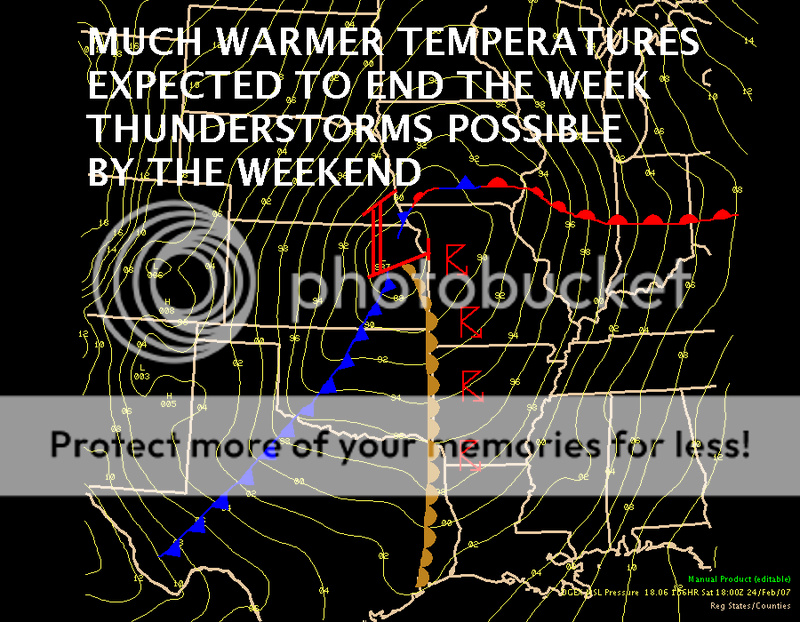
 
Having a look through (esp ECMWF output), at this stage, this is how I see it unfolding (albeit with the usual caveats of still being over 120 hours away!).

The strong system approaching the Plains starts affecting the region on Friday as height falls begin to overspread the region, and SSE winds transport Gulf air into the TX/OK region - dry line looks like setting up from SW TX - N Cent KS, with the best forcing appearing to be over the TX P'hndle/SW OK - shear suggests supercells, and with 60+dew points in place, tornadoes also possible. Overnight, squall line starts to take shape.

Saturday - squall line continues east, with some (but at this stage, not impressive) instability ahead of it - however, given the very dynamic set-up and strong shear, tornadoes seem quite likely, from MS/LA northwards towards IL. However, the most chaseable set-up maybe a cold-core type event over E KS/NW MO.

Plenty will change as the week progresses, but at this stage, a rather nasty event seems quite likely.

GFS is somewhat quicker with the progression of the trough - at least the 00Z run was.
 
I found an image that the NWS Springfield had designed and put on their page for the weekend's severe weather. It looks a bit similar to March 12-13 if I recall.

weekend_storms.png
 
This system is surely lacking in some areas as compared to the March 12th event. The plus is that this system is slowing down on the latest runs. The minus is that the mid-upper winds are pretty strongly backed...so would have to rely on very strong low level shear and deep speed shear to get things interesting. Also will have fast storm motions to deal with. Given the forecasts shown on the 06z GFS run, there should not be a problem getting low-topped tornadic supercells to organize...even though a squall line is likely to organize eventually. The target at this point would be between Wichita...KC...Joplin...and Tulsa for Saturday's chase. The surface low track is forecasted to take a Wichita to KC track from Sat. afternoon into the nighttime hours. Now the waiting game starts as to if there will be any other changes or surprises on the 12z runs. I would say Saturday is a green light go at this point for chasing. :)
 
Last edited by a moderator:
Okay, woke up this morning and headed over to my computer center to do a model analysis. Dissapointed last night (should not have been as run discrepencies are common), but glad to see models come back this morning to the original concencus, was certainly out to lunch last night's 00z. Just a little weaker on the run but the overall path fairly even with what it has portrayed the last few runs. From one who lives in the central plains, those far out glitches are annoying to see, but par for the course.

ECMWF and GFS are quite close with placement of the initial low...so consistency is pretty solid yet. Still reviewing the mid to upper level winds on this as looking at models and coming back here to post.

1. Upper level energy is definately there with this either way we go. Speed shear and directional shear look maximized in Missouri/Arkansas areas at this time southwest to NE Texas. Believe Illinois will also get in on the action as well at this point. Supercells in AR/MO/OK *should* consilidate into a fast moving squall line and move rapidly east into a line from Tennessee to Mississippi.

2. Dews to the mid 50s rapidly advecting north into the cyclone, with 60+ Tds even into Missouri will support the thunderstorm activity as a pronounced dry slot moves into Missouri and eventually SE Iowa.

3. Clouds should limit initial instability but shear and dynamics should over come. Expect fast moving supercells at the onset rapidly congealing into a messy squall line.

In my opinion do not expect this to be a chaser's dreamfest... as clouds and speed will make this difficult. However for those wishing to simply see convection and strong forward flank winds, it will be a sure arrival to spring in those sections.

This is just a quick analysis at this point....will look more later today for any revised thoughts and accept constructive criticism from peers more educated than I.
 
GFS shows something a bit simuler to 3/12/2006 in terms of the mean kinematic structure and placement of the sfc low/warm front. I don't see any reason why there wouldn't be supercells near the triple point upon first initiation, with strong, rapid low-level turning yielding enough boundary layer SRH to support strong tornadic supercells given that sufficient (+55-60F) moisture is also in place.

It wouldn't surprise me if there is problems early-on due to debries from earlier convection in the warm sector -- given that the strong low-level WAA will likely generate plenty of elevated convection in the latenight/early morning hours near the warm front. However, I'd assume things could clear up by the afternoon, with the strong DPVA/frontal forcing + warm/moist advection likely being enough to kickoff strong supercells near the sfc low and along the dryline/sfc trof, given the strong deep/low-level shear and likley sufficient CAPE in place.

I doubt that I'll be chasing this system, but I sure wouldn't have minded it, if I had the money. My laptop was stolen, and my miniDV is pretty screwed up. I probably won't bother to chase until April given the lack of funds. I just hope this season won't be like the last one... :rolleyes:... On the other hand, I am about that age where I could get a credit card, though... :D
 
Saturday's setup

Good post Nick...I like the early afternoon setup more than anything if the GFS 12z is to be believed. The only thing that keeps me from believing this is a 3/12 type setup is that the flow on 3/12 had a better veered component. The Sat. event 500mb flow is almost 190-220 in the area of interest. I think the directional shear is pretty darn good and that just a bit of CAPE in that sheared environment can go a long way.
 
Last edited by a moderator:
I agree....looks like the models are slowing things a tad. My location here in Alabama may remain capped until midday Sunday but things may kick off pretty good here with descent height falls and frontal forcing. Good boundary layer RH and vertical shear should allow severe storms (inculuding supercells) to fire if the cap can be broken. It looks like the more favorable thermodynamic and moisture fields could be found in my region later in the period. Looks really nasty near the better upper level dynamics across AR/MO/SRN IL/WRN TN where some strong tornadic supercell potential remains. KMEM talks about an occlusion possibly holding down instability across portions of there region, but I just don't see it. They also favor more of a linear mode than discrete.....it's too far out at this point to be determining that though. A good event looks on tap for the early season to say the least. :)
 
Fairly exciting first chase op. Was the first time I cracked open a model this year. Still fun, even at 120 hr.

System looks to have a healthy neg tilt at this point. Hard to believe that quality Gulf air is even a possibility, but will be watching during the week as things swing into gear. 500mb speeds currently look to be around 50 kts depending on location, so who knows ... it may even be somewhat chaseable. We'll see I guess. Not overly optimistic about that this time of year.

Current target (if things don't change during the next five days) for me will probably be Topeka to KC. Want to be close to the TP this time for manageable storm motion. Hopefully we'll have good moisture and some isolation at first, at least.
 
Last edited by a moderator:
Back
Top