1960s/1970s weather radar images

Joined
Mar 18, 2004
Messages
571
Location
Lawrence, KS
I am doing research and a case study over a supercell that had long track violent tornadoes with it on May 19, 1960 across Northeastern KS. Here are some radar grabs from Topeka. From my understanding there was a violent tornado on the ground at the time that these were captured. The tornado was reported to be up to 1 1/2 miles wide at times. The storm itself passed within 20 miles of Topeka. About 20 miles northwest of Topeka this tornado also destroyed an old school house where the current house I grew up in is. This page of images is from the June 1962 edition of Monthly Weather Review.

A picture of the tornado when it would have been over where my parents house currently is and a picture I took a few months ago that shows where the tornado was 45 years ago.

tornado%201.jpg
today2.jpg


radar.jpg
 
Nick,

I think that is a radar image of Hurricane Allen from 1980.

Pat
 
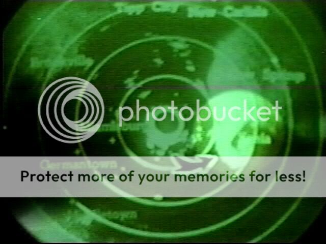
Here's the image I was thinking of from the other day... it's from a radar at WHIO-TV (4/3/74). The green phosphors don't stay lit long, even with a high antenna rotational rate.
daytonradarhook.jpg
 
Just ran across a "Weather Note" from Monthly Weather Review about contoured radar displays. Written in 1964 by Neil Ward. This would later evolve into the "Video Integrator and Processor", which began implementation at WSR-57 sites in about 1968.

http://docs.lib.noaa.gov/rescue/mwr/092/mw...092-10-0475.pdf


A Display of Radar Echo Maximum Intensity in Use at the National Severe Storms laboratory
http://docs.lib.noaa.gov/rescue/mwr/100/mw...100-01-0008.pdf

Hooked Echo Associated With Snow Showers
http://docs.lib.noaa.gov/rescue/mwr/097/mw...097-06-0462.pdf

There may be more papers of interest that contain images... I just searched docs.lib.noaa.gov on Google.
 
I did get to see the radar display I posted early without state lines or cities for a day back in the early 90s. The display zoomed in and moved quadrant by quadrant with the map and cities flashing on and off the screen. The data block was also in the wrong place.

If you wanna see the Jackson, MS radar in action (zooming to different ranges and flashing level 4 and 5), click this link http://www.minneapolischazz.com/twcclassic...989%20832am.wmv
It appears for the last 10 seconds of that local forecast. I have other videos of this, but they aren't online now (from that site).

Found this while looking through my radar archives... It's a still frame from the radar animation in the PBS special "Tornado!" from 1985. Radar is the WSR-57 at Neenah, Wisconsin.

Neenah6-8-84WSR-57.gif
 
Great radar image, Nick! Thanks!

Wonder why they didn't use an image from the 74c in Madison? Guess it doesn't make that much difference (I'm sure they couldn't get hold of any), but it may have shown the structure of the Barneveld storm a little better.

Pat
 
Wonder why they didn't use an image from the 74c in Madison? Guess it doesn't make that much difference (I'm sure they couldn't get hold of any), but it may have shown the structure of the Barneveld storm a little better.

From my experience, only the network radars had the equipment to take radar image pictures like that. The 74C was a local warning radar. The 74C's I used (FSD and SPI) did not have that capability.

Chris G.
 
Wonder why they didn't use an image from the 74c in Madison? Guess it doesn't make that much difference (I'm sure they couldn't get hold of any), but it may have shown the structure of the Barneveld storm a little better.
The network 10 cm radars all had cameras that took pictures of the image every so many minutes (archived at NCDC) while the 5 cm radars like the one in Madison did not have those cameras.

It takes me back to my grad school days at UW-Madison where an enhanced loop of the Barneveld storm from the Neenah radar would be playing nearly continuously on the McIdas monitors in various rooms. It looked like a mini-hurricane in animation.

Edit...Chris beat me to it.
 
I have a black and white photo of the WSR-74C radar at Indianapolis from the June 2, 1990 tornado outbreak. I thought none of the 74Cs had photographing capability, but this one apparently did (a series of photos were used to make contour tracings in a study of that outbreak).

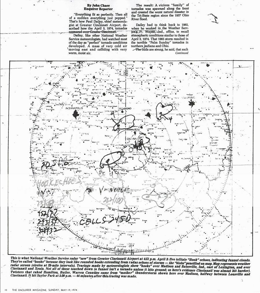
I thought it was common at all sites for the radar operator to make tracings on 12" x 12" mapping paper.
radar_echo_tracing-small.jpg
 
I was only thinking about the one I knew about in Rapid City. Come to think of it they didn't take pictures, did they? :)

After reading Nick's post, perhaps some took pictures while most didn't.

Pat
 
Back
Top