1/2/06 Bust: Capping Inversion Question...

Wow - those supes ahead of the line in KY really are getting their act together aren't they ... the one on the KY/TN line in south-central KY looks PARTICULARLY interesting to me. They have included the 'can and sometimes do produce tornadoes' in the svr t-storm watch language there. The entire line has a string of pearls look to it for the time being anyway. Sorry if this is discussion has started to reach the limits of this forum ... Brett's comments just made me take a look at radar for the first time - wow.
 
bmx.gif


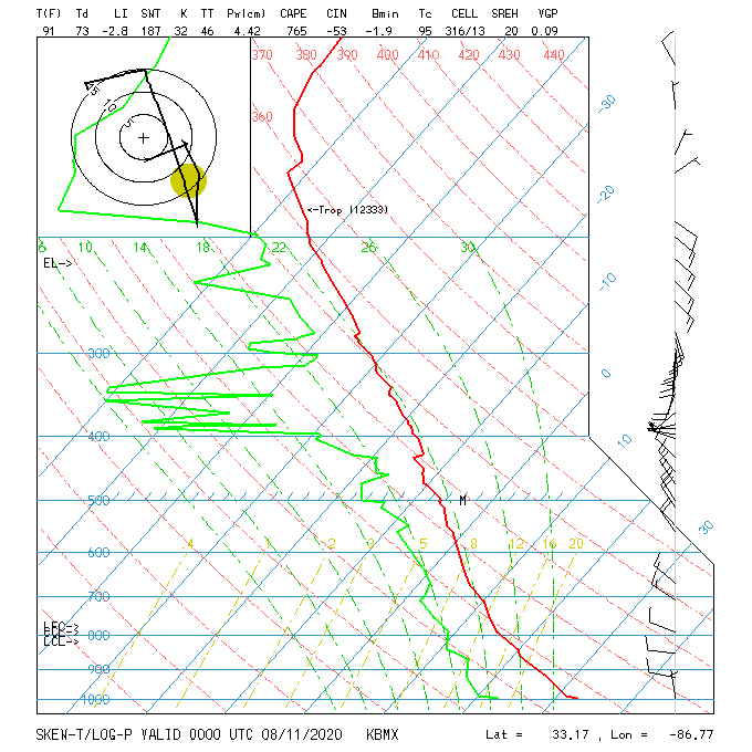
Special 18z sounding from BMX....I guess models were wayyyy off.
 
I'm not sure there is anything that is publicly available any more, but during events you can't go with model soundings from 12+ hours before. If you don't, at the least use the RUC analysis sounding, but not a forecast, to help pick up small (but very important) details.

- Rob
 
Aircraft soundings are integrated into RUC forecast.. Use w/Tamdar at Java soundings at FSL website expirementaly into the RUC DEV2. Not avaliable in raw format just RUC soundings and products which use it. I've seen at least one study about the improvement in having more correct moisture profiles during convective events not much else, yet.
 
Yeah, I usually use RUC soundings... Alot of times I have to manually adjust/modify the sounding in the low levels, as it usually has incorrect T/Td's resulting in either unusually high or unusually low CAPE. It's also a hassle because the temperature profile can sometimes be significantly off (for instance - comparing a 00Z RUC sounding to an actual 00Z RAOB). I imagine this would hold true for other hours of the day as well, not just the observation times. I think I'm gonna start pulling in the high-resolution RUC, I'm currently ingesting the 40KM stuff.

Anyway, I'm definitely not gonna chalk this one up as a bust. Within a couple hours of this thread being started, things got pretty active.
 
Yeah direct sampling is the way to go in the upper and mid-levels. Lets take a look to see just how different a 6hr forecast can be from reality.

NAM 18z 6hr forecast sounding for Dodge City, KS:

MB T T/TD
927 9.5 -1.6
850 9.8 -15.4
700 1.5 -14.2
500 -12.5 -28.5
300 -41.9 -48.2

SOUNDING:

MB T T/D
923 11.4 -2.6
850 9.0 -19.0
700 2.4 -15.6
500 -12.7 -37.7
300 -42.1 -48.1
 
I'm not sure there is anything that is publicly available any more

You are correct. It is protected I believe. I accessed it on a NOAA computer once or twice but you can't get it on a home PC. Sorry guys :( The TAMDAR soundings are integrated into the RUC though so you can always try to find the most up-to-date RUC sounding that you can.

...Alex Lamers...
 
Back
Top