• While Stormtrack has discontinued its hosting of SpotterNetwork support on the forums, keep in mind that support for SpotterNetwork issues is available by emailing [email protected].

05/23/07 REPORTS: MN/WI/NE/IA/KS/MO/CO/OK/NM/TX

Pictures from the 23rd May 2007 chase. Eventful from a structural perspective - otherwise the tornadoes were hard to come by.
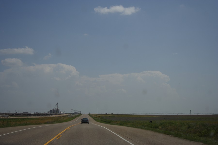
Headed south towards Perryton, Texas and I knew we had to be there fast

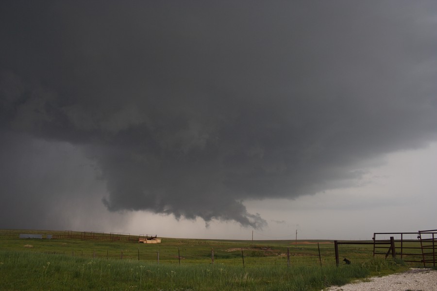
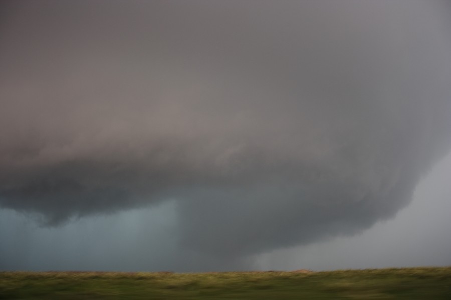
Rotating wall cloud SE of Perryton (first tornado warned storm?)


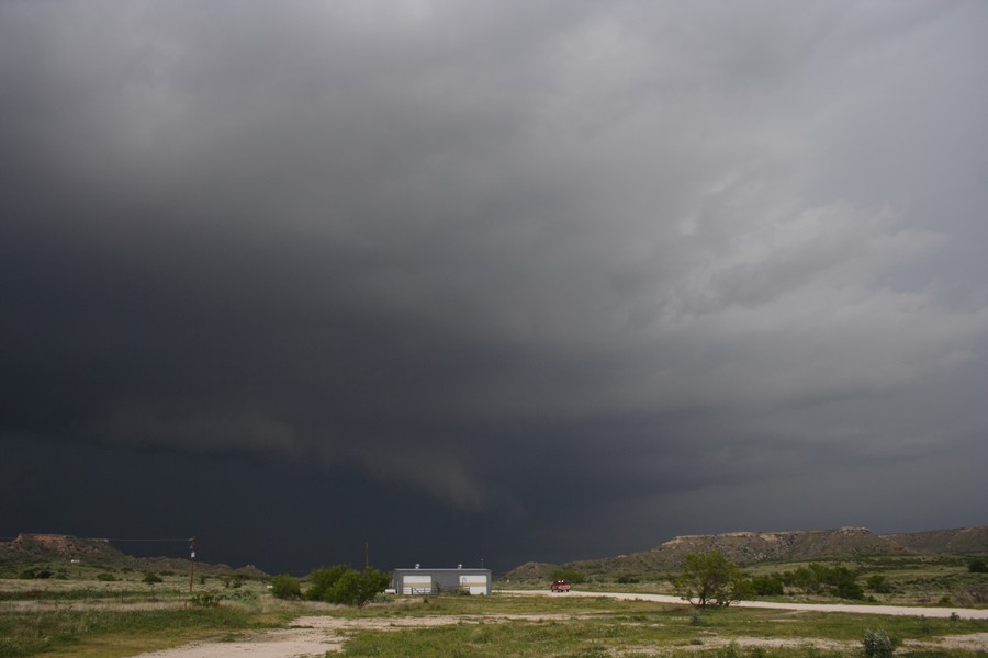
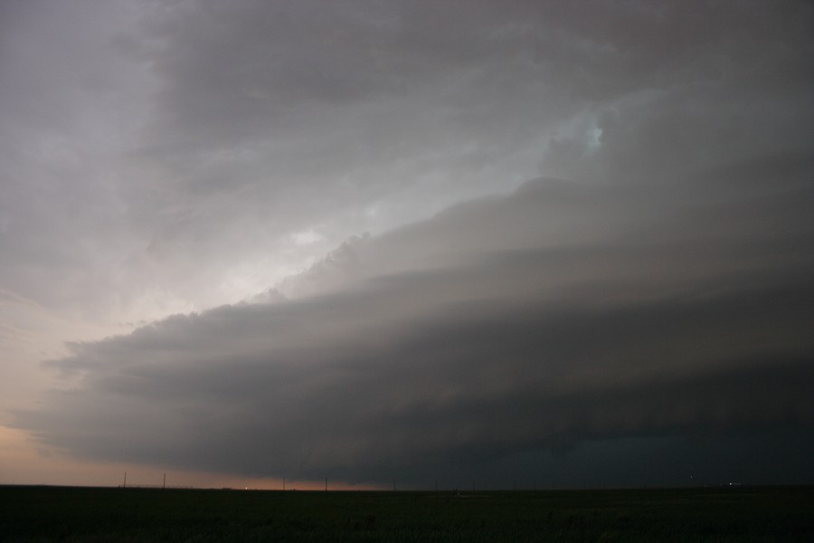
View of the supercell in Wolf Creek Park, due south of Perryton

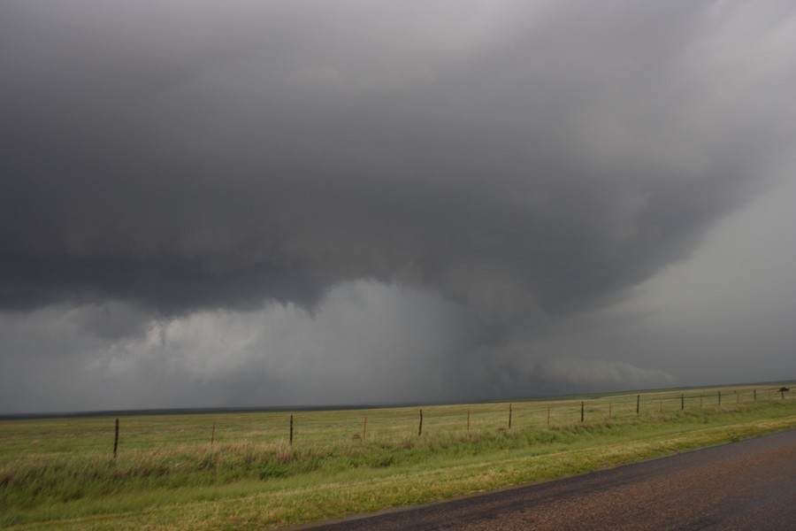
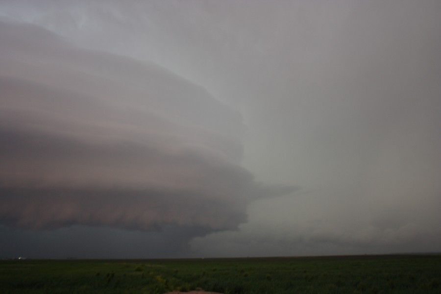
Supercell trying to wrap W of Libscombe - perhaps the few spin ups mentioned - have suspicious activity video
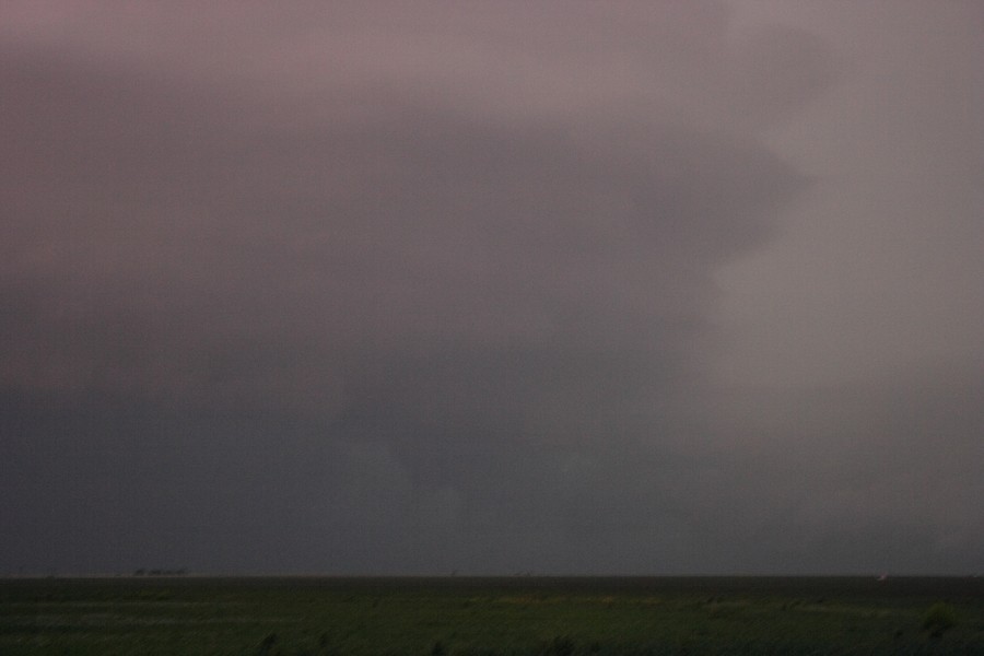
Further north

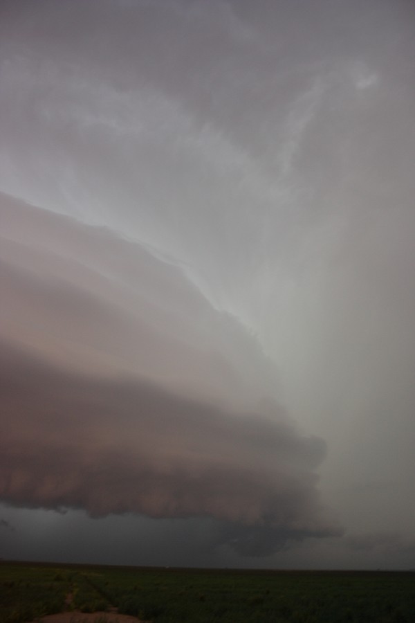
We emerged from the E side of Libscombe and look what emerged from the rain - awesome! I really like this structure.

We had pizza in Perryton than attempted to intercept the tornado warned storm approaching Libscombe. We would not have made it and the water across the road - we did not attempt to cross being night.
Regards,
Jimmy Deguara
 
Last edited by a moderator:
20070523_P1013318_sm.jpg


Michael and I were on the Laverne/Buffalo, OK storm from initiation. Followed it northeast where it almost tornadoed in the pic above.

20070523_P1013321_sm.jpg


As we followed it north to almost Buffalo we came around the corner and had tumbleweeds lofting into the air only 50-100 feet in front of us in a vigorous swirl. We counted this 30 second event as the only tornado of the day for us.

The storms to the north became weak due to anvil shielding from the southern storms so we blasted all the way down south and enjoyed the meso west of Lipscomb along with everyone else. Not a bad chase but kind of dissapointing for a PDS watch.
 
The WXtreme Chase Team intercepted the initial storms developing W of HWY 70 and followed them up to NE Lipscomb County, then returned SW to intercept the easternmost of the southern storms along SR 281. Here are a few pics.


Brief funnel on the first storm along SR 281 a few miles W of HWY 83 at 4:29pm.
wxtreme_2007047003.jpg


View of impressive HP core at 5:53pm
wxtreme_2007047002.jpg


(Still from video) Apparent partially rain-wrapped night-time tornado along SR 281 W of HWY 83 at 9:47pm. Visibility in the lightning was not ideal (!), but our doubts regarding whether this feature was a tornado were lessened somewhat when we heard spotters report power poles down at CR 23 along SR 281 about 5 miles W of our position shortly after we shot this segment of video...
wxtreme_2007047001.jpg


Website updates to follow.

Gene
WXtreme Chase Team 2007 Chase logs and pics:
http://www.geocities.com/genet_99/wxtreme_2007_029.htm
 
Last edited by a moderator:
Hi,
Although not the best photograph due to not using a tripod, this photograph coincides with the "possible tornado" 6 SW DARROUZETT 7:39pm CDT during the late afternoon / evening period - perhaps 10 minutes later. We had strong ESE inflow during this phase:

A few possible tornadoes and definite funnels though will have to view video to see what really was going on. I would not bet on it. We have scored a few dents on the car panels after entering the notch but it was worth the photograph opportunity as well as observe the circulation.

Regards,
Jimmy Deguara
 
Last edited by a moderator:
Canadian River Valley in the Texas Panhandle

SHORT...Great chase forecast and in-the-field chase decisions, but zero road options in the Canadian River Valley prevented us from witnessing the very probable significant tornadoes over eastcentral and northeast Hutchinson County, Texas east and northeast of Stinnett. Thought we might have seen the backside of a wedge northeast of Stinnett.

LONG...RJ Evans and I measured wind gusts to 61mph and golfball hail from the core of the first supercell of the day in the TX Panhandle as it crossed the roadside park on TX 70, a few miles north of the Canadian River in extreme northcentral Robert's County, TX. Road options stunk so we had to follow it ENE from the core all the way to southwest Lipscomb County observing lots of nickel and occasional golfball hail and winds gusting as high at 61mph from TX281 across southeast Ochiltree County. Great GR level 3 data feed showed periodic meso generation to our south and southeast, but it was apparent the storm had outflow problems. We finally got a good look at the updraft at the Lipscomb county line and said goodbye as the storms really started to line out/gust out. A long shelf cloud and racing southbound scud stratus was noted while driving westbound on TX281 across southern Ochiltree County.

We repositioned west and southwest to a new supercell moving from Fritch towards Stinnett. We punched the core from the north and witnessed lots of close CGs and small hail approaching Stinnett from the north. Measured northeasterly wind gusts to 61mph(?) feeding into the meso about 3-6 miles to our southwest and saw a neat eddy vortex while passing through downtown Stinnett. We positioned on the south edge of town as a rapidly rotating wall cloud passed about a mile from us.

Stinnett lucked out since the probable significant tornado waited until it was just east/northeast of town to touchdown in the uninhabited Canadian River Valley. We drove east a few miles on a paved county road towards Dial, but that's as far east as we could go. Radar signatures went wild at this point with a big hook, very high, large-scale rotational velocities and TVS were noted on GR3. However, our view was obstructed by the hook. A giant RFD notch was noted to our northeast. The rain curtains cleared briefly and we observed a very large, dark, blocky lowering that was either a wedge tornado or a very low, solid, cylindric wall cloud. We tried to reposition to even higher ground, but to no avail. Ouch :?

Our only safe option was to drive southeast and east for 60 miles through Borger and Pampa and north on TX 70 again to the Canadian River Valley in northcentral Roberts County. So this is what we did. We pulled our hair out watching the evolution on GR3 as the meso handoff occurred and another probable significant tornado was apparent over eastcentral/northeast Hutchinson county. No tornadoes noted on the AMA LSR since the area is uninhabited/roadless and the groundhogs won't phone in their reports. :lol:

In the twilight at TX70/283, the supercell was a giant spaceship with continuous lighting to our west through northwest. It put on quite a show with periodic anvil zits in the vault region. We both shot video. A wall cloud organized to our west through NNW, but never produced a tornado that we could see. We gave up around 0245z as the storm developed a laminar, horizontal cigar gust front to our north-northwest and appeared to be lining out on radar.

In retrospect, the event behaved about as I thought it would. I briefly thought the dryline might fire, but my earlier fears of loss of convergence due to falling pressures/backing winds held true. Lots of convective line problems along the front, particularly towards evening, but a kick-butt tornadic supercell at the western-end of the line east of the triple point during the evening. However, a worst-case scenario with the road options.
 
Wow, we went an entire chase day without seeing another chaser. Now there's a feat in this day and age. It was actually kind of nice, but then again I enjoyed Tuesday a lot too, with all the commotion and tornadoes and what not.

Anyways, we chased all the stuff in SC Kansas around Hutch and Pratt and McPherson. We were on two or three tornado warned storms throughout the afternoon and saw some decent rotation but no tornadoes. It was still quite the fun chase though, what with all the hail we had to drive through.

Also, we saw sooo much flooding up around McPherson and south of there on highway 61. We had to drive over a few water covered roads. (Tsk, Tsk...turn around, don't drown.) Not only that, but there were entire trailer parks and houses underwater. The lightning wasn't too shabby with these storms either...

Oh, and we ate at the same KFC in Pratt. It took forever to get our food too, and the bathroom there was more than a little gross.

Here's one of the flooded roads:
IMG_9003.jpg


This storm went on to go tor warned. It was glowing green with hail
IMG_8967.jpg


This was in a small town just south of McPherson, we saw quite a few flooded roads and houses:
IMG_9071.jpg


yours truly:
IMG_9037.jpg


....and a storm behind our truck:
IMG_9024.jpg
 
Targeted McLean on I-40 with high expectations. Diffuse dryline was present to our west and a north-south retreating boundary had just passed to our north. Ended up playing the early convection on the boundary. Was on the first HP supercell NW of Pampa from 4:30p until about 9p. Storm looked the best early on but the first RFD occlusion (usually the best in my experience) was cold.

A bit disappointed but every chase is different. Here's some screen grabs of the possible tornadoes and a link to the tornado that was reported near Wolf Creek....I'm doubtful unless the touchdown was very brief, we were quite a ways away. The night shots are from north of Follet, around 8:45-9p before we let the storm get away into the OK Panhandle...this was the most probable tornado we saw.

Overall, interesting chase in tough road conditions. Upper-level flow was lacking and might have helped in terms of updraft separation and prevented HP supercell structures.

Video
http://www.youtube.com/watch?v=zh4aRUrJ_Ug

Pics
http://weather.ou.edu/~aatkins/weird.bmp
(What the heck was this appendage, it was above surface inflow level atop the RFD gust front, on the northeast side of the updraft) INSIGHT PLEASE?

http://weather.ou.edu/~aatkins/funnel1.bmp
http://weather.ou.edu/~aatkins/funnel2.bmp
http://weather.ou.edu/~aatkins/funnel 3.bmp
http://weather.ou.edu/~aatkins/funnel 4.bmp
http://weather.ou.edu/~aatkins/funnel 7.bmp
 
Last edited by a moderator:
Well me and my chase partner left Okc a little later than I wished. Made it to the storm that was Tor warned by Buffalo but once we got there it was falling apart. After we slid around on some muddy back roads around Buffalo we decided to head over to the storm that was passing the through Lipscomb county. We made to to that storm and parked on a hill south of Follett for about 20 minutes watching the storm trying to make a new wall cloud. We went ahead and headed up towards Follett and the storm looked to have made one or two small funnells. We sat just the east of intersection 2741 and 15. We were watching some areas of interest that were illuminated by lighting. i was running video and Sergio (chase partner) was doing still's. Got a fantastic shot of what looked to be a funnel/tornado illuminated by lightning. After deciding I didn't want to run on back roads at night we headed back to Shattuck OK, were we were waiting for the beast in Lipscomb to come our way. As it proggressed (spelled that wrong) east it then started to crap out so we thought we would try and get some more lightinging shots. In trying to lock the images on the memory card we accidentally reformated the memeory card.:eek: FREAKIN YEAH! Oh well, just some of the interesting things that happen I guess. But as soon as we get some screen shots from the video i will post them. Take care everyone and happy chasing!
 
Last edited by a moderator:
Saw four supercells on Wednesday. The first was a well-structured classic supercell southwest of Buffalo, OK. The second supercell developed shortly after the demise of the first, also to the soutwest of Buffalo. This supercell weakened so we targeted the HP supercell in Roberts/Ochiltree/Lipscomb county. Finally, on our way back to Norman, we decided to target a tornado warned storm in the Lipscomb area.

Around 10:25 p.m., we emerged from heavy precipitation to see a gigantic barrell mesocyclone in southwestern Lipscomb Co. Interestingly, NWS AMA opted to drop the tornado warning. Regardless, the storm had incredible classic supercell structure complete with striations, rear-flank downdraft, and a very low wall cloud at the updraft/downdraft interface. Around 10:40, a lowering materialized to our north (near the intersection of Highway 23 and FM 3260) and began to rotate rapidly. A tornado quickly touched down along and just to the east of HW 23. This tornado became quite large (perhaps up to 1/2 mile wide) with as many as 4 sub-vortices observed at one time. The circulation was somewhat diffuse, but it was very dynamic nevertheless.

10:42 p.m. Multiple-vortex tornado. View is to the north along Highway 23.
multivortex.jpg


10:43 p.m. Multiple-vortex tornado. View is to the north along Highway 23.
multivortex2.jpg


Gabe
 
This was one of those days that was amazing, but not necessarily for the tornadoes.

Reed and I started out on the storms northwest of Canadian. It was pretty obvious that the storm was having outflow issues and that if it produced it would likely be small and brief. We stayed on it till we saw the storm going up in Hutchinson County, then we started diving back to the southwest.

Since the road options are terrible in Hutchinson County we had to make a decision as we headed south on 207 toward Stinnett. Either we drove into Stinnett or we took a little paved road south off of 281 about 7 to 10 miles east of there. After a brief discussion, we decided that we were likely too late for the first option so we did the latter. Even though the map showed the road abruptly ending 15 or so miles south of 281, we new it would give us the best option of seeing anything. After a few miles of pavement the road that goes nowhere turned into gravel, but we kept punching south as the base came into view.

What transpired over the next twenty minutes was absolutely amazing. The storm initially had a huge circular rain free base and was by far the best we had seen that day. It was a little high at first, but that took about two minutes to change as a large area of scud quickly developed just to our south and connected to the parent storm. The wall cloud slowly moved to the northeast and was rapidly rotating. It kept putting down funnels, several of which likely touched down but we can't confirm because we couldn't see the ground directly below the funnels. The wall cloud got about two miles to our east and then started moving back northwest then west as it rotated around the parent meso. We could see the hook wrap all the way around to our south then east and sporadically there would be a few rain curtains completely wrap around the wall cloud. The area inside the hook was completely rain free (we had no rain for most of ten to fifteen minutes), was at least five miles across, and was full of lightning (we had multiple close strikes). As the wall cloud continued it's trip around the storm it began moving to the southwest and was now due to our west where it put down two or three small tornadoes. This time we could easily see the debris (grass and leaves) on the ground 1/4 to 1/2 mile to the west and southwest. Our winds went from strong out of the northwest to east to strong out of the southeast in a ten to fifteen minute span as the wall cloud did a complete revolution around us. After a few more minutes the wall cloud dissipated just to our south (exactly where it began) as the cycle completed. It was an amazing experience and I've never witnessed anything like it in 10 years of chasing. It looked like it might put down something big several times but for some reason it was content with multiple small tornadoes.

I'll see if I can get Reed to put up some vid caps later.
 
I targeted Woodward, OK yesterday and jumped on the supercell south of Laverne just as it began developing a wall cloud. A tornado warning was issued and things looked promising for a brief period as it moved between Laverne and May, with nice rotation and brief funnels, but it quickly fell apart as it approached the southwest side of Buffalo. There was a report of a weak tornado with this storm, but I never saw anything on the ground, nor did any of the other chasers I talked to around this storm. I did come across golf ball size hail on the side of the road north of May. I then rolled back to the west a few miles to catch a new storm near and to the northeast of Rosston, OK that developed a nice lowering which prompted a new tornado warning for Harper county, but still no tornado and after following the same pattern as the first storm, it all fell apart as it reached the Kansas line. Heard reports of a beast supercell that was tornado warned in the Ochiltree/Lipscomb/Roberts counties, TX area, so we flew down that direction to catch the storm as it was entering Lipscomb county. Awesome structure with this thing and observed some brief funnels, but I never saw anything on the ground. I wouldn't be surprised if there were brief touchdowns though as I did see one or two suspicious funnels. I stayed on this storm until dark, then I headed back home. So, I saw 3 supercells that could've produced a tornado at any time, but never did. Could've been a better day, but not bad. I still had lots of fun.
 
We managed to intercept the initial tornado warned cell at the Roberts/Ochiltree TX county border. We stayed with this cell until dark in Lipscomb county. We could not pick out a defined tornado all day.

I don’t get caught up in tornado counts and this could be my imagination. The below were taken at 8:12 PM 5.9 miles south of Darrouzett, TX. GPS log show image was taken at N36 21.678 W100 18.251. The second image is a simple crop that might be debris cloud? A high resolution image is available on my website. www.gobob.com. I would appreciate feedback (PM is fine if you don’t want to clutter up this forum) if you think this is or is not a tornado.

-Bob Hall
WX5SKY
BlogMap.jpg


Darrouzett_1.jpg


Darrouzett_2.jpg
 
Here is a clip from our chase in northeast Hutchinson County, TX.

http://youtube.com/watch?v=BNqr3TwTmnQ

In order to view the base, we had to take a gravel ranch road about 5-10 miles south of 281. The storm had incredible structure but was initially high-based. A very low wall cloud developed rapidly a few minutes later, and was very low to the ground with intense rotation. It initially organized to our east, and our wind was about 30 mph out of the north. Over the following 20 minutes, the wall cloud moved west, and circled completely around our position. When the circulation eventually oved to our east, the surface wind shifted to a southeasterly direction and immediately warmed...a few seconds later, two brief tornadoes touched down just to our southwest.

The wall cloud was so large, and the rotation was so rapid, we thought a large tornado was a certainty. It appeared that the storm may have ingested some cold outflow from the storms to the northeast.
 
Back
Top