I have to be brief since I am using batteries on a slow wirelesss connection from somewhere. The hotel's high speed is down and I don't want to connect the the wall because of lightning power surges. The area is getting hit with a severe storm. I am in Great Bend, Kansas after an amazing day of storm chasing. I saw both a nice tornado and great storm structure. I awaited initiation in Hoxie, Kansas. Three storms formed, one to my north, the other over me and one to the south. The southern storm was stronger. I drove east, then south on a gravel road. The southern storm (that was moving north) split too soon and the righthand split was moving more east north east. My way south was blocked and the road network east was very poor.I had to double back, then go east on 24 then south at Hill City on 283 . As I drove, I could see the righthand split developing and become tornado-warned on radar. I turned west on a gravel road. The storm was to my southwest. it was high-based but already had a wallcloud.
http://www.harkphoto.com/052207wallcloudfirstmeso.jpg
The first storm developed a brief funnel but no touchdown.
http://www.harkphoto.com/052207funnelfirstmeso.jpg
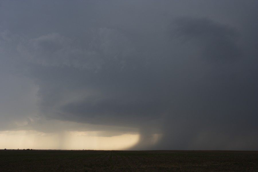
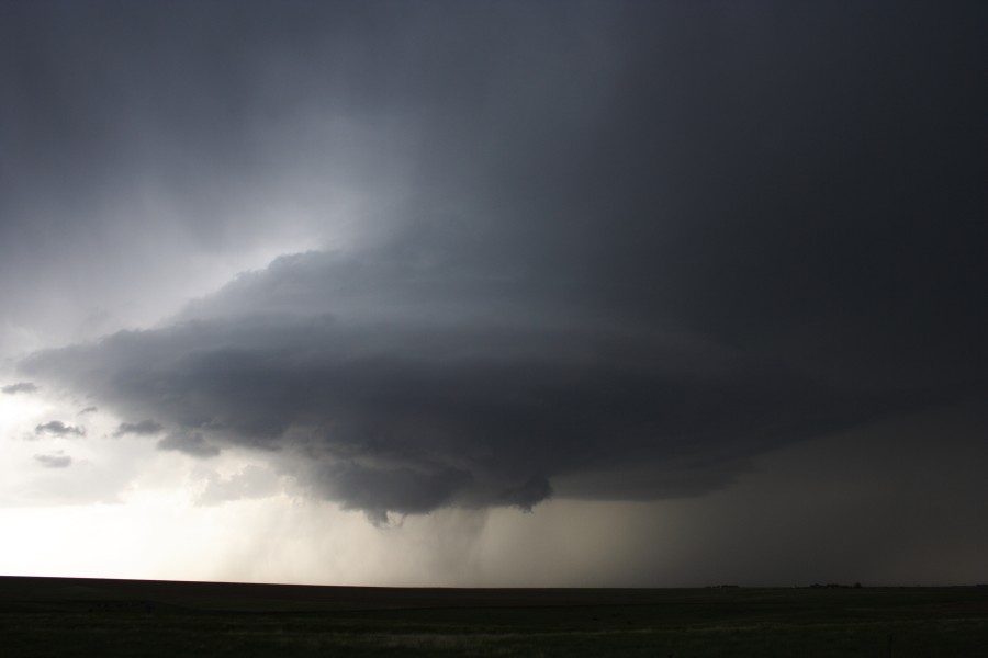
The storm was backbuilding to the south and another meso formed. I dropped southwest for a better view.
http://www.harkphoto.com/052207mesovault.jpg
Here is a wideangle view.
http://www.harkphoto.com/052207mesovaultwide.jpg
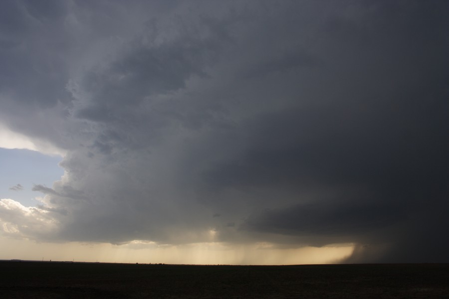
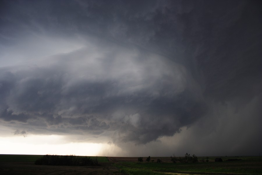
As the storm slowly moved northeast, the base lowered and it stregthened. I drove east and north.
http://www.harkphoto.com/052207stormbeforetornado.jpg
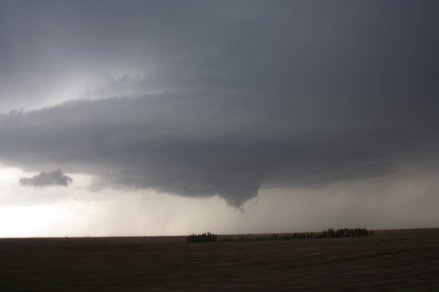
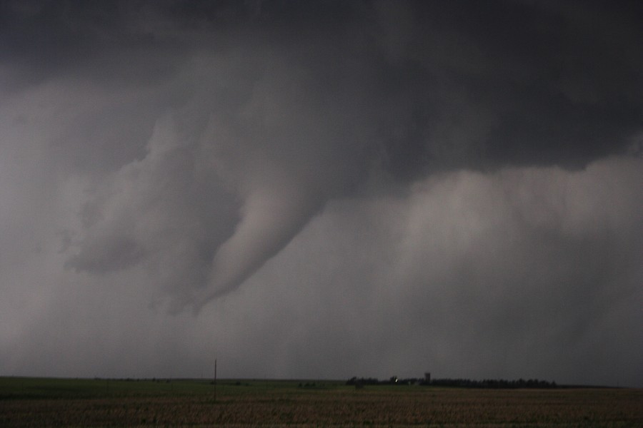
I saw a rapidly rotating wall cloud, then a funnel formed.
http://www.harkphoto.com/052207funnelcloud.jpg
Here is a wideangle view of the developing tornado
http://www.harkphoto.com/052207wideviewdevtor.jpg
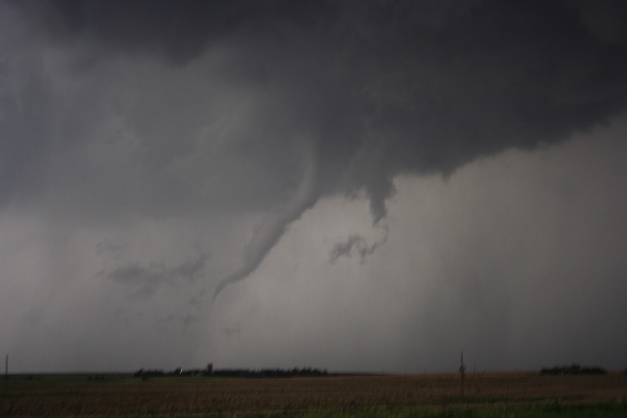
I drove north on a dirt road that paralleled 283 and east of the town of St. Peter. Here is the tornado with a debris cloud at the basr
http://www.harkphoto.com/052207tornado.jpg
I drove north to get a better view. As the road turned to mud, I drove a short distance east to get on 283. I could see the white cone tornado to the north.
http://www.harkphoto.com/052207whitecone.jpg
It soon "roped-out".
http://www.harkphoto.com/052207ropetornado.jpg
I continued east for another mile, then north on on 283. I could see more rotation but no tornado. There were chasers everywhere. At this point another storm formed to the south and I was trapped between two hail cores slowly moving north. I wanted to be on the southern storm but had no road options. I slowly moved north and got some helpful radar data from Dave Lewison. When the main hail core had diminished on the weakening storm, I drove back to Hill City, then east and south to intercept another tornado-warned storm. By this time is was getting dark. I watched a wild lightning display as a line of storms moved over Hays.
I will eventually post video and a more detailed account when I have time. Gotta get sleep for a another potential outbreak day.
Video of the tornado and supercells inclusing time-lapse
http://www.youtube.com/watch?v=EXoUhctDtQk
Bill Hark


") .
. 


")