Susan Strom
EF5
March 12, 2006
"Pictures in the Sky"
Winter Snow in the Mazatzal Range, Arizona
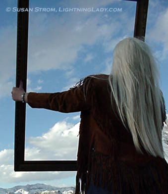
A friend once looked at me strangely when I said I was moving to Arizona. “Aren’t there camels and sand dunes there?†Picturing the Sahara Desert is not uncommon, but the Sonoran with its two annual rainy seasons, is worlds apart.
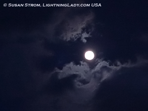
Perhaps she had never seen a desert snow like the one this morning, the kind that folds up the mountains under a cold moon and wakes them in a quilt of white.
There are times in the Desert Southwest when the existence of a landscape so extreme and beautiful is astounding to me. Perhaps that is why I never tire of the changing rocks, the chiseled canyons and the way that the night wind sings through a graythorn tree.
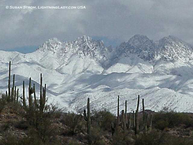
Today, I went to look for wild winter images, and began at the Four Peaks of the Mazatzals. Vantage points were not hard to find. Last night’s storm covered its sawtooth crest almost entirely, and the flanking hills that stretched to the horizon.
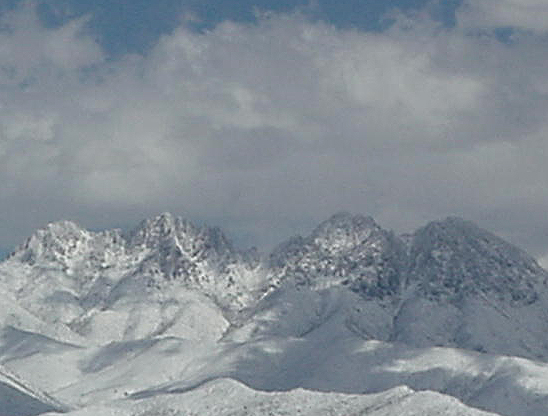
The Four Peaks mountain is visible from Highway 87, but better photography can be found on a dirt road turnoff and walking about in the desert for more creative angles. A grove of saguaro in the foreground was my reward for the effort.

Shortly after I took these pictures, the sheriffs came to close the access road to Four Peaks (reason unknown), so I headed north into the Mazatzals, a rugged desert mountain range that is part of the Tonto National Forest, a titanic landscape the size of Connecticut.
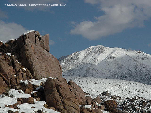
Just past the Four Peaks there is a sharp ascent that overlooks another valley, surrounded by jutting hills. A trailhead yielded more strange juxtapositions of saguaro and snow, a reminder that this location is the northernmost boundary of the Giant Saguaro cactus, a plant with a zone that extends well into Mexico.
Quickly the snow became thicker and I soon found myself overlooking powdery white mountains and the shadows of their clouds.
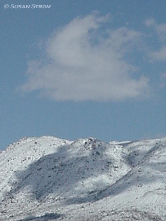
I did not drive much out of the desert zones or into alpine terrain that lies another half hour north and closer to the Mogollon Rim (still digging out of the 30 inches of snow that fell) not only due to road conditions and closures, but the appeal of the desert in snow.
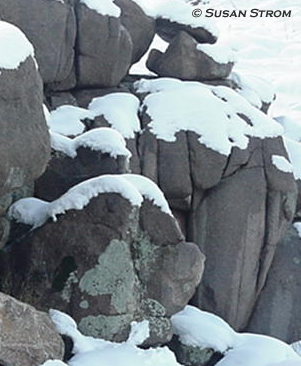
The sun was setting quickly so I headed back down the mountains. I knew of the splendor that might await me back at Four Peaks when the light is low. I also remembered that a near full Moon was due to rise shortly. I joked with the sheriff for a just a minute when he wouldn’t let me back in, but it was okay, I found a hilltop to shoot the Four Peaks at sunset with the floating white Moon.
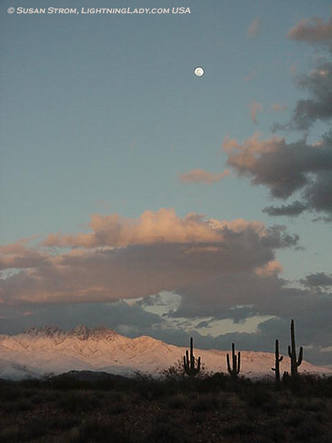
I made sure to spend the entire day in the Sonoran snow and make the most of it. This is a desert, and in the desert the forecast is certain…100% chance of change.
***
Four Peaks vital stats:
Four Peaks Wilderness: 60,740 acres
Location: Southern end of the Mazatzal mountain range
County: eastern Maricopa/western Gila
Nearby lakes: Roosevelt, Apache, Saguaro
Elevation variance: 1,600 feet to 7,657 feet
Ecosystem: Lowest to highest: Sonoran zone desert, chaparral and brush, manzanita and scrub oak, ponderosa pine to Douglas fir
Landscape: Ridges, gorges, and craggy summits.
Special feature: Amethyst mine (no public access).
Closest town: Fountain Hills
Tonto National Forest vital stats:
Size: Three million acres
Landscape: Rugged, much is roadless.
Elevation variance: 1,300 to 8,000 ft.
Mazatzal Wilderness vital stats:
Pronounced: “Mad-az-alâ€. Means “land of deer†(Mexican Indian origin)
Size: 252,500 acres encompassing part of Tonto and Coconino Natl Forests
Elevation variance: 1,600 – 7,903 ft.
Features: Close to Mogollon Rim (edge of Colorado Plateau) and the Verde River
Landscape: Rough desert terrain with vertical walled canyons. Much is inaccessible rugged country, sparsely populated.
Closest towns: Fountain Hills (desert); Payson (alpine).
***
"Pictures in the Sky"
Winter Snow in the Mazatzal Range, Arizona

A friend once looked at me strangely when I said I was moving to Arizona. “Aren’t there camels and sand dunes there?†Picturing the Sahara Desert is not uncommon, but the Sonoran with its two annual rainy seasons, is worlds apart.
Perhaps she had never seen a desert snow like the one this morning, the kind that folds up the mountains under a cold moon and wakes them in a quilt of white.


There are times in the Desert Southwest when the existence of a landscape so extreme and beautiful is astounding to me. Perhaps that is why I never tire of the changing rocks, the chiseled canyons and the way that the night wind sings through a graythorn tree.

Today, I went to look for wild winter images, and began at the Four Peaks of the Mazatzals. Vantage points were not hard to find. Last night’s storm covered its sawtooth crest almost entirely, and the flanking hills that stretched to the horizon.

The Four Peaks mountain is visible from Highway 87, but better photography can be found on a dirt road turnoff and walking about in the desert for more creative angles. A grove of saguaro in the foreground was my reward for the effort.

Shortly after I took these pictures, the sheriffs came to close the access road to Four Peaks (reason unknown), so I headed north into the Mazatzals, a rugged desert mountain range that is part of the Tonto National Forest, a titanic landscape the size of Connecticut.
Just past the Four Peaks there is a sharp ascent that overlooks another valley, surrounded by jutting hills. A trailhead yielded more strange juxtapositions of saguaro and snow, a reminder that this location is the northernmost boundary of the Giant Saguaro cactus, a plant with a zone that extends well into Mexico.
Quickly the snow became thicker and I soon found myself overlooking powdery white mountains and the shadows of their clouds.

I did not drive much out of the desert zones or into alpine terrain that lies another half hour north and closer to the Mogollon Rim (still digging out of the 30 inches of snow that fell) not only due to road conditions and closures, but the appeal of the desert in snow.

The sun was setting quickly so I headed back down the mountains. I knew of the splendor that might await me back at Four Peaks when the light is low. I also remembered that a near full Moon was due to rise shortly. I joked with the sheriff for a just a minute when he wouldn’t let me back in, but it was okay, I found a hilltop to shoot the Four Peaks at sunset with the floating white Moon.

I made sure to spend the entire day in the Sonoran snow and make the most of it. This is a desert, and in the desert the forecast is certain…100% chance of change.
***
Four Peaks vital stats:
Four Peaks Wilderness: 60,740 acres
Location: Southern end of the Mazatzal mountain range
County: eastern Maricopa/western Gila
Nearby lakes: Roosevelt, Apache, Saguaro
Elevation variance: 1,600 feet to 7,657 feet
Ecosystem: Lowest to highest: Sonoran zone desert, chaparral and brush, manzanita and scrub oak, ponderosa pine to Douglas fir
Landscape: Ridges, gorges, and craggy summits.
Special feature: Amethyst mine (no public access).
Closest town: Fountain Hills
Tonto National Forest vital stats:
Size: Three million acres
Landscape: Rugged, much is roadless.
Elevation variance: 1,300 to 8,000 ft.
Mazatzal Wilderness vital stats:
Pronounced: “Mad-az-alâ€. Means “land of deer†(Mexican Indian origin)
Size: 252,500 acres encompassing part of Tonto and Coconino Natl Forests
Elevation variance: 1,600 – 7,903 ft.
Features: Close to Mogollon Rim (edge of Colorado Plateau) and the Verde River
Landscape: Rough desert terrain with vertical walled canyons. Much is inaccessible rugged country, sparsely populated.
Closest towns: Fountain Hills (desert); Payson (alpine).
***
