Travis Davis
EF1
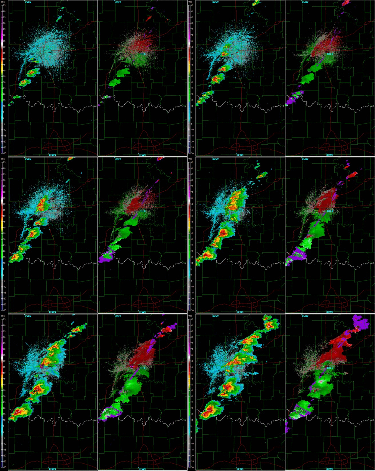
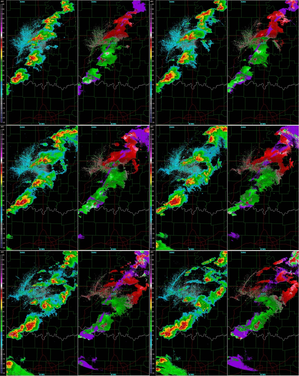
Here is a radar of pretty much the event.
1855 - 2033 Radar

2038-2215

1855 - 2033 Radar

2038-2215


How does one who witnessed this first hand recover? I have seen a lot of violent tornadoes on tv but never with my own eyes.
There are two things that I have been wondering about with this tornado. 1. The problems with the tornado rating system. 2. While reviewing the track it looks like it was beginning to die and then ramped up again near I-35.
I will start with #2.
I have been through the area just east of 35 several times while help with the clean up effort. The damage their is catastrophic, but it is very narrow. Then I found this link from NWS Norman:
http://google.org/crisismap/2013-ok...=CUSTOM&layers=9,7,11,8,layer2,layer11,10:100
While looking through this in a zoomed out view you can notice that after the tornado hit Plaza Towers, it began to move NE and somewhat N. Then, right about 4th st and Telephone road, the tornado turn just S of East. From this point on the damage path is much narrower, although still EF-4 for a while. I find it interesting that the tornado was headed on the NE then North path, which we see when many mesocylones begin to become occluded. I would have expected that meso to die while another one formed to the southeast. However, the tornado/meso survived and then went on for another 5-6 miles. Has anyone else noticed this?
Brian McKibben said:Now for #1. On my old street (SW 149th Pl) most of the houses between 149th Pl and SW 149th St were destroyed. Not wiped clean but, they were destroyed. The houses of the other side of the street fared better. However, some of them got hit pretty bad. In fact, some even further south got hit pretty bad.
Here is the problem I see with the damage scale. I think the reason why some of the houses further into the neighborhood got hit was because they got hit by some debris. Once that debris damaged the house and exposed the interior, there became more drag, thus the house suffered significantly more damage than the one right next to it. This made two houses sided by side look drastically different. One would have EF-3 while the other would be low EF-1. I doubt the winds were significantly different 20 feet away (especially oriented East to West), so the damage was likely caused by debris.
A tornado with a significant debris cloud would likely cause more damage than one with out it. Therefore, a weaker tornado in an urban area will cause more widespread damage than a stronger tornado in a rural area.
I know the rating scale is inaccurate. This is just one of the many problems with it.
I wonder if anyone had a mobile radar sampling this storm?
I'm a little perplexed by everyone talking about Moore as an especially fast tornado intensification. For comparison, here is a timeline for Joplin:
Now, I realize Joplin was exceptionally fast. That said, seventeen minutes (if that is what it was) from touchdown to F-4 in Moore doesn't seem especially fast given the F-4 and F-5's I have reviewed over the last decade.
- 5:32pm, no known tornado
- 5:33-5:34pm, tornado touches down
- 5:41pm: F-4 tornado, eight minutes from earliest touchdown
- 5:42pm: F-5 tornado, nine minutes from earliest touchdown
If I am missing something or there is a climatology of which I'm not aware, please illuminate me.


I am personally bewildered at the behavior of that storm. It went from a little shower to violently tornadic so quickly. I'm curious where the vorticity came from to generate such a strong tornado so quickly. The 5000 CAPE in the 17Z OUN sounding likely had something to do with that, but I don't think I've ever witnessed a storm go from shower to producing an EF5 in 45 minutes or so like this storm did.
