Marko Korosec
EF4
Hey all,
check this out, this happened yesterday over SW Slovenia. Strong Siberian polar airmass with ENE winds is progressing over Dinaric mountain range along NW Balkans.
This is how it looks on visible satellite (© NASA):

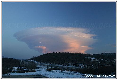
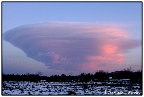
Those were all Ac lenticularis clouds, its shape is great visible on this image as well. Shadows are also pretty impressive.
This is how it looked outside (those upper right clouds on the pic above), pretty amazing view:
We had the usual strong "Bora" wind with gusts up to 150km/h in the past three days with temps around -10°C, sweet WindChill :wink:
Regards,
check this out, this happened yesterday over SW Slovenia. Strong Siberian polar airmass with ENE winds is progressing over Dinaric mountain range along NW Balkans.
This is how it looks on visible satellite (© NASA):
Those were all Ac lenticularis clouds, its shape is great visible on this image as well. Shadows are also pretty impressive.
This is how it looked outside (those upper right clouds on the pic above), pretty amazing view:
We had the usual strong "Bora" wind with gusts up to 150km/h in the past three days with temps around -10°C, sweet WindChill :wink:
Regards,