Shear Funnel Photos

Joined
Jul 2, 2004
Messages
1,781
Location
Hastings, Michigan
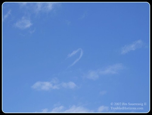
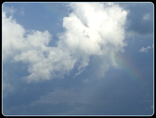
Been meaning to post these photos and am finally getting around to it. They were taken on June 13, when Kent County, MI, lay under a slight risk. I just happened to glance out the sliding glass door to my deck and saw the following. You'll find a more detailed account in my blog posting for September 3.
 

Attachments

  • IMG_0818.JPG
    IMG_0818.JPG
    16.2 KB · Views: 222
  • IMG_0819.JPG
    IMG_0819.JPG
    23 KB · Views: 177
Cool photos, Bob. This reminds me of something I wanted to ask about here on ST ... As Gustav made its way north last week, we were in the ne quadrant here in northern AR. I did not have my camera with me at the time I'm about to explain (I was in the parking lot of a Wal-Mart), but I observed what appeared to have been a vertical funnel -- as in, pointing "up" rather than down. It lasted for probably 30 seconds. Has anyone ever seen something like this at all? I know the low-level shear was pretty decent that day. In fact, only a couple of hours after this there was an EF-0 tornado in my county. It was just a weird sight, and since I've never heard of such a thing I sort of wanted to dismiss it, but maybe I shouldn't have? (I'm not leaving home without my camera if Ike heads our way, that's for sure!)
 
Heidi,
Never, ever leave home w/out your camera:) I've never seen funnels as you've described, but have seen many cold air funnels not unlike the ones associated with tropical systems...
...Oh, and great catch, Bob!
 
Nice pics Bob. I ended up seeing a wall in Jackson County that day, but nothing ever came of it. Approximately what time did you snap those pics?
 
Cool photos, Bob. This reminds me of something I wanted to ask about here on ST ... As Gustav made its way north last week, we were in the ne quadrant here in northern AR. I did not have my camera with me at the time I'm about to explain (I was in the parking lot of a Wal-Mart), but I observed what appeared to have been a vertical funnel -- as in, pointing "up" rather than down. It lasted for probably 30 seconds. Has anyone ever seen something like this at all? I know the low-level shear was pretty decent that day. In fact, only a couple of hours after this there was an EF-0 tornado in my county. It was just a weird sight, and since I've never heard of such a thing I sort of wanted to dismiss it, but maybe I shouldn't have? (I'm not leaving home without my camera if Ike heads our way, that's for sure!)
If it was on the edge or top of a cumulus cloud it could have been a horseshoe vortex.

edit: Here is some video I shot a few years ago of a horseshoe vortex.
 
The thing I saw was attached to the top of very low, hurricane-leftover junk-type cu but was a lot fatter than the examples I am seeing (thanks!), and wasn't really curved at all. But now it does seem feasible that it was something legitimate ... the arg-factor has been racheted up a few notches, too. :o It was pretty close, actually. If it had been on the ground, it would have been in the field right behind Wal-Mart, roughly 1/2 mile from where I was at the time. It would have been an awesome photo.
 
It's an interesting sight - but I don't think you can correlate it to a tornado occurring later or calling it "lucky" that it went up instead of down.
 
rdale, does your computer screen show you magic things? Because I can't find the place where I made any correlations or used the word lucky. ;) I made mention of the tornado in my county to emphasize that there was enough shear in place for what I saw to have been an actual funnel as opposed to something that looked like one but wasn't. And any time a funnel goes up instead of down is a good thing for people underneath it, as far as I am concerned.
 
Understood - I'm just saying it wasn't the type of funnel that is related to a tornado.

No magic on my screen ;)
 
I seen something this spring that I think might be similar to what you seen.. In my case I was on the SW end of a passing cell and watched some low inflowing clouds form a backwards (pointing up) type of a rotating cloud that then shot a skinny dark funnel skywards for a few seconds before coming apart in an area of updraft on the main cell.

It was definitely not related to the Horseshoe Vorticies I have seen in the past. I had pictures of the cloud just after it happened but they are on my lost hard drive. I may have a bit of video from right after it happened as well but would need to look for it. One of my previous Horseshoes:


As far as what all is defined as a shear funnel I am unsure, I have been told this little dual vortex critter was a shear funnel by some and told by others it was not one so I am not sure myself...

 
Last edited by a moderator:
Nice pics Bob. I ended up seeing a wall in Jackson County that day, but nothing ever came of it. Approximately what time did you snap those pics?

Thanks, Ben. The time stamps on the photos show that they were taken around 3:45 a.m. Obviously that's not right; after cross-checking a few photos taken on other days, methinks I need to adjust the a.m./p.m. setting on my camera. Quarter to four in the afternoon is probably about right, though.
 
Saw this shear funnel on May 26th on the Pratt supercell.

20080526_ShearFunnel1.jpg
 
Back
Top