John Farley
Supporter
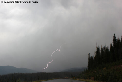
I made a couple outings to the area around Wolf Creek Ski Area and Wolf Creek Pass near the beginning and end of the three day storm that impacted the Rocky Mountain states September 8-10. Here is a picture of lightning associated with a squall producing graupel and snow near Wolf Creek Ski Area at the beginning of the storm the afternoon of September 8:

This was my first-ever capture with a lightning trigger of a bolt from a storm associated with winter precipitation, and also my earliest-in-the-season experience of thundersnow.
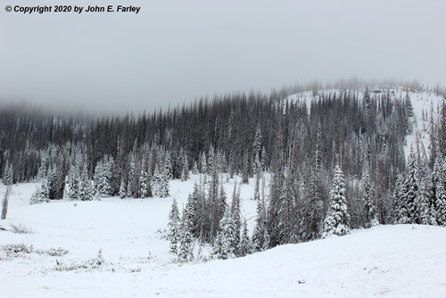
The next picture was taken about a mile away, near the end of the storm two days later:

In the morning before I took this picture at Wolf Creek Pass, Wolf Creek Ski Area reported 13 inches of snow. Some more fell during the day, and there was intermittent light to occasionally brief moderate snow while I was up there in the afternoon, but also some compaction so probably not quite that much when I was there, but a beautiful winter scene while it was still summer by the calendar.
I have written up a full report, including additional pictures, a short thundersnow/graupel video, and some discussion of the weather setup and the impacts of the storm. You can access it at:

This was my first-ever capture with a lightning trigger of a bolt from a storm associated with winter precipitation, and also my earliest-in-the-season experience of thundersnow.
The next picture was taken about a mile away, near the end of the storm two days later:

In the morning before I took this picture at Wolf Creek Pass, Wolf Creek Ski Area reported 13 inches of snow. Some more fell during the day, and there was intermittent light to occasionally brief moderate snow while I was up there in the afternoon, but also some compaction so probably not quite that much when I was there, but a beautiful winter scene while it was still summer by the calendar.
I have written up a full report, including additional pictures, a short thundersnow/graupel video, and some discussion of the weather setup and the impacts of the storm. You can access it at:
