Michael Snyder
EF3
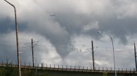
Shot this funnel Cloud just north of SeaTac Airport today at about 11am
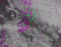
Upper level low moved just south of the area and gave us just enough shear apparently.
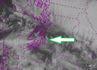
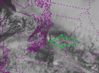
You'll also see that I captured the CB that produced the Funnel Cloud nicely on VIS SAT.
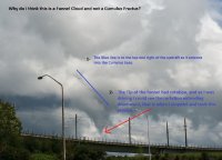
I couldn't believe my eyes, but when I saw it spinning and saw the updraft leading into the base of the CU I knew it was legit. I missed the lowest point of the funnels reach however.
I misspelled rotation on the diagram I drew, too lazy to go back and fix it.
Upper level low moved just south of the area and gave us just enough shear apparently.
You'll also see that I captured the CB that produced the Funnel Cloud nicely on VIS SAT.
I couldn't believe my eyes, but when I saw it spinning and saw the updraft leading into the base of the CU I knew it was legit. I missed the lowest point of the funnels reach however.
I misspelled rotation on the diagram I drew, too lazy to go back and fix it.
Attachments
Last edited: