calvinkaskey
Guest
- Joined
- Feb 17, 2014
- Messages
- 384
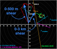
I'm wondering if anyone has a good idea of what the minimums for helio, shear, and cape combinations for tornado genesis. For example in NE pa NAM is predicting 450 parcel cape with helio of 709 and BSHR of 149 at 2am EDT this Thursday. At 4 pm EDT in northern VA this Wednesday the numbers are 329 parcel cape, helio of 683 and BSHR of 193. Now the hodographs are pretty much off the charts from other times I've chased and been near tornado and severe weather outbreaks. Here is the hodo for northern VA http://www.twisterdata.com/index.ph...ng=y&sndclick=y&sounding.x=716&sounding.y=315
This one if for ne pa http://www.twisterdata.com/index.ph...nding=y&output=image&view=large&archive=false
Climatologically in New York 2 am would not be unprecedented as 4 out of 10 tornadoes to occur in New York have occurred at odd hours ie. 12am, 2:45am and 2 between 9 and 10 am.
Thursday afternoon has a 244 BSHR but only 307 Helio and 274 parcel cape and has this hodograph http://www.twisterdata.com/index.ph...nding=y&output=image&view=large&archive=false Maine has had 6 tornadoes which is pretty impressive considering the lack of population, terrain and that N.Y. has had only 10 and PA only 13.
Last edited:

