cdcollura
EF5
Good day,
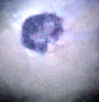
Anyone recognize this picture above?
This is the tiny (2.5 miles wide) eye of 150-MPH hurricane Charley (at maximum intensity - strong Cat-4) over Punta Gorda, FL on Friday, August 13, 2004!
The picture above is a composite of several pictures taken by myself and Jason Foster (N3PRZ / WeatherWarrior.com) that were spliced together to give a wide-angle and unobstructed view of the tiny area of blue-sky and eyewall surrounding it.
Such an tiny eye is basically a narrow cylinder of thunderstorms, 10 miles (50,000 - 60,000 feet) high, and visually clear from sea (or ground) to sky. The eye of such a storm quickly collapses shortly after landfall.
Pinhole eyes are notorious for rapid changes in intensity (particularly explosive deepening). Storm examples with pinhole eyes are shown below...
Hurricane Wilma - 2005 (175 MPH / 882 MB) - Caribbean - 1.5 NM wide.
Hurricane Beta - 2005 (115 MPH) - Nicaragua - 5 NM wide.
Hurricane Dennis - 2005 (120 MPH) - Florida - 4 NM wide.
Hurricane Charley - 2004 (150 MPH / 941 MB) - Florida - 2.5 NM wide.
Hurricane Andrew - 1992 (165 MPH / 921 MB) - Florida - 6 NM wide.
Typhoon Forrest - 1983 (165 MPH / 883 MB) - Phillipines - 4 NM wide.
Hurricane Opal - 1995 (150 MPH / 919 MB) - Florida - 5 NM wide.

Above is a picture of Typhoon Forrest from an aircraft taken by Scott A. Dommin while stationed in Guam for the US Air Force (WC-130 recon) ... Looks familiar to the first picture of Charley - Right?
A link to his site (general) is given below ... Very interesting...
http://home.att.net/~typhoon1/index.html
Just something to ponder as the 2006 hurricane season is just several months away!
Chris Collura - KG4PJN

Anyone recognize this picture above?
This is the tiny (2.5 miles wide) eye of 150-MPH hurricane Charley (at maximum intensity - strong Cat-4) over Punta Gorda, FL on Friday, August 13, 2004!
The picture above is a composite of several pictures taken by myself and Jason Foster (N3PRZ / WeatherWarrior.com) that were spliced together to give a wide-angle and unobstructed view of the tiny area of blue-sky and eyewall surrounding it.
Such an tiny eye is basically a narrow cylinder of thunderstorms, 10 miles (50,000 - 60,000 feet) high, and visually clear from sea (or ground) to sky. The eye of such a storm quickly collapses shortly after landfall.
Pinhole eyes are notorious for rapid changes in intensity (particularly explosive deepening). Storm examples with pinhole eyes are shown below...
Hurricane Wilma - 2005 (175 MPH / 882 MB) - Caribbean - 1.5 NM wide.
Hurricane Beta - 2005 (115 MPH) - Nicaragua - 5 NM wide.
Hurricane Dennis - 2005 (120 MPH) - Florida - 4 NM wide.
Hurricane Charley - 2004 (150 MPH / 941 MB) - Florida - 2.5 NM wide.
Hurricane Andrew - 1992 (165 MPH / 921 MB) - Florida - 6 NM wide.
Typhoon Forrest - 1983 (165 MPH / 883 MB) - Phillipines - 4 NM wide.
Hurricane Opal - 1995 (150 MPH / 919 MB) - Florida - 5 NM wide.

Above is a picture of Typhoon Forrest from an aircraft taken by Scott A. Dommin while stationed in Guam for the US Air Force (WC-130 recon) ... Looks familiar to the first picture of Charley - Right?
A link to his site (general) is given below ... Very interesting...
http://home.att.net/~typhoon1/index.html
Just something to ponder as the 2006 hurricane season is just several months away!
Chris Collura - KG4PJN

