Good day all,
I actually took the time and effort to log each and every chase / observation down since the 1980's.
Here is some of my first "intercepts" (foolish in their ways, but I was a teenager)...
1). OCT 14, 1984 ... 9:00 AM - Coastal observation of large southeasterly swells impacting the beaches along Fire Island at Smith Point State Park near Moriches, New York. Hurricane Josephine was about 250 Miles to the south with winds decreasing from 100 to 85-MPH and turning towards the ENE. Josephine’s outer fringe effects were felt in extreme eastern New England. Conditions observed were 45-MPH NNE winds, cloudy skies with light drizzle, and 8 to 15 foot swells with tides 2 to 3 feet above normal. This was the first storm observed by myself. I used a bike to ride to the beach and a boogie board to observe the waves. Documentation was audio recording from a tape recorder wrapped in garbage bags.
2). OCT 11, 1985 ... 3:00 PM - Penetration of a strong thunderstorm in Margate and Coral Springs, Florida along Atlantic Blvd. The storm had 40-MPH winds, Torrential rains, and frequent lightning as I rode through it on my bicycle. This foolish and dangerous chase was the first thunderstorm I ever intercepted intentionally. Tropical moisture and sea breeze activity spawned the storms near a low-pressure trough.
Yeah, I know ... Chasing with a bicycle is dumb (from lightning) - But I had to get there somehow! I moved to Florida (from New York) in July 1985. Below is the first intentional intercept of a thunderstorm in a car...
3). APR 30, 1986 ... 7:00 PM - Penetration of a strong thunderstorm in western sections of Lake Worth, Florida near State Road 7. Heavy rain, frequent lightning, and 40-MPH wind gusts were observed. Conditions causing the storms were a prefrontal wave and surface heating. A 1984 Chrysler Laser was used to chase the storm.
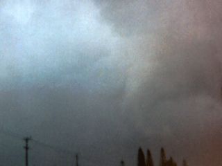
Below if my first tornado intercept (with a picture of the funnel)...
4). JAN 5, 1987 ... 2:00 PM - Penetration of a severe thunderstorm and tornado interception. With a guest, the severe thunderstorm was encountered near Sample Road and State Road 7 in Margate, Florida. High winds, heavy rains, and small hail was encountered as this fast moving storm crossed the area. Near Pompano Beach, Florida, on Sample Road, A small tornado was observed on the backside of the thunderstorm. The chasers came within one mile of the touchdown area, where 2 street lamps were downed and several trailer homes damaged. A jet stream aloft and a strong cold front allowed the storms and tornado to develop. A 1980 Ford Pinto was used to chase the storms. Documentation was still photographs. A tornado watch was also in effect until 3 PM for this area.
Enjoy...

