Forward flank notch and HP supercells...

Joined
Jun 26, 2004
Messages
1,104
Location
Italy/Tornado Alley
HP supercells are pretty common in tornado alley during may. It's not very difficult to detect an HP supercell on the radar: it has got a kidney shape because of the formation of the forward flank notch.
I was looking for a radar image of a HP supercell but all I have in my archive is an high number of classic supercells...

Guys, do you have some good radar images of a HP supercell with the forward flank notch in evidence? post here please :wink:
 
Here is a GRLevel3 image I saved of the May 12th 2005 South Plains storm:

TXbustola02.png


Perhaps someone could tell me if this was before, during or after it tornadoed - I'm not entirely sure as we were out of position - thankfully.

This storm probably didn't qualify as a bona-fide HP until later in its life, but I included it here because of the unique characteristics of its precip regions - particularly the hook. This was the hook that creamed a lot of chasers that day with grapefruit-sized hail - to no fault of their own.

It's interesting to speculate on why this storm had such an intense hook-from-hell on it - and what may have caused that. Visually from photographs I have seen - it looked very "wet", too.

Later in its life, near Quitaque, we got back up into the notch to view the storm again - and confirmed that it had transitioned into a fully HP supercell. I'm afraid I don't have any images of it from that timeframe.

KR
 
Also,

Here are two resources from the infamous 5/5/95 Mayfest HP supercell:

http://www.stormtrack.org/library/1995/hail.htm

http://ams.confex.com/ams/pdfview.cgi?username=47099

I would be careful in asserting that HPs sometimes have a kideny-bean-shaped radar representation because of where the inflow notch has formed. Rather, it is more likely to be the other way around. HP supercells sometimes appear kidney-bean-shaped because the circulation has dragged large amounts of precip. around the storm, pinching off the inflow notch to greater and greater extents.

When this happens - the area of inflow available to the supercell fundamentally decreases as more and more of the storm's flank is eaten up by heavy rain and hail. Eventually, all that is left for the storm to feed on is a wrapped-up notch of inflow - which is generally where any HP tornado would occur if it formed.

There are many factors which can contribute to conditions favourable for the formation of HP supercells. Winds aloft or storm-relative-flow could be very weak - which does not allow for the forcing of lofted precip away from the updraft region. Also - an overload of CAPE can produce very wet-looking storms.

KR
 
Originally posted by Karen Rhoden
Also,

Here are two resources from the infamous 5/5/95 Mayfest HP supercell:

http://www.stormtrack.org/library/1995/hail.htm

http://ams.confex.com/ams/pdfview.cgi?username=47099

I would be careful in asserting that HPs sometimes have a kideny-bean-shaped radar representation because of where the inflow notch has formed. Rather, it is more likely to be the other way around. HP supercells sometimes appear kidney-bean-shaped because the circulation has dragged large amounts of precip. around the storm, pinching off the inflow notch to greater and greater extents.

When this happens - the area of inflow available to the supercell fundamentally decreases as more and more of the storm's flank is eaten up by heavy rain and hail. Eventually, all that is left for the storm to feed on is a wrapped-up notch of inflow - which is generally where any HP tornado would occur if it formed.

There are many factors which can contribute to conditions favourable for the formation of HP supercells. Winds aloft or storm-relative-flow could be very weak - which does not allow for the forcing of lofted precip away from the updraft region. Also - an overload of CAPE can produce very wet-looking storms.

KR

So we could say that sometimes HP supercells have got a kidney shape, but generally they are charachterized by forward flank notch/hook echo with a rainy inflow notch, in this sense; I wanna say that the inflow notch is not like classic supercells(well defined and free from precipitations) but it's just"rainy" because of the massive falling of precipitations down into the updraft. Am I right, Karen?
 
I've never heard it referred to as a "forward-flank notch" before... usually just as an inflow notch. This notch corresponds with the inflow region of the supercell... in between the FFD and RFD.


As for the formation of the inflow notch.... no different than a classic supercell, except much more precip is being wrapped around with the low level mesocyclone.
Check out the diagram below.

scellvar.gif

(Comet MetEd)

Aaron
 
Originally posted by Andrea Griffa
So we could say that sometimes HP supercells have got a kidney shape, but generally they are charachterized by forward flank notch/hook echo with a rainy inflow notch, in this sense; I wanna say that the inflow notch is not like classic supercells(well defined and free from precipitations) but it's just\"rainy\" because of the massive falling of precipitations down into the updraft. Am I right, Karen?

The one main identifying feature of High Precipitation supercells is attained from ground-truth - i.e. what people looking at the storm are seeing. HP supercells at ground-truth levels are characterized by copious amounts of precipitation falling back through the updraft region. Instead of a classic-looking rain-free base, we are presented with something that looks like this:

typ1.gif


Rather than this Classic supercell on June 23rd, 2002:

june23xx.jpg


Also, we can compare HP vs. Classic tornadoes.

A tornado with an HP storm:

wraptorn.gif


A tornado with a Classic storm:

june23h.jpg


Inflow notches -

HPs are not characterized by having what I'm assuming you are meaning a forward flank meso or inflow notch. These are all features resulting from being an HP storm - not features that would cause it to be an HP storm. I mentioned earlier what causes storms to become HP and what the initial defining features of an HP are.

KR
 
Originally posted by Karen Rhoden+--><div class='quotetop'>QUOTE(Karen Rhoden)</div>
<!--QuoteBegin-Andrea Griffa
So we could say that sometimes HP supercells have got a kidney shape, but generally they are charachterized by forward flank notch/hook echo with a rainy inflow notch, in this sense; I wanna say that the inflow notch is not like classic supercells(well defined and free from precipitations) but it's just\"rainy\" because of the massive falling of precipitations down into the updraft. Am I right, Karen?

The one main identifying feature of High Precipitation supercells is attained from ground-truth - i.e. what people looking at the storm are seeing. HP supercells at ground-truth levels are characterized by copious amounts of precipitation falling back through the updraft region. Instead of a classic-looking rain-free base, we are presented with something that looks like this:


Rather than this Classic supercell on June 23rd, 2002:


Also, we can compare HP vs. Classic tornadoes.

A tornado with an HP storm:


A tornado with a Classic storm:


Inflow notches -

HPs are not characterized by having what I'm assuming you are meaning a forward flank meso or inflow notch. These are all features resulting from being an HP storm - not features that would cause it to be an HP storm. I mentioned earlier what causes storms to become HP and what the initial defining features of an HP are.

KR[/b]

Yes Karen I know this, I wouldn't say this. I know that these are all features resulting from being an HP storm - not features that would cause it to be an HP storm.
What I tried to say it's that the thing that make the differnce between HP and classic hook echo is that at the radar in HPs there's a more rainy wrapped around inflow notch and less defined than classic supercell.
 
In the end - I'm not entirely sure I understood the question - wondering the same as what Aaron mentioned.

But I would add that inflow notches - by their very nature - do NOT contain precipitation. That's because they're inflow notches.

Perhaps I'm still not really understanding the question.

KR
 
Originally posted by Karen Rhoden+--><div class='quotetop'>QUOTE(Karen Rhoden)</div>
In the end - I'm not entirely sure I understood the question - wondering the same as what Aaron mentioned.

But I would add that inflow notches - by their very nature - do NOT contain precipitation. That's because they're inflow notches.

Perhaps I'm still not really understanding the question.

KR[/b]

<!--QuoteBegin-Aaron Kennedy

I've never heard it referred to as a \"forward-flank notch\" before... usually just as an inflow notch


If you're talking about the term "forward/front flank notch" and if you're thinking it's a my invention, guys, you're wrong :wink:
I'ver already read this term before some other times. This confirm what I'm saying.

super6.gif

Here the link complete:

http://www.crh.noaa.gov/lmk/soo/docu/supercell.htm

Taking apart this, as it seems to me that is a word pronuncation problematic, let's come back to our question.

Karen, you're saying that "inflow notches - by their very nature - do NOT contain precipitation. That's because they're inflow notches. "

In part I agree with you because, in the "classic" definition, the iflow notches don't contain precipitations; but are you sure that sometimes in HP supercells, things don't go in this way? I would be careful in asserting that HP inflow notches never contain precipitations...
I make you an exemple: Hallam supercell, posted by Gabe.

0124-r.jpg


If the inflow notch is "a radar signature characterized by an indentation in the reflectivity pattern on the inflow side of the storm" as from definition, here there is not "precipitation free" indentation. Instead, if we see the radar image of the supercell posted by Scott Olson,May 5, 1995 Fort Worth HP SUPERCELL , I agree with you, Karen, the reflectivity of the inflow notch is pretty free from precipitations.

But in Hallam supercell, as you can see, the inflow notch isn't completely free from precipitations: I wanna say I see a low reflecttivity, that well represents the inflow, but I don't see the complete absence of rain.

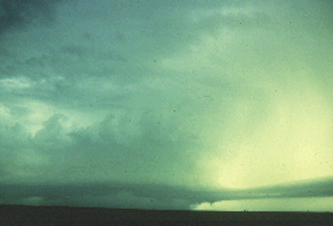
Besides, the complete absence of rain is clearly evident in classic supercells inflow notch; I make you an example.
The inflow notch of this supercell has not reflectivity. You could go inside the notch but you would see only the mesocyclone structure and wall cloud at the base, without rain.


ktlx-100498_2-panel90.gif


I hope to have written more clear than I did before.
 
Some rain could be in a low level inflow notch from clouds above the notch. Also I think Andrea is mostly talking about the radar presentation, in such cases on HP supercells you will see a decreased reflectivity gradient, she is refering to their being reflectivity in the inflow notch and not appearing to always be free from precipitation.
 
Originally posted by Andrea Griffa
Karen, you're saying that \"inflow notches - by their very nature - do NOT contain precipitation. That's because they're inflow notches. \"

In part I agree with you because, in the \"classic\" definition, the iflow notches don't contain precipitations; but are you sure that sometimes in HP supercells, things don't go in this way? I would be careful in asserting that HP inflow notches never contain precipitations...
I make you an exemple: Hallam supercell, posted by Gabe.

If the inflow notch is \"a radar signature characterized by an indentation in the reflectivity pattern on the inflow side of the storm\" as from definition, here there is not \"precipitation free\" indentation.

You forget to take into account the fact that the radar doesn't see lower levels in the storm closer to the ground. The lower reflectivity gradients present near the inflow notch will most likely be elevated precipitation that doesn't reach the ground. Also, every storm is different some with more overhang (like Hallam) than others. Each storm probably varies as to when the precip 'mixes' and in what location. If you consider that an HP typically has a rainy meso structure then inflow feeds into the meso kind of like a tunnel or inflow jet near the ground. I think for the most part the inflow will be rainfree except for around the edges of the upper flow as it is headed in, and along the sides as it enters the rainy HP structure. For some storms the inflow air can travel a long ways before they enter an area of wrapping precip such as when the RFD is wrapping around the meso as well; others don't have to go so far - such as probably Hallam. I think it is correct to assume though that the force of the inflow winds travelling in will typically force the precip away from it and maintain mostly rainfree areas (such as for someone standing there on the ground). That said, supercells can cycle up and down as well. When this happens we get various degrees of inflow strength and in mature / decay stage we can even have outflow. In that case the inflow may not be strong enough to hold the precip back and so it could be lightly raining. In decay of a mature HP you can have violent microbursts (associated with downdrafts). Of course then, you really don't have any inflow at all probably - so nothing really to define on radar as an inflow notch.

Keep in mind also that inflow is more spread out and weaker further from the storm. As it nears the actual updraft it is focused and channeled and has more forcing. So if for instance the upper level anvil winds are blowing across the top of the inflow area then further out you may get some precip hit you if you are standing under it. However I assume this should to some degree decrease as you get closer into the updraft. Once you get in real close though you get to the wrapping 'Bears Cage' though and there will be rain and mist. The inflow air however probably still clears it's own path and pushes out precip as it channels it's way into and up the updraft. This may also result in a very fine atomized mist. So the air can probably find a way to get in without getting wet, but you probably won't be able to.

So, working through this and in brief. The inflow area on the ground is mainly free of precip - even though precip may be elevated and showing up on radar above. However close in to the updraft there may be some precip affecting people on the ground. Also, if the storm has a very weakened inflow, or is outflow dominant then it is possible for rain in that location but then the inflow area is almost non-existant.
 
Originally posted by Bill Tabor+--><div class='quotetop'>QUOTE(Bill Tabor)</div>
<!--QuoteBegin-Andrea Griffa
Karen, you're saying that \"inflow notches - by their very nature - do NOT contain precipitation. That's because they're inflow notches. \"

In part I agree with you because, in the \"classic\" definition, the iflow notches don't contain precipitations; but are you sure that sometimes in HP supercells, things don't go in this way? I would be careful in asserting that HP inflow notches never contain precipitations...
I make you an exemple: Hallam supercell, posted by Gabe.

If the inflow notch is \"a radar signature characterized by an indentation in the reflectivity pattern on the inflow side of the storm\" as from definition, here there is not \"precipitation free\" indentation.

You forget to take into account the fact that the radar doesn't see lower levels in the storm closer to the ground. The lower reflectivity gradients present near the inflow notch will most likely be elevated precipitation that doesn't reach the ground. Also, every storm is different some with more overhang (like Hallam) than others. Each storm probably varies as to when the precip 'mixes' and in what location. If you consider that an HP typically has a rainy meso structure then inflow feeds into the meso kind of like a tunnel or inflow jet near the ground. I think for the most part the inflow will be rainfree except for around the edges of the upper flow as it is headed in, and along the sides as it enters the rainy HP structure. For some storms the inflow air can travel a long ways before they enter an area of wrapping precip such as when the RFD is wrapping around the meso as well; others don't have to go so far - such as probably Hallam. I think it is correct to assume though that the force of the inflow winds travelling in will typically force the precip away from it and maintain mostly rainfree areas (such as for someone standing there on the ground). That said, supercells can cycle up and down as well. When this happens we get various degrees of inflow strength and in mature / decay stage we can even have outflow. In that case the inflow may not be strong enough to hold the precip back and so it could be lightly raining. In decay of a mature HP you can have violent microbursts (associated with downdrafts). Of course then, you really don't have any inflow at all probably - so nothing really to define on radar as an inflow notch.

Keep in mind also that inflow is more spread out and weaker further from the storm. As it nears the actual updraft it is focused and channeled and has more forcing. So if for instance the upper level anvil winds are blowing across the top of the inflow area then further out you may get some precip hit you if you are standing under it. However I assume this should to some degree decrease as you get closer into the updraft. Once you get in real close though you get to the wrapping 'Bears Cage' though and there will be rain and mist. The inflow air however probably still clears it's own path and pushes out precip as it channels it's way into and up the updraft. This may also result in a very fine atomized mist. So the air can probably find a way to get in without getting wet, but you probably won't be able to.

So, working through this and in brief. The inflow area on the ground is mainly free of precip - even though precip may be elevated and showing up on radar above. However close in to the updraft there may be some precip affecting people on the ground. Also, if the storm has a very weakened inflow, or is outflow dominant then it is possible for rain in that location but then the inflow area is almost non-existant.[/b]

Thanks for the precisation Bill! your arguement is well explained.
 
Back
Top