Early Season Winter Storm: 10/26-28

Drew Terril

Staff member
Joined
Feb 18, 2015
Messages
664
Location
Fort Wayne, IN
Pretty substantial winter storm unfolding today. I've kept my focus on Oklahoma as the weather here directly affects my job, but the Texas Panhandle and into New Mexico looks to be impacted pretty severely as well. NM DOT most likely is preparing to shut down I-40 as needed, while TxDOT does not shut down interstates for winter weather (learned that the hard way).

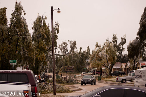
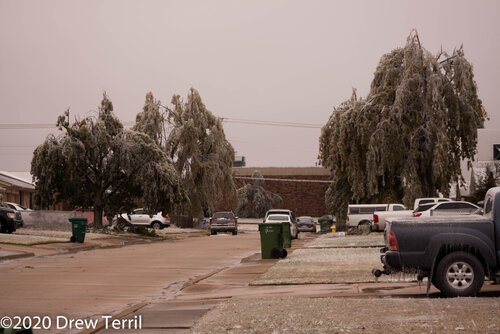
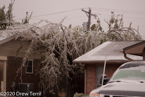
As far as my neck of the woods in Oklahoma, it appears that we have 1/8" of ice or so already on trees and vehicles, with close to a half inch forecasted for today's round, and another quarter to half inch for tomorrow. As I get ready to leave for work, I'm hearing trees starting to strain under the weight. The fact that most of the trees still have their leaves will exacerbate this issue, and I expect large scale power outages.

For those experiencing this system in other areas, what are you seeing?
 
I see white. :eek: Out here near Lamar CO we have a thin coat of frozen rain from yesterday under a couple inches of snow. Record cold, too. I saw forecasts on TV that some records were expected to be beaten by up to 40 degrees. (Clayton, I think?) The same thing happened with that blast of unbelievable cold air last month!
 
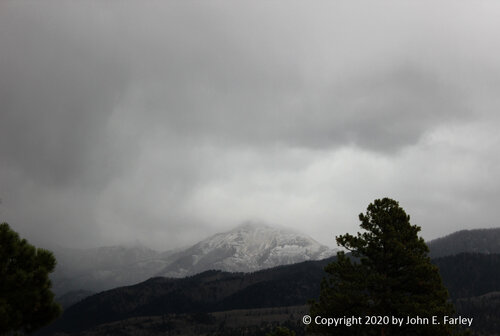
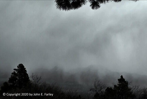
Sunday afternoon a band of convection set up from SE of Navajo Lake up into the South San Juan Wilderness east of Pagosa Springs, CO and north of Chama, NM. It produced thundersnow off and on for several hours in the South San Juan Wilderness. I drove up as close as I could to the roadless wilderness area east of Pagosa Springs, but all of the thunder and lightning and accumulating snow were up in the roadless area. I could hear a couple rumbles of thunder and got a few pictures looking southeast of the band, but the roads stopped well short of where I could have gotten into good thundersnow. The storm produced around 2 feet at the Wolf Creek Ski Area and it was likely more in the high mountains south of there. But unlike most of CO and northern NM, Pagosa Springs itself was in a slot of warm air through much of the storm and got mostly rain, with less than an inch and a half of snow.

mtn_thundersnow102520-1.jpgmtn_thundersnow102520-2.jpg
 
I have a roll of film waiting to be developed (and digitized) that I got some good pictures from on the Yukon area. My neighbor's tree split down the middle of the trunk and had to be cut down. They got most of it today, except for the main trunk itself.
 
I was going through race pics tonight and forgot I'd snapped a few from the DSLR the other day as the ice was beginning to melt. Probably will be later this week before I have the film pics processed though. These were on my street in Yukon, Oklahoma. Canadian County was particularly hard hit, especially out towards El Reno and Calumet.

IMG_0276.jpg

IMG_0277.jpg

IMG_0279.jpg
 
Back
Top