Boris Konon
EF4
It was announced Wed that imagery from the three DMSP polar-orbiting satellites will no longer be distributed effective 6/30/25. And atypically short notice as this imagery is very important for TC fixes and intensity estimates worldwide.
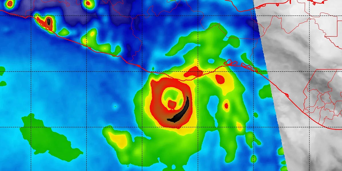
The key is microwave imagery (SSMIS), which allows us to see through clouds to assess TCs better. Thick cirrus often obscures TC structure and the center. Microwave imagery shows us where the true deep convection is, sprial banding, and often will show an eye present when conventional imagery does not.
There are other microwave satellites up there, but the loss of these three DMSPs cuts it back by about 40%.
DMSP is run by the DoD. They cite cybersecurity risks, a platform that can no longer be updated, and the DMSP program is scheduled to be ended no later than Sep 2026. I agree wholeheartedly w/ the cybersecurity risks, as threats are rife and hacker methods are evolving at an alarming rate. However, we couldn't wait until at least the end of this hurricane season?
This is not crippling to TC analysis or forecasting, but significant. It will have an immediate impact. Accurate TC center fixes and intensity are key for model forecasts.
More in-depth can be found here:
 michaelrlowry.substack.com
The key is microwave imagery (SSMIS), which allows us to see through clouds to assess TCs better. Thick cirrus often obscures TC structure and the center. Microwave imagery shows us where the true deep convection is, sprial banding, and often will show an eye present when conventional imagery does not.
There are other microwave satellites up there, but the loss of these three DMSPs cuts it back by about 40%.
DMSP is run by the DoD. They cite cybersecurity risks, a platform that can no longer be updated, and the DMSP program is scheduled to be ended no later than Sep 2026. I agree wholeheartedly w/ the cybersecurity risks, as threats are rife and hacker methods are evolving at an alarming rate. However, we couldn't wait until at least the end of this hurricane season?
This is not crippling to TC analysis or forecasting, but significant. It will have an immediate impact. Accurate TC center fixes and intensity are key for model forecasts.
More in-depth can be found here:
Critical Hurricane Forecast Tool Abruptly Terminated
U.S. Department of Defense announced Tuesday it would no longer process and deliver data essential to most hurricane forecasts
michaelrlowry.substack.com


