John Erwin
EF5
9/16/06 REPORTS: SD / MN / NE / KS *rescued*
**rescued post**
**NOTE: I was unable to recover page 1 of this article from the Google cache: what you see below is from page 2 onward. If I manage to get it later I (or someone else) will need to append it to the end of this article for now** J.BE.
afischer
Joined: 22 Jun 2005
Posts: 49
Location: kansas city mo
Posted: Sun Sep 17, 2006 8:25 pm
Remarkable photos everyone! I was lucky to be there too. Can 2006 get any stranger?
Here is my prelim account... http://www.tornadohead.com/091606chase.htm
Andy
Jeff Snyder
Moderator
Joined: 09 Dec 2003
Posts: 3858
Location: Norman, OK
 Posted: Sun Sep 17, 2006 9:49 pm
I chased with Dan Dawson, Gabe Garfield, Robin Tanamachi, and my wife yesterday in southwestern KS. It looked like things may play out favorably for us by the time we reached Woodward, with convection initiating to the north-northwest of us in KS. By the time we made it through Coldwater, we had witnessed several updrafts go up... and down. We headed eastward towards Pratt, watching several very small, yet nicely corkscrew-shaped, updrafts (LP supercells) to our north. In the end, the updrafts weren't able to sustain themselves. It beat a clear-sky bust, but I'm not sure it was worth the drive... Oh well.
_________________
Jeff Snyder
KC0HJX
University of Oklahoma Graduate Student
http://www.tornadocentral.com
Simon Brewer
Joined: 18 Apr 2005
Posts: 88
Location: Norman
Posted: Mon Sep 18, 2006 2:27 am
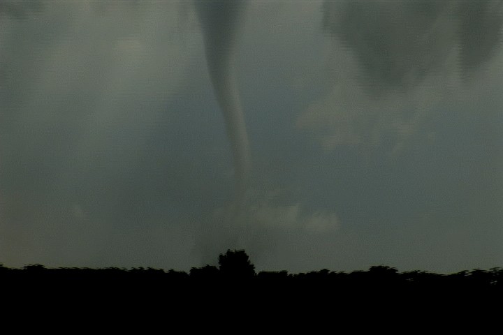
Jim Bishop and I documented two tornadoes in Southeastern SD, which everyone else seemed to catch:


We left Brookings, SD a little late and caught the tail end of the tornado near I-90, but had a decent view of the next tornado.
Check out chase account here...hope to add some actual text later:
http://www.stormgasm.com/9-16-06/9-16-06.htm
_________________
Touchdown, Stormgasm!
www.stormgasm.com
**rescued post**
**NOTE: I was unable to recover page 1 of this article from the Google cache: what you see below is from page 2 onward. If I manage to get it later I (or someone else) will need to append it to the end of this article for now** J.BE.
afischer
Joined: 22 Jun 2005
Posts: 49
Location: kansas city mo
Posted: Sun Sep 17, 2006 8:25 pm
Remarkable photos everyone! I was lucky to be there too. Can 2006 get any stranger?
Here is my prelim account... http://www.tornadohead.com/091606chase.htm
Andy
Jeff Snyder
Moderator
Joined: 09 Dec 2003
Posts: 3858
Location: Norman, OK
I chased with Dan Dawson, Gabe Garfield, Robin Tanamachi, and my wife yesterday in southwestern KS. It looked like things may play out favorably for us by the time we reached Woodward, with convection initiating to the north-northwest of us in KS. By the time we made it through Coldwater, we had witnessed several updrafts go up... and down. We headed eastward towards Pratt, watching several very small, yet nicely corkscrew-shaped, updrafts (LP supercells) to our north. In the end, the updrafts weren't able to sustain themselves. It beat a clear-sky bust, but I'm not sure it was worth the drive... Oh well.
_________________
Jeff Snyder
KC0HJX
University of Oklahoma Graduate Student
http://www.tornadocentral.com
Simon Brewer
Joined: 18 Apr 2005
Posts: 88
Location: Norman
Posted: Mon Sep 18, 2006 2:27 am
Jim Bishop and I documented two tornadoes in Southeastern SD, which everyone else seemed to catch:


We left Brookings, SD a little late and caught the tail end of the tornado near I-90, but had a decent view of the next tornado.
Check out chase account here...hope to add some actual text later:
http://www.stormgasm.com/9-16-06/9-16-06.htm
_________________
Touchdown, Stormgasm!
www.stormgasm.com
Last edited by a moderator:


