We prepared ourselves for a down day, starting from Pueblo, Colorado. After a relaxed, long lasting lunch at a pizzeria we decided to hunt dust devils in the area that *might* see some storms, northeast Colorado. But we got stuck in the traffic jams in and around Denver. We took it easy.....
...until we saw a significantly deeper developed storm anvil in the distance, when driving northeast over I-76 towards Sterling, CO. We decided this is better than nothing, and the storm appeared straight on our course. We passed by the Doppler on Wheels and the Tornado Intercept Vehicle, apparently holding a film shoot alongside the interstate with the storm in the background.
We wanted to see the storm before sunset and turned off the I-76 to head to Chappell and Oshkosh, Nebraska.
By a long dirt road we ended up close to the storm's south flank. Meanwhile, the anvil was huge and looked like a round pancake, but the updraft tower looked like a very small cumulus congestus. The storm had a small foot which made me think the ascent was due to the dynamic effects of shear rather than just thermodynamics...
As we parked the car in the middle of nowhere, about 20 miles north of Chappell, and started shooting, we noticed incredible updraft speed and even rotation!
Our down day turned into a spectacular show, as the sun set... we timelapsed the storm but could see growth and rotation every second. Eventually a laminar wall cloud grew apparently as cooler, stabilized boundary layer air was ingested.
Here follow some pictures:
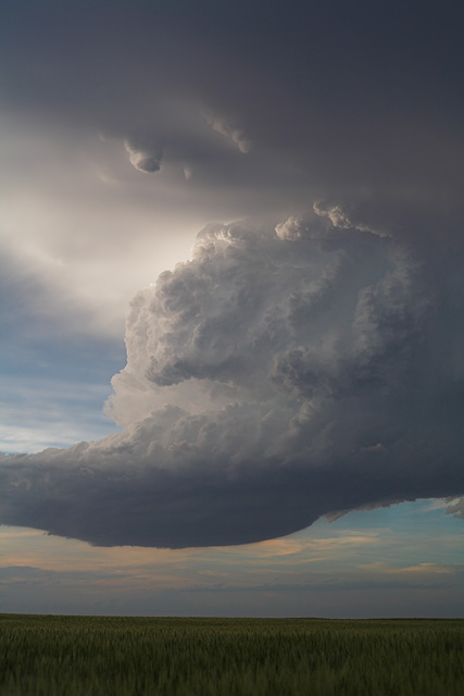
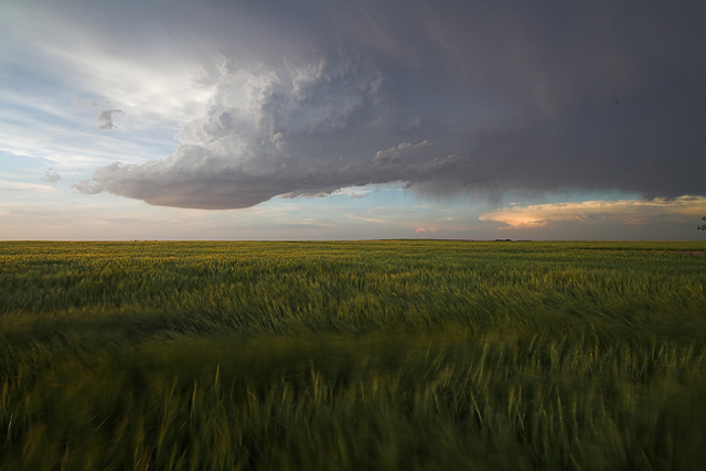

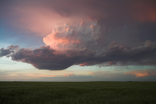
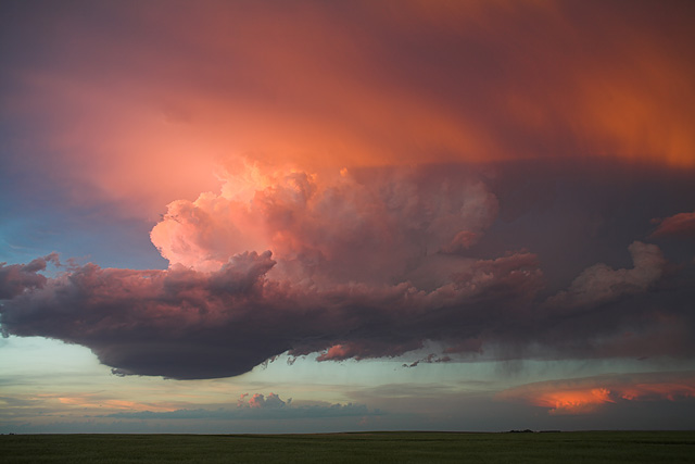

All taken from the same spot between 830 CDT and about 1000 CDT")
...until we saw a significantly deeper developed storm anvil in the distance, when driving northeast over I-76 towards Sterling, CO. We decided this is better than nothing, and the storm appeared straight on our course. We passed by the Doppler on Wheels and the Tornado Intercept Vehicle, apparently holding a film shoot alongside the interstate with the storm in the background.
We wanted to see the storm before sunset and turned off the I-76 to head to Chappell and Oshkosh, Nebraska.
By a long dirt road we ended up close to the storm's south flank. Meanwhile, the anvil was huge and looked like a round pancake, but the updraft tower looked like a very small cumulus congestus. The storm had a small foot which made me think the ascent was due to the dynamic effects of shear rather than just thermodynamics...
As we parked the car in the middle of nowhere, about 20 miles north of Chappell, and started shooting, we noticed incredible updraft speed and even rotation!
Our down day turned into a spectacular show, as the sun set... we timelapsed the storm but could see growth and rotation every second. Eventually a laminar wall cloud grew apparently as cooler, stabilized boundary layer air was ingested.
Here follow some pictures:
All taken from the same spot between 830 CDT and about 1000 CDT
