5/27/06 REPORTS: ND

Joined
Apr 1, 2005
Messages
161
Location
Goodland, KS
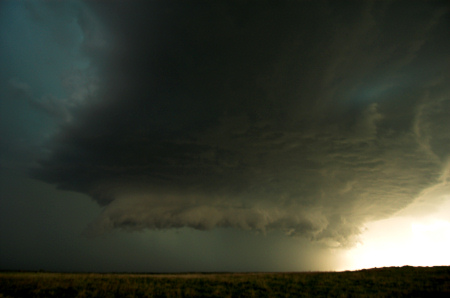
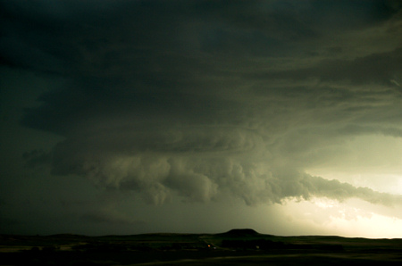
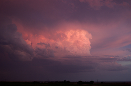
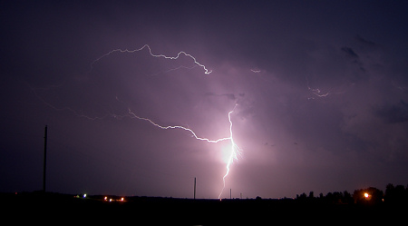
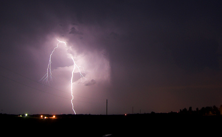
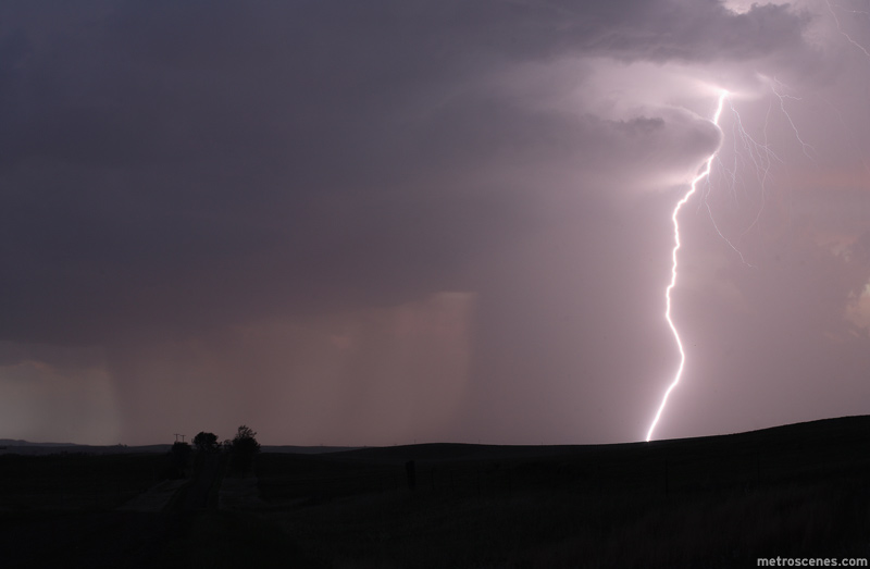
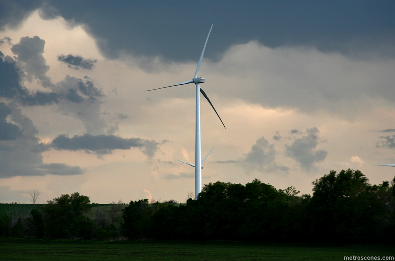
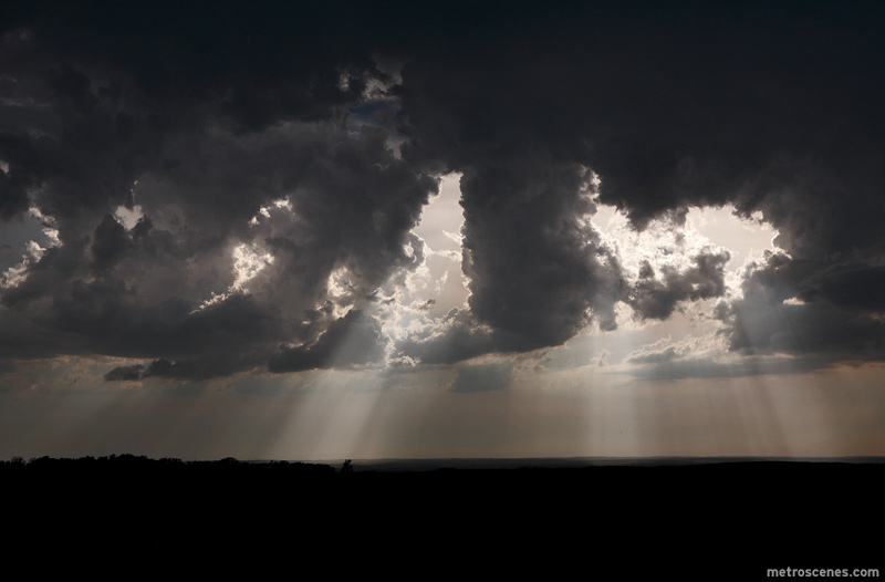
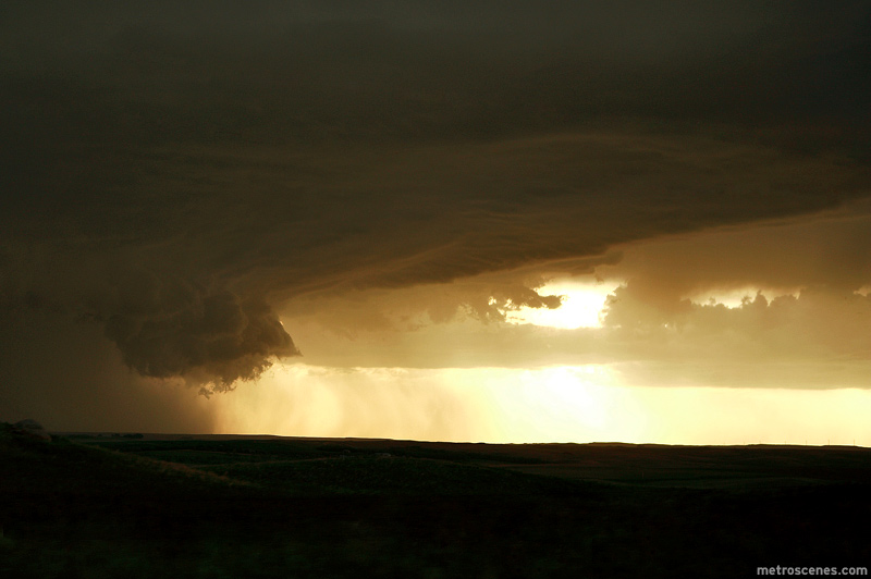
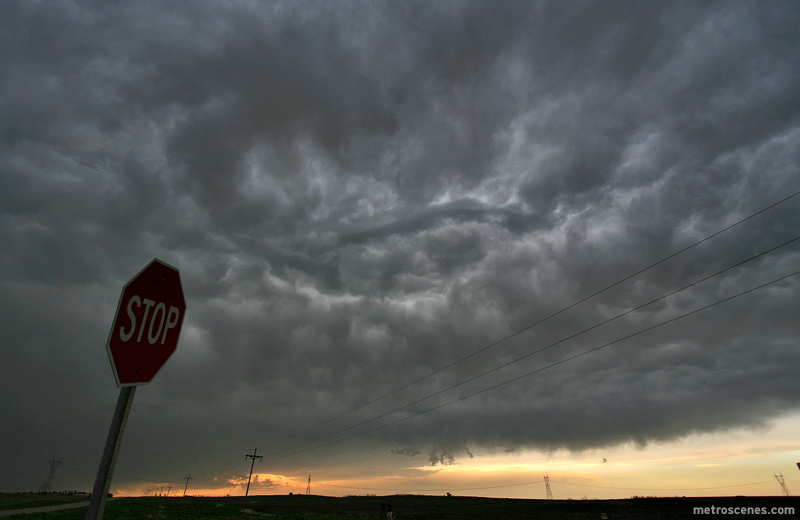
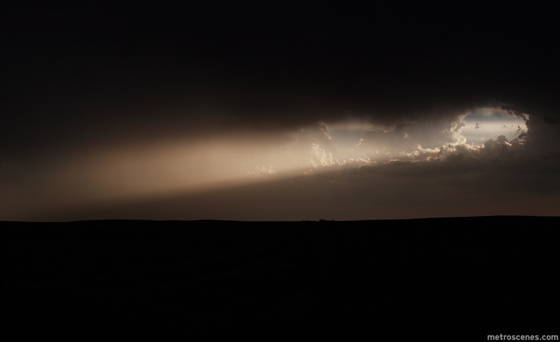
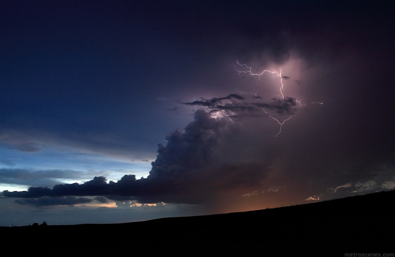
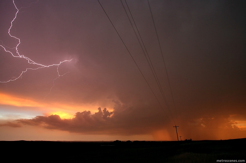
Had an improptu first chase in North Dakota today as my wife and I just moved here. Literally unloaded the U-Haul truck this morning. About 5pm this afternoon I noticed Cu going up in the vicinity of Devil's Lake, ND which is about 90 miles west of Grand Forks. Decided what the heck. Loaded the laptop, ham radio, and cameras into the car and took off. Headed west on US 2 toward Devil's Lake. As we went west, a lone storm developed. Made it to that storm just east of Leeds. Eric Whitehill pulled up alongside and we chatted while watching the storm which became outflow dominant. Decided to stick with the storm to see if it could pull back together which it did a short time later becoming torn warned in Towner County. We were 8 miles south of Cando when the warning went up so we worked our way northward though the town. Just north of Cando, we observed a wall cloud and brief funnel (my apologies for the raindrops and radio tower). The storm could never completely get it's act together and eventually crossed the boundary. Overall, a fun chase considering no real planning went into it whatsoever.
 
Storm Chase May 27, 2006


I know the season is really bad when I have to go to North Dakota looking for storms. My initial target was northeast of Bismarck. I left Rapid City and headed east, driving by the Badlands and the famous Wall Drug. I haven’t been there since I was in college driving around the country and camping with my roommates. Wall Drug is sort of like South of the Border, but less tacky. I turned north on 63 and drove through beautiful rolling grass covered hills with scattered trees in the low areas. I took back roads to avoid the larger towns. In McLauglin, I ran into the Doppler on Wheels group who are doing tornado research. The armored Tornado Intercept vehicle was also there. They were waiting and checking data. I continued north until I reached the Bismarck area. I liked the southeast winds and area of cumulus. While checking data and preparing my vehicle, I noticed that an area of cumulus just to the southwest became “agitatedâ€￾ and formed small towers. The data showed that the front was just to the west. Storms that could move along the front had the highest chance of tornadic potential. I waited just east of Bismarck and watched the storms develop. Unfortunately, there were three in a north south line. The middle storm seemed well enough isolated from the southern storm and it was gaining strength. I drove north on 83, then west and north on 1804 to get a better view. It initially looked good though high-based. Just as it was showing more signs of development, the southerly storm was growing and blocking my initial storm’s inflow. I drove east on a dirt road, then south to intercept the southerly storm. As the storm, moving in a northerly direction, passed north of the I-94, I drove east for a better view. I couldn’t see much due to rain and hail. My east road became dirt and I had to pick my way along the wed muddy surface to avoid sliding into a ditch. This caused me to lose the storm because it was rapidly moving north. I wasn’t worried since it was not looking good on radar. I finally reached a paved road and noticed that a better and more isolated storm had formed about 30 miles south. There was initially nothing competing with it for energy. I headed back south on 1804 and I could soon see a nice updraft. There was also a rain free base. Darkness was approaching and I ended the chase when I couldn’t see any more storm features. I watched the intense lightning for awhile, then drove back to Bismarck. In the city, there were scattered gold ball sized hail stones form the storm I was observing. The Perkins restaurant was full of about 50 storm chasers. I ate with Jim Leonard of Cyclone Tours, Matt Crowther of The Weather Channel, Jay Antle, Mike Umscheid and several other chasers. My target tomorrow is likely in northeast to north central South Dakota but I have to check more data. Thabks to Tim Vasquez, Jim Leonard and Dave Lewison for nowcasting/forcasting suggestions.


Road in northern South Dakota

http://www.harkphoto.com/052706road.jpg

Landscape in South Dakota

http://www.harkphoto.com/052706landscape.jpg

Horses

http://www.harkphoto.com/052706horses.jpg

Towering cumulus

http://www.harkphoto.com/052706toweringcu.jpg

Initial storm north of Bismarck

http://www.harkphoto.com/052706firststorm.jpg

Dirt road heading east after the first storm was dying

http://www.harkphoto.com/052706dirtroad.jpg

The isolated southern supercell, last storm of the day. Southeast of Bismark, view to the southwest

http://www.harkphoto.com/052706southernstormlast.jpg

Later view of that southern storm

http://www.harkphoto.com/052706southernstormlastlate.jpg

Lightning

http://www.harkphoto.com/052706lightning.jpg

Hail is Bismarck, max size slightly....jpg"]http://www.harkphoto.com/052706hail.jpg


Bill Hark
 
A much better chase day on May 27th in North Dakota! We intercepted storms northeast of Bismarck, one of which becoming a meaty supercell between Wing and Regan. The structure on this supercell was quite nice. We followed this north until it weakened, and as it shriveled up, there was visible rotation at cloud base…with even a nascent funnel it appeared looking WSW towards the shrinking updraft area near the Florence Lake NWR. At Denhoff we travelled west to catch the backside of these storms. We almost drove into a 72 VIL core (golfball hail or larger), but thanks to a timely radar update, we obviously reconsidered going south on Hwy 41 at Mercer… and optioned farther west dropping south on 200 Alternate to Washburn. The backside of the supercells were very photogenic with just incredible deep saturated colors of pink, violet, blue, orage… you name it. It was stunning color contrast right at sunset. We ran into very brief quarter size hail just northwest of Wilton then decided to stop off at the intersection of Hwy 83 and Hwy 36 to photograph lightning from the southern most supercell that was over Mandan-Bismarck.

_DSC3299.jpg


_DSC3307.jpg


_DSC3362.jpg


_DSC3404.jpg


_DSC3410.jpg
 
Drove all day from Colby KS to Mobridge SD. It sucked. I "chased" the southern storm from a long ways away and could see a few overshooting tops on it. Overshooting tops have never meant much to me as most storms have them if you are far away. It was a piece of garbage on radar the entire time I could see them and the anvil was quite fuzzy. The whole drive during the time I could see the tower I thought for sure this was going to be the one that pisses me off by not getting to it in time and finally missing a real tornadic storm. Not in 2006 I guess! Finally near Mobridge I said screw it and stopped to take some road pictures. I wish I had just done more landscape photography on the way. I guess that was the nice part. I really do love the sandhill and these areas of SD. I was in cool landscapes all afternoon. Some of the not so main highways can be scary on hot days with no cell signals and 70 miles between "towns"...along with little to no traffic on them. Oh yeah this reminds me. Somewhere south of Merriman NE in western Cherry county I saw something I thought was a deer cross the road ahead of me aways. I get up there and look in the tall grass for it and see what must have been one big grey coyote. I thought wolf at first until I did a little googling on wolves in Nebrsaka. Sadly enough that was probably the highlight of the day.

Hopefully today is better.
 
Great chase day in the Bismarck area today. First time in ND. It is obvious I need to chase up here more often. Sampled several marginal supercell storms that were very photogenic. Lots of cloud striations, inflow bands, mammatus, lightning, and beautiful vistas. Saw storms go up from the first towers. It was nice being part of the inflow and seeing so many chasers that I know. Now this is what chasing is all about. Aahh, yes. TM
 
Started the day in Rapid City, SD and took I90 to US 83 to I94 into Bismarck. Arrived in Bismarck around 3:30PM. The connection between our phone and laptop broke so made a quick stop to Radio Shack...... fixed the issue and headed north on 83 as the cu started to go up. Stopped at a Lewis and Clark interpretive center.... FYI they actually have an internet computer inside the building that the public can use.

Sat there for a while, then as the storms were going up SW of Bismarck we kicked south a little to Wilton, ND to watch the storm go up and hope that something else would go up north along the front in the better enviornment.

When it became clear that the storm to our south was what we would be chasing we kicked over to the road along the Missouri and let the storm come to us..... Saw some mammatus clouds but the storm was weakening....

Moved to the storm that came up just south of Bismarck... and hung on that one as it came through down. Sat inbetween that one and the one that was hailing across the river in Sioux County hoping that either one would amount to anything. We heard a report on the radio that there was a funnel cloud spotted at 6N 5E of Bismarck on the northern storm so came back north to Bismarck as the sun was setting. Nothing was doing so we called it a night.
 
It was a fantastic chase day if you like lightning and structure. This day had no shortage of that. The inflow dominated the storms almost the whole day. We were able to keep up with them from birth to death. The last storm in the very broken line was very impressive. The nearly constant anvil crawlers and intermittent CG's made for some great photo-ops. I was able to take some of my best lightning/structure shots of the chase trip. I still need a tornado!!! My trip ends soon as I follow the system east with Nick, Kurt, and Dr. Flescher. I would just like to thank Dan once again for this opportunity. I have enjoyed myself to the fullest.

My pics will be up soon.
 
may27i.jpg


may27car1.jpg


Video Clip, WMV 22MB:
http://wvlightning.com/2006/may27.wmv

Chased in the Bismarck, ND area on Saturday afternoon. Started east of Bismarck on I-94 watching turkey towers struggle, then finally break through and get things going. Moved north of Bismarck to watch the first few cells struggle, then dropped back southeast to our original starting point where a new cluster of convection was getting organized. We stopped just north of I-94 to watch the nicely sunset-backlit precip and base with blue-white lightning. To our distant southwest, a storm with a long, well-defined inflow tail got our attention. With light fading, we caught up to the remnants of the southern storm as a new updraft organized to its west. This new cell, heading straight north for Bismarck, also developed great structure with a large, tapered inflow tail, smooth base and dense precip shafts.

As the daylight faded, this storm put on quite a show of nearly constant intracloud 'anvil zits' lightning with the vibrant, saturated colors of sunset and twilight in the background. Every once in a while, a powerful CG arced to ground in the forward flank precip. What an amazing storm! We filled our videotapes and memory cards with this awesome spectacle, as it gave us plenty of time to get every shot we wanted. At one point we observed a shallow wall cloud and RFD slot. The precip core glowed bright orange as it moved over the Bismarck city lights.

More screen grabs:
may27j.jpg


may27e.jpg


may27h.jpg


may27d.jpg


What would a chase trip be without a crisis:

may27cb.jpg


After we were done with the storm, we started heading for Bismarck for the night when my car lurched, then stalled. It would not restart. Possible engine problems of an unknown origin, unfortunately nothing that can be fixed without a mechanic. After two hours of waiting, the AAA tow truck arrived and took us to the Bismarck Ford dealer. Of course, it was Saturday night on Memorial Day weekend, meaning we are going to become temporary North Dakota residents until at least Tuesday. Needless to say, this puts a premature end to our chase trip.

Unless we run into storms on our way home, Saturday was our final chase of the 2006 Plains season. The Bismarck storm IMO made our trip, and was as good as a tornado for me - so to me, the trip is by no means a failure.
 
They're nothing spectacular, but I've uploaded my photos this afternoon from Saturday afternoon/evening's chase through the Devils Lake basin...

I desperately need a lens hood (or a better lens, altogether!) and need to learn how to better shoot with the polarizing filter on... *grin

Enjoy!

http://photos.mhartman-wx.com
 
No storms, but I was still chasing. Perhaps it is somewhat entertaining.

06-5-27-6339.jpg

All the states I had driven by I forgot to get the state sign pose thing going on. Ok, so SDS was kicking in and a bit of insanity from the miles.

06-5-27-2.jpg

Almost stepped on this guy in my sandals while looking for a better photo op.

A few others here:
http://www.extremeinstability.com/06-5-27.htm
 
Back
Top