Chad Ringley
EF2
Myself, Paul Suffern, and Patrick Pyle chased in NE NC and SE VA today ahead of the cold front/lee trof. Started out in Wilson, NC on I-95 and worked our way N to Roanake Rapids, NC where a few small cells came scootin' by at light speed. Ended up on a larger cell on the Sussex/Emporia/Greensville County VA Line near Jarratt (pics below). The storm had some slight rotation at mid-levels (and perhaps very briefly at cloud base) and nice scud action before gusting out almost as quickly as we got into position (less than 10 min). Then, naturally, it became a little bow segment. Was nice to find some open areas in SE VA without any trees ")

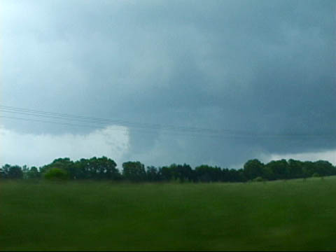
I'm a pretend supercell in SE VA!

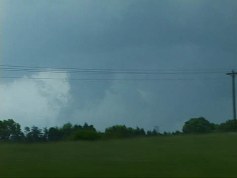
10 minutes later, I've gusted out!
We then went back to the SE and waited for convection to overrun us in Southhampton County VA near Courtland, which ended up with a SVR on it. Very impressive shelf cloud was followed by a few impressive wind gusts (probably 40-50 mph) and very small hail. We would have had some serious wind damage had there been enough mixing though...fastest cold pool I've seen at LCL level. I'll post a still image of the sweet shelf cloud when we get one that isn't dark. :blink:
Couldn't catch any discrete convection that developed to our E...storms were just moving way too fast. We also couldn't make it up I-95 fast enough to catch convection along the warm front. Driving up 95 toward DC/Richmond is bad enough at normal times, let alone near rush hour.
No doubt that the enhanced helicity along the wf made all the difference today. Almost all of the convection we encountered struggled to maintain itself, owing to the lack of steep lapse rates and MLCAPE. Most orgainzed storms didn't take long to transist from potential low-topped supercells into bow segements either. Only a few times did it appear cells were rooted in the boundary layer (cell in SE VA near Jarratt certainly appeared to be before gusting out).
Good day nonetheless, especially since we were supposed to be in OK today, and I sorely needed to chase SOMETHING! lol
I'm a pretend supercell in SE VA!
10 minutes later, I've gusted out!
We then went back to the SE and waited for convection to overrun us in Southhampton County VA near Courtland, which ended up with a SVR on it. Very impressive shelf cloud was followed by a few impressive wind gusts (probably 40-50 mph) and very small hail. We would have had some serious wind damage had there been enough mixing though...fastest cold pool I've seen at LCL level. I'll post a still image of the sweet shelf cloud when we get one that isn't dark. :blink:
Couldn't catch any discrete convection that developed to our E...storms were just moving way too fast. We also couldn't make it up I-95 fast enough to catch convection along the warm front. Driving up 95 toward DC/Richmond is bad enough at normal times, let alone near rush hour.
No doubt that the enhanced helicity along the wf made all the difference today. Almost all of the convection we encountered struggled to maintain itself, owing to the lack of steep lapse rates and MLCAPE. Most orgainzed storms didn't take long to transist from potential low-topped supercells into bow segements either. Only a few times did it appear cells were rooted in the boundary layer (cell in SE VA near Jarratt certainly appeared to be before gusting out).
Good day nonetheless, especially since we were supposed to be in OK today, and I sorely needed to chase SOMETHING! lol