• While Stormtrack has discontinued its hosting of SpotterNetwork support on the forums, keep in mind that support for SpotterNetwork issues is available by emailing [email protected].

4/23/07 REPORTS: TX / OK / KS / CO

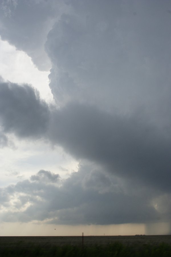
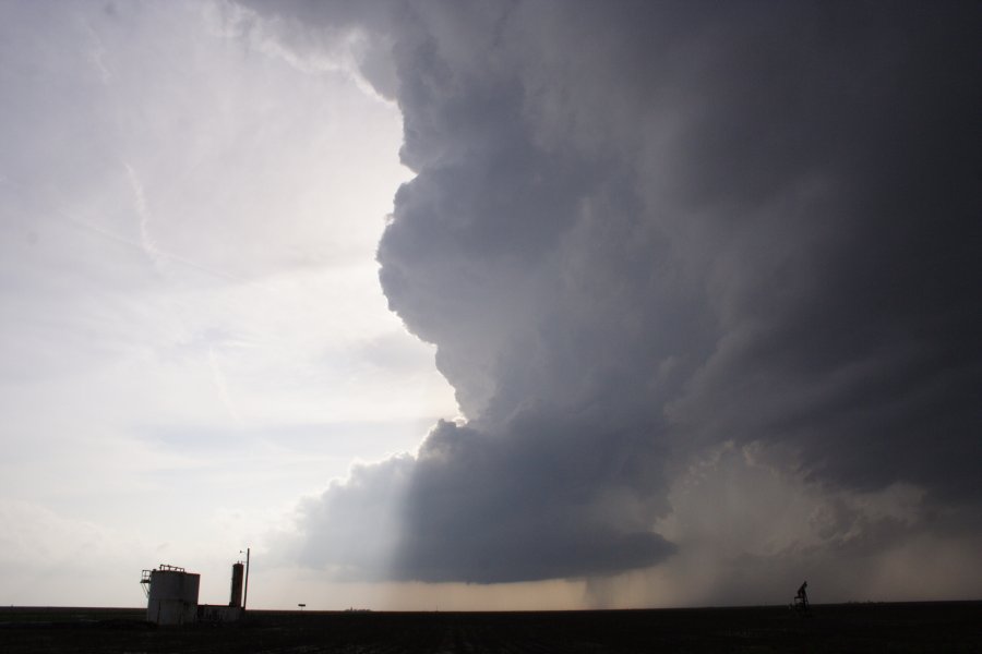
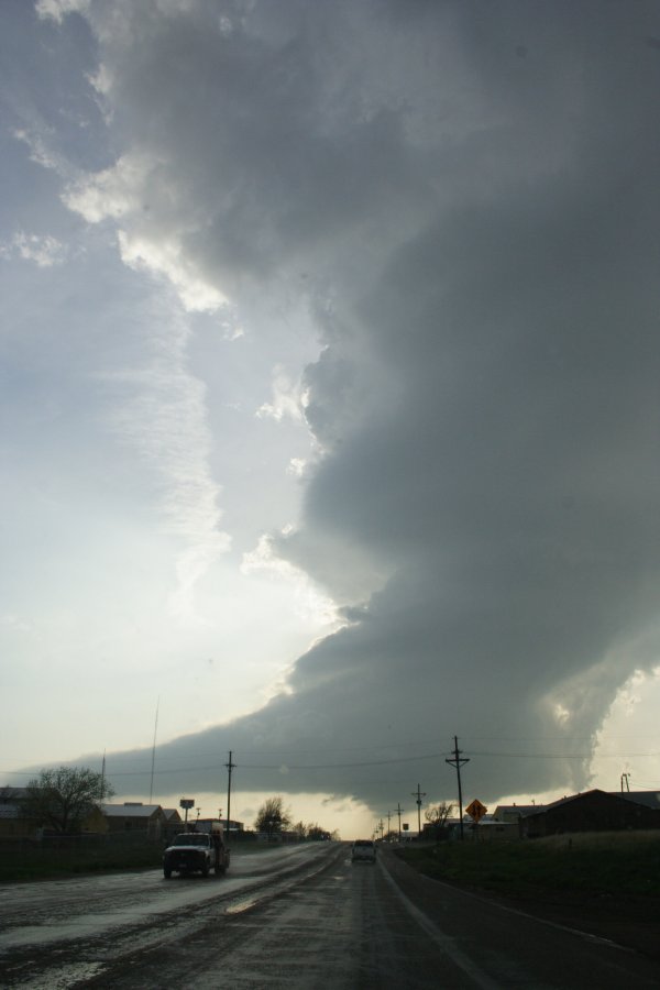
Well Brandon covered the basics. We were on the LP supercell near Pampa, Texas. The chase account can be found in my blog which is linked in my signature. If not you can just click here.

For being a non-tornado chase I was actually riding home pretty happy. That was a very impressive storm, my first LP supercell and that made me happy. Nothing near it at all either so it was very photogenic.

AJL
 
NW OK/SW KS tornadic supercell

I hope to have a chase story and photo gallery of the Lipscomb CO. TX to Comanche Co. KS supercell life cycle posted on Vortex Times by tomorrow night. Got some interesting shots including one from N. Harper Co. OK that may be one of my "quiz type" photos (tornado or no tornado). This photo is very interesting to say the least !! The chase was certainly a very rewarding April chase and got some awesome shots of this storm to post. I must say that any day around the April 20-24 timeframe usually produces for me across S.Kansas !! ;)
 
I finally completed our log for April 23, complete with video, frame grabs and Matt's digital stills. Four tornadoes for the day.


http://stormhighway.com/april232007.shtml

EDIT: It now appears clear that we also can confirm the three tornadoes on the ground simultaneously (first three thumbnails above). The only other 'maybe' we have is the rapidly spinning wall cloud with an apparent narrow tube extending to the ground in the fourth thumbnail above.
 
Last edited by a moderator:
I opted for the "middle of the road" target area in NW Oklahoma and set up shop in Arnett, OK, giving myself the option to shoot south into the Texas panhandle if good stuff fired down there or move north into Kansas if that seemed to be the better show. Storms soon began to fire and I weighed the options for about 30 minutes until the storm nearing Lipscomb, TX seemed to be my best option at that time. Wall cloud soon formed
http://www.orangepower.com/gallery/displayimage.php?imageid=430
and an unusual scud show developed,
http://www.orangepower.com/gallery/displayimage.php?imageid=432
and we all know how the story ends near Protection, KS.
http://www.orangepower.com/gallery/displayimage.php?imageid=435
As the storm neared the OK/KS border, I opted to break away from the convergence and shoot south, east, and north again on hwy 1 towards Coldwater.

Well, I missed out on the good tornadoes, but I did get some fantastic structure shots as the storm really got wrapped up over Protection. From the pictures, you can see how the main area of circulation was segmented from the main body of the storm. It almost appeared as a "mini-sup" on the southern periphery of the storm. These were taken while rocketing north towards Coldwater, and then just south of Coldwater at the airport looking due west at around the time of the larger of the tornadoes reported during that period.
http://www.orangepower.com/gallery/displayimage.php?imageid=436
http://www.orangepower.com/gallery/displayimage.php?imageid=437
http://www.orangepower.com/gallery/displayimage.php?imageid=438

Ended up getting some nice lightning shots before heading back home, only to return to Kansas the next day.
http://www.orangepower.com/gallery/displayimage.php?imageid=439


(Any info on getting these pictures to show up instead of just links would be greatly appreciated. Thanks.)
 
Finally got some pics up on my website, but still haven't gone through the video, check out the pics at this link:
http://www.stormgasm.com/4-23-07/4-23-07.htm
IMG_0355%20copy.JPG

IMG_0365%20copy.JPG


IMG_0396%20copy.JPG
 
4/23/07 REPORTS: TX/OK/KS/CO

One lesson I learned after leaving Sitka and driving through the approaching rain-core (no hail) toward Protection was to always look around and not just at the first tornado. A thin trunk came into view SW of town as I cleared the rain. Since available pull-offs were occupied, I continued driving east and taped most of it through the windshield.

After it lifted, I stopped on a country road a few miles west of town and turned around, back to the highway. Suddenly, rapidly twisting low cloud fragments appeared overhead and within a 1/4 mile (or closer) NW of me. It was the recent remnant of a tornadic lowering very close (!) to my SW, while I was blissfully pre-occupied with the first one. Thereafter, I framed that base in my viewfinder with the third one farther west --to keep both in view!!

After seeing distant photos of the rather large wedge overhead, I have resolved to be more alert in the future and not let the obvious make me miss something better or more dangerous in another direction. Sometimes, we are lucky to see a tornado --and sometimes we're just lucky!

- - - Dave Hoadley
 
I hate to drudge up an old thread, but I've finally been able to upload a bunch of video stills from the local tornado-fest near Protection KS on 4/23/07. The tornado count seems to stand around 7 right now, but a couple of the tornadoes seem to have come from the same circulation. I'm not sure where my video stills of the first tornado ended up, but the 2nd-7th tornadoes are up there.

See my chase log and video stills at http://www.tornadocentral.com/chasing/2007/04232007.php

So as to avoid drudging up more "old" threads, I'll just say that I've added pictures from more of my April - May 2007 chases. See my 2007 Chase Logs page at http://www.tornadocentral.com/chasing/2007.php (the camera icon near the date - location indicates that pictures are available from that chase).
 
Back
Top