4/23/06 REPORTS: KS/CO

Joined
Mar 21, 2005
Messages
1,191
Location
Kearney, NE
Was invited to ride shotgun with Ryan McGinnis today and hit Hays, KS at around 4:30 and stopped for data. We found that we were in the north end of the blue box. We could see a line south of us, which eventually became the warned storms around Dodge City but we did not think it looked like the greatest environment. As I posted in the forecast thread, my hopes were for around Lyons, KS at 0Z. Ryan studied the conditions and felt that the juicier air to the east, toward Salina and just south of the boundary looked promising and saw cumulus starting to appear in the area on satellite.

At 23:30Z we pulled off at a rest area just NE of Ellsworth and convection was initiating in a big way just to our northwest. The storm was just north of I70 and appeared to be getting organized rapidly, though we were surprised to see it presenting next to nothing on radar. We went a bit further east and took and exit where we were positioned in the inflow. The storm went on to split and recycle presenting some extremely interesting form including lowering and a brief high altitude funnel (video and stills to follow). The right-mover went on to produce a classic flying eagle presentation on radar.

It was great to experience a storm from absolute initiation to impressive supercell. The high-base made tornado production a long shot, but I'm not disappointed in what I saw. The storm did go on to be tornado-warned as it approached Salina, but I'm not sure what the warning was based upon.

Met Amos and fellow chasers (sorry the names were lost in the excitement) who I'm sure will post reports of their own. Ryan got some amazing structure stills and I got some decent video I hope to post by late Monday. What looked like a potentially disappointing day was saved by some serious "border magic"!

Darren Addy
Kearney, NE
 
Well, as I suspected would happen but everyone else (including the SPC) doubted, thunderstorms did indeed develop just after 6 p.m. along the Front Range. As they moved east they encountered the southward moving coldfront, really began firing up along and north of the boundary in mid 40's dewpoints and in backed low level flow with strong veering wind profiles through 6 km. One of the storms produced inch diameter hail as it rolled through Denver. I didn't even have to chase as the storms came to me. As we finished up our community band concert about 8 o'clock, a nasty storm rolled through Fort Morgan, producing very heavy wind driven rain and pea size hail. We drove out of it about 3 miles from our place and when we got home the road was dry and it was barely spitting. The storms had decent structure given the environment and put on one hell of a lightning show (probably the best I've ever seen in April in Colorado) and I got some really great lightning shots between 8:30 and 10 p.m. I'm sooo happy with my Nikon D70S as I finally got to test its capabilites out and it proved, as expected, to be a great lightning camera. :lol: I'll put up a link to those pictures tomorrow.
Overall not bad for a late April afternoon in Colorado that everyone else overlooked or ignored. :p
My SDS is finally cured, and May can't come soon enough for me. I have a feeling its going to be a wonderfully stormy summer in Colorado, and I'm going to love every minute of it. :D
 
Just wrapped up another interesting chase. We waited forever and finally around 7pm got initiation north of I-70 near Lincoln KS (Lincoln Co.). We tracked the developing supercell east into SW Ottawa Co. near Culver. The supercell apparently made the right turn there, and the well structured meso and wall cloud got that interesting look as it approached I-70 west of Hedville in NW Saline Co. The wall cloud lowered and a very long and impressive tail cloud wrapped into the fairly high based bowl. For several minutes, it appeared ready to drop a tornado. After the tornado warning went out for NW Saline Co., the overall weakness of the winds aloft gradually allowed the meso to spin down and weaken as it moved slowly south-southeast. I will get pics posted on this report tomorrow after work. I would rate today a success, even though no tornado was observed. We watched the circulation from start to finish, and were right on the money with positioning when the t-warning came out. Close but no cigar !!

A special thanks to Terry Schenk for the nowcasting, and my chase partners for the day Rich and Ryan Thies, and Greg Kennedy (who chased with me last Tue. on the Chillicothe MO supercell)


423culverksi70.jpg


This pic was at exit # 244 along I-70...looking west towards Glendale (Saline Co.) Kansas right
before the tornado warning came across NWR. Quite a stunning look at the vault and high based
wall cloud as it started to crank up.
 
I photographed two well-structured high-based severe storms (marginal supercells) from the Minneola area east towards the Coldwater area. The first storm got its act together once it hit the mid 50s dewpoints south of DDC. It revealed well-organized updraft base structure with all sorts of close CGs. I had to be real careful not to get outside for too long, if at all. One decent sized grass fire resulted from one of the strikes. This storm moved east towards the Coldwater area, and the structure wasn't looking overly impressive anymore, so I optioned back west. A new east-west updraft base was rapidly forming to my immediate southwest. After a bit of a quagmire with road decisions, I had to follow this storm from behind between Sitka and 4 S Coldwater with some quarter size hail and heavy rain. I needed to get south...which I finally did towards Buttermilk. I was not dissapointed with the structure of this storm; perhaps a marginal supercell, but it was just gorgeous. A couple photos are posted below, with more on my website in a couple days...

Mike U

_DSC2366.jpg


_DSC2389.jpg
 
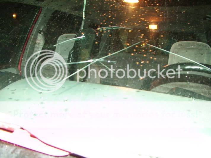
Well, it was a close chase for me tonight atleast. I was on the tornado warned storm that approached Lawrence before I called off the chase after the storm moved through Lawrence. I had some good structure when I stopped at the airport just northeast of town. I then moved east a couple of miles and learned that the storm had dove to the south so I tried to backtrack to get to it. It wasn't a pretty sight to see when I emerged through the hail core. After one pretty badly cracked windshield and one detached rearview mirror later due to atleast tennis ball if not baseball sized hail later I decided to call off the chase and drive the two miles back to my apt.

Also, a huge thanks to Dick McGowan and Jeremy Goodwin for the nowcasting!

042306.jpg


DSCF0219.jpg
 
It was great to experience a storm from absolute initiation to impressive supercell. The high-base made tornado production a long shot, but I'm not disappointed in what I saw. The storm did go on to be tornado-warned as it approached Salina, but I'm not sure what the warning was based upon.

Darren Addy
Kearney, NE
[/b]

One volume scan of KTWX's radar showed strong rotation just north of Brooksville, KS, along I70. The next scan showed little if any rotation. This cell appeared to be at the intersection of the warm front and the line of storms to the south.
 
20060423_3_sm.jpg

Looking east towards Medicine Lodge, KS

20060423_7_sm.jpg

East of Dodge City, KS

Myself, Michael, Tony L and friend Jennifer Brindley, Tom Dulong, Allan Covelli, Jon Van De Grift and his girlfriend started out in Wakeeney, KS and decided that the action south of us was too tempting to pass up so we headed south out of Hays to spend the rest of the afternoon getting down to the tail-end-charlie storms. Storm speeds this day were 30kts, not the 60kts of chases previous so we were actually able to catch up to them.

We spent a few of the evening hours moving east of the tail-end storm on hw160 as it would move towards us, start raining and then we would move further east. We spent most of this time between Coldwater and Medecine Lodge, KS.

On the way back we caught some great lightning near Dodge City, had dinner at the Sonic drive in and got back to Denver where my head hit the pillow at 4:30am

Not a bad little chase - still waiting for that first tornado catch of the year. Chase cation is less than 3 weeks away now!
 
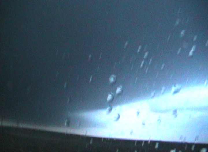
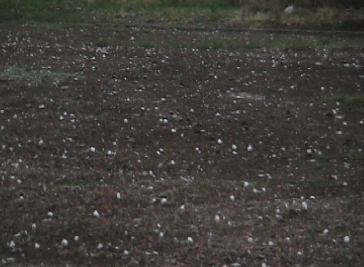
Man, there was only a %10 chance of thunderstorms here for denver, but when i saw the amount of CAPE expected and that area that just got sooo much heating with no inversion. I knew there were gonna be storms. The first chase of the year was very sweet. There was 3/4 inch to 1 inch hail, i got some cool video too. Ill upload that hopefully tonight, along with the pics. The storms were like multi-cell clusters but had some real nice structure at times. There were also a grip of lenticulars around, and the storm, and other clouds had that "twisted", "smooth" appearance to them. The only issue was the heights of the storms. They were high based, but as youll see on the video. Lowered ok, but were still just too high based. It wasnt even a risk day, but my first severe storms of the year were well worth the chase.
b33888661.jpeg

b33888916.jpeg


b33889055.jpeg
 
Yesterday's chase was what I'd call "sweet-ass-mamba-jamba". It was totally a long shot, and I ended up catching a really, really beautiful storm. My friend Darren Addy and I left out of Kearney at around 18Z and dropped south via Holdrege to Hays, Kansas. There we got gas and leeched wifi off of Days Inn. (BTW, if you're looking for a data stop, Hays has a ton of open wifi. I mean, seriously, you could probably hold a LAN party in the parking lot of Days Inn. Anyway, I was feeling a little better about the day as I saw on the surface obs that Tds of 60 were starting to pump their way up into eastern KS. The SW flow wasn't helping things much were we where, though, and the Tds hovered in the mid 50's. Upper level winds were still mediocre at best accordin to the profilers, but, hey, it was almost May... I had hope. :) Eventually the dryline initiated to our south down by KDDC. The storms looked pretty boring on radar, though I now realize that that was an illusion due to the very high bases of the storms and that we were only using tilt 1 to view returns. (Why that didn't occur to me until later, I dunno!) The Tds down there weren't too impressive, either, not that they were much better up where we were. I stayed north, as there was no way to get that far south quickly and because I still had my fingers crossed that something would initialize near the now warm front. It was tough not to go rabbiting south, because I've been burned more than a few times by waiting too long to get a move on.

It got to around 22:30Z or so and I noticed that the Tds in Hays were actually dropping -- they were now in the mid 40s. Not a good sign for where we were; I guess the dry air was mixing in. But on the sat shot, it appeared that a field of cu were starting to form about 40 miles to our east, so we hit the great east-west interstate that is I-70 and drove east. We came upon the cu field about 30 minutes later. A small area had become congested, and it literally began initiating as we drove under it. I pulled over at a reststop north of Ellsworth and had a ham sandwhich with Darren while we watched it go nuclear just to our west-northwest.

init2lr.jpg


(not nuclear yet, but you can see the tower peeking out beneath the crud below)

darrensandwichweb3pf.jpg


Darren demonstrates the Socratic Method of eating a ham sandwich.

There is nothing cooler than watching a vault form overhead and hearing a storm's first rumble of lightning! Eventually we decided to go east, as the storm was starting to slide just to our north. So we west east on I-70. Along the way, we passed Amos & crew. There was a black 'stang in my rearview, too, so I'm wondering if Mike wasn't in the hunt. Amos got off on the same exit we did. Turns out that was probably one of the best places to witness storm development in central Kansas -- right off the exit was a flat field about 3 miles long with an easy place to pull off and park. Park we did, and wow, did the cell put on a show. Oddly, the storm did not produce much of a radar signature for a very long time -- it was almost invisible to radar. At least on tilt one. ;) Later I realized why I wasn't getting radar returns -- the base of the storm was above the tilt-1 beam. Doh. After a bit, the storm dumped it's core and split. This was interesting to watch, as I didn't understand what was happening at the time. I've seen right splits on radar and know what they mean, but I've never actually been able to watch one with my own eyes as it happened. Amos filled me in. Anyway, the right-mover started moving back to the southeast, which put us in pretty much the best position possible to watch it. The inflow was a good 25 or 30mph. Eventually, to the surprise of pretty much everyone, the darn thing formed an RFD and demonstrated a very obvious meso and wicked-looking wall cloud.

storm15ok.jpg


It really turned into a mothership of a storm -- check out the striations at right! I have a new respect for really high-based storms. Around sunset, this storm was one of the most beautiful things I've ever seen. I mean, I put it up there with the Grand Canyon and redheads. The color and depth on this storm was amazing.

storm28zx.jpg


storm33xs.jpg


storm48hq.jpg


From the Amos crew (if you don't want your picture posted, just lemme know! :))

storm59uw.jpg


The streaks are actually raindrops that the flash illuminated. I think. If you look close, you can see a small funnel waaaay up in the meso.

storm63mx.jpg


Eventually, we repositioned one exit east on the interstate. What a beautiful, beautiful storm.

storm71lx.jpg


Props to Amos for his headlights, which makes this photo better IMO. I was a bit frightened when I took this, as I was on top of a freakin' hill with a metal tripod while zeus zots were falling all over the place.

Darren actually has some hilarious and cool video of us coming up to the top of a hill behind Amos, ominous as all heck, when suddenly a parade of tumbleweeds blows by. Lol. The storm never put down a tube, but who cares?! This was the best storm I've seen in a while -- truely spectacular in it's beauty.

darren2web5dk.jpg


Darren and Ryan give this supercell two thumbs up!

Anyway, great chase. Hope I didn't bug Amos too much, as we followed them around a bit without asking after we converged the first time. Thought I'd give my navigator a break and let him shoot some video instead. ;)

Wow, is it only April?!
 
FULL CHASE LOG HERE!

Gas prices play a significant role in storm chasing, and I think we've found a good remedy to the problem. Between Verne's Subie and my Minivan, we crammed eight of us from Colorado into the pair of rides and ventured into Kansas for a leisurely Sunday drive. Jennifer Brindley debuted in her first chase as she sat in the van with myself, Jon Van de Grift, and his girlfriend, Allison. Verne drove along with his son, Michael, Tom Dulong, and Alan Covelli in his Subie.

Verne and crew met near DIA and were on the road about 45 minutes before we were. Jennifer arrived first, then Jon and Allison arrived. We packed and headed out I-70 to meet with Verne and company at our favorite spot in Kansas; the Oasis Truckstop in Colby. We chilled over Quiznos before continuing east on I-70 to Wakeeney, Kansas where a very hospitable woman allowed us shade under the parking overhang in front of the new Best Western on the north side of I-70.

We hung out for a couple hours in hopes that storms would develop and ride along the front which was draped over the area. Weak winds and rather meager moisture kept things in doubt, but we felt confident we were in the best place for the day. Models were dipicting a dryline buldge to our south and we were hoping to see storms fire off this buldge and into our front. It never evolved that way.

Storms fired in southern Kansas and after waiting a while, we elected to move east on I-70 to Hays where we skirted the city and dropped south on Hwy 183. We continued south along 183 through Rush Center and into Kinsley where we elected to blast south to the tail-end Charlie and skip out on the northern storms which appeared to be lining out. We headed down to Greensburg where we punched a rather windy and rainy core which blew the WX Radio antenna off the roof of my car. We fixed that in Greensburg after a quick gas top-off.

We made it as far as Coldwater before finally moving east. Our storm was positioned to our south and west and was moving generally east just south of Hwy 160, our Holy Grail Highway of 2004. We stopped at various points to shoot, then continued east to clear the rain and shoot again. Our hopes were that this storm would have some northerly component and take it across 160 where we could enjoy a core before dark. Our storm, moving slowly (very nice for a change), never made it to the highway. We let the storm pass to our east where we photographed lightning on the backside.

We weren't done there, however, even as we surrendered the day. We headed back to Greensburg the same way we came and noticed a weak storm going up to our west which was dishing out quite the lightning show. We turned west on Hwy 54/400 out of Greensburg and stopped outside of town to enjoy the show.

We continued into Dodge City where we took in dinner at Sonic. This was actually the location of the day's biggest disappointment as we arrived in Dodge shortly after 10. We saw an Applebee's which looked to be open, and when I read the sign, I skipped over the days of the week and was excited to see it open til 11. No such luck; the 11 time was not for Sunday. They had closed 15 minutes earlier. So much for ribs and steak. We settled for Sonic and I munched down on some popcorn chicken. We filled up at Love's and began our trek home.

To our surprise, we watched lightning from a distant complex of storm rolling out of Northeast Colorado. A watch went up for these storms and we were thinking that we'd get a third chance at lightning for the night. By the time we hit Colby, the storms had weakened and the night was officially done. We crossed the Colorado border with 56 temps and filled up in Limon about 75 minutes later in a brisk north wind and temps in the mid 30s. We parted ways with Verne and company and arrived back in Lakewood at 3:45, 19 hours and 15 minutes after leaving with another 974 miles under our belts.

060423a.jpg

The April 23 Kansas Krew from left to right... Michael, Verne, Tom, Alan, Jennifer, Allison, me, Jon

060423l.jpg


060423v.jpg


060423zc.jpg


FULL CHASE LOG HERE!
 
Anyway, great chase. Hope I didn't bug Amos too much, as we followed them around a bit without asking after we converged the first time. Thought I'd give my navigator a break and let him shoot some video instead. ;)[/b]

No way! We were glad to see other chasers up there and particularly Darren and Ryan since I assumed Ryan would have the right lenses to shoot that great storm at close range. Those pictures are excellent. When you see somebody like Ryan or MikeH on your storm, you know you can relax and concentrate on video. :p

Here's the report I wrote on the way home from Kansas last night. I haven't had time for any image processing from Sunday since I worked yesterday and chased yesterday evening, so this is all text. Ryan's images speak for themselves and Brian Stertz's image of the tail cloud and rain foot is better than anything I captured, I'm sure.

Report for April 23, 2006:

Eric Nguyen, Robert Hall, and I intercepted a supercell west of Salina, Kansas between 0z and 0130z. The storm produced three interesting wall clouds plus a large rain foot and several midlevel funnels. One of the wall clouds featured a tail cloud that hung from the elevated base to very near the ground, the longest example of this feature I've seen. The storm exhibited rotation for much of the time we chased it, but never threatened a tornado as it was too elevated.

Our initial target was the nose of what we expected would be a vigorous dryline bulge. We hoped storms would fire ahead of this lift and traverse the warm front along or just north of I-70. Like everyone else, we were disappointed by the quality of boundary layer moisture and by the apparent weakness of the impulse that had tempted us to chase under a ridge in the first place. Early RUC forecasts for midlevel winds were discouraging, but we checked profilers throughout the day and never gave up entirely on the idea that something along the boundary could see improved SR flow if it anchored to the front.

We wandered about and encountered Scott Eubanks on his first day of chase vacation, and enjoyed a lazy dinner in Wakeeney before turning back east with the intention of reaching I-35 and our route home. The lack of cumulus and consistent forty degree dewpoint depressions in central Kansas had convinced us it was time to turn south. Along the way, all three of us were either sending text messages or engaged in cell conversations about the bust when a rounded updraft base appeared north of the highway.

The base was elevated but compact and over the next twenty minutes a core developed then split away. We met Ryan McGinnis and Darren Addy at this point and watched the slowly-developing storm spit intermittent CG’s that ran us back into our vehicles. Afterwards, the remaining updraft base looked much like it had earlier near the highway, a smooth underside with a signs of circular organization. Our inflow picked up substantially and the storm developed a collar cloud that turned while scud condensed and attached to the center of the elevated meso. Within ten minutes, the storm produced a large, blocky wall cloud that rotated lazily while two elevated funnels formed around the periphery of the collar cloud.

After the first occlusion, we followed the storm a few miles south (mean forward motion was probably around five knots!) while looking in amazement at a new, larger wall cloud and associated tail cloud near a dark and well-defined rain foot. When we stopped, the tail cloud grew very low. Our best guess is that this feature was 1-1.5 km long and very vertical, nearly reaching the ground. While it's important to emphasize that this was not tornadic or even rotating with any vigor, it was nevertheless interesting for illustrating the elevated nature of the storm and how much trouble it went through to tap into boundary layer moisture and higher RH air along the stationary front.

Soon the outflow-dominated fate of this cell befell our last attempt at organization and the final wall cloud was much more elevated and broad. By 0130z, the storm suffered both from a lack of midlevel winds and contaminated inflow courtesy of convection to the south. With pictures and video we hadn't anticipated capturing, we turned for home around 0200z. A clear-sky bust became a fun and unexpected chase with a great looking supercell.

Eric and I will both have video and pictures on our websites within a few days.
 
Back
Top