Excellent day today in East Central Illinois. Got 2 tornadoes, excellent video of the first one. It was the best Easter I've ever had!
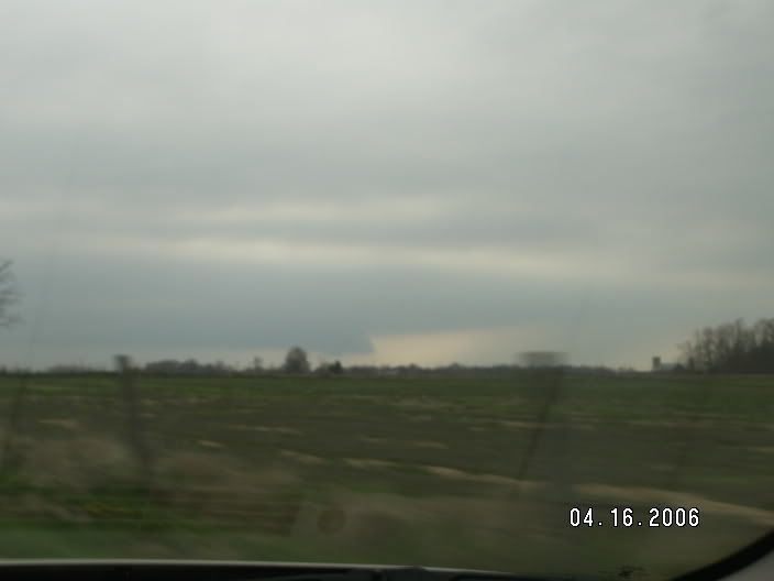
Today’s chase began around 2:00 when I left my Grandparents Easter dinner in Sullivan, IL. I headed north to Cerro Gordo and waited for a tornado warned storm to move through the area. I positioned myself on the southern end, but it was hopelessly high precipitation. There was no way to view any type of clouds inside the very heavy rain. I moved north from Cerro Gordo then east on I-72 to catch back up to the storm. I was rarely able to see any clouds through the heavy rain.
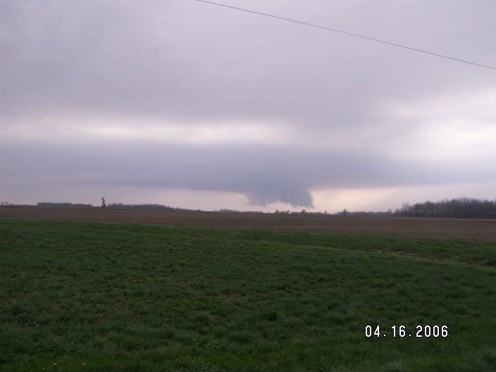
After screwing around in rain only, I decided to head back to Mattoon to analyze the weather situation. There were several times on I-57 where traffic was completely stopped. Each highway overpass was down to almost 1 lane due to the large number of people seeking shelter under them. When I was about 5 miles north of Mattoon I could see a rain free storm base with small but persistent wall cloud. I exited I-57 at Mattoon and traveled north on route 45 and stopped around 1100 N. At this point it was clear that things were starting to happen. The wall cloud had been there for a while and was showing clear signs of rotation. I could see that an RFD was blasting down and kicking up dust. These were all good signs! During this time I was reporting my observations to the spotter net which was relaying them to the Coles County EMA and NWS ILX. I then jumped back on 45 and drove north. Things were really starting to happen now, the wall cloud was unmistakable. It was clearly rotating as it moved over or just south of Humboldt.
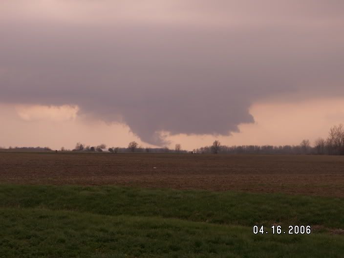
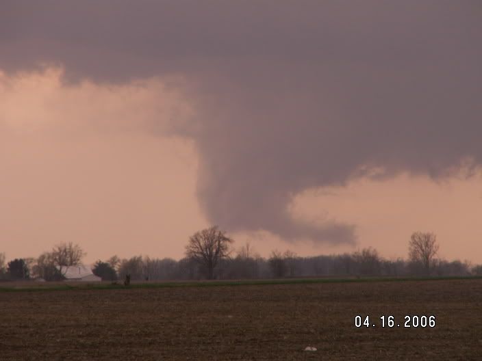
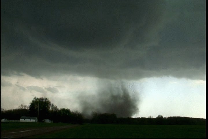
Shortly after it moved over Humboldt a nice cone shaped funnel appeared out of the wall cloud. Everything was coming together; there was a clear slot on the back of the wall where the RFD was punching down. A long, curved inflow band extended from just above the base of the wall cloud. Dust was visible from both the inflow region and RFD region. The funnel cloud touched down just before I-57 and moved over the interstate. The condensation funnel wasn’t down yet, but there was obvious circulation on the ground and a debris field. I have the tornado moving over the interstate on video. I wasn’t close enough to see if any cars or tractors were hit, but I’m sure somebody had a close call due to the high traffic on Easter.
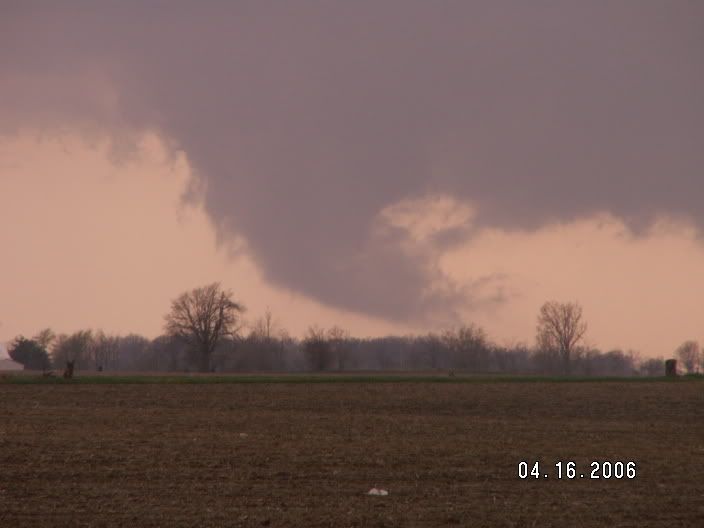
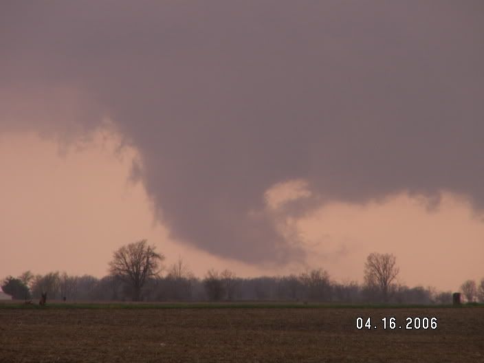
At this point I was loosing contrast and was barely able to see the tornado. I had to push south 2 miles to cross I-57. I then traveled east and witnessed a beautiful tornado. It was cone shape and the condensation funnel extended to the ground. There was a debris field rotating quickly around the tornado. I drove north and stopped about ½ mile south of the tornado and watched it move through a field. From my vantage point it appeared to directly hit a farm. Obviously the tornado wasn’t very strong because all trees and buildings were left standing. Shortly after hitting the farm the tornado roped out and returned to the clouds.
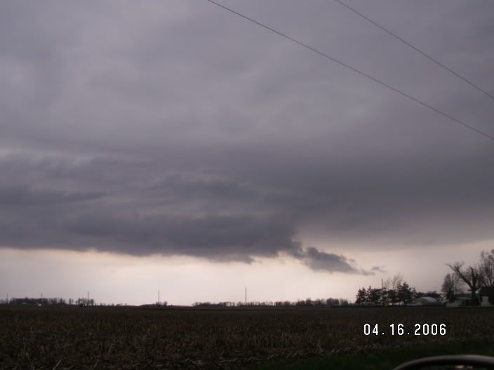
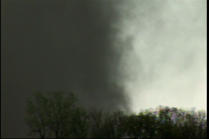
The second tornado became visible not more than 2 or 3 minutes after the first one. It was about 4 miles north of the last tornado and appeared much larger and more dangerous. I traveled north to get closer to the tornado for a better view. I can confirm that this tornado was on the ground, but it was very brief. Probably less than 1 minute. There was a debris field, but the condensation funnel never touched fully. Since I saw circulation on the ground that means it was a tornado. This tornado displayed some very rapid rotation, much more than the first. It dissipated and lifted back into the wall cloud.
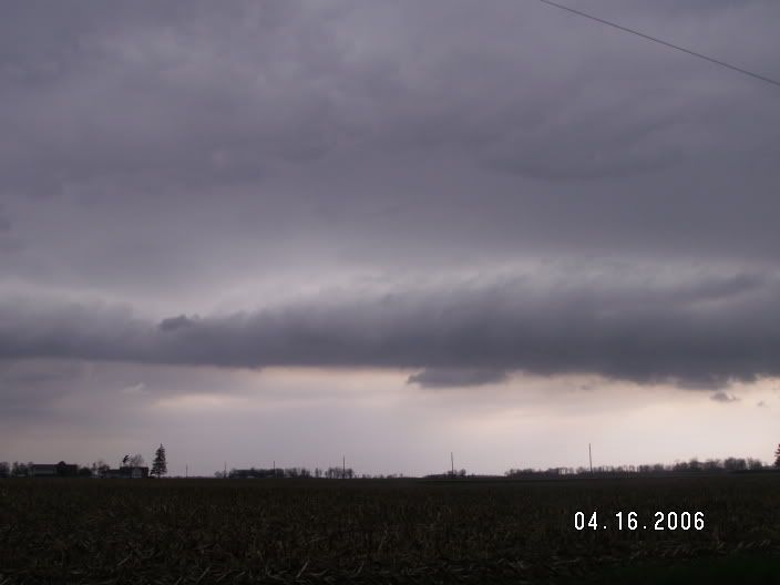
I was able to keep up with the wall cloud region of this supercell for about 1 hour and 30 minutes as it produced several other quickly rotating wall clouds. To my knowledge, the storm did not produce any other tornadoes. I called the chase around 6:30 and headed back to home.
My tornado footage was the top story on WAND TV at 10:00.
I have more pictures and videos on my chase log.
http://www.brademel.com/pages/storm_chase_...php?year=&id=17
Still uploading the videos, they will be linked soon.
EDIT: Videos uploaded