• While Stormtrack has discontinued its hosting of SpotterNetwork support on the forums, keep in mind that support for SpotterNetwork issues is available by emailing [email protected].

4/11/07 REPORTS: MS/AL/GA/IL/IN

Joined
Dec 19, 2005
Messages
517
Location
Saltillo, MS
guess ill start this thread...im sure yall can finish it...

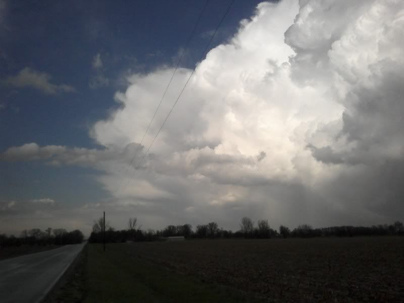
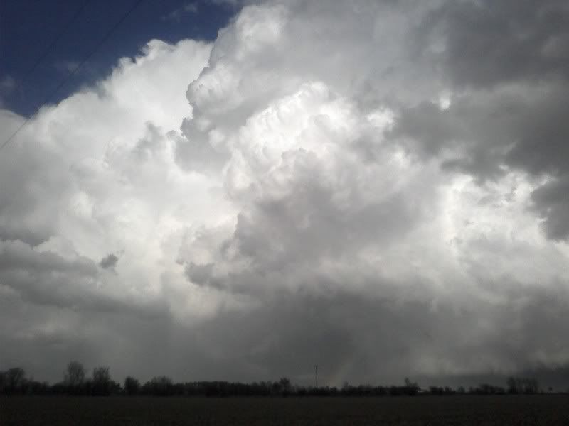
its been a busy day, so i wasnt able to follow the storms into AL...just got home now, but i took the camera out with me...

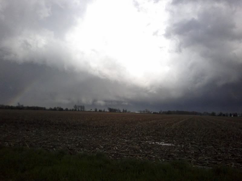
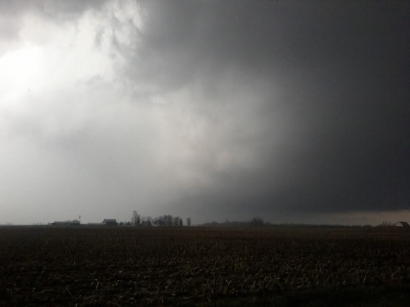
there was a line of storms that moved through north mississippi today...it was non-severe when it moved through my area, but it had a few cloud to ground bolts, and a half-way decent look to it...

IMG_0011528x396.jpg


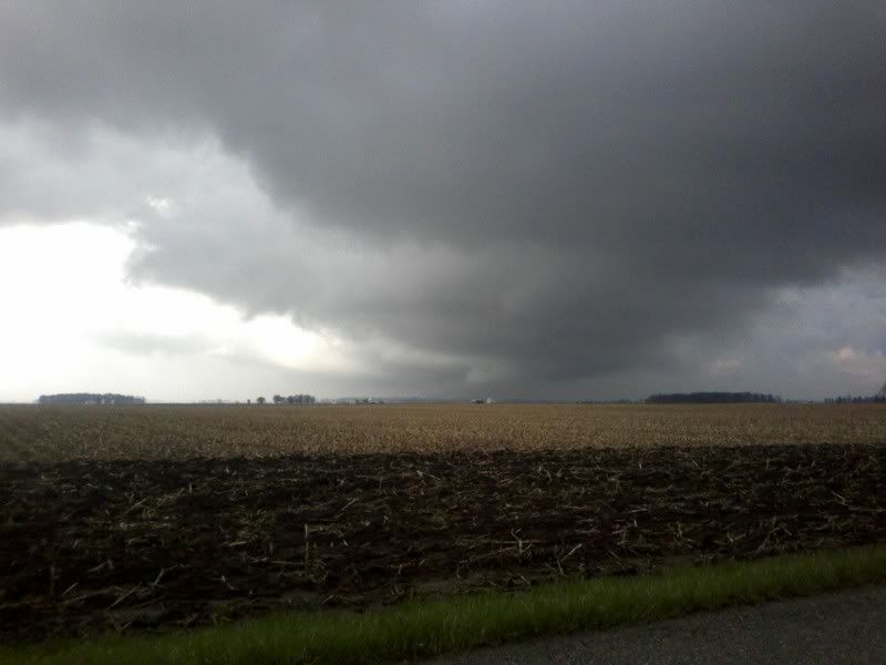
this was the look of the storms currently TOR warned in AL...as soon as the line passed, the skies cleared out in a hurry...

IMG_0012400x300.jpg
 
IN

This is the right-mover that was tor warned at the time of the shot. Looking south in this shot, storm was moving to the northeast

IMG_0916.jpg


I had to core punch to get the top shot. The rain was coming down so hard people were driving 10 mph down the highway, hail was coming down in the rfd to the right of the shot above. Pea, dime, and quarter size hail in this cell.

The next shot below is after the cell crossed highway 74 in Hendricks county.
sorry about the semi in that shot. And in IN their are pockets of trees everywhere, which makes for crappy chase terrain.

IMG_0920.jpg


The shot below is just some convection on the east side of the storm. You can just make out a pileus cap. The rest is all video.

IMG_0933.jpg
 
Firtst tornado in the past 2 years today

Did a impulse chase today in the indy metro area and caught a tornado northeast of arcadia, in. Unfortunately the camera i had was my phone so the pic quality is not that great.

This pics are of the storm in hendricks county around 5:30.


Was then separated from the storm by I-65 and was able to get some shots on the backside.


I then followed the storm through hamilton county and just east of arcadia(maybe 3 miles northeast). These are the pics there.


Funnel coming down and making contact.


And from the backside. Sorta fuzzy


Have a video from the phone also. bad audio.
http://www.youtube.com/watch?v=mFLgWw4-vUE
 
Last edited by a moderator:
IL, IN

Kudos to Raymond, nice job using the low-end camera to capture the event. I saw the towers going up East of Crawfordsville and wished I was in position. Amazing how it survived so long with the line of storms encroaching. It may take a day or two but I'll post a picture of the storm from 50mi. and the tops were only 35,000!!

Here are some pics of the Arcadia Sup' when it was north east of Crawforsville, pics taken from approx. 50 miles.


-Terrence
 
Last edited by a moderator:
Started out the day thinking not much would happen, but then the sun came out and I began to see towers shooting up west of Muncie. Got excited once I started hearing about tornado warnings and I jumped into my car. I went on 128 west until i got to state road 9 and really wasent sure which direction to go. I ended up calling a friend to look at radar and direct me. I made it to Elwood as soon as the tornado sirens went off, and at the same time was hearing my weather radio spitting out tornado warnings for the county I was in. I also was getting reports of a tornado on the ground SW of Elwood (realtime), I was getting really excited. I went south on 37 and went 4 miles south of Elwood before getting caught in the precip core and pelted with hail twice the size of peas and probably 40 kt winds. After the hail passed there was no evident or obvious updraft base to be seen (contrary to reports I had been hearing just ten or fifteen munuets ago) the storm continued to die and ended up with only some good lightning shots. Turned out I was only ten or fifteen min away from seeing the tornado! Killllls me...!
URL%5D
2992302700089407043ywRWSr


http://good-times.webshots.com/photo/2992302700089407043ywRWSr

http://good-times.webshots.com/photo/23838886550089407043UVrStN

http://good-times.webshots.com/photo/2339376160089407043baxOmO

http://good-times.webshots.com/photo/2488419040089407043KffOeh

http://good-times.webshots.com/photo/2651915040089407043HMzdsS

2383886550089407043UVrStN
http://www.youtube.com/watch?v=3-QXTrZ2ZLE

2339376160089407043baxOmO


2488419040089407043KffOeh


2651915040089407043HMzdsS
 
Last edited by a moderator:
Good day all,

Good job Raymond, and anyone on the Arcadia, IN storm!!

Yup - I headed out kinda late after work from Dayton at around 6 PM since the storms were not too far from me. I was on the storm just southeast of the Arcadia (Madison county) storm. So I was not too far, the picture below could have been part of that storm system.

My chase log is below...

m8gf2.jpg


Summary: April 11, 2007 was pretty much a short "impromptu" chase along Interstate 70 from Southwestern Ohio into East-Central Indiana to intercept a line of strong and severe thunderstorms. The chase began leaving Dayton, Ohio at about 6 PM and heading west into Indiana along Interstate 70 after looking at radar and seeing a developing line of severe thunderstorms moving across Indiana near Indianapolis. An area of light to moderate rain and cool temperatures, ahead of a warm front, moved off to the northeast and a clear slot allowed limited heating in a region with very cold air aloft.

A severe thunderstorm watch was issued for parts of east-central Indiana and parts of southwestern Ohio. These were actually two watch areas, watch 126 valid until 11 PM EDT and another watch 127 farther east valid until 1 AM EDT. The SPC outlook called for a slight risk centered over east-central Indiana with a 5% tornado, 15% damaging wind, and 15% hail possibility. A severe thunderstorm was encountered in Wayne County, Indiana at about 7 PM along Interstate 70. The storm had winds strong enough to blow over a semi-trailer headed westbound. The storms moved rapidly northeast and could not be intercepted more than once. A tornado warned storm also was present in Madison County, about 15 miles to the northwest of the severe storm intercepted. The storm producing the tornado was not observed. After the quick intercept, a fuel stop was done and the chase finished by heading back east into Dayton, Ohio. Total mileage was about 120 miles.

April 11, 6:30 - 7:00 PM: Penetration of a severe thunderstorm in Wayne County, Indiana along Interstate 70. The storm was a bow-echo type structure in a multi-cell line of strong and severe thunderstorms. Lightning, torrential rains, winds near or exceeding 60-MPH, and small hail were observed with this storm. This storm also produced an impressive shelf cloud associated with its gust front. The strong outflow winds of the storm also overturned a semi trailer headed westbound on Interstate 70 in Wayne County. The storms were caused by a low-pressure trough, approaching strong cold front and strong surface low, and a strong upper-level low-pressure area (differential PVA and very cold air aloft). A 2007 Ford Focus was used to chase the storms. Documentation was still digital photos and HD video. A severe thunderstorm watch was also valid for this area until 11 PM EDT.

Full chase log can be found at the link below...

http://www.sky-chaser.com/mwcl2007.htm#APR11

Congrats to all who went out today on such a "seemingly marginal" day ;-)
 
Caught the Dadeville, AL tornado this afternoon. It formed very close to me. The video that I caught was very shaky but there is a chance it will make NBC and FOX National News. I will post the video up here very soon.
 
This was my first try at a cold-core setup and I am pleased with the result. I got up close and personal (more than I intended, actually) with a rapidly rotating wall cloud along I-70 east of Terre Haute, IN. This was the strongest rotation I have ever seen when a tornado did not occur.

Video here:

http://www.youtube.com/watch?v=TnfliFopaII

I will post a full report soon.
 
Well, I had two targets, and went with the wrong one. I planned either on heading south into southern Illinois, or east into Indiana ahead of the main line.

Being so close, the main line suckered me in. For such a iffy set up I didn't feel it would be justified to drive much further (especially with gas going up 15 more cents that morning).

I drove south a bit along the line of cells, looking for one that had a shot. It appeared most of the shear was further east in Indiana so the storms were having trouble sustaining themselves, let alone rotating. I wound up around Allerton, Illinois before turning around and heading home. I only took one still photo of a storm base near Tuscola which I may or may not post, and didn't get the video camera out once. Had it not been such a local chase I would have been annoyed that I even went out, but I really didn't waste much of an already free afternoon and was able to test out some new gear.

Needless to say, I was slightly annoyed to see the sup in central Indiana crawling along tornado warned, but I have yet to see any good tornado pics from it, so I'm not terribly upset about not being there.

EDIT: Okay, just saw the photos on the NWS IND site, and now I'm a little more annoyed at myself. Ah well. For those that haven't seen...

http://www.crh.noaa.gov/images/ind/Apr1107/arcadia1.jpg

http://www.crh.noaa.gov/images/ind/Apr1107/liztontor1.jpg
 
Last edited by a moderator:
http://alabamaweather.org/blog

Video and photos of the damage from the Tallapoosa County, Alabama EF-1 tornado. Also, some still shots of the back side of the monster supercell along with some near 5" hailstones that fell in Russell County. What a day....the video did make National news on FOX and NBC has picked it up from what I understand. Sorry about it being so shaky.
 
I feel foolish for not catching one. I got home at 4 PM and carefully watched the storms track and felt they would clip south/southeast of my location in Tipton county and would make for a great intercept point.

However, I waited around and then decided to hang out west of my house in Howard county thinking the line might produce something rough for us. (I really didn't think an EF2 or really any tornado would happen, just severe thunderstorms.) I monitored the local SKYWARN and the state NWS net and by the time I figured out I needed to move to intercept, it was too late.

I drove toward the action but was still15 miles north when it all touched down. I knew then I would just be playing catch up so I bailed and went home. I guess next time even a newbie chaser should follow his gut.
 

Attachments

  • rainbow.jpg
    rainbow.jpg
    35.5 KB · Views: 42
  • front.jpg
    front.jpg
    12.4 KB · Views: 48
Last edited by a moderator:
Back
Top