• While Stormtrack has discontinued its hosting of SpotterNetwork support on the forums, keep in mind that support for SpotterNetwork issues is available by emailing [email protected].

2025: Year Without a Winter in the Western US

Significant May snowstorm for the Front Range forecast Tue-Wed. DEN could see up to 8" of snow. See ECMWF total snowfall attached.

I post this b/c all the talk about a lack of snow this winter in the Rockies, but I find important details have been overlooked since Feb.

When many think of winter, they say Dec-Feb. That's the eastern U.S. bias talking, as if this part of the country is the climate standard? But in West, winter, or should I say snow season, is much longer.

Also, many locations in the Rockies, their snowiest month is March, outside of meteorological winter.

I saw the media in Feb so many committing "counting their chickens before they have hatched" fallacy in regards to this snow season.

Yes you can slice and dice things down into periods for this or that record (e.g. Dec-Feb), but what matters when talking climate is the entire picture, not cherry-picked items that fit a particular narrative or the like. In this case, significant snowfalls can occur in large population areas, like Denver, in the Rockies anytime Sep thru May. Heck, you can back it up even to Aug on rare occasions w/ locations like Great Falls MT (August 1992).

Denver this snow season has had more snow March-April (13.9") than meteorological winter (13.2") and more on the way. Since Feb, this location and many areas in the Rockies have made up some ground and are no longer rank record lowest for snowfall. Below avg still yes, but that's not the same as all-time records. Just b/c the snowfall was unevenly disturbed, does not mean something is off/wrong. Sometimes you get the distinct impression these days that any deviation from normal or anomaly is somehow extreme and not supposed to happen. That does not mean they are not worth talking about or should not be reported, but let's not turn the ordinary into the extraordinary by default every time (not talking about people here on Stormtrack, of course!) :)
 

Attachments

  • densnow.png
    densnow.png
    184.1 KB · Views: 1
Boris is absolutely right that the snow season in Colorado is much longer than elsewhere - at least October to April, and September and May also sometimes get significant snowstorms. That said, it is highly unlikely that seasonal snowfall in Denver or anywhere else in Colorado is going to be even close to normal. The average seasonal snowfall in Denver in the period 1882-2015 was 57 inches. No May storm will get them anywhere near that - even if they get the high end of what Boris mentions, they will still be more than 20 inches short. And in other parts of Colorado, New Mexico, and other Western states, the situation is even more dire. It is great to be getting a couple May storms (picture attached below from Ski Santa Fe in NM on May 1), and every little bit helps. But it is not going to keep anywhere in the West, except maybe a few places in California, from having winter snow totals that are far below normal. And the March heat wave probably made things worse, as the mountain snow pack is nowhere where it normally is this time of year, although no doubt some of the early runoff from March was captured in the reservoirs.

20260501_153117.jpg
 
Denver's current seasonal snow stands at 27.3". There are 7 other seasons since 1881 that have had less. That was my main point here. Not the "lowest on record" as much of the MSM stated. Yes, season-to-date at times in Feb I think it was the lowest, but you can play statistical games all you want w/ season-to-date numbers and come up w/ all sorts of records that don't mean much overall. What matters is the entire season/longer-term. This goes back to how the mindset Dec-Feb is the only real significant snow season everywhere in the CONUS.

And I looked a bit further. The differences between previous observation snow locations and DIA are non-trivial. Take a look here.

9 and 13" difference are quite significant. So really, looking at the climate POR for Denver, the snow amount for 2025-26 is not as minimal or historically impressive as it seems. Another case where the details count, and can make a noticeable difference in quantifying things.
 
Yes, agreed the location matters and it does on average snow less at DIA. But even if they get the high end of the forecast, they are still well below the average since the measurements moved there, and many other areas in Colorado and nearby states are worse. Plus the effects I mentioned of the March heat wave. So all-time record low snowfall? Not in Denver, as you note. But it still may be in other parts of the West, and nearly all areas near and west of the Rockies are far below normal. That is true from the Canadian border to the Mexican border, which is unusual. As you know, it is not unusual for the Southwest to be low and the Northwest high on snowfall, or vice versa. But for everywhere to be low like this year, as will almost certainly still be true at the end of May, is unusual. That said, I hope this storm brings a lot of snow, because it is much needed. And I am still looking for a good thundersnow chase in 2026! ;-)
 
Now that April is over(man that went fast ) I'll this'll be my little April update to the thread.

As stated in my 'March update', where I am only got 2 snows (but both were reasonable amounts, that part seemed fairly 'normal', but the above-average temperatures did not).
Well for April, where I am got all of *one* snow - on the 17th (of a bit over 3" .. ~1/4" water), for any other year that would be pretty weird, considering April is one of the snowier months, for this year though, its just another thing.
That was followed by a 'hard freeze' with a low in the low-20's which froze some of the plants & trees that'd started sprouting/leafing-out too early.
Forecast for week of the 26th looked pretty promising for rain & even possibly some (non-severe)thunderstorms. We did end up getting a few little rains, even a cuple rumbles of thunder, but no 'storms'...and just around 1/4" total. So not a total dud, but less than what I'd hoped for(though I was certainly glad to see what we did get). I think part of the issue was on a few of the days that had higher potential, there was morning clouds that just didn't clear out in enough time to allow for enough heating to build good afternoon/evening showers/storms.
During this period, the mountains did get some snows though.

I've attached some images below to show a few things seen locally..and some weather data.
The first couple are comparing how snow looks on a couple of the higher mountains(sorry, but I don't know which ones) on different dates.
Image #1: 'mountain 1', April 22 & May 2
Image #2: 'mountain 2', April 21 & May 2
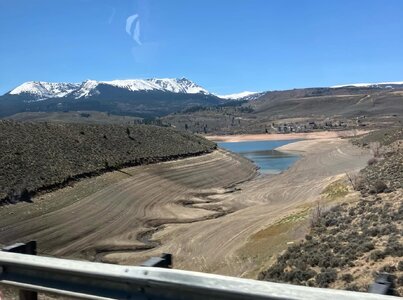
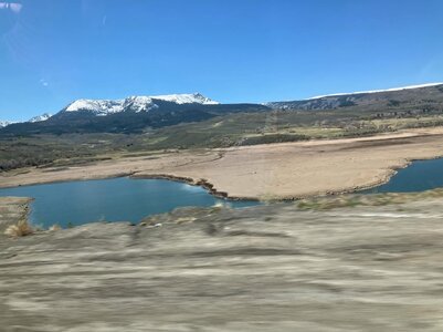
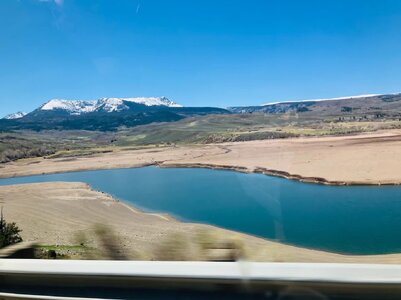
Image #3: low water in small lake at a local park, April 21
Image #4: frozen leaves on a tree & shrub from the snow/cold, April 18
 

Attachments

  • image_1.jpg
    image_1.jpg
    580 KB · Views: 1
  • image_2.jpg
    image_2.jpg
    593.9 KB · Views: 1
  • image_3.jpg
    image_3.jpg
    310.5 KB · Views: 1
  • image_4.jpg
    image_4.jpg
    488.9 KB · Views: 1
Last edited:
--splitting this into 2 posts mainly for the attachments--

Drought has increased over parts of the plains, and has decreased somewhat in some mountain locations (but nowhere is in good condition).

From what I'm seeing, the La-Nina has ended! and its currently in the neutral phase which is certainly good news.
Then foretasted to be El-Nino in the summer, be nice if that happens in time for monsoon season. (but thats really a topic for another thread)

Image #5: NWS - April temps
Image #6: NWS - April precip
Image #7: NWS - April drought
Image #8: NOAA - Goes satellite, April 22 & May 2
 

Attachments

  • Image_5.jpg
    Image_5.jpg
    388 KB · Views: 1
  • Image_6.jpg
    Image_6.jpg
    410 KB · Views: 1
  • Image_7.jpg
    Image_7.jpg
    234.4 KB · Views: 1
  • Image_8.jpg
    Image_8.jpg
    234.1 KB · Views: 2
@Boris Konon and @John Farley have made posts on this above, I'm adding one as well
The forecast this week could prove.. um.. "interesting":

Snow is in the forecast for tue-night/wed.
Current forecast shows up to 5" in my area (and this has been trending upward). And winter storm watches issued in parts of the mountains for up to 20".
I looked at a few models & was seeing 5"-14" inches here.
And while its actually totally normal to get accumulating snow in may here(I've even seen snow in June with no accumulation),
But this year there's the issue that trees down here started leafing out early (I have no idea on mountain ones though).
A couple inches wouldn't be a problem, but much more than that & this being heavy wet spring snow, there's gonna be issues:
Those trees that got their fresh leaves frozen a couple weeks ago might be their saving grace.
The ones that didn't get frozen on the other hand...this storm may be a branch-breaker. (and if we got the high end of what I saw, that going to be bad)
This could deff be good for the mountains! (but as mentioned by John), its still not going to make up for the ongoing drought.

I'll be watching this one closely to see what its gonna do. There's even the chance I could get some of that very rare thundersnow.
If it looks like a bigger storm, I might even have to go out & split some firewood for on the chance branches come down & we lose power.
I can 'protect' my smaller trees by de-snowing them(something I've done many times through the years), the big ones though, can't do anything about those.
 
I was not sure if I would even bother to put together a Winter Weather Observation web page given this year's lame winter in the West, but since things turned around in April and May I decided I would. The web page includes links to summaries of my observations of three late-season storm sequences, April 3-11 in Colorado, April 30-May 1 in New Mexico, and May 5-6 in Colorado. You can view the Web page at:

 
Since we are talking about snowpack and drought, what I write below displays how you can't always take things as face value and need to actually fact-check and verify from what is said to what is reality.

This blog entry lays out all the facts in an orderly and systematic way about how it is definitely *not* a drought emergency status in WA looking at all metrics as a mean. Yet the powers that be declared one, and their only reason is b/c snowpack is 50% of normal. Yet all other factors that go into drought states indicate no issues at all.
There Is No Drought Emergency in Washington State

The U.S. Drought Monitor, which factors in a lot, not even half the state is actually in a drought (yellow shade is not a drought level, it means "abnormally dry"), and it is only largely moderate status (see attachment).

And drought as a definition is a lot more complex than many think. There are 4 basic types of drought:
- meteorological
- agricultural
- hydrological
- socioeconomic

The word "drought" in itself has become a pejorative more than it should. Ppl hear that word and freak b/c the relentless hype/negative which conditions to act/think so. Well, just saying "drought" doesn't tell you much. One should ask, "how bad is it or what level?" "What parts of society/infrastructure are being impacted, if at all?" "Is it a short- or long-term drought?" Quantify it! But such is left out so often in the narrative these days. Details are ignored in favor of ideology or the like.

And two of the drought types have nothing to do w/ wx/climate. So you can have plenty of precip, but still be in a drought. Is this key detail ever included in the narrative?

10-15% of the U.S on avg is in drought at any one time. That in itself is not cause for alarm or means something unusual/wrong. This goes back to the misguided notion that has evolved in recent years that *any* deviation or anomaly that exists in nature means there is a problem and we need to "fix" it. It's the same notion when we get a major landfalling hurricane, and it is said, "this would not or should not be happening at *all*". What planet are these ppl living on?

"Drought" as a term has evolved somewhat like the word "climate." Hear these words and many ppl think "bad." "Drought" has some bad by definition, but "climate" does not. "Climate" is a neutral word in this sense, but the media and politicians have turned into a fear-instilling term.

So much these days wording and presentation are throttled to the max. The ordinary is turned into the extraordinary. Use the most superlative wording by default. No scaling or perspective. It's not an "alert," it is an "emergency." There are no severe, heavy, or disastrous/disaster events/damage anymore, it's all "catastrophic." How does this really serve the public in a positive way? Being pushed into a constant state of alert put on edge is not healthy and it is all making us being "held hostage" by the wx. This hurts business and commerce big time, among other things.

The drought hype angle has become more of a racket IMHO. It allows $$ to flow/be available by declaring an "emergency" and this opens things to graft/corruption.

I know this sounds cynical, but you have to take a hard look at society today. Having problems, real or invented, are profitable, and that's one reason why we have so much hype nonsense. And this masks or makes it hard to know what truly are problems we can address practically and efficiently b/c no one knows what is what.
 

Attachments

  • wastatus.jpg
    wastatus.jpg
    57.8 KB · Views: 1
Back
Top