gdlewen
EF4
This is very early, but I like to begin looking at events as they appear on the horizon. Especially if they do not appear to be very impressive, because I think there is a lot to be learned from studying "subtle effects". (In Physics this is often true, so why not Meteorology?)
Plus the historical trend seems to be the risk increases daily as the event approaches, so if that holds we should get at least a SLGT risk out of it.
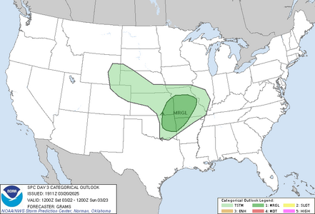
Key phrases that caught my attention in the Day 3 Outlook:
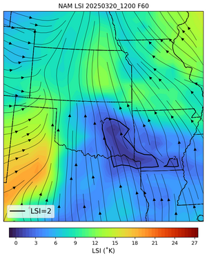
Of course, all of this presumes the Lid Strength Index has predictive power. I posted here some time ago to ask, "Whatever happened to the LSI?", partly because I wondered if the LSI was found to be "not so useful".
Anyway--it will be interesting to see how this event develops.
Plus the historical trend seems to be the risk increases daily as the event approaches, so if that holds we should get at least a SLGT risk out of it.
Key phrases that caught my attention in the Day 3 Outlook:
- favorable speed shear should exist for at least a few elevated supercells
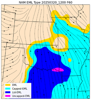
- extent of convective development may have a sharp cutoff beyond the Ozarks given the expected strength of the EML
 | |
Forecast LSI. For regions with values ≤ 2˚K, if deep convection occurs it is more likely to be severe | Spatial Depiction of EML Classification. Based on Lanicci & Warner (1991) |
Of course, all of this presumes the Lid Strength Index has predictive power. I posted here some time ago to ask, "Whatever happened to the LSI?", partly because I wondered if the LSI was found to be "not so useful".
Anyway--it will be interesting to see how this event develops.


