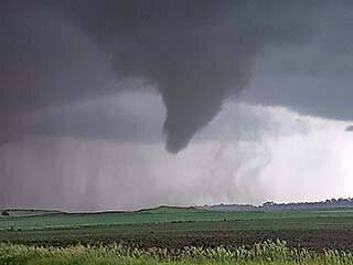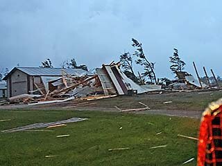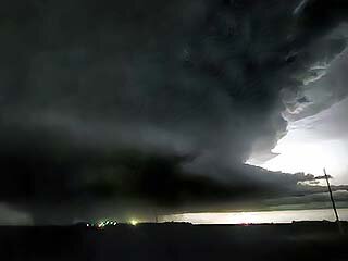
This was another great day, given the cap broke and the rest was history...
Summary:
June 20 was a highly successful and remember-able chase day with a target area from central to east-central North Dakota. The target area was between Fargo and Bismarck, near I-94, mainly around Jamestown. The SPC had a large enhanced-risk outlook, from Montana and into Minnesota, with hail and wind probabilities of 30%, and a 10% tornado probability, all hatched for significant. I left Sioux Falls via I-29 north, making it into Fargo, North Dakota by mid afternoon. From there, I began heading west on I-94 towards Bismarck, stopping in Stutsman County west of Jamestown under clear-blue skies, working on some remote IT work and meetings until early evening while waiting for the cap to erode. Alto-cumulus castellanus clouds were noted overhead, giving way to clear skies, confirming the needed upper level support for storms was arriving. To the west, an MCS and tail-end supercell was coming into SW North Dakota from Montana, with many storm chasers racing towards that area. I decided to remain in the primary target, hoping storms will fire along the warm front well to the east in my area. The SPC issued mesoscale discussion 1385, then tornado watch box 448, valid until 3 AM CDT the next day for my target area.
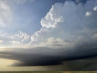
By early evening, with many hours of sunlight left, fair-weather cumulus was noted forming south of I-94 to the SW of Jamestown. This seemingly benign quickly became agitated, then towering, and an LP supercell fired southwest of town. I headed back east to Jamestown, grabbed some food, then south a bit on Highway 281. This LP supercell was highly sheared (tilted) and showed explosive development, and quickly evolved to classic mode. I headed back north and took I-94 east into Stutsman County. The storm continued to intensify and rotation was intense, and a powerful, possible violent tornado, was observed near Spiritwood and Urbana by roughly 8:30 PM CDT. I backed off, and headed back south and east on I-94 to SR 1 south towards Hastings. Another large, highly visible, but anti-cyclonic tornado (rare) was observed in this area, including a rope-out.
I continued south on SR 1, noting the storm cycling up again and becoming HP, with another large and destructive tornado noted near Hastings and SR 46 east. Damage was noted, with some structures completely destroyed in this area. After checking everyone there was unhurt / in shelter, I continued east on SR 46 to near Enderlin, then south on SR 32 to Lisbon. Another violent and tornadic supercell storm was noted in this area, with a large wedge tornado illuminated by lightning, with incredible supercell structure, as viewed north while heading east out of Lisbon on CR 27. I continued east past Colfax and finally to I-29 north, after finally securing a room for the night in Fargo. I continued north on I-29, avoiding the dangerous supercell to my west, and watched the derecho catch up with my location (severe winds and small hail). I ultimately spent the night in Fargo.
Storm Chase Details:
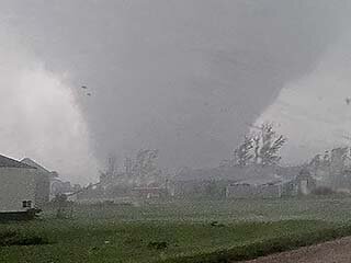
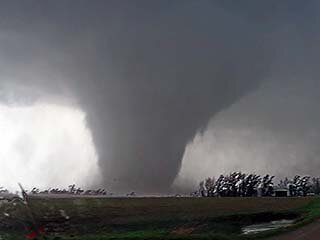
June 20, 8:30 PM - Observation and indirect penetration of an extremely severe, violent, and tornadic thunderstorm near Spiritwood in Stutsman County, North Dakota, east of Jamestown and I-94, and to near Hastings on SR 1 in Barnes County. The storm was a classic and cyclic supercell, which started out LP and evolved to HP late in its life-cycle. At least four tornadoes were observed with this storm, starting with dust under a rotating cloud base / wall cloud, to a possible violent stove-pipe / wedge tornado near Spiritwood. Two additional tornadoes were observed southeast into Barnes County, one a highly-visible cone / elephant trunk tornado (this large tornado was anti-cyclonic, spinning clockwise, and rare for the northern hemisphere), and then a large, partially rain wrapped tornado near Hastings. Major structural damage was observed with these tornadoes, including at least one home destroyed. The core of this storm, with 3" hail, was not penetrated. Other conditions encountered were heavy rains, winds gusting over 70 MPH (possible near 100 MPH in RFD), hail to 1", and frequent lightning with close hits. The supercell had a highly striated, and intimidating, visual appearance as well. Conditions causing the storm was surface heating, a stationary / warm frontal boundary, a low pressure trough, and upper trough. Documentation was digital stills, audio, and HD / 4k video (including time-lapse). A 2022 Jeep Renegade was used to chase the storm. A tornado watch was also valid for the area until 3 AM CDT the next day.
June 20, 10:30 PM - Observation and penetration of an extremely severe, violent, and tornadic thunderstorm in Cass and Ransom Counties, North Dakota, near Enderlin and Lisbon, from SR 46 / 32 and eastward on CR 27 eastwards. This after-dark supercell (during its encounter) was a cyclic and powerful classic to HP supercell. Large hail to golf-ball sized was encountered west of Enderlin before heading south on SR 32 into Lisbon. Powerful inflow winds was noted in this area, to 60 MPH, giving way to RFD winds. While heading east on CR 27 east of Lisbon and looking north towards Enderlin, a large wedge, possibly violent, tornado could barely be seen (illuminated by lightning). The storm also had an incredible visual structure, with tilted "slinky" and striated updraft, inflow bands, and RFD cut. Lightning was continuous with this supercell storm, and some close hits were observed. Heavy rain was also encountered during the risky core-punch of this storm west of Enderlin. Unfortunately, this storm caused major damage and two fatalities in Enderlin. A powerful derecho caught up with, and undercut this storm by about 11:30 PM CDT. 60 MPH winds, small hail, frequent lightning, and torrential rains were encountered with this version of the storm south of Fargo, albeit without a tornado threat. Conditions causing the storm was surface heating, a stationary / warm frontal boundary, a low pressure trough, and upper trough. Documentation was digital stills, audio, and HD / 4k video (including time-lapse). A 2022 Jeep Renegade was used to chase the storm. A tornado watch was also valid for the area until 3 AM CDT the next day.
Video Link To June 20:
Gallery:
 Above:
 Powerful upper level support (and attendant jet stream) arrives and the capping inversion is quickly eroded. Explosive supercell development south of Jamestown during the evening (the sun is out for a few more hours in this part of the USA). The LP storm here is highly sheared (tilted from left to right) and rapidly intensifying. The view is to the north.
 Above:
 Tornado expands into a large (and possibly violent) tornado to the northwest of Spiritwood in Stutsman County during the early evening. The view is to the northwest.
 Above:
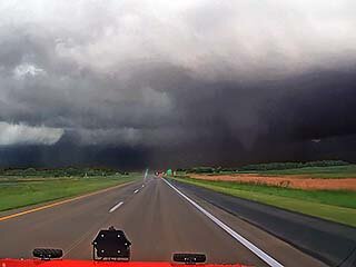
 View looking east along I-94 while heading towards Berea and Valley City near dusk. The RFD is blasting east, and a rare anti-cyclonic tornado (#3), rotating clockwise, is forming to the right.
 Above:
 View of tornado #3. This tornado is rotating clockwise, and very rare for the northern hemisphere. The view is to the south and southwest from southwest of Valley City.
 Above:
 Damage to a farmstead near Hastings from Tornado #4 (or possibly #5 and rain wrapped). Luckily no one was inside any structures and / or in shelter.
 Above:
 Wedge tornado (to lower left) under the powerful supercell storm near Enderlin illuminated by lightning. Unfortunately, this storm will kill 2 people. The view is to the north.

