• While Stormtrack has discontinued its hosting of SpotterNetwork support on the forums, keep in mind that support for SpotterNetwork issues is available by emailing [email protected].

2025-05-16 EVENT: MO/AR/IL/TN/KY

Joined
Aug 19, 2005
Messages
319
Location
Atlanta, GA
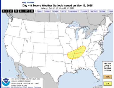
We are planning to head out for the western trough ejection beginning late weekend/early next week, but on the way, I might as well take a stab at some storms along the stalled boundary in the middle MS Valley. There are lots of CAPE, the parameters look good for supercells, and if a storm can stay discrete, just maybe a tornado. The attached is an NAM sounding at 21Z Friday in the MO Bootheel.
 

Attachments

  • Screenshot 2025-05-13 at 11.11.12 AM.png
    Screenshot 2025-05-13 at 11.11.12 AM.png
    468.2 KB · Views: 10
  • Screenshot 2025-05-13 at 11.10.44 AM.png
    Screenshot 2025-05-13 at 11.10.44 AM.png
    892.4 KB · Views: 11
Today looks like it could be worth chasing across IL and IN. The models rapidly push the warm front through this afternoon (all the way to Michigan!) giving plenty of moisture and warmth. Areas north of I-70, where the terrain is much better, could come into play.

Concerns are that ongoing convection in MO/KY robs moisture and energy from stuff farther north. The models may also be overdoing the warmth/moisture - the RAP suggests a temperature rise of 84 to 94 in Northern Illinois in 2 hours which doesn't sound correct at all. Still, it seems like a situation worth monitoring and possibly going out for.
 
As usual, I'm pessimistic about today north of the AR/MO and IL/KY border. Surface winds are veered resulting in very little low-level turning. In the Midwest, this usually means big HP blobs, in this case racing east-northeast. As Robert noted, moisture recovery behind the MCS to the south looks to be stunted with the 70F line mainly along and south of the Ohio River. Storm speeds will make keeping ahead of anything off of fast east-west highways like Interstates 64 or 70 nearly impossible. The better environment is south where high-speed east-west road options are limited. Any way you slice it, this will be a difficult chase day. I'm not a fan of these types of setups, but of course will be out there as it's my backyard!
 
Long story but I was planning to have been in OKC by now setting up for the weekend, ignoring as usual these Midwest outbreaks with messy mode, fast-moving embedded supercells. However, flight delays caused me to miss the last connecting flight from Chicago to OKC on Wednesday night. Finding myself in Illinois, I decided to make my way down from Chicago to near St. Louis yesterday afternoon/evening, with a half-hearted chase on the way down. My chase partner flew into STL last night so I was more focused on getting down there in time to see him for the first time since 2023 and get a late dinner. We will chase IL today and fly to DFW tomorrow morning.

Today is not a day where I will necessarily pick the most favored area for initiation or the best parameters. There are significant terrain considerations. Southeastern MO is out, with the Mark Twain National Forest, Mississippi River valley and the usual issues with river crossings, the St. Louis metro area, etc. Especially with 50+mph storm motions, it’s a day to prioritize terrain and roads; stay safe, give storms plenty of room to come to you, and be happy to see whatever you are able to see. Kind of a bonus day for me anyway, as I did not expect to be chasing here on this trip, and if I was on a Plains chase vacation I would never come all the way over here. Planning to base around Vandalia, IL, which may not be in the 70s dews but will be in the 60s with favorable MLCAPE. Shear is ample just about everywhere in the region so no need to fine tune that all too much. Will adjust as needed - but hopefully only further north - depending on extent of northerly moisture return, boundaries, and local backing of winds.
 
I will be favoring a storm on the warm front where it encounters dewpoints greater than 68F, which appears may be some distance south of I-64 - hopefully right on it if storms can hold off long enough. I fear that might not happen until well east of I-57, maybe even SW IN. HRRR is already behind the curve with initiation which has already occurred in southern MO. I-64 is a preferred corridor IMO, fast enough to keep pace and provides the ability to drop south at Evansville if a trailing round of supercells can stay discrete.
 
I think Vandalia or really anywhere along I-70 in Illinois is a reasonable target to balance terrain and weather. (I-64 in Illinois may be great too, I'm just less familiar with that area.) As I am limited at when I can leave due to work, I will probably target Terre Haute and hope things don't squall out too quickly. Or possibly Danville, IL depending on how things evolve.
 
It appears likely that a tornado hit St. Louis and nearby suburbs. Correlation coefficient dropout and damage reports along the corresponding path.
Yes, right through the center of the city and the residential area just to the North. Lots & lots of trees down with roof & car damage and north of the center area, collapsed old brick houses.
 
Back
Top