Dan Robinson
EF5
I was traveling through Pennsylvania this day, and was able to make a chase out of it. Decent supercell wind fields associated with a passing shortwave in mean 30-40kt 500mb flow would be juxtaposed with some instability across the state of PA. I managed to get on the only two tornado warned supercells in the region in difficult terrain and road networks, having to mainly rely on my drone to get views of the storms. I started in State College, intending to focus on an area of clearing that visible satellite showed nosing northeastward into the central part of the state. Storms started initiating in southwestern PA by early afternoon and moved northeast. I intercepted the first storms at Phillipsburg, which were outflow dominant.
I dropped south to an isolated storm moving south of Tyrone. I set up ahead of it at Arch Spring. It had a large RFD surge that was curling in on the north side into a slowly-rotating circulation.
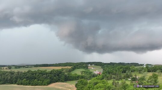
RFD precip moving across the mountains:
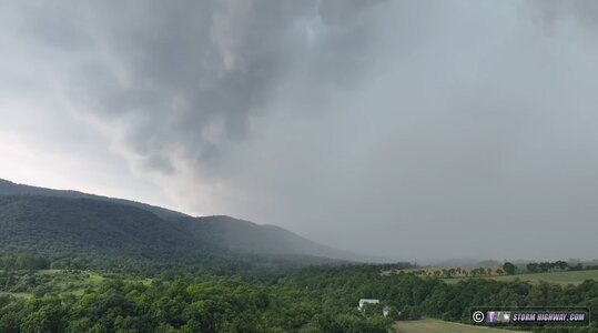
The circulation intensified as it crossed Route 453, with very fast-moving rain curtains. The storm was tornado warned shortly thereafter.
The road network did not allow staying with the storm, so I dropped south to the next one south of Mt. Union. This one briefly wrapped up, but was soon blown apart by outflow.
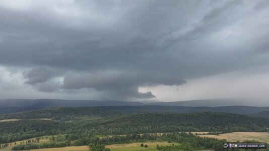
I once again went south to the tail-end storm at Shade Gap. This one was the best structured storm of the day, periodically developing strong circulations on radar to past Shippensburg when it was tornado warned. At Shade Gap, the base of the wall cloud was below the ridgetop:
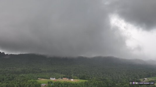
The core beat me across the Turnpike at Roxbury, and I could not get back ahead due to a combination of unfavorable road options and slow-moving traffic on the highways. I gave up the chase at Shippensburg.
Some timelapse and lightning video from the day:
I dropped south to an isolated storm moving south of Tyrone. I set up ahead of it at Arch Spring. It had a large RFD surge that was curling in on the north side into a slowly-rotating circulation.

RFD precip moving across the mountains:

The circulation intensified as it crossed Route 453, with very fast-moving rain curtains. The storm was tornado warned shortly thereafter.
The road network did not allow staying with the storm, so I dropped south to the next one south of Mt. Union. This one briefly wrapped up, but was soon blown apart by outflow.

I once again went south to the tail-end storm at Shade Gap. This one was the best structured storm of the day, periodically developing strong circulations on radar to past Shippensburg when it was tornado warned. At Shade Gap, the base of the wall cloud was below the ridgetop:

The core beat me across the Turnpike at Roxbury, and I could not get back ahead due to a combination of unfavorable road options and slow-moving traffic on the highways. I gave up the chase at Shippensburg.
Some timelapse and lightning video from the day:
