2024-04-30 REPORTS: NE/KS/OK/IA/MO

Joined
Aug 2, 2009
Messages
12
Location
Blue Springs, MO
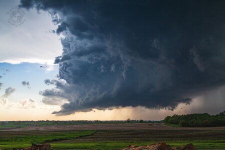
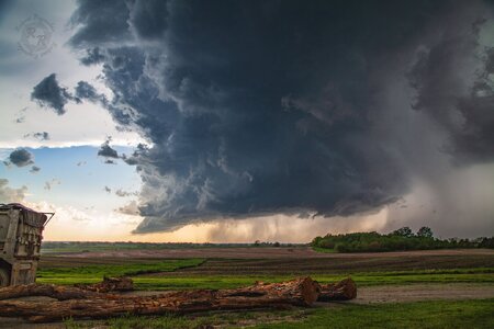
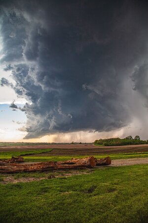
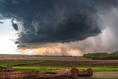
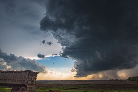
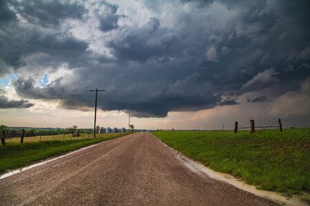
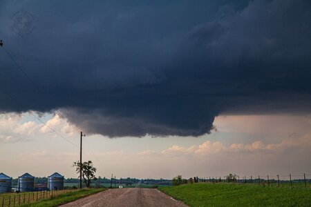
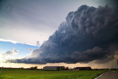
Initial target was Topeka, KS. Had we left KC a bit earlier, we might have been on the Westmoreland, KS cell. Instead, we targeted a tornado-warned storm headed east out of Vermillion, KS. It produced a TOG between Goff and Wetmore that we missed by a few minutes (confirmed by photos and video from locals where we stopped). We intercepted this storm near Netawaka, where it came very close to producing a tornado. We then dropped south to Holton and headed east, where we watched it try to produce again. After, the storm began to show signs of weakening - it was being choked off by a monster supercell that was moving through the Topeka area. We attempted to get in front of that storm, but due to safety issues we decided to hang back and come in behind it. It produced a tornado NE of Lecompton, KS which was heavily wrapped in rain and not visible to us. Headed home as the sun set, backlighting the storms in front of us.
 

Attachments

  • IMG_2053.jpg
    IMG_2053.jpg
    202.8 KB · Views: 4
  • IMG_2058.jpg
    IMG_2058.jpg
    244.2 KB · Views: 4
  • IMG_2059.jpg
    IMG_2059.jpg
    139.8 KB · Views: 4
  • IMG_8397.jpg
    IMG_8397.jpg
    246.4 KB · Views: 5
  • IMG_8396.jpg
    IMG_8396.jpg
    163.3 KB · Views: 5
  • IMG_2067.jpg
    IMG_2067.jpg
    335.9 KB · Views: 5
  • IMG_2069.jpg
    IMG_2069.jpg
    157.4 KB · Views: 4
  • IMG_2076.jpg
    IMG_2076.jpg
    190.1 KB · Views: 3
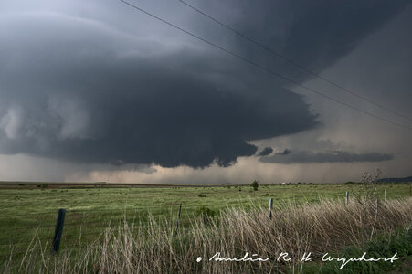
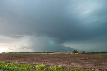
I had no intention of chasing this day due to work. I got off around 6pm and noticed a towering storm to my north. Imagine my surprise when I checked the radar to find a tornado warned supercell a half hour away! I rushed home, changed, grabbed my camera, and headed north. I went up US-283 to Blair, and then east on OK-19. This was my initial view as i came upon the storm just west of Roosevelt.
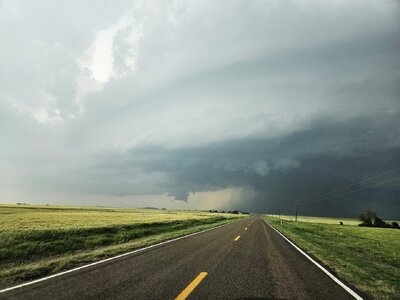
20240430_184600_edit.jpg

The storm was barely moving, and so I had all day to sit and take photos. I saw lots of vertical motion, and a little bit of low level rotation, but nothing crazy on this first cycle, though it was rather photogenic.
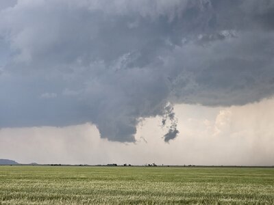
20240430_185258.jpg

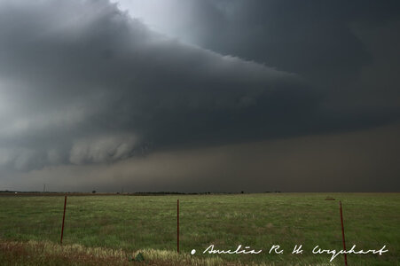
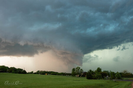
I pushed to the east as the storm cycled, and pulled off at the OK-19/US-183 intersection. This time the ragged wall cloud had some noticeable rotation.
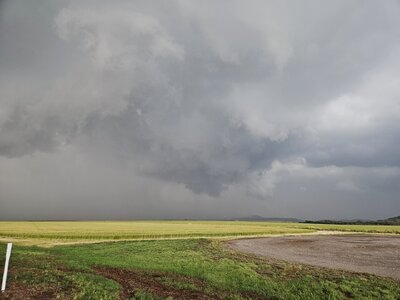
20240430_191854_edit.jpg

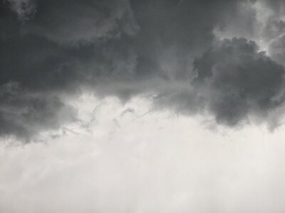
At this point the storm, while still nearly stationary, had taken on a sort of southward drift. As it cycled once again, I moved south on US-183 to stay ahead of it. I stopped after a few miles and saw the most vigorous rotation I had seen all day, as well as a tiny little danger noodle of a funnel.
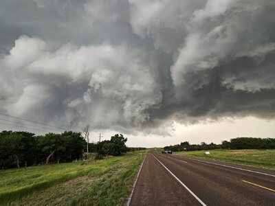
20240430_193804_edit.jpg

20240430_194416.jpg

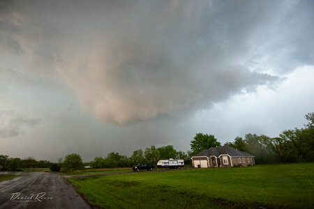
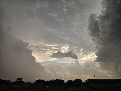
At this point, the storm's outflow was starting to push south, and I was close to being pinched into storms south of my position (the ones that would eventually go nuts near the KFDR radar later that night). I went ahead and took this opportunity to push the rest of the way south to Snyder. On the way I encountered some small quarter-ish sized hail and low end severe wind gusts. I also encountered this beautiful view of sunlit mammatus peaking out from between the 2 storms near Mountain Park.
20240430_200157.jpg

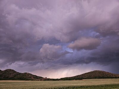
I turned west on US-62 to head for home, but not before stopping to photograph some more beautiful landscapes.
20240430_202724.jpg

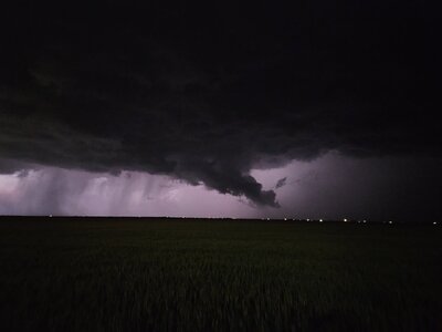
I was immediately west of Altus when another supercell briefly tried to get itself going, though it never quite succeeded. I still managed to get a view of its short lived inflow tail before the sun set for good.
20240430_205729.jpg

Despite not getting a tornado on this chase, I rank it as one of the most fun I've had. I got some great photos, and I will hopefully be uploading a video compilation of the 3 rotating wall clouds I saw soon. In my chase report from 27 April, I had lamented the fact that I always managed to find myself out of position. That was not the case on this chase. I got in front of the storm, and stayed there, backing up and adjusting based on what the storm was doing. Also, with how discrete this storm was for most of the time I was on it, how slow it was moving, and the minimal number of other chasers present, I was really able to see the storm structures and understand how things were working. I was able to take the time to notice the warm inflow at my back, and then notice the change to the cooler outflow in my face as the storm moved closer to me. I was able to notice how as the storm was about to cycle, the visible inflow bands weren't flowing into the part of the storm I was focused on, and instead into a new lowering. As cheesy as it may sound, I felt connected to Nature in a way I have never felt before during this chase, and I hope to have many more moments like that in the future. See y'all on the next one!
 
Last edited:
I wasn't expecting to chase at all on 30 April, and I only did so because I was encouraged by some more experienced friends. I was only expecting to see a bit of structure, but I was encouraged to leave the mammatus behind in Anadarko when the northernmost cell became warned for an observed tornado. Since the northernmost cell's inflow was about to be contaminated by another storm's outflow, I decided my chances were better if I dipped south to the Roosevelt storm. That storm ended up being the most beautiful, most photogenic storm I have ever seen.

IMG_5226.jpg

It was similar to a storm I saw near Guymon, Oklahoma on June 27, 2023. However, this storm was much more isolated and slow-moving, which allowed me to keep my timelapse rolling for over 30 minutes before I had to reposition. Near the end of the timelapse, the storm's inflow began to kick up a cloud of dust from the ground, and the dust highlighted a stream of horizontally rotating air under the inflow tail flowing into the updraft base. A funnel began to form near the end of the stream, but I had to leave it to reposition in a safer spot.


As the cell cycled, I picked a new spot south of Cooperton. Since road options in the area were limited, and my Honda Accord can't handle muddy roads, I decided to stay near Highway 54, which would let me escape to the south. The mesocyclone remained highly photogenic, but my timelapse was cut short by a surprise event.

IMG_5776.jpg

Even though I was 8 miles away from the hook of the cell to my north, a tornado had managed to form just across the road from me. Its ground circulation was clearly visible just over the hill to my west. This is my best attempt to represent where it was in relation to me when I first noticed it. I believe it to have somehow been caused by the left split either enhancing or creating an RFD-like feature in the area.

1714873873814.png

I spent the tornado's duration driving away from it. I was only able to see it as a curtain of solid dust in my rearview mirror. I briefly stopped the car to try to take a picture of it once I had gone a few miles south. By that time, all that was left was a column of rotating dust, accompanied by an extremely clear RFD cut.


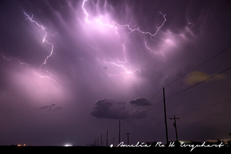
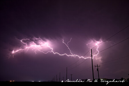
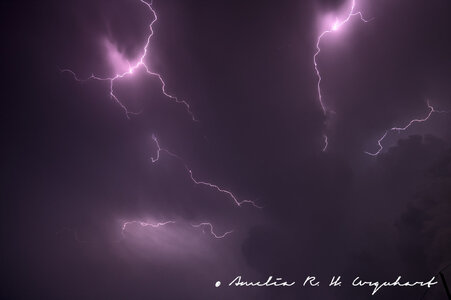
After this, I decided to reposition to safety behind the line for the night. As the sun set, the cell near Altus began to produce frequent anvil crawlers. I was able to keep my camera rolling a timelapse for over an hour before the battery ran out.

IMG_6039.jpg
IMG_6165.jpg

Almost every single frame of the timelapse could've been a still of its own. I stood there in awe for the whole time, jaw dropping with each bolt that crawled across the ceiling of the sky. I was vaguely aware of the anticyclonic PDS-warned tornado happening at the time, but I was too awestruck by the storm in front of me to keep up with the anticyclonic tornado on radar. I've chased over 35 times in the past two years, but this chase is the most incredible I've ever had.
 

Attachments

  • IMG_5952.jpg
    IMG_5952.jpg
    106.9 KB · Views: 2
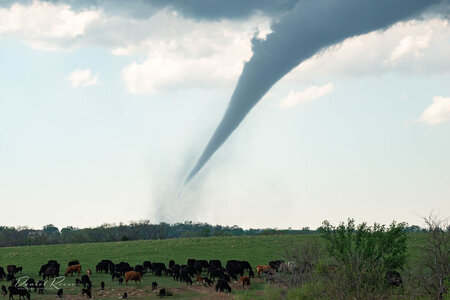
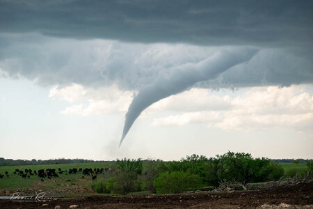
My best chase in a few years, as I managed to catch the Westmoreland EF-3 tornado, and then followed the supercell down Highway 24 to Topeka and Lawrence. Left Lawrence around 3:20 almost too late, as construction slowed me by about 10 minutes on the north side of Topeka. As I continued west on I-70, I decided to target the cell then developing north of Manhattan, rather than the healthier cells to the north. Figured they were in a similar environment, and that the southern one might eventually cut off the activity to the north. Plus it was just closer and easier to get to first. Turned north to Wamego, and once I was north of the town got a view of a healthy rain free base to my northwest. Didn't fully realize it at the time, but this was a developing updraft on the flank of the original cell. Didn't see any rotation or even wall cloud at first, but as the RFD began cutting in a small funnel quickly developed. Once this happened I found a good pull-off area on a hill (roughly 6-7 miles southeast of the cell) and stopped to watch. Within a couple minutes I could see a ground circulation, and the rest of the tornado quickly condensed following this.

800_9729.jpgDSC_7777.jpg

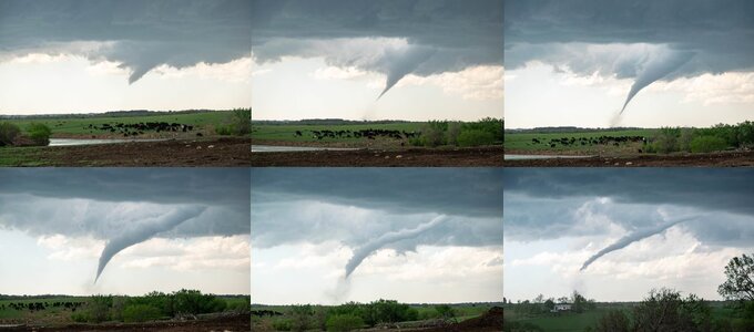
It stayed on the ground for approximately 10-11 minutes, and I was able to watch nearly the entire lifespan from this spot before I repositioned as it began to rope out. Each of these frames is approximately 2 minutes apart.
WestmorelandTorPanels.jpg

It became obvious that the parent storm was turning more to the ESE by this point, and worried about future development I bailed southeast to get away from a windy gravel road network and onto the ESE-running Highway 24. By the time I stopped again near Rossville, it had become a big HP.
800_9743.jpg
Continued following it along Highway 24 north of Topeka before crossing the Kansas River at Lecompton and getting on Highway 40 west of Lawrence. Saw a couple circulations wrap into the increasingly messy parent storm. The second of these around 6:55 might have been the beginning of the Williamstown EF-1 around 7:00.
800_9762.jpg800_9773.jpg
By this point the entire circulation was almost entirely rain-wrapped from my vantage and starting to weaken, and since I was only 10 minutes from home I decided this was a perfect time to call the chase. All in all it was a fairly easy chase all within an hour of home, and one of my best chases of the 2020s. Sad though to hear about the damage and fatality in Westmoreland, that does put a bit of a damper on the whole day.
 
Last edited:
Around 5:30 PM weak storms began moving northeast toward Tillman County from Hardman County, Texas. I decided to go west on Highway 5 from Tipton and watch them come into the county. At 6:26 PM, the National Weather Service in Norman issued the first Severe Thunderstorm Warning of the day for a storm that had made its way into Tillman County. This storm was mainly elevated with the main concern being very large hail and severe winds. I watched from Highway 5 and CR EW178 as this storm pushed northeast toward the Town of Tipton. Just after 7 PM a wall cloud started to form and then fifteen minutes later I watched as rain curtains began circulating over the Town of Tipton. Roughly around 7:22 PM, a TCEMA Storm Spotter came over the radio and informed me that a tornado was on the ground to the Northwest of Frederick. Immediately I repositioned as the tornado was obscured by rain from my location and headed east on Highway 5 towards the City of Frederick. I called the TCEMA Storm Spotter to verify that I had heard what he transmitted correctly as the transmission was very static. He informed me that he was looking at a tornado and I forwarded the information to the National Weather Service. I turned down NS 221 from Highway 5 and noticed a funnel cloud developing on the western side of the clear slot. I transmitted over the radio "Officials in Tipton and Manitou, continue sounding your sirens" as this storm was right in between the two towns. At 7:52 PM, the National Weather Service informed me that there was increasing low-level rotation on another storm to the Southwest of Frederick. Three minutes later a TCEMA Storm Spotter near Davidson reported a funnel and a wall cloud on the back side of the storm. At 7:59 PM, Manitou Fire Department and Tillman County EMS were dispatched to a medical call in Manitou right as severe weather was impacting the town. I made a special request to the NWS (National Weather Service) and asked them to give me detailed information about the storm so I could relay it to the first responders. A few minutes later, multiple firefighters and civilians reported a funnel cloud going through the town. I repositioned myself back south towards the City of Frederick as another massive supercell started to close in on the City. At 8:13 PM, the NWS notified me that they were going to issue a Tornado Warning for circulation approaching the City. Without hesitation, I sounded the Outdoor Warning System in the City of Frederick. The entire storm was rotating rapidly. I remember thinking to myself "Wow, in all of my years of storm chasing, I've never seen rotation like this before." Photos of funnel clouds from residents in Frederick began to flood my phone and I passed the information off to the NWS. I repositioned myself at the Great Plains Technology Center in Frederick where golf ball-sized hail slammed into my vehicle, so I hid under a tree in hopes that the leaves and branches would stop most of the damaging impacts. A few minutes passed and the hail ceased and was replaced by heavy rain. I sat at the intersection of NS 223 and Highway 5 and relayed what I saw to the NWS. At 8:36 PM I informed them that a wall cloud was forming on the storm. A few minutes later I wrote "Still 1 mile east of Frederick starting to get wrapped in rain at my location. Funnel cloud halfway to the ground."

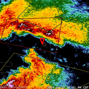
The storm became heavily rain-wrapped shortly after and for safety reasons I decided to reposition myself to US-70 in between Davidson and Grandfield. I remember driving down US-70 and seeing someone farming on their land all while hell was breaking loose just a few miles to their northwest. I remember saying to myself "There is nothing more Oklahoman than that!" By this point, it was 9:10 PM and the Tornado Warned storm had moved into eastern parts of Tillman County. I was on a conference call with my storm spotters, the Sheriff, and at times stakeholders in the county, keeping them all updated. Myself and other TCEMA Storm Spotters near Hollister noticed a wall cloud on the storm and I relayed the information to the NWS. I sat at the intersection of US-70 and HWY-54 for the next 20 minutes and at 9:29 PM, a funnel cloud developed on the storm. Ten minutes later, the NWS wrote "We believe there is a TDS signature emerging east/northeast of Hollister. A tornado appears to be in progress. 3-5 miles east/northeast of Hollister at present time." I repositioned to US-70 and CR NS 233 so I could try to identify this "tornado." At 9:49 PM, I saw a flash of lightning and something wedge-shaped in the rain curtains and wrote in NWSChat "I believe I see something on the ground." Not a moment later another flash lit up the sky and I wrote "Tornado on the ground Hollister." The tornado quickly became wrapped in rain and I repositioned myself to US-54 and EW188 where I met up with another TCEMA Storm Spotter. The time is now 10:09 PM. The NWS informs our agency that an anticyclonic tornado is ongoing near Loveland, just to my Southeast. Two tornadoes are currently on the ground. I contact city officials in Grandfield and inform them to sound the sirens as a tornado is just to their NW and moving towards the town. A new Tornado Warning is issued for the City of Frederick and Hollister, but power is out in the City of Frederick and there is no way to warn the citizens so I quickly contact the Frederick Fire Chief and ask him to sound the sirens on his fire apparatuses, however, I realize that it's unnecessary as the rotation is now SE of the City. Inflow winds start to increase as winds feed into the monster supercell to my east near Loveland and I tell my TCEMA Storm Spotter that we're in a dangerous position and it's time to move west towards Davidson. At 10:29 PM, the NWS writes "Debris up to 10kft with the anticyclonic tornado. Indicative of strong damage potential." I immediately inform the sheriff of this and my desire to perform a rapid damage assessment in the area. He agreed with my request and we put together a plan to perform such an assessment immediately following the departure of storms in the county. Additionally, I ask the Grandfield Fire Department to help with operations if they are not affected by storms.

Ten minutes later I position myself at the intersection of NS221 and US-70. Lightning flashes and I see what looks like a very large tornado on the tornado-warned storm near Frederick, but I don't write anything to the NWS until another flash of lightning goes off and I see the tornado again. Storms exited the county an hour later and damage assessments were underway. During our assessments, we mainly find damage to trees and sheet metal. We call off all rapid damage assessments at 2 AM due to the Deep Red Creek overflowing and making roads in the area unpassable. I finally go to sleep around 4 AM.I woke up four hours later and immediately began assessing the damage across Tillman County. At around 8:30 AM, a representative from Tom Cole's office called to offer assistance in light of the tornadoes. I respectfully informed them that I was still determining the extent of the damage, but so far, there was nothing particularly concerning. By 3 PM, I had sent a detailed six-paragraph email to local and state stakeholders, outlining all the recorded damage and confirming that no assistance was needed from the State. I also posted the following statement on our Facebook page: "TCEMA has conducted surveys throughout the day and we have concluded the following. Primarily, our damage across Tillman County focuses on snapped tree limbs/uprooted trees, and county roads that have been affected by flooding. Additionally, our agency found damage at the Frederick Golf Course and Airport. The damage consisted of sheds being destroyed at the golf course as well as trees uprooted/snapped and then at the airport, the roof on a hangar was torn off on the NE side. Elsewhere, we have confirmed minimal structural damage in Hollister and Grandfield. Please continue to submit damage reports to our agency if you know of anything."

This event ended up becoming a presidential declared disaster and our county received nearly $60,000 in damages to our roads from severe flash flooding. I am still currently working to get our county reimbursed by FEMA for all of the roads we fixed.
 
Back
Top