Andy Wehrle
EF5
Surely someone has a report on the Houghton-Mediapolis, IA EF2, or the cold-core tornadoes that occurred well to the northwest?
Unfortunately, I am not one of them. This joined my long list of "close, but no steak dinner" chases.
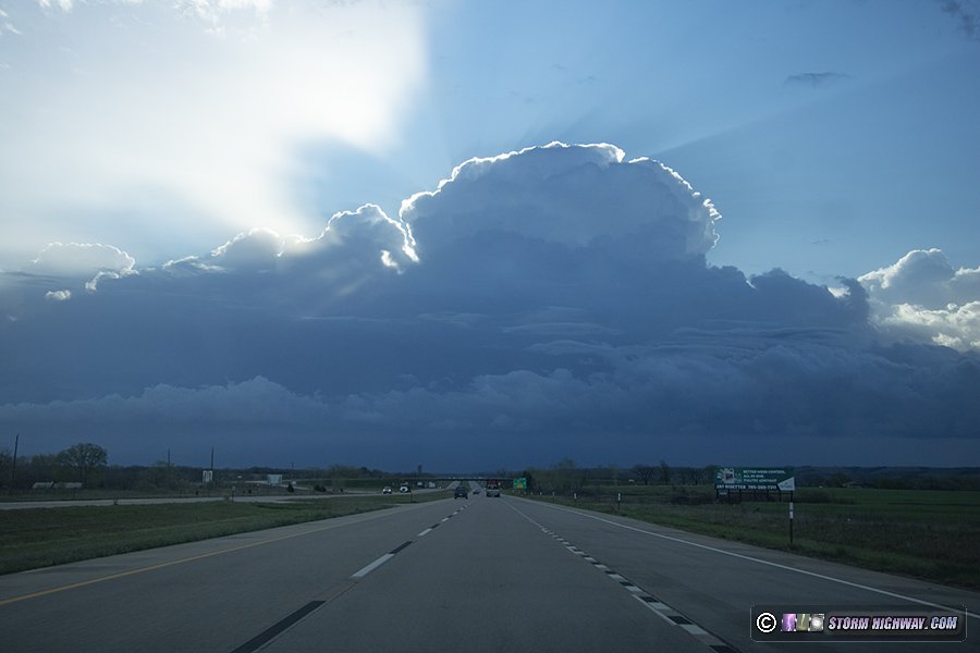
From getting off work at noon it was a race to Mt. Pleasant, threading the needle through the first round of storms just before some of them started to go tornado-warned in the Cedar Rapids area (I had no interest in chasing these as they were embedded and flying to the north), then diving south in front of the second round as it fired up in the form of an annoyingly-linear band. However, as I drew closer the two southern cells began to gain a little bit of separation (as reasonably depicted in multiple consecutive HRRR runs in the morning) and went tornado-warned. I dropped south on US-218 in front of the forward flank of the northernmost one, and turned off at IA-16 towards Houghton to check it out.
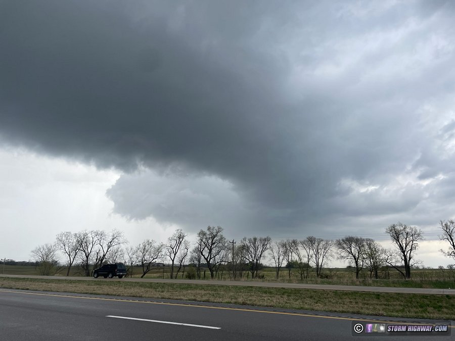
GoPro snap, westbound on 140th St., just east of 150th Ave. at Mt. Hamill:

What I see here is an inflow tail feeding into a rather ragged, scuddy, not-too-impressive wall cloud that has quite a lot of rain obscuring the area underneath it. I turned left onto 150th Ave. and watched the storm off to my west for a couple minutes, but I didn't see anything that screamed imminently tornadic; that and I didn't like how rainy it was under there, combined with the poor radar coverage I wasn't sure I'd be able to tell where under that base a tornado was forming if one did.
When I saw the tail-end Charlie cell to the south was also tornado-warned, I decided to bail and jump on that one. Of course, it was minutes later that the original cell wrapped up and tornado reports started to come in. Meanwhile, the other cell which I intercepted near Argyle, IA remained quite outflow-dominant and never did anything much of note.

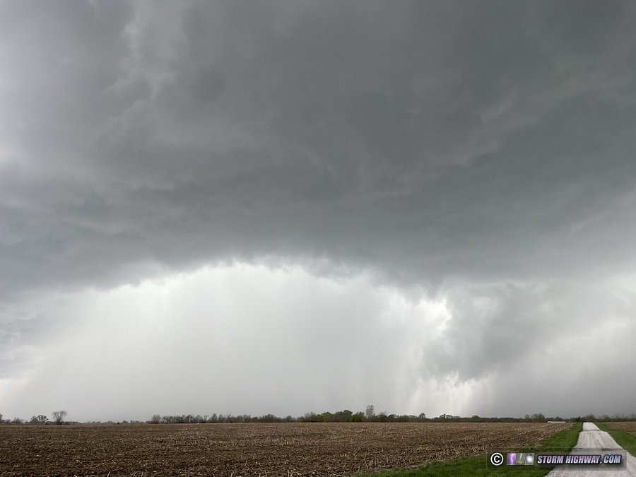
Scuddy pseudo-wall cloud-ish thing with mostly rising motion from US 61 just west of Ft. Madison:

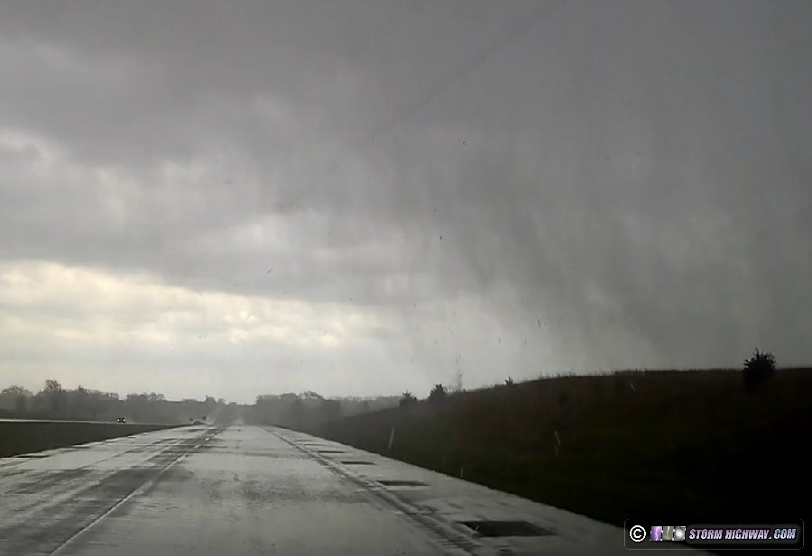
Fortunately, the storm's northeastward movement pretty much perfectly paralleled the Mississippi River in this area, so I was able to cross over at Burlington comfortably ahead of the storm without either getting overrun by the RFD gust front/potentially tornadic region, or having to drive into the forward-flank core. I stair-stepped with the RFD gust front region until Little York, IL where I broke off and let the storm go.
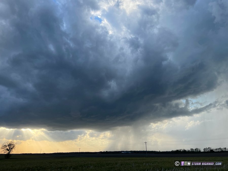
I went back to Monmouth for dinner. The most photogenic sights of the chase, ironically, came from the final round of storms which fired up as a linear band to the west/southwest and went severe-warned while I was eating. There were some noticeable kinks in the line on reflectivity, with subtle velocity couplets colocated with some of them, but none of them ever went tornado-warned. Northbound on US 67 to head home I threaded the needle through a relatively weak spot in these, still catching a brief burst of near-blinding rain and pea size hail. The lightning show was worth the price of admission, though.


Unfortunately, I am not one of them. This joined my long list of "close, but no steak dinner" chases.
From getting off work at noon it was a race to Mt. Pleasant, threading the needle through the first round of storms just before some of them started to go tornado-warned in the Cedar Rapids area (I had no interest in chasing these as they were embedded and flying to the north), then diving south in front of the second round as it fired up in the form of an annoyingly-linear band. However, as I drew closer the two southern cells began to gain a little bit of separation (as reasonably depicted in multiple consecutive HRRR runs in the morning) and went tornado-warned. I dropped south on US-218 in front of the forward flank of the northernmost one, and turned off at IA-16 towards Houghton to check it out.
GoPro snap, westbound on 140th St., just east of 150th Ave. at Mt. Hamill:
What I see here is an inflow tail feeding into a rather ragged, scuddy, not-too-impressive wall cloud that has quite a lot of rain obscuring the area underneath it. I turned left onto 150th Ave. and watched the storm off to my west for a couple minutes, but I didn't see anything that screamed imminently tornadic; that and I didn't like how rainy it was under there, combined with the poor radar coverage I wasn't sure I'd be able to tell where under that base a tornado was forming if one did.
When I saw the tail-end Charlie cell to the south was also tornado-warned, I decided to bail and jump on that one. Of course, it was minutes later that the original cell wrapped up and tornado reports started to come in. Meanwhile, the other cell which I intercepted near Argyle, IA remained quite outflow-dominant and never did anything much of note.
Scuddy pseudo-wall cloud-ish thing with mostly rising motion from US 61 just west of Ft. Madison:
Fortunately, the storm's northeastward movement pretty much perfectly paralleled the Mississippi River in this area, so I was able to cross over at Burlington comfortably ahead of the storm without either getting overrun by the RFD gust front/potentially tornadic region, or having to drive into the forward-flank core. I stair-stepped with the RFD gust front region until Little York, IL where I broke off and let the storm go.
I went back to Monmouth for dinner. The most photogenic sights of the chase, ironically, came from the final round of storms which fired up as a linear band to the west/southwest and went severe-warned while I was eating. There were some noticeable kinks in the line on reflectivity, with subtle velocity couplets colocated with some of them, but none of them ever went tornado-warned. Northbound on US 67 to head home I threaded the needle through a relatively weak spot in these, still catching a brief burst of near-blinding rain and pea size hail. The lightning show was worth the price of admission, though.