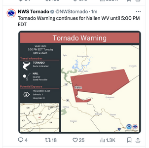
2024-04-02 EVENT: IN/OH/KY/WV/TN

Joined
Jan 14, 2011
Messages
3,316
Location
St. Louis
Models are depicting a much more classic-looking outbreak setup in the eastern Midwest/Ohio Valley on Tuesday. NAM forecast soundings and depicted supercell storm mode in Indiana and Ohio look quite ominous, with a 100kt+ midlevel jet max and 0-1km SRH pushing 300 by 00z.

The entire states of Indiana and Ohio look to be in play, with the shear maximized in the northern third of both states. Storms will be blazing fast, but this has the look of the best tornado event of the year so far (as shown).
 
My current thinking is that any warm sector storms will start to go up somewhere in the I-69 corridor, and maturing closer to the Indiana/Ohio state line. At least, for the portion of the risk area north of I-70. I've not looked enough south of I-70 as I will not be chasing that far south. Likely looking at dews in the 60s along and south of the warm front, which I believe will be draped parallel to (but south of) US-30. Storm motions look close to ideal for being able to ride the warm front, so those will be the storms that I will be going after.

Tentatively, I'm planning to eat an early supper in Bryant, IN, where I'll have good options in all directions. I do not expect to have to go west from there. Of course, with my luck, tomorrow will be the day I'm late-ish getting off work and I have to just head that direction and opt for the first storm I can get to. But, with that said, I have batteries charging for my digital camcorder and SLR, and film and tapes ready to go for my film SLR and analog camcorder. I'll be packing everything in my car when I head to work, so I won't have to go home afterwards.
 
In a not-too-unfamiliar fashion for Midwest tornado setups, this event looks much less potent if not completely trashed per morning data. Overnight convection has stopped the northward advance of deep moisture, which may not make it to the areas of best dynamics in time. It appears that the only play now is the western end of the outflow boundary where there is still a sliver of sunshine over the better moisture ahead of the cold front. If this area can expand a little and force its way northward, there may be a brief window for tornadic supercells. I'm currently in Mount Vernon, Illinois and will be staying within the northern reaches of this area south of the boundary, moving northeast if it manages to start pushing in that direction. I'm not expecting much, as the forecast soundings where models show the moisture making it remain unidirectional with not much low-level turning.
 
The ongoing convection near Indy and Muncie has knocked my planned play out of contention. Since I can't take off work tomorrow this late (I need a week or two notice under most circumstances), I would have to be back home in time to get to sleep at a decent time for a 0600 wakeup. Can't do that with the potential target in southern Ohio/northern Kentucky. In addition, from the time I left for work to the time I got off work, gas has jumped 65 cents per gallon. Even if time weren't a consideration, an extra $50-80 in gas (I would probably need 3-4 tanks to chase that far south and would have to fill up again after getting back) just isn't in the budget at the moment. So, as much as it pains me to do so, it appears that I will have to sit this one out.
 
Back
Top