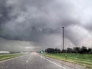
C.D. Burke
Enthusiast
tl;dr saw twister sisters (!!) in far southeastern Colorado on a marvelous chase day overall.
Started the day in Tucumcari, near where the previous day’s chase had finished with a picturesque sunset mothership supercell overtop of Logan—not a tornado-producer but a positive enough start to this three-day chase, likely my only one of the year.
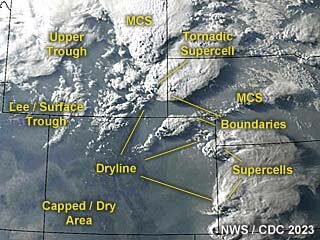
Thursday night I had gone to sleep assuming I would chase the TX Panhandle the next day, but upon checking the models Friday morning I began to reconsider. The SPC was assigning *zero* tornadic risk to the entire region and focusing all its attention on Wyoming. The Panhandle itself was forecast to have a linear MCS. So Panhandle out, Wyoming too far away … what about eastern CO/western KS? I couldn’t help but notice that the CAMs were all unified (and had been so for several runs) in having discrete cells fire in eastern CO and strengthen as they arced east-southeastward into southwestern KS. I ran a “does this make sense?” check against the NAM's forecasted parameters and everything checked out: there was a priapic plume of rich moisture inserting itself into southwest KS about as far as the CO border, a modest dryline shaping up on the CO side, forecast bulk shear in the 40-55kt range, ample CAPE from daytime heating, classic elongated hodographs all over, with slow storm motion (10-15 kts) the icing on the cake. The models were all fairly consistent with each other: I sampled the forecast soundings from one point northwest of Plains, KS for 00z and found that each sounding model on the Pivotal site suggested a TOR or MRGL TOR hazard.
So it was CAM, NAM, thank you ma’am, and I was on my way to Springfield, CO as soon as I could pack up—a very straightforward decision. The only curious part was that the SPC was completely ignoring this region … in their midday update they finally extended a 2% risk to it, but it was satisfying to have read the tea leaves a few hours ahead of them.
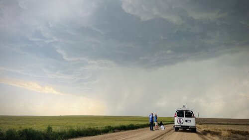
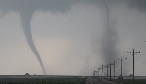
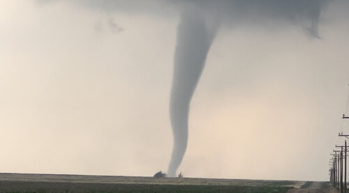
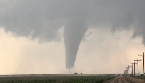
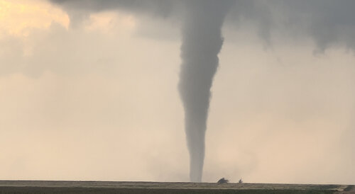
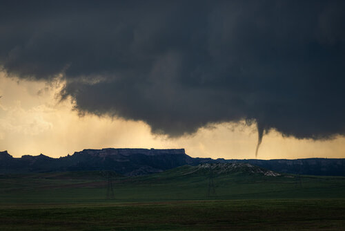
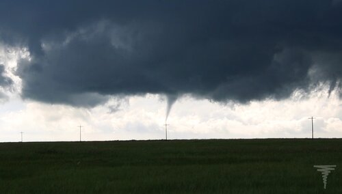
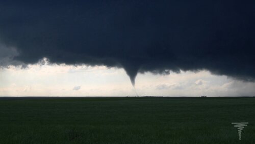
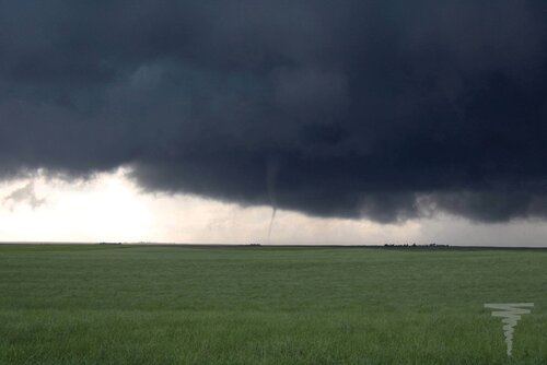
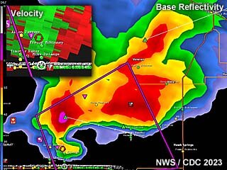
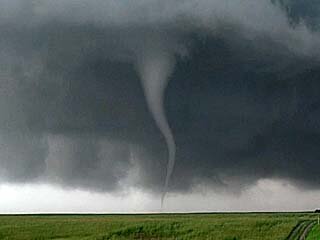
What turned out to be the storm of the day had already farted into life just west of Lamar by the time I reached the area; the first dirt road I parked on had Brandon Ivey’s tour group at it, adding to the growing sense that maybe I wasn’t completely clueless after all. The storm cycled and split as we were standing there, sometimes with warm inflow at our backs and sometimes with outflow-driven dust in our faces, and eventually it began to hail so it was time to stair-step south and east. I scooted rather farther south than I wanted to, because of my personal rule about only cutting in front of storms using paved roads or known dirt roads (I’d never been here and didn’t know whether to trust this dirt road network ... turns out most of it is fine), and while I was still 8 minutes or so from reuniting with the cell, the first spotter report came in of a cone tornado on the ground, about 12 miles south of Holly. “Oh darn,” I said to myself, or something along those lines, fearing that I might have driven all this way only to miss a High Plains Spectacular by passing up perfectly good road options. But my fears were put to rest once I arrived on the scene, because the tornado was still going: a tall, rain-free stovepipe visible for what felt like a dozen miles around. It was the scene everyone dreams of: a photogenic twister whirling around a lonesome field, barely moving, far from any structures but close enough to the road network, and moreover staying on the ground for a long time! I don’t know where to look these things up, but this tornado must have been on the ground for at least 15 minutes, if it was on the ground from the time of the first spotter report until I got close enough to see it with my own eyes.
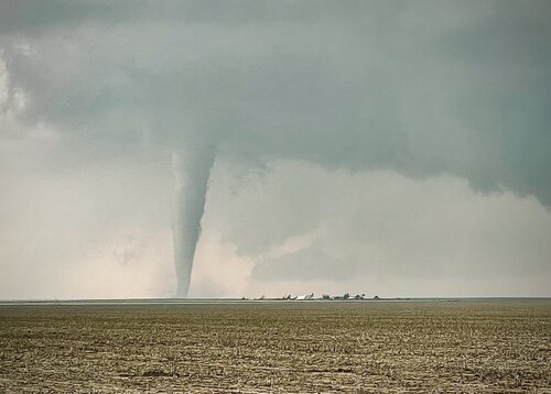
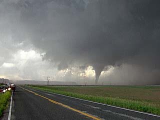
One of the many remarkable things about this storm was the low number of chasers—I did not see more than 10 vehicles in position on the cell at this point. I was free to move in closer down a dirt road without worrying about finding shoulder parking, ruining photographers' shots, etc. I ended up with a wonderful unobstructed view of the stovepipe, which was enough of a treat, but about two minutes into filming it, I realized we had sisters! A weak rope tornado dropped from a separate area of rotation to the east-southeast, closer to me, and stayed down for approximately 30 seconds. I don’t carry any photo equipment, but I was able to get both in the shot of the video I was taking on my phone.
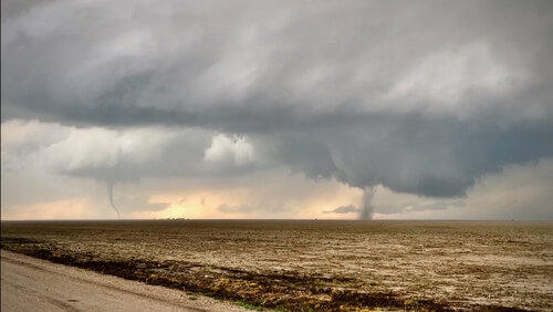
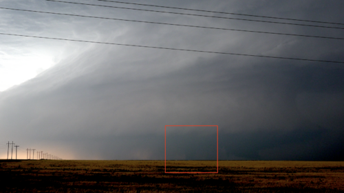
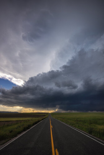
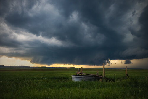
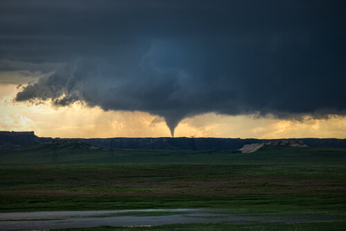
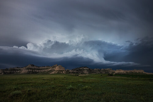
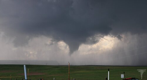
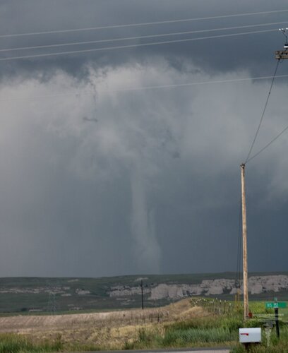
Tornado 1 held on impressively even after appearing to rope out on a couple of different occasions, and when it finally disappeared for good I repositioned east-southeast again, across the border into Kansas using the dirt road network this time. For a time I was far enough south to look up and get a glorious view of the sunlit southern edge of the supercell, then I moved back in to get closer to the rotation. I ended up parking at the same spot as the tour van again, where we oohed and aahed at the rotation almost directly above our heads, but nothing came down. Dust was increasingly problematic at this point—it felt to me like unless you were practically in a position to reach out and touch a tornado, you would never really be able to positively ID one. Several spotter reports came in over the next 15 minutes of “dust-wrapped” or “dusty” tornadoes, but even though I was within three miles each time I can’t say I saw any of these. At one point I caught a poorly-contrasted cone-shaped funnel through the dust that didn’t appear to be making ground contact, but that was the closest I came. The sun set with tornado sirens wailing over Ulysses but the storm clearly deflating. A truly excellent day—even if I chased a lot more than I do, I'm not sure I would experience this this combination of storm quality, "catchability" (good road network and slow tracking) and chaser scarcity for a long time, if ever.
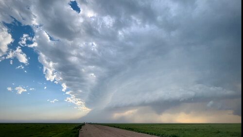
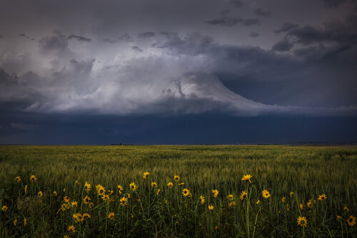
Stepped down far enough to get out of the dust and catch some blue sky
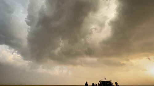
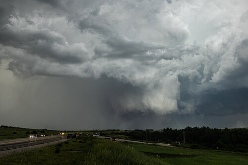
Rotation overhead
Started the day in Tucumcari, near where the previous day’s chase had finished with a picturesque sunset mothership supercell overtop of Logan—not a tornado-producer but a positive enough start to this three-day chase, likely my only one of the year.
Thursday night I had gone to sleep assuming I would chase the TX Panhandle the next day, but upon checking the models Friday morning I began to reconsider. The SPC was assigning *zero* tornadic risk to the entire region and focusing all its attention on Wyoming. The Panhandle itself was forecast to have a linear MCS. So Panhandle out, Wyoming too far away … what about eastern CO/western KS? I couldn’t help but notice that the CAMs were all unified (and had been so for several runs) in having discrete cells fire in eastern CO and strengthen as they arced east-southeastward into southwestern KS. I ran a “does this make sense?” check against the NAM's forecasted parameters and everything checked out: there was a priapic plume of rich moisture inserting itself into southwest KS about as far as the CO border, a modest dryline shaping up on the CO side, forecast bulk shear in the 40-55kt range, ample CAPE from daytime heating, classic elongated hodographs all over, with slow storm motion (10-15 kts) the icing on the cake. The models were all fairly consistent with each other: I sampled the forecast soundings from one point northwest of Plains, KS for 00z and found that each sounding model on the Pivotal site suggested a TOR or MRGL TOR hazard.
So it was CAM, NAM, thank you ma’am, and I was on my way to Springfield, CO as soon as I could pack up—a very straightforward decision. The only curious part was that the SPC was completely ignoring this region … in their midday update they finally extended a 2% risk to it, but it was satisfying to have read the tea leaves a few hours ahead of them.

What turned out to be the storm of the day had already farted into life just west of Lamar by the time I reached the area; the first dirt road I parked on had Brandon Ivey’s tour group at it, adding to the growing sense that maybe I wasn’t completely clueless after all. The storm cycled and split as we were standing there, sometimes with warm inflow at our backs and sometimes with outflow-driven dust in our faces, and eventually it began to hail so it was time to stair-step south and east. I scooted rather farther south than I wanted to, because of my personal rule about only cutting in front of storms using paved roads or known dirt roads (I’d never been here and didn’t know whether to trust this dirt road network ... turns out most of it is fine), and while I was still 8 minutes or so from reuniting with the cell, the first spotter report came in of a cone tornado on the ground, about 12 miles south of Holly. “Oh darn,” I said to myself, or something along those lines, fearing that I might have driven all this way only to miss a High Plains Spectacular by passing up perfectly good road options. But my fears were put to rest once I arrived on the scene, because the tornado was still going: a tall, rain-free stovepipe visible for what felt like a dozen miles around. It was the scene everyone dreams of: a photogenic twister whirling around a lonesome field, barely moving, far from any structures but close enough to the road network, and moreover staying on the ground for a long time! I don’t know where to look these things up, but this tornado must have been on the ground for at least 15 minutes, if it was on the ground from the time of the first spotter report until I got close enough to see it with my own eyes.

One of the many remarkable things about this storm was the low number of chasers—I did not see more than 10 vehicles in position on the cell at this point. I was free to move in closer down a dirt road without worrying about finding shoulder parking, ruining photographers' shots, etc. I ended up with a wonderful unobstructed view of the stovepipe, which was enough of a treat, but about two minutes into filming it, I realized we had sisters! A weak rope tornado dropped from a separate area of rotation to the east-southeast, closer to me, and stayed down for approximately 30 seconds. I don’t carry any photo equipment, but I was able to get both in the shot of the video I was taking on my phone.

Tornado 1 held on impressively even after appearing to rope out on a couple of different occasions, and when it finally disappeared for good I repositioned east-southeast again, across the border into Kansas using the dirt road network this time. For a time I was far enough south to look up and get a glorious view of the sunlit southern edge of the supercell, then I moved back in to get closer to the rotation. I ended up parking at the same spot as the tour van again, where we oohed and aahed at the rotation almost directly above our heads, but nothing came down. Dust was increasingly problematic at this point—it felt to me like unless you were practically in a position to reach out and touch a tornado, you would never really be able to positively ID one. Several spotter reports came in over the next 15 minutes of “dust-wrapped” or “dusty” tornadoes, but even though I was within three miles each time I can’t say I saw any of these. At one point I caught a poorly-contrasted cone-shaped funnel through the dust that didn’t appear to be making ground contact, but that was the closest I came. The sun set with tornado sirens wailing over Ulysses but the storm clearly deflating. A truly excellent day—even if I chased a lot more than I do, I'm not sure I would experience this this combination of storm quality, "catchability" (good road network and slow tracking) and chaser scarcity for a long time, if ever.

Stepped down far enough to get out of the dust and catch some blue sky

Rotation overhead

