I was pretty excited to have a local chase on a weekend, almost screwed it up, but was able to redeem myself before the evening was over.
With nothing to do, I still somehow managed to leave Omaha late as I headed down I-29 towards Nebraska City area. I kept noticing the western most cell that the 3km NAM was showing and eventually the HRRR, but most forecasted activity looked like it would be in western Iowa.
So once it became obvious that the storms south/southwest of Lincoln were going to be the storms to go for at least initially, I headed towards them. I was finally able to approach from the north on Hwy 77 north of Beatrice, as the storms had morphed into the one giant HP monster heading into Kansas.
I was mad I was this far behind and was mad that it seemed like any chance of seeing anything in this HP beast was gone. Not to mention the prospect of trying to get to the other side while it was moving away from me at 40 mph.
I was also watching the storms back to the north that had just moved through Omaha and I could tell had knocked out power to my house because my weather station was no longer online. I was also seeing video from neighbors that looked pretty bad in my neighborhood.
I had noticed the amazing structure on pretty much all the storms going up especially early in their cycle and there were now 2 cells moving south out of Omaha and towards me, so I called off the chase on the southern storm and decided I would see what these 2 cells would show me.
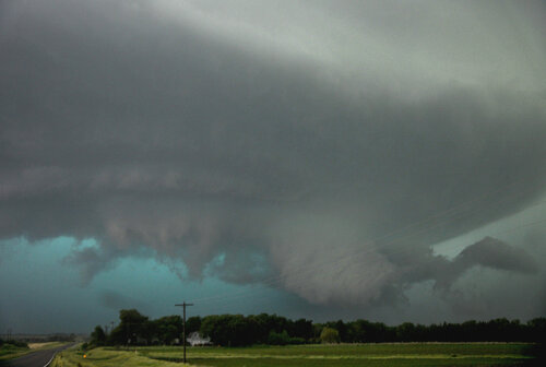
Boy did I make the right choice. I made it to Cook, NE and rather than continuing on north to meet it close up, I decided to stay back once I noticed how amazing the structure already was in the distance.
I was able to sit for about 20 minutes and let the storm come right at me taking pics and video. Once it was almost upon me, I bailed south towards Tecumseh to get back out ahead of it for some structure shots.
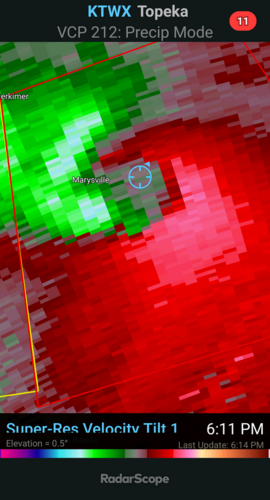
On the drive south, it became tornado warned and had a pretty decent couplet on radar. I stopped for a quick couple of phone pics at a hotel parking lot in town and then headed south of town to get further out ahead of it again.
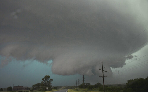
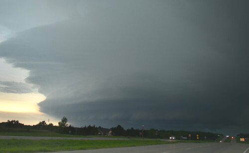
There was nothing real close to producing, but it still had amazing structure and motion. The gust front of the storm was like a huge wave with a bit inflow tail cloud coming into it.
I went east a bit and here is where it came really close to producing a tornado with a nipple funnel forming for a short period.
The storm died pretty quickly thereafter so I made the trip home arriving shortly after 9p. The power was back on in the neighborhood, but I had quite a bit of damage in my backyard with my shed pushed off it's foundation, my gas grill flipped over and pushed about 4 feet on our patio, and I lost a section of fence.