• A friendly and periodic reminder of the rules we use for fostering high SNR and quality conversation and interaction at Stormtrack: Forum rules

    P.S. - Nothing specific happened to prompt this message! No one is in trouble, there are no flame wars in effect, nor any inappropriate conversation ongoing. This is being posted sitewide as a casual refresher.

2022-04-29 Reports: KS/NE

Michael Towers

Supporter
Joined
Jun 28, 2007
Messages
358
Location
Machesney Park, IL
Short summary: One junkcell, one tantalizing classic supercell

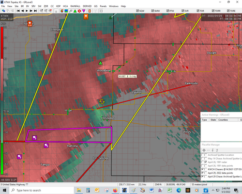
Instead of chasing the closer WF target with higher tornado probabilities I opted for the dryline with a target of Hillsboro hoping for a chance at a nice isolated classic supercell. Unlike 4/12 where my initial target ended up being about 400 miles off (targeted Kansas dryline, ended up chasing the Iowa WF) I nailed the target this time as TCU went up just to the SW and became a severe warned cell as it hit the target. Unfortunately it went all downhill from there as it never got organized, I tracked it for about 40 miles before deciding to let it go near Liberty in favor of a new cell organizing to the SW. Even though it appeared to be tracking toward the same area worked over by the first storm it was apparent the environment wasn’t fouled as strong surface winds brought warm/humid air from the south ahead of its approach. I noted a broad RFB with light precip to its north and in the span of 5 minutes it went severe warned to tornado warned to producing a funnel that made it about halfway down. The funnel happened so quickly that I missed its initial descent but still managed to capture some of it on film. A tornado report quickly followed but it must have been brief and somehow obscured from my view as I did not see it. Back in the day this would have really pissed me off but I’ve missed so many by now that it hardly registered and I was actually encouraged by the development.

The next 30 minutes would be among the most tantalizing under a storm I can recall, the motions were so convincing I was sure a tornado was about to happen again and again and again. I let it go south of Chapman as a gravel road turned to mud and the resultant backtrack basically ended any chance of further effective pursuit. Although I didn’t witness a tornado the overall chase was very rewarding, my target was dead on and although the first cell was a dud I was ultimately able to observe an awesome classic supercell for an extensive period of time. Overall a more gratifying experience than some of the tornado producing storms I’ve seen that were either messy or went messy or rocketed off after a quick spin-up.

I didn’t even know about the Andover tornado until getting home the next night and at first there was a sense of disappointment and jealousy but in retrospect I have no regrets and if I had to do it again I’d play it the same way. Drive 650+ miles and have a storm go up at your target in an environment conducive to producing strong tornadoes? I’m not going to let it go in hopes another storm will go up later when the LLJ is stronger and hope it’s in a location that I can intercept and chase effectively.

Tragic news about the traffic accident that claimed the lives of three chasers, may they rest in peace and my condolences to those grieving their loss.


@Rodney Price I saw the feature reported as a tornado as I was trying to escape golfballs south of Chapman. It was reported multiple times as a landspout and also “a big dusty tornado”. At the time I thought it was a gustnado as it was diffuse and I couldn’t discern any rotation but I was pretty far away and mostly concerned with the hail so I really didn't have a sustained focused view. Still, I wrote it off as nothing noteworthy but your video got me interested so I checked other video of this feature


and I’m now convinced it was indeed a tornado so a nice feather in my cap for the trip, thanks!

Congrats! There was a landspout at 7:55 near Tampa. This particular tornado was about 10 minutes later and according to NWS TOP was on the ground for 22 minutes. The red line on both radar images is the tornado path. The green dots are my SN GPS locations.

radar804.png
 

Attachments

  • radar804srv.png
    radar804srv.png
    521.1 KB · Views: 0
This isn't necessarily a report, but I wasn't sure where else to share this video. I came across some absolutely incredible footage of the Andover tornado from security cameras provided by Andover Public Schools. The tornado appears to have just clipped the school, but there is fantastic footage of it crossing the parking lot, close ups of cars being picked up out of said parking lot (I'm talking camera MAYBE 50 ft from the cars), and a good shot as the tornado moved away from the school and started tossing cars in an adjacent parking lot. If this is the wrong place for this video, I apologize.

 
Hey @Ben Holcomb! Great video man!! That was one heck of a storm!! I was the guy in the parking lot who was chatting with you while we were patiently waiting! It went from "umm, I don't think it going to pop, to, well, time to get moving" in like 3 minutes!! Dinnertime magic! Nice to finally meet you! I will post my video here as well!

Here is my video -

Hope to see you out there again soon!
 
Good day all, This is my official detailed report for April 29, 2022...

Summary: April 29 was the first official chase day of my chase trip (ending June 18). I started by finishing some remote work for my company, leaving Sallisaw, Oklahoma via I-40 west to Oklahoma City, then north on I-35. I decided on a target area from near and north of Wichita, Kansas via I-35 and Highway 81 north. The SPC (Storm Prediction Center) had much of north-central Oklahoma and Kansas in an enhanced-risk outlook, with a moderate-risk area over north-central Kansas. Within these outlooks, up to a 45% wind, 30% hail, and a 15% tornado probability was forecasted. All these were also hatched for significant. By afternoon, the SPC issued mesoscale discussion 582, and subsequent tornado watch box 158, valid until 10 PM CDT. I settled into Newton, Kansas via I-135 north out of Wichita, and chatted with Australian chaser Dan Shaw amongst others. Convective initiation began on a sharpening dryline to the west, with two main targets from northeast of Newton, and a more conditional target closer to and east of Wichita. The atmosphere remained capped south of these areas. I took SR 15 north off I-35 to Highway 56, and north again on SR 15 / Highway 77. A powerful supercell formed near Marion County, Kansas, and produced a small tornado before becoming outflow dominated near Junction City and I-70. I headed back south, targeting the southern end of a developing line of severe storms. A large landspout was observed looking southwest from Highway 77 near Woodbine. Continuing south, a powerful tornadic circulation crossed Highway 77 to my north with its inflow jets passing over me! A total of 4 tornadoes were observed today. A destructive tornado (not observed) also affected Andover, Kansas with the southern target. I wrapped up at dusk, heading south on Highway 77, and west on Highway 56 through a break in the line of storms, and back down SR 15 to I-135. I headed south to Wichita, and spent the night there on the west side of town.

Below - Storms logged for this day (Note: I was not the Andover storm)...

1). Apr 29, 6:30 PM
- Interception and observation of an extremely severe and tornadic thunderstorm west of Nevarre, Kansas and west of Highway 77 and northward until Junction City and I-70 from Morrison and to Dickinson Counties. The storm was a powerful classic to HP supercell storm. The storm had a striking visual appearance, with striated "stacked plates" appearance, wall cloud, and funnel / small tornado under the base looking west from near Nevarre and well south of Chapman. The core of this storm was not directly penetrated, and contained hail to grapefruit sized. Conditions encountered were inflow winds over 60 MPH (with blowing dust), hail to 1", heavy rains, and frequent lightning with some close hits. Conditions causing the storm were surface heating, a low pressure system, outflow / stationary boundary, dryline, and an upper trough. A 2016 Jeep Wrangler was used to chase the storms. Documentation was digital stills and HD video. A tornado watch was also in effect for the area valid until 10 PM CDT.

2). Apr 29, 7:30 PM - Interception and penetration of very severe and tornadic thunderstorms near and along Highway 77 in Morrison County, Kansas. These storms were part of a powerful QLCS with embedded / leading-edge tornadic circulations. Looking southwest from near Woodbine, Kansas, a large and persistent landspout tornado was noted looking southwest, with a colorful, multi-tiered shelf cloud / storm structure above it. The tornadic storm near Andover was also visible looking SE from this area at the time at long-range. A close-range / near direct-hit from a powerful leading edge tornado was encountered off Highway 77 near Herington. A third gustnado / landspout as also observed again looking SSE south of Herington. Conditions encountered were maximum winds probably near or exceeding 100 MPH (during close range tornado encounter / inflow jets). Hail to 1", very heavy rains, and frequent lightning was also encountered with penetration of this storm line. Conditions causing the storm were surface heating, a cold front / dryline, and an upper trough. A 2016 Jeep Wrangler was used to chase the storms. Documentation was digital stills and HD video. A tornado watch was also in effect for the area valid until 10 PM CDT.

m23tor2.jpg

Above: View looking southwest towards a large landspout tornado on the southern end of a large QLCS complex of storms near Marion, Kansas. The view is to the southwest.

m23tor3.jpg

Above: Close up (zoomed) view of the large landspout tornado near Marion County.

m23tor4.jpg

Above: Developing tornado on the leading edge of a QLCS complex of storms. The cloud motion was very rapid and the ground "contact swirl" confirming tornado-genesis. The view is due west, and directly in the storms path west of Highway 77.

m23rad1b.jpg

Above: This a radar image composite of an extremely intense QLCS (quasi-linear convective system) tornado north of Marion, Kansas at around dusk (after 8 PM CDT). The reflectivity clearly shows a "swirl" with my position (blue marker) just on the south side of the circulation. The Doppler velocity, inset, shows an intense couplet with this feature.

m23ss2.jpg

Above: Looking south, two powerful supercells loom over the horizon, one of these was producing a destructive tornado near Andover, Kansas at the time.

Link: Full chase log for 2022 is available here: www.sky-chaser.com/mwcl2022.htm
 
Good day all, This is my official detailed report for April 29, 2022...

Summary: April 29 was the first official chase day of my chase trip (ending June 18). I started by finishing some remote work for my company, leaving Sallisaw, Oklahoma via I-40 west to Oklahoma City, then north on I-35. I decided on a target area from near and north of Wichita, Kansas via I-35 and Highway 81 north. The SPC (Storm Prediction Center) had much of north-central Oklahoma and Kansas in an enhanced-risk outlook, with a moderate-risk area over north-central Kansas. Within these outlooks, up to a 45% wind, 30% hail, and a 15% tornado probability was forecasted. All these were also hatched for significant. By afternoon, the SPC issued mesoscale discussion 582, and subsequent tornado watch box 158, valid until 10 PM CDT. I settled into Newton, Kansas via I-135 north out of Wichita, and chatted with Australian chaser Dan Shaw amongst others. Convective initiation began on a sharpening dryline to the west, with two main targets from northeast of Newton, and a more conditional target closer to and east of Wichita. The atmosphere remained capped south of these areas. I took SR 15 north off I-35 to Highway 56, and north again on SR 15 / Highway 77. A powerful supercell formed near Marion County, Kansas, and produced a small tornado before becoming outflow dominated near Junction City and I-70. I headed back south, targeting the southern end of a developing line of severe storms. A large landspout was observed looking southwest from Highway 77 near Woodbine. Continuing south, a powerful tornadic circulation crossed Highway 77 to my north with its inflow jets passing over me! A total of 4 tornadoes were observed today. A destructive tornado (not observed) also affected Andover, Kansas with the southern target. I wrapped up at dusk, heading south on Highway 77, and west on Highway 56 through a break in the line of storms, and back down SR 15 to I-135. I headed south to Wichita, and spent the night there on the west side of town.

Below - Storms logged for this day (Note: I was not the Andover storm)...

1). Apr 29, 6:30 PM
- Interception and observation of an extremely severe and tornadic thunderstorm west of Nevarre, Kansas and west of Highway 77 and northward until Junction City and I-70 from Morrison and to Dickinson Counties. The storm was a powerful classic to HP supercell storm. The storm had a striking visual appearance, with striated "stacked plates" appearance, wall cloud, and funnel / small tornado under the base looking west from near Nevarre and well south of Chapman. The core of this storm was not directly penetrated, and contained hail to grapefruit sized. Conditions encountered were inflow winds over 60 MPH (with blowing dust), hail to 1", heavy rains, and frequent lightning with some close hits. Conditions causing the storm were surface heating, a low pressure system, outflow / stationary boundary, dryline, and an upper trough. A 2016 Jeep Wrangler was used to chase the storms. Documentation was digital stills and HD video. A tornado watch was also in effect for the area valid until 10 PM CDT.

2). Apr 29, 7:30 PM - Interception and penetration of very severe and tornadic thunderstorms near and along Highway 77 in Morrison County, Kansas. These storms were part of a powerful QLCS with embedded / leading-edge tornadic circulations. Looking southwest from near Woodbine, Kansas, a large and persistent landspout tornado was noted looking southwest, with a colorful, multi-tiered shelf cloud / storm structure above it. The tornadic storm near Andover was also visible looking SE from this area at the time at long-range. A close-range / near direct-hit from a powerful leading edge tornado was encountered off Highway 77 near Herington. A third gustnado / landspout as also observed again looking SSE south of Herington. Conditions encountered were maximum winds probably near or exceeding 100 MPH (during close range tornado encounter / inflow jets). Hail to 1", very heavy rains, and frequent lightning was also encountered with penetration of this storm line. Conditions causing the storm were surface heating, a cold front / dryline, and an upper trough. A 2016 Jeep Wrangler was used to chase the storms. Documentation was digital stills and HD video. A tornado watch was also in effect for the area valid until 10 PM CDT.

View attachment 22959

Above: View looking southwest towards a large landspout tornado on the southern end of a large QLCS complex of storms near Marion, Kansas. The view is to the southwest.

View attachment 22960

Above: Close up (zoomed) view of the large landspout tornado near Marion County.

View attachment 22961

Above: Developing tornado on the leading edge of a QLCS complex of storms. The cloud motion was very rapid and the ground "contact swirl" confirming tornado-genesis. The view is due west, and directly in the storms path west of Highway 77.

View attachment 22957

Above: This a radar image composite of an extremely intense QLCS (quasi-linear convective system) tornado north of Marion, Kansas at around dusk (after 8 PM CDT). The reflectivity clearly shows a "swirl" with my position (blue marker) just on the south side of the circulation. The Doppler velocity, inset, shows an intense couplet with this feature.

View attachment 22958

Above: Looking south, two powerful supercells loom over the horizon, one of these was producing a destructive tornado near Andover, Kansas at the time.

Link: Full chase log for 2022 is available here: www.sky-chaser.com/mwcl2022.htm
For the record, it is Morris county in Kansas.
 
Back
Top