• While Stormtrack has discontinued its hosting of SpotterNetwork support on the forums, keep in mind that support for SpotterNetwork issues is available by emailing [email protected].

2021-10-24 EVENT OK, AR, MO, IL

Todd Lemery

Staff member
Supporter
Joined
Jun 2, 2014
Messages
858
Location
Menominee, MI
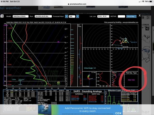
I just took a quick look at tomorrows outlook. A couple of things stood out. The LCL’s will be darn near to the ground and the storms will be moving along at up to 45 knots. Getting in a good position ahead of time will be important. I also have to post this sounding for NW Arkansas 2200 UTC. You don’t see that very often in October 716F4D2F-4687-4464-B4BD-C8BE7A645F8A.jpeg
 
I am targeting along the warm frontal boundary that should set up this afternoon from Pittsfield, IL to Springfield, IL for the potential of supercells and a few tornadoes. My car is currently getting new tires, so I'm going to be chasing with my chase partner (currently getting ready to leave, however I only live about 90 min from the target lol). I think storms should fire up along a pre-frontal convergence zone in East Central Missouri around 20z and move into Western Illinois after 4pm where instability and low level shear combinations are very high for this time of year....or let alone any time of year. It will be an interesting setup for sure.

I've learned that setups like these are either boom or bust. Either we will end up with a 4/19/11 type scenario (Litchfield/Girard) or we end up with a messy QLCS storm mode which would still bring widespread severe storms to the Mid Mississippi River Valley this evening through overnight.

Either way, I'll be out and hopeful for one last good chase of the 2021 season! Good luck everyone!
 
Back
Top