2021-05-23 REPORTS: CO/NE/KS/TX

Joined
Mar 23, 2013
Messages
384
Location
Denver, CO
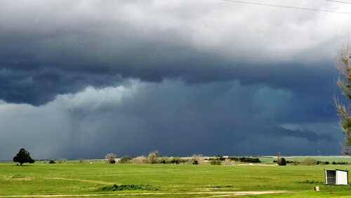
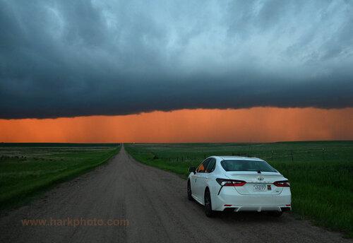
Caught a local chase Sunday after work. Headed to Limon and went up 71 N to Last Chance. Encountered an HP mess that went linear. Bugged out east to Burlington to wait on more discrete cells developing to the SW. These storms too turned into a linear HP mess and the chase was called. Needless to say the chase was a bust for tornadoes despite 6 others being seen in Colorado during the course of the day.

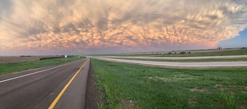
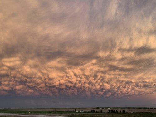
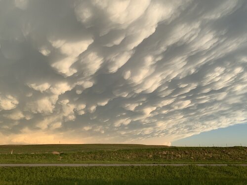
However, it wasn’t a total loss as the drive home included core punching the line and then I was rewarded with the best Mammatus show I have ever seen. Colorado is such an amazing, mystical, magical place. I sat in awe on an off ramp and watched this for an hour in Arriba as the sun dropped below the horizon and daylight faded away. Colorado never ceases to amaze me. You may not always get a tornado, but you will get something from every chase here.

27C890AF-B758-4D04-8DC6-AF74A601818A.jpeg
6BC09609-2490-45B2-B2D2-E2BF1DDE8133.jpeg
B722ACB2-1A98-4021-9878-E3B999C1268D.jpeg

70E453C3-9166-4A39-97E6-CBABB4E3969D.jpeg

BC45FBE6-ECF9-4C33-9C7D-733908C13D70.jpeg
3A1A13E3-88EA-43BA-B8FC-B33310B1BF4D.jpeg
 
After arriving in Denver on Saturday night, 5/23 was the first chase of my chasecation and first chase since 2019. Let’s just say I hope I can blame my poor performance on shaking the rust off and hope it gets better from here on out, weather permitting.

My initial target was Joes CO but I stopped at Cope which still turned out to be a bit too far east. For whatever reason I failed to have a proper sense of urgency about the cell coming up from the southwest toward Last Chance and thought it would take more time to mature/develop as it moved northeast, where I would be able to intercept from the south once it approached my longitude. I was caught napping (figuratively, not literally) when it went TOR warned and so I raced back west to Anton and north toward Akron from there.

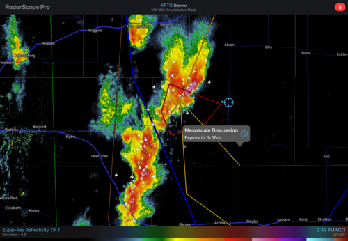
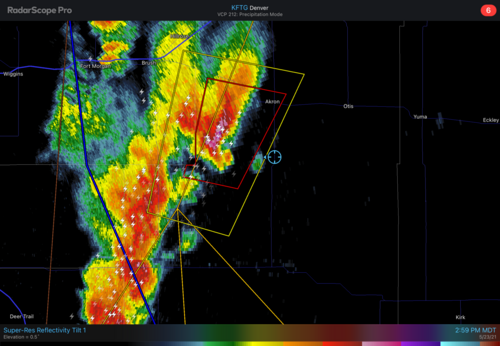
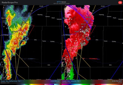
There is a tweet on Twitter of a large tornado said to be at 2:40 MDT somewhere between Woodrow and Akron but the SPC report for a similar location is closer to 3pm. In any case you can see below where I was at 2:42, still playing catch-up. I have an image saved from 2:46 where the tornado warning was no longer in effect and it was just severe, but by 3pm it was TOR warned again and that’s when it looked best on radar (see 2:59 image below). (Sorry for douplicates on the radar images, I can’t figure out how to delete one without deleting both and can’t easily reinsert in the proper sequence, especially on an iPad).

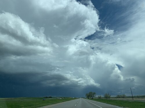
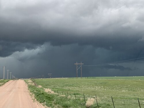
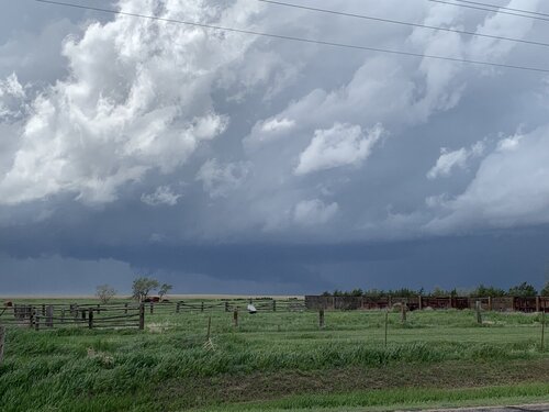
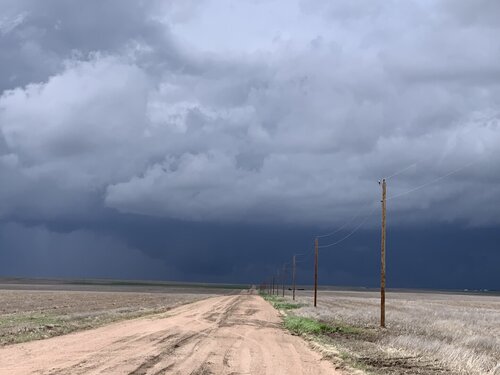
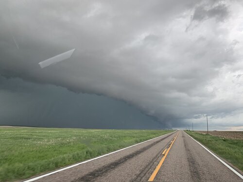
The storm pics below are just before and after that radar image and were the only time I had a view of the base. These are all iPhone pics. I do have a picture on my DLSR that I have not yet had a chance to download, but it may have captured a dissipating tornado with a condensation funnel that was not all the way down to the ground.

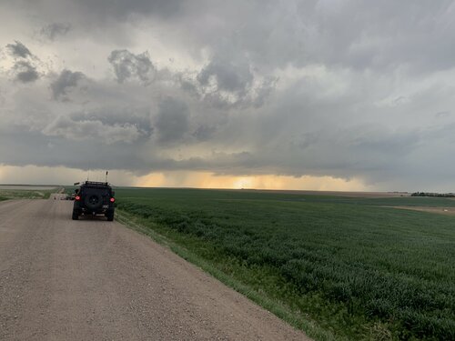
By the time I got to Akron, continuing north did not seem like a safe choice, see radar image below, so I went east to Otis and north from there. By then the storm was clearly HP (see pic below from this time) and I was hopelessly behind. I went through some heavy precip and small hail as the road curved northwest behind it to Sterling and I was pretty much done.

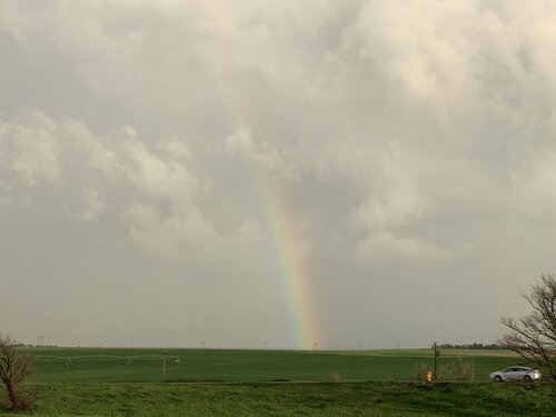
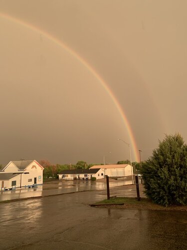
Went to Ogallala for the night. There was no great structure to be seen from outside the storm but I did get to enjoy being run over by it at the hotel in Ogallala and then was treated to a great full rainbow when I finished one of the excellent burgers at the Open Range Grill in Ogallala.

173BEA53-E8B8-48B4-B2CC-A642B0F9017A.png93A38CA2-6FDF-4DC7-B237-22291B20DF5A.png173BEA53-E8B8-48B4-B2CC-A642B0F9017A.png93A38CA2-6FDF-4DC7-B237-22291B20DF5A.png224F13EF-1D4B-406D-8A44-549945E1838E.jpegF5C9F3EB-DE84-4304-B4E8-C34F0D56BBEA.jpeg7B8A1AD8-E802-4B6B-B450-F12481D9A31E.jpegC0ED55C1-6C28-414C-8995-6865619C1366.jpeg58B9E127-5C76-47FD-A8F7-3FFC7B2C6B9A.jpeg7D02FCB6-A545-4930-B56C-CD8A10F0FB79.jpeg
 
May 23rd started off with a good rest and freshening up in Wray, Colorado. I headed west toward Limon to catch the first in a couple rounds of anticipated storms that day. I was running late though and approaching Limon just as the first tornado warned storm of the day was sweeping past on its way north.

I considered flanking the storm northward on Route 71, but was concerned that positioning for the notch could wind up running me off into untested roads and that hanging south could leave me gazing mushwise into the back of the storm and never able to cut back ahead. So I headed east to Genoa and took County Road 31 north in hopes of using that as my flanking route.

The road was great. Until it wasn’t. About 13 miles north, I stopped short to see a couple chaser vehicles delicately trying to turn around on the slick surface of a portion of the road that had seen a lot of recent rain.

I tried another option on CR3S to get east then get back north but that wound up sketchy too and figured at that point I was probably not going to keep pace or catch up with that lead cell. Looking back at the storm’s path, slow movement and other chaser angles, I could have used Route 71 to keep with it, but didn’t know at the time it wouldn’t press eastward more.

I set myself back up on the less messy legs to the west of CR31 and watched for new development south of the original storm. For a while, I cruised around on CR3N, 28 and 3R watching the back building line dress up the wind turbine fields. The wind pressing into the boundary and forcing up the storms was fierce and I had to be careful every time I opened car door to be sure it didn’t get ripped out of my hands or crash into some part of me or my gear.
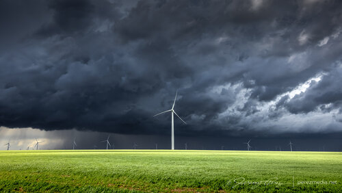
img20210523-R5__2948_1280px.jpg
Turbines and green fields contrasting against the line of storms. 2113Z
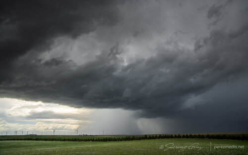
img20210523-R5__3013_1280px.jpg
Some organization taking shape in part of the line. 2143Z

Around this time, as the boundary and line of storms continued advancing slowly eastward, a new batch of cells were popping to the south and a bit east of the boundary. So I cruised south to get back to I-70 to hedge bets on both of them and reposition faster.

As I got down to Genoa, a new area of organization nudged into the line. I watched it and grabbed some shots, but as expected nothing materialized as it filled in with precipitation and moved off to the north. I should have taken this as a hint of more serious opportunities in the making with the tail end of that line. But at the time, I figured I was still mostly in landscape & moody sky mode.

I hustled east to Flagler to gain some ground and be ready for developments to the south. I set up about a mile south on CR5 and watched ongoing development and crepuscular rays drifting across the bubbling towers.
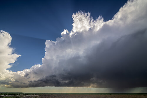
img20210523-R5__3060_1280px.jpg
Tail end of convection on the boundary as crepuscular rays filter across. Funnel, unnoticed at the time, barely visible just left of center. 2241Z

At 2241Z, I was just beginning to drive off for another vantage, when the tip of a funnel caught my eye. I quickly pulled back into my spot, grabbed the still and video cameras and hopped out to capture it before it disappeared. The wind was still fighting me every step of the way. As soon as I released grip on my tripod mounted video camera to fire off a couple still shots, it got toppled. I hadn’t extended the legs yet and so it didn’t fall far, but still a few anxious seconds being sure nothing was damaged.

img20210523-IMG_1179-Edit_1280px.jpg
Quick first shot of the funnel as my video camera was toppling over. 2243Z.

After extending the legs and then bracing it against my body, I got the video started and went back to alternating between stills and re-framing video. Meanwhile, the funnel had thickened up and had my hopes up that it might fully condense. It never took things that far, but was a gorgeous sight as it drifted into dappled sunlight and glowed brilliantly from behind. It showed off for about six minutes before rain started to fall and I jumped back into the car. It went on for another couple minutes before receding as that notch in the line continued northward.
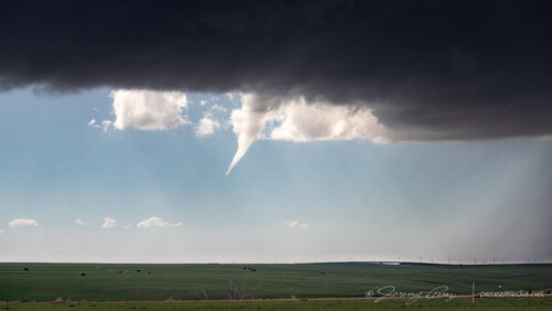
img20210523-IMG_1245_1280px.jpg
Backlit funnel. 2248Z

I filed a spotter report for a funnel with no ground contact visible from my vantage due to poor contrast and intervening terrain. Later on however, a video surfaced on Twitter from Paul Smith/@PaulMSmithPhoto showing ground circulation from his vantage in Arriba:


I went back to my footage and stills with strong contrast edits and found frames that showed the dust plume at 22:45Z. I passed that along to the Goodland WFO and got a confirmation response from them. So I'm keeping an eye on the Severe Event Database — which hasn't been updated for the May 2021 timeframe yet.
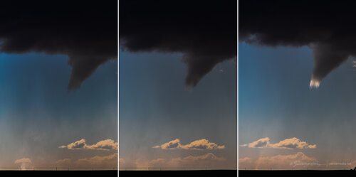
img20210523-IMG_1201-Edit_1280px.jpg
High contrast stills showing dust plume illuminated beneath the funnel. 2245Z

Video of the Arriba funnel/tornado. 2242Z–2252Z

I had some time to enjoy that moment as I drifted further east on I70 and storms along and ahead of the boundary to the south started to get stronger. I lingered around Stratton and grabbed more shots of those as they moved in.

By 0000Z, the storms to the south were getting serious enough that I wanted to get in a good spot to surf them as they piled in. I headed north on SR57 and then east to Idalia where I had a great view of a cluster of multiple rotating updrafts moving in as the sun was starting to drop behind them. The glow through the precipitation cores was stunning and even though I wasn’t watching an isolated supercell, I was still captivated by the beauty and ominous quality of this gang of marching storms.
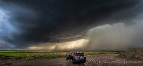
img20210523-IMG_1303-Pano_1280px.jpg
Hanging out east of Idalia, Colorado as multiple cores stake their claims in the line. 0053Z

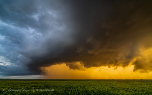
I continued to surf this scene east into Kansas along Highway 36 stopping at various points along the way to take in the heft of it. As the sun set, the brilliant yellow-orange glow set the cores on fire and went from one kind of spectacular to another.
img20210523-IMG_1347_1280px.jpg
Gust front surging and moving in. 0142Z

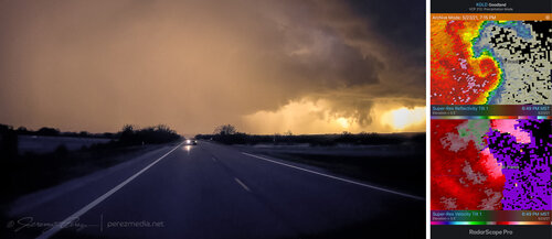
I wanted to pause briefly in St. Francis to watch one of the cells move in, but the line to the south began to surge quickly and I had to keep moving out of the way. A quick check of radar showed an ominous hook develop just as the storm moved past the town. Fortunately only some straight line wind damage was later reported there.
imgvid20210523-03-Edit_1280px.jpg
Surging gust front spiraling into a mesovortex just west of St. Francis, Kansas, viewed from rear camera and radar presentation. 0149Z

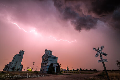
A few miles further east at Wheeler got me far enough to catch a breath and capture the whale’s mouth and lightning over grain silos and elevators. And then on from there, watching the gaping gust front flicker its way eastward.
img20210523-IMG_1373-Edit_1280px.jpg
Grain silo, elevator and gust front lightning from Wheeler, Kansas. 0207Z

I finally let it go around 03Z near McDonald after about 8 hours of chasing. Despite some tactical goofs early on, this turned out to be a prolific and awesome chase day.

Full batch of images in the report here:
Highways & Hailstones Chase Report — 23 May 2021
 
Little late to the reports party, but I've finally been able to muddle through editing some of my storm photos and whatnot now that school is out.

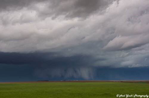
Anyway, after my struggles the previous 2 days, I was determined to get something out of todays chase. I targeted Sterling CO, having gotten burned by the fast storm motions of the previous two days I wanted to have a little space to judge the storms and maneuver. Wary of having the storms blow right by us, me and dad circled around Sterling 2-3 times as storms grew upscale and I dithered on when to pull the trigger, knowing that once we intercepted and stopped to watch the storm, get timelapses, etc. the storms would rip by us and we wouldn't be able to catch up in our painfully slow camper van that can't do anything over 65 mph in pretty much any wind. The maturity of the leading supercell caught me by surprise, it dropped a tornado early in its lifecycle and then things grew into a linear mess from there. We caught up to the supercell at the tip of the line around 3:00 MDT, N of Otis, CO in time to watch it drop a fat ragged wall cloud with some dust whirls under the base.
5-23WallCloud.jpg
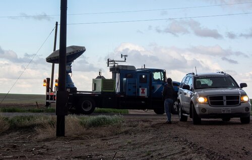
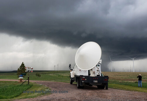
The storm blew by us and I believe dropped a brief tornado according to reports, but we couldn't see it as it was blocked by the downdraft of the squall line/leading HP supercell. We did see the University of Illinois DOW unit though, so that was cool.UIDOW.jpg
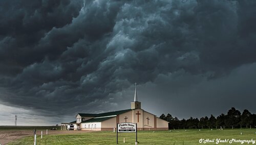
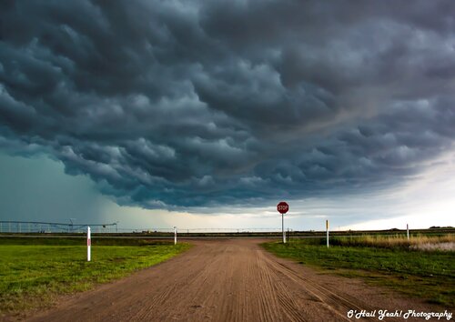
We decided to drop a bit SE to get ahead of the squall line so I could get some more timelapse footage and to find some shelter so the camper van wouldn't get blown over/hailed out/etc. We ended up parking 2/3 of the van underneath an overhang (we couldn't squeeze in completely with the AC unit on top, lol) at the entrance of the Prairie Home Baptist Church in Haxtun, CO and saw a gorgeous whales mouth as the squall line approached HaxtunPrarieBaptist.jpgWhale'sMouth#1.jpg
To finish the day off, we saw an amazing lightning display with a CG barrage and a few anvil crawlers, although unfortunately I wasn't able to get any decent lightning shots as the storms were too far off. Overall, I'd say this was a pretty successful day even though I missed seeing any tornadoes, the whales mouth and squall line structure was epic.
 
The day started in Sterling, Colorado. I spent the early morning resolving some equipment issues. I had hoped to walk around a local park to see what types of animals and flowers grew in this area, but the forecast showed unusual early storm development. There was a risk for tornadoes in northeastern Colorado. The difficulty would be keeping up with fast storm motions on a limited road network. Storms were expected to rocket northward at 40 to 50 miles per hour. I met up with Chris and Alethea and we decided to target the area north of Limon, Colorado. We had to hurry and lunch was skipped. A tornado watch was already issued. We blasted south through Akron, then west to Last Chance and then south toward Limon. There was already a storm far to south of Limon moving northward. As we approached Limon, I decided to hold back as the storm would be difficult to catch if we got behind it. Chris and Alethea went on into Limon and got behind the storm. I followed the storm back north though the storm was starting to cross the road. I skirted the core of the storm that was now tornado-warned and headed east at Last Chance. It was wrapping up at last Last Chance and I was sure it would produce a tornado. It didn't. I know of a couple of chasers including Melanie of the Twister Sisters who got up into the core of the storm north of Last Chance and saw a brief tornado. I wasn't inclined to get munched. The storm was moving north-northeast. My only option was to head east, then turn north at Anton and try to catch up with it. The storm was moving fast. I couldn't follow it north of Last Chance as the storm was blocking the road, and I would be on the wrong side of the storm to see a tornado. I raced east and then north. I was gaining on the storm. Barely. As I approached the town of Akron, I could occasionally make out a tornado or funnel in the murk. I couldn't stop to take pictures. I managed to quickly get through the town by cutting through some back alleys and parking lots to avoid the traffic. There was only one road to view the storm. I again caught glimpses of a tornado, but no god view. I finally got to a good viewing position north of town and watched a large rotating wall cloud shift northward. No tornado. I followed the storm until crossed the road as it moved northeast. I wasn't going to drive through the core and there were no immediate east options. I let it go. There were more storms in a north-south line below the main storm. Storms in lines usually don't produce easily viewable tornadoes. I dropped south in front of the line. At one point, one of the storms by me became tornado-warned, but I couldn't see anything. With the potential for more storm development near Burlington, Colorado, I decided to head east and then south through Wray. I was briefly pulled over for speeding, but was let off with a warning. I was very polite, apologetic and cooperative. There were more storms coming from the west and they would occasional have a high-based wall cloud. Nothing too interesting, but distracting. At this point, there was a big storm blocking my way south to Burlington. I had to head east, then south to Goodland, Kansas before heading back west to Burlington. It was getting dark, and the storm had no chance of producing a tornado. In Burlington, I stopped to photograph lightning without much success. I met up with Chris and Alethea at a PIzza Hut along with Jason Persoff and two of his kids. We picked up take out since they were closing. Nothing else in town was open. Chris and Alethea had targeted the area near Burlington for storm development since they were caught behind the Limon storm. This was an exhausting chase with brief views of tornadoes.


05232021DOWscan20210523_134405ad.jpg

05232021eoflastchnce20210523_142324ad.jpg

The storm was really wrapping up outside of Last Chance. It almost produced a tornado


05232021tornado3381.jpg

Highly enhanced image of tornado near Akron, Colorado


05232021somethinggoingon320PMMDT9200.jpg

Something is going on there in a highly enhanced photo

enhancedbetCR39and40offof63about1miSofAkronCO513PM33963.jpg
 

Attachments

  • 05232021sunsetstormDSC_1847ad.jpg
    05232021sunsetstormDSC_1847ad.jpg
    226 KB · Views: 0
This was another early-initiation day, so I left extra-early, early enough to find good coffee in Sterling, CO before heading down to Lamar to meet the first storm of the day. The problem I was having now was the secondary roads were very bad in these areas. They would start out near the paved roads with ample gravel/aggregate and plenty of traction, but would devolve into slippery mud with minimal gravel after 5 or 6 miles, requiring a lengthy backtrack to pavement (I don't mess with muddy roads at all, I turn around immediately upon encountering one). This meant that I would have to stick to paved roads for this day's event.

After the Lamar storm moved north of I-70 and started crossing Highway 71, the next paved road north to re-intercept was 40 miles east at Seibert. Of course, while I was making this lengthy jaunt east and north, the storm produced a tornado near Akron, about 20 minutes before I arrived back on it. The storm was increasingly HP at this point, so I chose to drop back to I-70 for additional rounds of supercells moving up from the south.

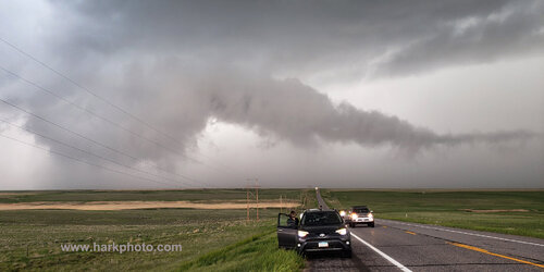
The plan was to get gas at Seibert and await cells crossing the highway, hoping they do something interesting while in view. Right before driving into the town, however, I looked to the west to see a well-defined funnel hanging below the flat updraft bases of new storms to the west.

h-6771.jpg


It turns out this funnel was near Arriba, about 22 miles away. Another photographer who was closer confirmed that this had a debris cloud at ground level, making it a tornado.

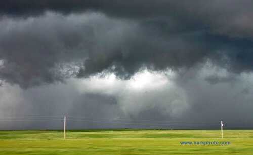
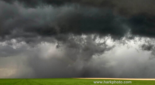
After finally getting gas at Seibert, I made my way slowly east as storms approached and crossed I-70. Some of them wrapped up nicely with RFD clear slots cutting in, albeit high-based with none appearing close to producing a tornado.

h-6772.jpg


Lightning was also meager, although a burst of positive CGs at sunset allowed me to catch one on high speed off to the side of the frame near Kanorado.

Not expecting these storms to do much else, I headed to Hays for the night.
 
Back
Top