John Farley
Supporter
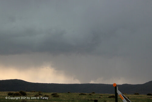
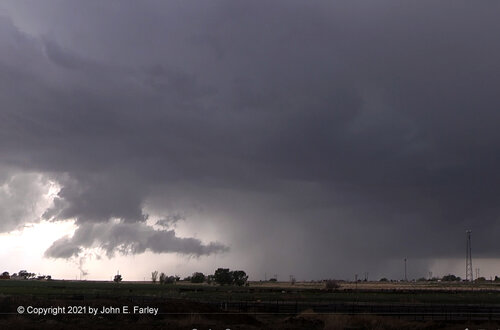
My first severe storm chase of 2021, in far northern NM and southeastern CO, was very successful. I intercepted two bow-head mesocyclones - the first over the Raton Mesa east of Raton, NM, and the second near Rocky Ford, CO. I thought the first one was on the brink of producing a tornado, but it apparently did not, although it did cover a highway with one-inch hail. I did not think the second one seemed as close to producing a tornado, but it did - although I did not realize it at the time. The NWS confirmed, by video submitted on social media, that there was a ground circulation that lasted for five minutes or so a couple miles south of Ricky Ford. The first picture, below, is of the mesocyclone over the Raton Mesa.
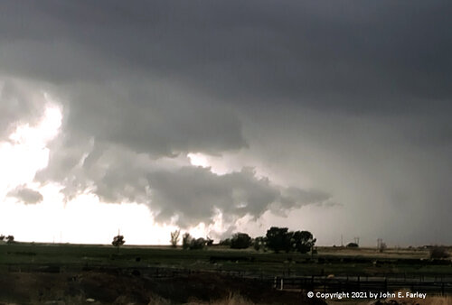
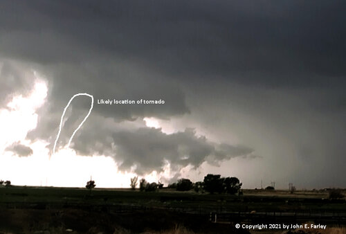
The next picture is of what turned out to be a tornado, taken from just south of La Junta looking west toward Rocky Ford, where the NWS confirmed a tornado a couple miles south of town. I did not think it was a tornado at the time, but I guess it was since someone gave the NWS video of a ground circulation. Note the narrow, squiggly feature near the ground at the left - I am guessing this was the tornado, but I am not sure. I am also not sure it is technically correct to call this a bow-head feature, but if it was not, it quickly evolved into one once the storm was north of Rocky Ford. So I do not think it would be totally incorrect to call this a bow-head tornado, in which case it would be my first.
Note the narrow, squiggly feature near the ground at the left - I am guessing this was the tornado, but I am not sure. I am also not sure it is technically correct to call this a bow-head feature, but if it was not, it quickly evolved into one once the storm was north of Rocky Ford. So I do not think it would be totally incorrect to call this a bow-head tornado, in which case it would be my first.
Eventually I will get around to posting a full report, but it will not be for a while as I will be out on the road chasing for another day or two.

The next picture is of what turned out to be a tornado, taken from just south of La Junta looking west toward Rocky Ford, where the NWS confirmed a tornado a couple miles south of town. I did not think it was a tornado at the time, but I guess it was since someone gave the NWS video of a ground circulation. Note the narrow, squiggly feature near the ground at the left - I am guessing this was the tornado, but I am not sure. I am also not sure it is technically correct to call this a bow-head feature, but if it was not, it quickly evolved into one once the storm was north of Rocky Ford. So I do not think it would be totally incorrect to call this a bow-head tornado, in which case it would be my first.
Note the narrow, squiggly feature near the ground at the left - I am guessing this was the tornado, but I am not sure. I am also not sure it is technically correct to call this a bow-head feature, but if it was not, it quickly evolved into one once the storm was north of Rocky Ford. So I do not think it would be totally incorrect to call this a bow-head tornado, in which case it would be my first.

Eventually I will get around to posting a full report, but it will not be for a while as I will be out on the road chasing for another day or two.

