-
While Stormtrack has discontinued its hosting of SpotterNetwork support on the forums, keep in mind that support for SpotterNetwork issues is available by emailing [email protected].
You are using an out of date browser. It may not display this or other websites correctly.
You should upgrade or use an alternative browser.
You should upgrade or use an alternative browser.
2020-04-22 REPORTS: OK
- Thread starter James Wilson
- Start date
Quincy Vagell
EF4
I waited until almost lunchtime to leave Oklahoma City, as I wanted to make sure I had the right target in mind and didn't potentially overshoot... I left around 11:15 and headed down I-35.
I was really torn between North Texas and south-central Oklahoma. The first place to stop would be Ardmore, since there was a good road network in all directions. I almost jumped on going south when I saw some attempts at CI to the northwest of Fort Worth, but they didn't amount to much and the FWD special sounding showed a warm nose that would probably suppress development for a while. I also saw that the initial storms over by FDR were near or even a bit northwest of the surface low, suggesting possible left splits and a very low tornado threat.
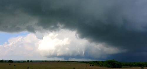
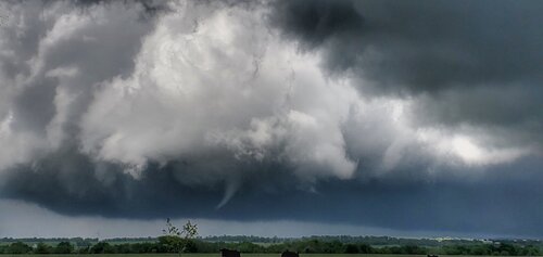
By mid-afternoon, several small cells were approaching I-35 and began to show improved low-level rotation. I zeroed in on the storm near Springer and I saw an organizing wall cloud. I pulled over for a spot and all of a sudden a small funnel had dropped down. I wanted to get closer, but there were no more routes going north and with trees at least partially blocking view, I turned east.
Within a few minutes, I caught glimpses of a wedge tornado in the distance. It took a few miles before I could find a suitable place to pull over.
Timing was good, because I only had about two minutes before the tornado would rope out.
I stayed with the storm all the way east to near Wapanucka, but I had no other visuals on a tornado after the initial one.
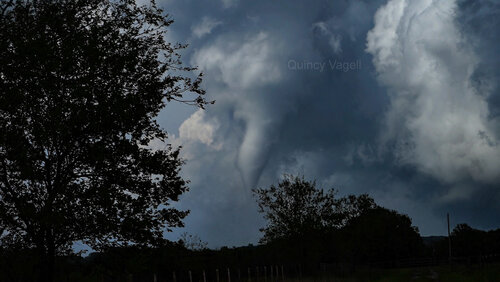
After that, I briefly drove through Wapanucka to look for any damage. I saw what appeared to be an overturned RV and some minor damage to trees, but nothing that caught my attention. I headed home and made it to Oklahoma City just as the sun was setting.
This was probably my best Oklahoma tornado to-date, at least one that I had a clear visual on and managed to get some decent footage of. Every tornado I've chased in Oklahoma has been in hilly/forested areas and this was no different.
I was really torn between North Texas and south-central Oklahoma. The first place to stop would be Ardmore, since there was a good road network in all directions. I almost jumped on going south when I saw some attempts at CI to the northwest of Fort Worth, but they didn't amount to much and the FWD special sounding showed a warm nose that would probably suppress development for a while. I also saw that the initial storms over by FDR were near or even a bit northwest of the surface low, suggesting possible left splits and a very low tornado threat.
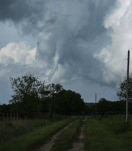
By mid-afternoon, several small cells were approaching I-35 and began to show improved low-level rotation. I zeroed in on the storm near Springer and I saw an organizing wall cloud. I pulled over for a spot and all of a sudden a small funnel had dropped down. I wanted to get closer, but there were no more routes going north and with trees at least partially blocking view, I turned east.
Within a few minutes, I caught glimpses of a wedge tornado in the distance. It took a few miles before I could find a suitable place to pull over.
I stayed with the storm all the way east to near Wapanucka, but I had no other visuals on a tornado after the initial one.

After that, I briefly drove through Wapanucka to look for any damage. I saw what appeared to be an overturned RV and some minor damage to trees, but nothing that caught my attention. I headed home and made it to Oklahoma City just as the sun was setting.
This was probably my best Oklahoma tornado to-date, at least one that I had a clear visual on and managed to get some decent footage of. Every tornado I've chased in Oklahoma has been in hilly/forested areas and this was no different.

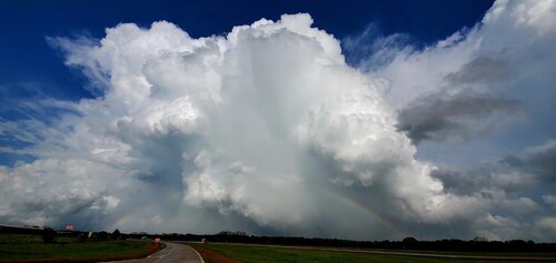
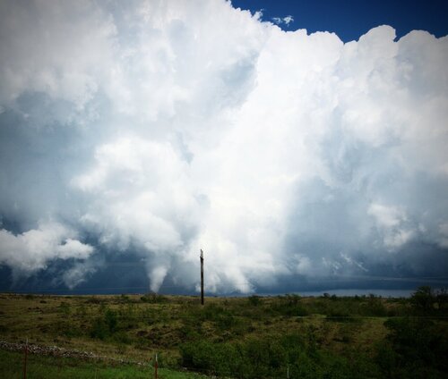
I left Granby, Mo at 8am. Took 69 south to Atoka and crossed over to Ardmore just as things started to happen. Rapid clearing and heating kicked things off quickly on the dry line so I jumped on that first cell that spawned the Springer tornado....eventually. But once it went, it WENT. I just posted a quick screenshot from a video I took as the tornado was a peak strength and trying to wedge. Trying to view this tornado from I35 was a mess of trees, but I got a few minutes of video as the tornado was really going full bore. But my favorite shot was this one I snapped real quick of the tornado gracefully beginning to rope. What a gorgeous tornado. Lots of chasers out today, and with at least 4 cells producing at once I am sure most chasers got something that made it worth the trip. Total miles traveled today 690, but I’m still in my own bed tonight. Let’s be thinking about the folks that were hurt by these storms tonight. I know the tornado that was in Marshall county did quite a bit of damage and reported fatalities.
View attachment 20332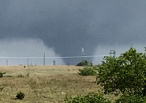
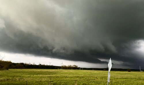
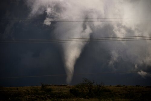
View attachment 20332


James Wilson
EF5
Adam Lucio
EF5
Caught the Springer tornado (ugh no roads!) and then tracked the storm northeast to Wapanucka where I caught the later half of a second tornado that crossed hwy 48 just north of town. Then dropped to tail end charlie along the red river to catch a brief view of a 3rd tornado that developed just east of hwy 271 in Powderly, TX.
Overall a difficult chase in eastern Oklahoma which I call "Dixie Light" but those tornadoes are my first in the state east of i-35 so that's a feat in itself I suppose. I don't chase there very often. Overall a solid day! That Springer tornado reminded me so much of the Waldo, KS tornado from last year. If it had formed 10 minutes earlier it could've been a career catch, instead I had to watch it pull away east from i-35 as it charged into no-roads-land.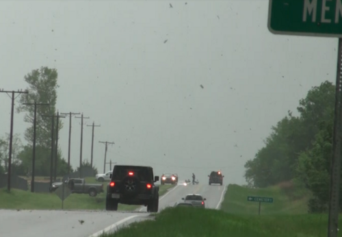
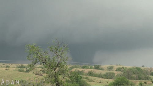
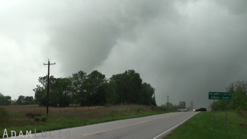
Overall a difficult chase in eastern Oklahoma which I call "Dixie Light" but those tornadoes are my first in the state east of i-35 so that's a feat in itself I suppose. I don't chase there very often. Overall a solid day! That Springer tornado reminded me so much of the Waldo, KS tornado from last year. If it had formed 10 minutes earlier it could've been a career catch, instead I had to watch it pull away east from i-35 as it charged into no-roads-land.


David Hoadley
Stormtrack founder
- Joined
- Apr 19, 2006
- Messages
- 122
When and where was the second tornado that you posted? I was live-streaming with John Humphress (Severe Studios) from Virginia that afternoon, and he caught one close-up that looked like this. I later determined that it was the one SPC reported 5 miles SE of Caddo, OK at 5:53 CDT. Thanks.I left Granby, Mo at 8am. Took 69 south to Atoka and crossed over to Ardmore just as things started to happen. Rapid clearing and heating kicked things off quickly on the dry line so I jumped on that first cell that spawned the Springer tornado....eventually. But once it went, it WENT. I just posted a quick screenshot from a video I took as the tornado was a peak strength and trying to wedge. Trying to view this tornado from I35 was a mess of trees, but I got a few minutes of video as the tornado was really going full bore. But my favorite shot was this one I snapped real quick of the tornado gracefully beginning to rope. What a gorgeous tornado. Lots of chasers out today, and with at least 4 cells producing at once I am sure most chasers got something that made it worth the trip. Total miles traveled today 690, but I’m still in my own bed tonight. Let’s be thinking about the folks that were hurt by these storms tonight. I know the tornado that was in Marshall county did quite a bit of damage and reported fatalities.
View attachment 20332View attachment 20333View attachment 20334View attachment 20337
This is the tornado just northeast of Springer, Ok around 4:25 Wednesday. Quite a few chasers were on this storm, parked on that section of I35. There was not a lot of options to get a close view of this tornado and absolutely no roads into the area. This tornado hit in the best location possible. Not even as much as a shed in that location.When and where was this tornado? I was live-streaming John Humphress (Severe Studios) from Virginia that afternoon, and he caught one close-up that looked like this. I later determined that it was the one SPC reported 5 miles SE of Caddo, OK at 5:53 CDT. Thanks.
Michael Snyder
EF3
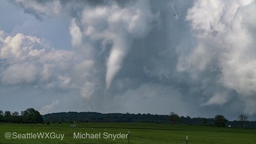
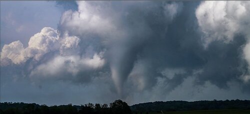
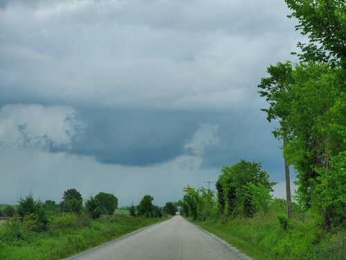
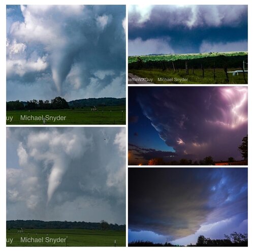
Started out just west of Ardmore, OK as we passed a boundary and it started to warm up considerably. Watched the Springer, OK storm start over the Red River and then make its way NE and west of Ardmore, OK and over Springer, OK. We were right under the base until the East option ran out and it started to produce. Saw the really brief EF-0 tornado over the town itself, not really noteworthy. Dropped south and then east and went north on a back road and had a pretty good view of the Tornado and its rope out stage. The view and the shots were good enough that we ended the chase shortly after. Included my breakfast, a couple shots from the night before and the wall cloud that this storm cycled about 30 min before it produced the tornado. A very fun day overall and a great start to 2020. 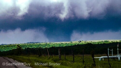


Ben Holcomb
EF5
Intercepted a wedge near Bromide, OK. Missed the Springer tornado because I was apparently too blocked by terrain in the Arbuckles.
My chase recap is here. It's a short read.
My chase recap is here. It's a short read.

