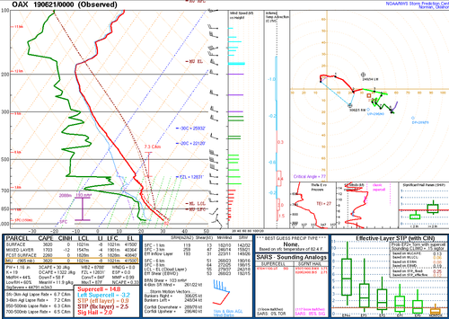
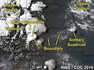
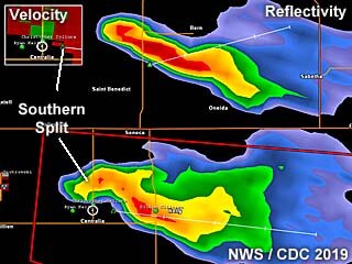
Chased for the first time in 3 weeks on the 20th. Initially, was pretty stoked the night before for a possible great local chase as the CAMs were showing 1-2 big supercells/strong helicity tracks tracking south/southeast across either eastern Nebraska or western Iowa. Woke up in the morning to see a couple of the 12Z CAMs hold onto that idea but the HRRR wasn't too optimistic anymore.
Nonetheless, since it was such a close target I knew I would go out, especially since I hadn't been out in 3 weeks. There were morning storms across northeast Nebraska that were moving slowly east and slowly weakening. However, a cell formed on the southwest side northwest of Norfolk a ways that briefly went severe and even caused a MD to be put out for a possible watch by early afternoon. Unfortunately, that storm weakened as it moved towards Norfolk.
I headed out about 1p. There was still a small almost stationary t-shower just west of Norfolk as I left and headed that general direction. The storm briefly pulsed stronger for a bit on my way there, but once I was within 20 miles or so, it rapidly weakened. Figures, a storm that was there for a couple of hours decides to die once I get close.
Thereafter for the next couple of hours, other small, and short lived cells would pop up and usually within 20 minutes or so fizzle. I slowly made my way up to Wayne and then towards Sioux City, IA. At this point there was one other cell northeast of Sioux City about 20 miles. It was about 5-530 and my plan was actually to start heading home once I made it to S. City and could jump on the interstate south back home. However, once I made it to S. City I thought I would feel pretty stupid if I went home so early and then something still formed or happened in the area so I decided to check out the storm near Hinton, IA.
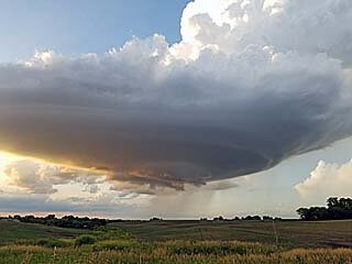
It too grew stronger and in fact actually had the 1" hail marker pop up on it on GRLevel3(first time all day). I came around to the southwest side of the storm and it too started to weaken and nothing was too visually exciting about it. It was drifting off to the east, but as it was slowly weakening it was producing some non/slowly rotating wall clouds, so I stuck with it for a while.
Finally another cell popped in eastern Nebraska near the river and Onawa, IA. I headed that way and took the Onawa exit west of town about a mile. This storm had a nice base but little else with it at first. Lucky for me though, no longer than probably 10 minutes it suddenly started forming an inflow tail and a wall cloud. There was very slow rotation with it as the storm also slowly drifted off to the southeast. Radar presentation though started looking much better with a bit of a hook on the reflectivity, and a decent couplet on the velocity scans. I ended up dropping south to the next exit down on I-29 at Blencoe, and then took a road back north a bit to watch the storm.
It now had a pretty beefy looking wall cloud but nothing too crazy for rotation. I was able to take pictures and video for about 10 minutes as it slowly approached my location. Just as it was maybe a mile or 2 north of me, it finally started rotating a little harder and looking like more of a "legit" wall cloud. It was about this time I started to get hit with pretty strong RFD winds probably gusting close to 50 mph. I jumped in the car to head east so I could beat it across the road and stay in front of it. However, the storm was also starting to move much more quickly compared to the crawl it was at before. I beat it across the road and went south, stopping after a bit to look back and was disappointed to see everything had fallen apart as the RFD had apparently choked everything off.
At this point, I let the storm head off to the southeast and stuck around in the countryside to take some pictures of the weakening storm and a beautiful sunset with crepuscular rays. I'm glad I had the patience and stayed out long enough to finally see "the storm of the day" in the area.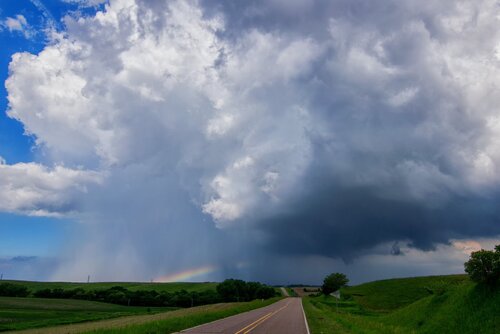
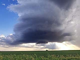
Storm near Hinton, IA
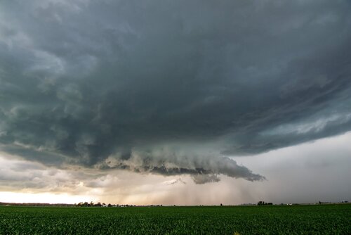
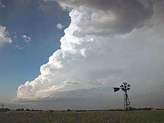
Storm near Onawa, IA finally starting to wrap up a bit
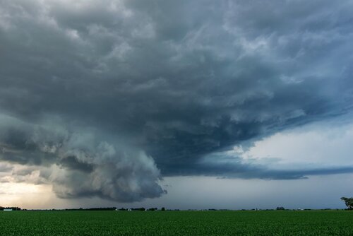
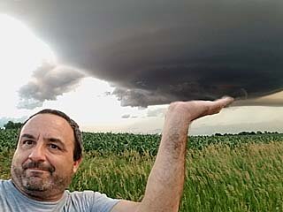
Looking north from Blencoe, IA
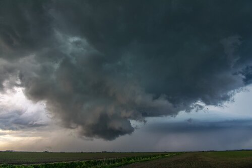
Closest it came to dropping a tornado. Right about this time is when I started to get hit with the RFD
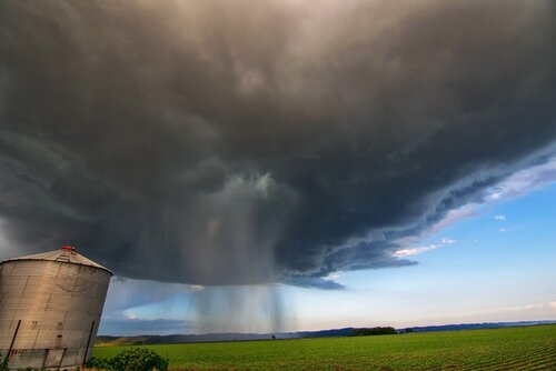
Thought this looked really cool. This was the storm weakening after it came close to producing a tornado. This base was totally rain free for a while, when suddenly this rain shaft punched through the cloud causing a "hole" to appear. Maybe a small wet microburst?
Nonetheless, since it was such a close target I knew I would go out, especially since I hadn't been out in 3 weeks. There were morning storms across northeast Nebraska that were moving slowly east and slowly weakening. However, a cell formed on the southwest side northwest of Norfolk a ways that briefly went severe and even caused a MD to be put out for a possible watch by early afternoon. Unfortunately, that storm weakened as it moved towards Norfolk.
I headed out about 1p. There was still a small almost stationary t-shower just west of Norfolk as I left and headed that general direction. The storm briefly pulsed stronger for a bit on my way there, but once I was within 20 miles or so, it rapidly weakened. Figures, a storm that was there for a couple of hours decides to die once I get close.
Thereafter for the next couple of hours, other small, and short lived cells would pop up and usually within 20 minutes or so fizzle. I slowly made my way up to Wayne and then towards Sioux City, IA. At this point there was one other cell northeast of Sioux City about 20 miles. It was about 5-530 and my plan was actually to start heading home once I made it to S. City and could jump on the interstate south back home. However, once I made it to S. City I thought I would feel pretty stupid if I went home so early and then something still formed or happened in the area so I decided to check out the storm near Hinton, IA.
It too grew stronger and in fact actually had the 1" hail marker pop up on it on GRLevel3(first time all day). I came around to the southwest side of the storm and it too started to weaken and nothing was too visually exciting about it. It was drifting off to the east, but as it was slowly weakening it was producing some non/slowly rotating wall clouds, so I stuck with it for a while.
Finally another cell popped in eastern Nebraska near the river and Onawa, IA. I headed that way and took the Onawa exit west of town about a mile. This storm had a nice base but little else with it at first. Lucky for me though, no longer than probably 10 minutes it suddenly started forming an inflow tail and a wall cloud. There was very slow rotation with it as the storm also slowly drifted off to the southeast. Radar presentation though started looking much better with a bit of a hook on the reflectivity, and a decent couplet on the velocity scans. I ended up dropping south to the next exit down on I-29 at Blencoe, and then took a road back north a bit to watch the storm.
It now had a pretty beefy looking wall cloud but nothing too crazy for rotation. I was able to take pictures and video for about 10 minutes as it slowly approached my location. Just as it was maybe a mile or 2 north of me, it finally started rotating a little harder and looking like more of a "legit" wall cloud. It was about this time I started to get hit with pretty strong RFD winds probably gusting close to 50 mph. I jumped in the car to head east so I could beat it across the road and stay in front of it. However, the storm was also starting to move much more quickly compared to the crawl it was at before. I beat it across the road and went south, stopping after a bit to look back and was disappointed to see everything had fallen apart as the RFD had apparently choked everything off.
At this point, I let the storm head off to the southeast and stuck around in the countryside to take some pictures of the weakening storm and a beautiful sunset with crepuscular rays. I'm glad I had the patience and stayed out long enough to finally see "the storm of the day" in the area.

Storm near Hinton, IA

Storm near Onawa, IA finally starting to wrap up a bit

Looking north from Blencoe, IA

Closest it came to dropping a tornado. Right about this time is when I started to get hit with the RFD

Thought this looked really cool. This was the storm weakening after it came close to producing a tornado. This base was totally rain free for a while, when suddenly this rain shaft punched through the cloud causing a "hole" to appear. Maybe a small wet microburst?


