Chased with veteran chaser and atmospheric scientist Anton Seimon, Tracie Seimon, my long time partner Jennifer Brindley Ubl, and "Pecos Hank" Schyma who had newly joined our team.
We looked at eastern Kansas, but with PWATs approaching 2 inches we anticipated HP storms approaching ugly, populated terrain near the Missouri River, and possibly traffic from the horde suckered in by SPC's higher tornado probabilities. Tail-End-Charlie on the dryline down by Wichita looked intriguing. But then there was that low. Moisture wrapped all the way around the surface low, strongly destabilized on the back side of it with a massive 0-3km CAPE pool. Every time I've seen that happen, it's a ridiculous tornado machine. June 20, '11 comes to mind. It's like you're getting the extreme directional shear north of the warm front, all the lift and vorticity off the low, but also warm sector instability. We sat in Beloit awaiting initiation under an airmass that was something like 79/72 with a howling northeast wind. Pretty unreal. We worried about undercutting from the cold front if it surged and storms crossing the boundary into cold air in Nebraska too quickly, but a little surprised to see SPC kind of look the other way on this target, at least for starters. Tipton was in the 2% at the start of the day and outside the initial watch boxes.
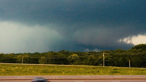
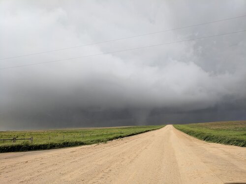
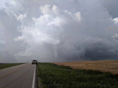
We anticipated the I-70 storms on the stationary boundary running west into Colorado, but expected those to be the high based hailers way to the west, and held our ground in Beloit awaiting something closer in to the low. It soon became apparent that the cell coming up from Hays was going to absolutely dominate the local environment, and it would indeed tap the ingredients on the west side of the low as it tracked northeast. We made a mad dash west for it.
We were still 20 miles out when the first tornado reports came in. Meanwhile a cell to the north-northeast was going up in front of us, exploding like a bomb, and rapidly organizing. In my head, I always run through the scenarios of how the universe is most going to screw me over, built upon years of painful busts. On this one, it's that we'd be chasing tornado warnings. We'd miss the "one and done' on the southern storm, leave this perfectly good supercell going up over our heads, and then be way out of position as it wrapped up and produced an even bigger tornado near Beloit while choking and killing the southern storm with its outflow where we would be. Typically you'd prefer the southern storm, but with the northeast inflow, the north storm actually had the most unimpeded access. I was ready to hold for the north storm, but I was talked out of it. We had no clean path to keep up with it with the dammed and flooded waterways south of Cawker City and Beloit.
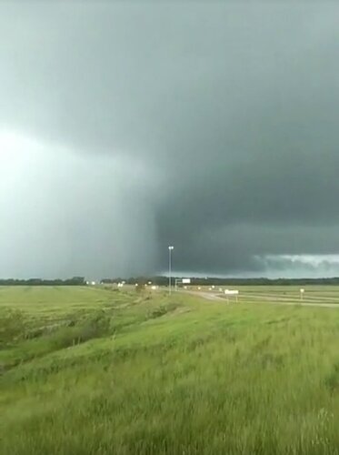
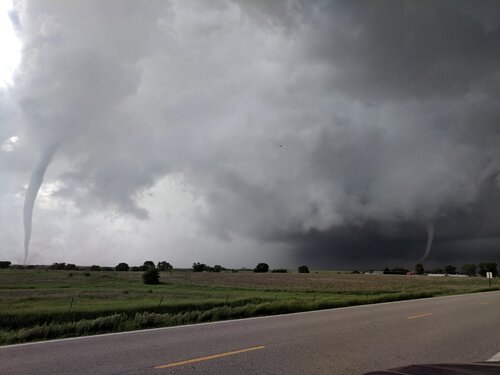
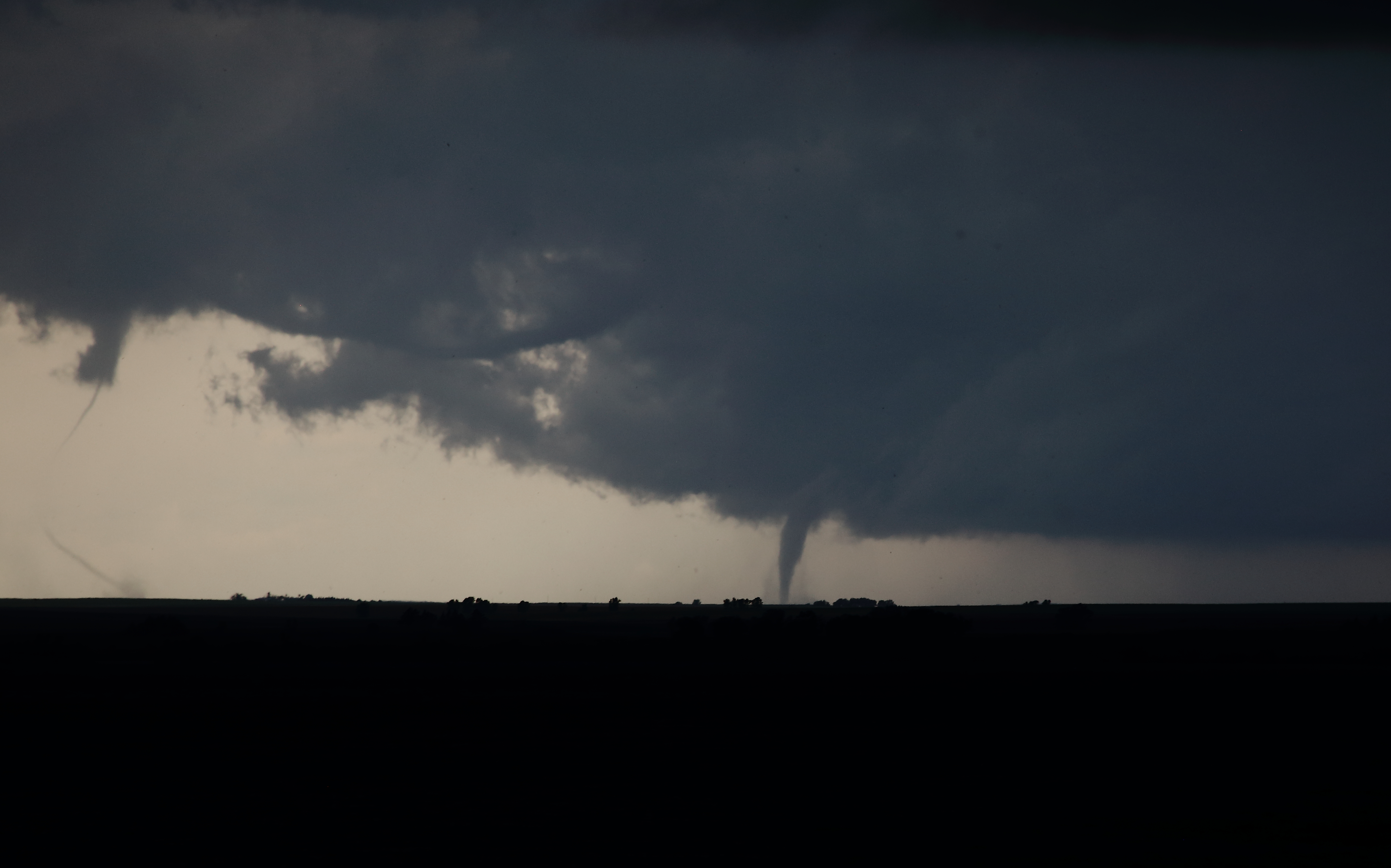
We had a shot of the Waldo tornado as we approached, a distant smudge under a giant, menacing supercell. We stepped onto the grid a few miles southwest of Tipton to get in closer. Then the storm just turned into a bewildering and utterly alien mass of writhing tornadoes. Concurrent tornadoes spawned from grotesquely distended updraft tubes. A stovepipe and rope surged eastward at high velocity on the southern rim of the meso, and I wondered if they were just orbiting satellites. There were three concurrent circulations at one point. I'm not going to lie. I was pretty nervous coming in from the northeast as we approached this storm. The base under the meso seemed to go on for miles and miles with multiple tornadoes coming out of it at odd places. Years spent studying storm structure and building up confidence, and this storm made me feel like a helpless newb.
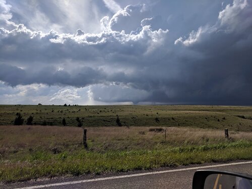
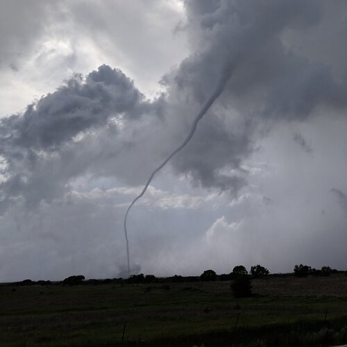
The rope and stovepipe had dissipated, the eastern rope connected to or coming out of a long horizontal vortex, which I believe may have just been the distended parent updraft tube, but initially thought it might have been a vortex arch, or a toroidal ring vortex. Meanwhile, a fourth circulation was kicking up large debris at the surface with intermittent dust cloud flare ups. I actually didn't notice it at the time, which really alarms me. I was fixated on the two other ongoing tornadoes. But I believe this was the initial, multi-vortex development stage of the large tornado that tracked southwest of Tipton.
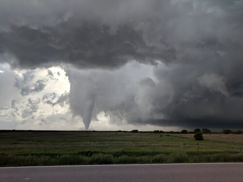
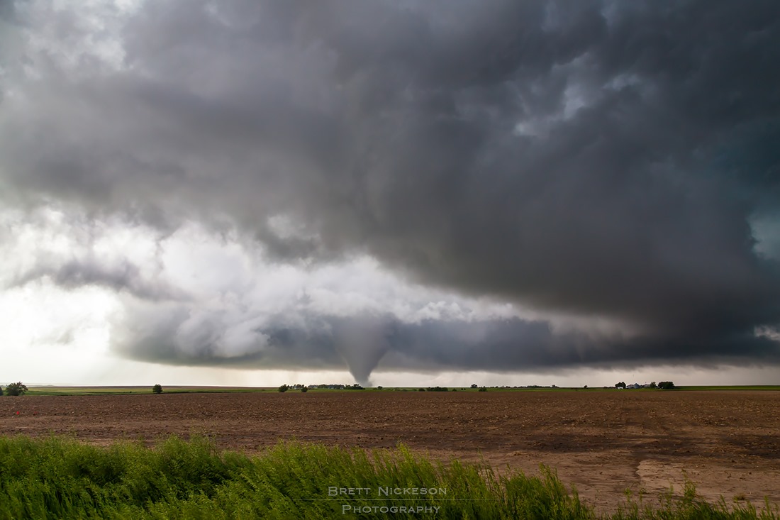
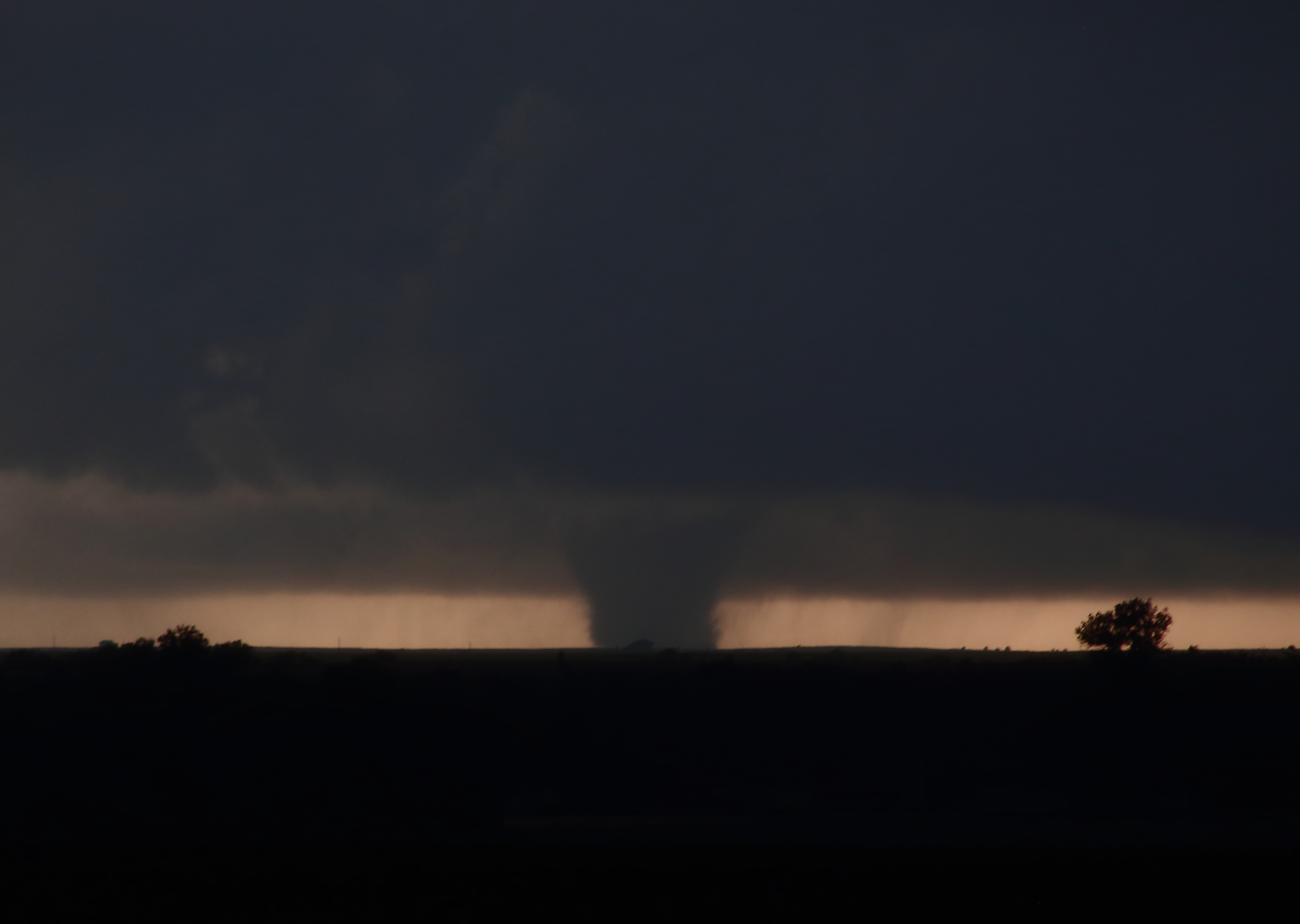
Once the two condensed tornadoes had dissipated, we dropped south for the "kill". Dust was ongoing on the developing tornado, which was centered under the main meso, not distended from it or orbiting the rim. It fully condensed as we traveled south a mile or two, but then retreated. We stopped next to a farmstead with a great view over the rolling hills. A truncated funnel lined with tentacles spun away a few miles to our southwest, and we let it approach, hoping to capture a multi-perspective, close range shot for the research program Anton is leading.
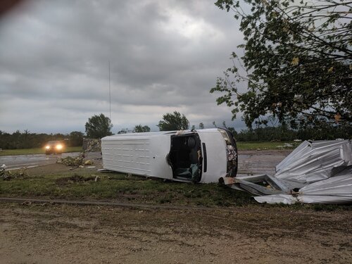
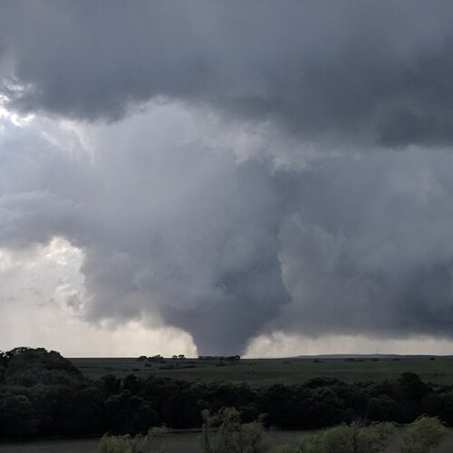
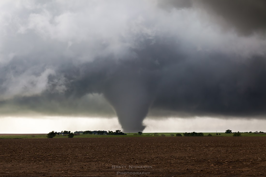
It became apparent we were pretty much directly in the path. We held our ground for a couple minutes, but as the tornado cyclone above the tornado drew near we punched our escape route to the south, Hank trailing behind us. We cleared the cyclone aloft, Brindley noting her ears were popping from the pressure drop. We were in sunny "clear air" now, but getting absolutely rocked by RFD. 60-70 mph winds easily and the car shook as we turned around to watch the tornado cross the road to our north. Hank now in front of us, we nosed in cautiously. The farmstead we had been parked next to was directly in the path. A whole outbuilding lifted and then blew apart in front of us, well ahead of the main condensation funnel, which was heart wrenching to see, but also incredibly alarming as a chaser who thinks he knows how close he can get.
Multiple roaring inflow jets raked the farmstead, and the air was filled with debris. The tornado crossed the road with a parade of suction vortices whipping around the bottom of the giant cone funnel. Trees were stripped of branches and partially debarked where it crossed and it seemed as if the tornado ramped up massively in those moments, no doubt to a level much higher than the EF2 rating suggests.
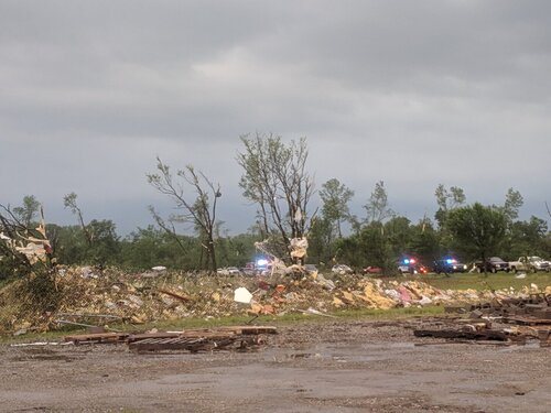
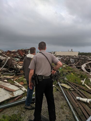
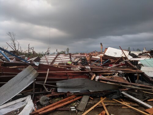
Hank ran into the farmstead to check to see if anyone needed help. Fortunately the house took only minor damage. It was the barns and outbuildings on the west side that had been destroyed, and nobody was home anyway. Powerlines blocked the road ahead so we turned around and plodded across some minimum maintenance roads to get back to pavement. Fortunately it was balmy and sunny immediately south of the storm and the roads were dry for the most part. It was kind of surreal going from that intense tornado encounter straight into totally balmy, serene weather with blue skies and fluffy cumulus. Several minutes later we got a glimpse of what we think was the Tipton rope-out, a white tube dissipating on the back end of a brilliant white, turbulent, and disorganized updraft tower. Minutes later, the storm collapsed, kicking up a massive and surging gust front, and the chase was over. We timelapsed gorgeous supercell updraft towers and anvils from our hotel in Salina as they caught the golden evening light.