• While Stormtrack has discontinued its hosting of SpotterNetwork support on the forums, keep in mind that support for SpotterNetwork issues is available by emailing [email protected].

2018-12-01 REPORTS: IL

Joined
Jan 14, 2011
Messages
3,483
Location
St. Louis
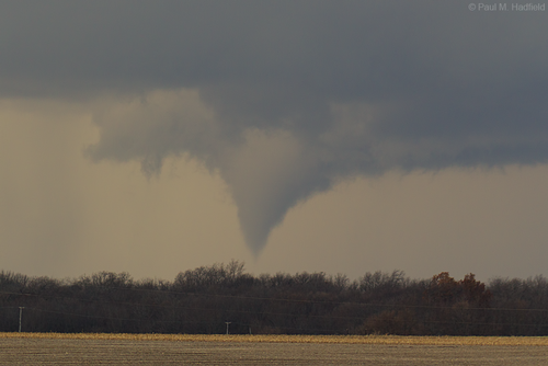
Incredible day in central Illinois. I watched tornadoes almost continually for 2 hours from a single storm from near Winchester to Beardstown. Visibility was excellent with precip far removed from the updraft. The Beardstown tornado was my catch of the day as it nearly fully condensed around 1/2 mile away before entering the east side of town, filling the air with debris:

beardstown4.jpg
beardstown7.jpg

I am not sure of my total count, as it appeared to me that only one or two distinct long-track tornado cyclones were responsible for everything I saw. My best guess is 3, possibly 5. I did not see major meso/RFD handoffs during the times I had visual. I made two close intercepts of ground circulations, one near Detroit and another near Bluffs.

My completed chase log is here:
http://stormhighway.com/december12018.php

Video edit for the day:
 
Last edited:
My original target was Beardstown, but repositioned in Rushville on the way down to review mesoscale data. I liked that the storms in Pike County had better instability to work with, though the cells that formed between Hannibal and Quincy were entering an environment of extensive vorticity and MLCAPE for a cool season setup.

Decided to head west to intercept a burgeoning cell entering Schuyler County southwest of Camden. The cell quickly tightened up, became severe, and within ten minutes produced several weak tornadoes just SW and NW of Camden. As I headed north of Camden to reintercept, as I came out of the LaMoine River valley, it tightened up and produced the nice cone tornado in the photos that narrowly missed Brooklyn, IL. As the storm entered McDonough County, it produced several more brief tornadoes between Industry and Bardolph.

120118a.jpg 1201018f.jpg 120118b.jpg 1201018d.jpg IMG_20181201_155339_01.jpeg

Sent from my Pixel XL using Stormtrack mobile app
 
Last edited:
I had my eye on this day as early as last Sunday as the Euro was signalling for a very strongly sheared low cape environment with very steep lapse rates. I started the day in Jacksonville, IL and waited for the cells that initiated in Missouri to make there way closer to I-72. After I got a good feel for where the storm I chose would be as it crossed I-72, I made my way toward Oxville, IL and observed the first few Tornadoes of the day. Afterwards I then followed this same supercell all the way to Havana, IL where I observed at least 6 separate tornadoes total from this particular supercell along the way. Unfortunately due to the nature of the trees near the Illinois River I didn't get any video of the Bluff City or Havana tornadoes, but I did see them and managed to get a picture of the Havana tornado at least. After the supercell passed Havana, I decided to dip south to the next supercell and observed an additional large tornado with a quite audible jet engine-like roar a bit west of Easton, IL. I decided to just sit in place and watch as this tornado continued on into the night northwards to Forest City as I felt it was now too dark to continue the chase, and I observed several power flashes from a distance. Today exceeded all of my expectations, and I'm now not so annoyed over the lack of any quality Illinois tornadoes this year haha. Top chase of the year for me easily.
Video of the Oxville/Bluffs Tornado:
Video of the Beardstown Tornado:

Images of some of the tornadoes I saw today:
02741d9852.jpg

97bc4cc3fa.jpg

a7588a6919.jpg

0333390df1.jpg

18834c63eb.jpg
 
Chased today and although we could've done better, we still did pretty well. We witnessed 2-3 tornadoes between Pleasant Hill and Oxville as the our storm (the soon-to-be-Havana storm) got its act together near and south of I-72. We thought it looked like it might be done producing tornadoes after the Oxville one, so we bailed for storms just south. We then proceeded to miss the most photogenic tornadoes of the event. Following the southern storm, it finally produced a tornado for us near Easton, and a fairly large/long-lived one at that. Observed multiple power flashes as the tornado lifted northeast, shapeshifting rapidly between lightning flashes.

The 2nd of two possible tornadoes before crossing I-72:

DtYdDBCXoAAp4Lk.jpg

The Oxville tornado:

upload_2018-12-2_0-54-32.png
Easton tornado shortly after developing:
DtYdRLgXcAED7rV.jpg

DtYdbqLWsAM-WqC.jpg

Highlights video (that Youtube has destroyed quality-wise):
 
I woke up at 5 am this morning expecting a tornado or two, maybe briefly touching down and stirring some things up in front of me. I figured I could get close enough to get it on video, bail east, and use the miracle that is Illinois' road network to stay with storms moving NNE at 45 knots. I turned out to be completely wrong, but it worked out in the end, so all is good.

Before I say anything, I think it is only fair to point out that Devin's insistence a week ago in the ST Discord that this was a legitimate cold core or even low topped setup is nothing short of prescient. He was on the money all week long, and having never really been introduced to the concept of a cold core low and low topped supercells that come from these sort of setups, he basically had me convinced six days ahead of time that this was the event that Illinois chasers have been begging for all year, so convinced that I proudly told my own mom that there will be tornadoes on Saturday and to keep a look out for something crazy to happen.

I picked up Chris Bray at his home and met my regular partner Nick Krietz on the way down and we piled into my SUV. We started off in Jacksonville, pilfering the McDonald's for wifi because we're all Verizon users and I-72 hates Verizon. We knew things would probably be fine when the sun came out by 9:30 am and we watched as initiation occurred just northwest of St. Louis. We bided our time going after those first storms even when we recognized that one was quickly becoming dominant among the cluster in hopes that we wouldn't have to play with any rivers, but on December 1, you take what you can get, so eventually we meandered west down the interstate leaving reception and the comforts of a connected society behind. We chased the first three hours of this day without a single radar update and GPS on my offline map files that I downloaded in 2016. It was an adventure.

We sat at an interchange off I-72 and highway 100 for nearly an hour as this dominant storm slowly progressed our direction, its speed far slower than we had anticipated. We probably saw three or four brief, insignificant tornadoes as it came our way, or at least funnels. It was basically in a constant state of flux between an uncondensed tornado and a cycling funnel cloud. I will call this my first tornado of the day to be conservative, but in reality it was probably my third or fourth individual tornado to this point. It came close enough to where the ground swirls were on the near side of the hill, not far from where I had us positioned an hour prior.

Jacksonville IL Tornado_12118.jpg

Nick and I traveled to Alabama together on March 19. We can technically claim that we saw two tornadoes that day, but in reality the Belmont EF-0 we saw was nothing more than an invisible swirl out of a wall cloud and the Russellville EF-2 was only visible for a brief few seconds with basically no contrast through the rain. We decided that this one was more worthy of being called his first tornado. As of this evening, he has seen more tornadoes in December than I have in April.

We followed this tornado to the north as it danced harmlessly in the woods and in some fields. The storm cycled again. It produced multiple funnel clouds, one of which briefly touched down in front of us - our second tornado of the day. I didn't get a shot of the ground swirl, but this stout funnel put on quite a show for us before this storm became a little bit more of the HP variety.

Exeter IL Tornado 12118.JPG

Only for a short while, though. We made our way up the east end of the river, along with a conga line of no more than a dozen chasers that managed to take this storm on, toward Beardstown. On the way, we observed numerous funnels, most of them of the whitish, front-lit variety. Some chasers obsess over the dark cone against a bright sky. I obsess over the exact opposite. After too many funnels to count, one of them finally gave us something to really get excited about.

Beardstown IL Tornado 12118.JPG

Link to the video of this tornado:


At this point, I'm happy. Nick has his first photogenic, close range tornadoes. Chris is in the back seat excited about his first chase since the spring being such a successful one. My DSLR is getting more work than it has on every other chase I've taken it on since I bought it combined. It's just a good day. Our expectations are shattered. We're having fun and loving life. As we're doing so, the storm motion picks up to just about what we thought it would be basically out of nowhere and we find ourselves 10 miles behind this storm without radar, without accurate GPS, and with the next supercell's anvil raining down on us. We decide to catch up to the first storm instead of dropping down to the second, which looked more HP and had less going on in general. When we did, we saw this.

Havana IL Stovepipe Tornado 12118.png

Seriously?

You all know by now that this turned into a multivortex wedge. Unfortunately, our path across the river, which would have given us the shot of a lifetime as this tornado navigated just west of Havana, IL, was blocked by the local police department. It's hard to blame them for doing so, but despite everything today it feels like a missed opportunity. Even so, we got bonus points for seeing a fat stovepipe with a satellite while there was snow on the ground. Crazy stuff.

Havana IL Stovepipe Tornado 12118_2.png

Our view of this tornado vanished as it wrapped itself in rain, so we went east, just about ready to go find a spot for dinner when a thought occurred to me. That southern storm we had previously neglected was still right on our tail, and in an environment that just spawned a likely violent tornado, why not give it a shot? The sun was about to set, but we ducked south. We pulled up about 15 miles away from its base. Despite how far we were from it, I told Nick and Chris that if this storm decided to put down a tornado, it was going to be in the field next to us. We stopped directly in its path and that was the best decision we made all day.

DSC_0815.JPG

This sunset mothership put on a show, but as it got closer, it began drawing in inflow. Shortly thereafter, it had two funnels simultaneously, one stemming from the wall cloud and the other directly from the base. The funnel coming from the base won the battle, and shortly thereafter we had a close range, high contrast tornado on the ground as the sun began to set. It was a hell of a grand finale. Follow this link and you'll be able to see it. https://www.facebook.com/spencer.dant.9/posts/2125211150874961

If you prefer, you can also watch on Youtube, or watch the embedded video.


We weaved our way back and forth through nocturnal tornado warnings back home and we all made it back safely. The lightning was so, so much more intense than we had expected all the way back in every storm, big or small. We were all a little bit astounded, surprised, and ultimately thrilled. I have no idea how many tornadoes we saw. Maybe 5. Maybe 10. I'll figure that out another day. For now, I'm going to sleep, and wish all of you a good night.
 
I unfortunately got stuck in some dense fog behind a bus on a rural highway going about 20 and slowing for every crossroad which I can't even be mad about with all the crazy bus videos I've seen this year but it put me way behind and on the wrong side of the storms for most of the day. I eventually caught up to cell in this pic but I was in the jungles of Illinois at that point and couldn't see anything. From what I understand it produced only briefly so not too mad. At that point I was frustrated with the road network and how the day was going and decided to head home. The beautiful sight of snow melt being sucked into the storms to my east and lightning made me feel a little better...until I got home and seen everything I missed LOL. I'm not looking forward to chasing this part of Illinois again anytime soon.
_DSC1041.jpg
 
I was not as lucky as seemingly so many others were with this event. I had two targets: just south of the I-72 corridor, and just to the northeast of the St. Louis area. The latter target was on the way to the former, so I was going to stop there and assess whether or not to continue north. Storms fired a little sooner than I expected and didn't fill in as far south as I expected initially, so I passed my southern target and continued north, targeting the initial supercell near Pleasant Hill. I got within 15-20 miles of it around the time it produced the tornado near Griggsville, but I couldn't really see anything due to my distance:Capture.PNG

The road network between the storm and where I was at (Winchester) was not the best for me reasonably reaching the storm, so I sat and watched another cell pass by on the heals of the tornadic one, hoping this one too might organize and produce. However, it stayed weaker and never really organized, but looked cool:
Capture1.PNG
Capture2.PNG

Giving up on this storm, I moved south to a cluster of storms, some supercells, near Carrollton, IL. There was one in particular that looked very healthy, but by the time I got to it, it weakened substantially and became jumbled with several other nearby storms. This was around the time the Litchfield storms were producing tornadoes, the main storm having formed right over my southern target :mad:. I watched as the jumbled mess in front of me pushed east, lit beautifully by the setting sun. Some of the storms briefly became supercells, but nothing in this cluster looked promising, so I gave up and went home. More photos and detailed log here: thunderheadscenicphotography.com/december-1-2018-log.html
 
Woke up in Springfield, IL very happy to see that the well advertised dry slot the models were predicting had indeed verified. I had two targets in mind, one in west central IL along the I-72 corridor, and the other northeast of STL along the I-55 corridor. I knew the I-72 target was the safer target as far as guaranteed initiation, but I also knew it came with the price of less favorable terrain and god awful Verizon service, two things the southern target excels at. However I just couldn't take the risk of the southern target not producing diurnal convection, so westward I went. I fueled up in Pittsfield just as storms were strengthening nearby, and zeroed in on the dominant cell approaching from the south. This storm really got its act together near Beardstown where it dropped a nice white elephant trunk that unfortunately did some damage in town.
RBduvwJ.jpg


At Beardstown, I hopped onto IL-100 which conveniently paralleled the meso's path along the Illinois River valley. The storm cycled again, and dropped a slender tube near Bath. Extremely cold temps aloft made these low topped cells prolific ice machines, and hail production is something they did very well as evidenced by the stones in the foreground!
k9PzEiB.jpg


I was already more than thrilled at this point, but little did I know that the best was yet to come as the storm cycled yet again just to the SW of Havana. I rounded a corner just in time to see the birth of the Havana tornado in an open field less than a mile in front of me.
lCoZG3M.png

LSuNZyK.png


Amazed, I watched while this tornado grew into a large stovepipe as it churned along the Illinois river floodplain.
wWwKs7Z.jpg


I stayed with the storm up to US-24 where I let it go in favor of a more isolated cell to the SE. Darkness was really setting in at this point, but I was able to get a dim glimpse of the Forest City tornado, however was unable to get any photos due to nightfall. Needless to say, this day exceeded my rather high expectations, and with the cyclical nature of these storms I'm not surprised that it has now smashed the 61 year old record for most IL tornadoes in a December day!
 
Targeted Jacksonville, IL area for early afternoon low topped supercells, noting arc of congestus coming out of Missouri that looked to provide a daytime target, and a bubble of steeper lapse rates that was plotted on Mesoanalysis over the northern end of the target area. The system looked like it had pretty classic markers of a Davies'-esque cold core/cold air mini supercell environment with a vertically stacked low and super cold temps aloft over more modest surface conditions. Despite rather marginal parameters, those setups often produce the most photogenic storms so I was pretty geeked about chasing this one, but not at all expecting a significant tornado outbreak, just hoping for a nice December surprise.

I had eyes on a severe warned cell shortly after 2pm west of Jacksonville from I-72. The storm was low topped, but there was already a bowl lowering underneath the well defined rain free base. From maybe 20 miles out, I could see a distinct backlit funnel cloud, which Dan Robinson would later confirm was indeed a weak tornado. I exited 72 at Bluffs, IL for the intercept. The storm cycled with a new bowl lowering, followed by intermittent dust clouds and condensation at the surface making for my first shot of a tornado of the day south of the town of Bluffs:
181201fb01.jpg


I tracked the storm north from there as it reorganized, the tornado never fully condensing. I was underneath RFB/RFD clear slot between Bluffs and Beardstown, and out of the car, when I noticed the leaves. They were getting kicked up off the ground by howling inflow winds. Then they started to spiral upwards. The wind shifted 180 and I was smacked with howling outflow from the RFD. I'd dismiss the little leafnado as a gustnado, but I noticed a more substantial whirl in the field immediately afterwards, following by point funnel clouds encompassed by a large rotating bowl lowering. This may have been the very start of the Beardstown tornado, a pre-tornado vortex, or a half assed attempt at tornadogensis. But I'm pretty sure I was standing in the middle of a supercellular tornado process.

I followed the storm up to Beardstown, trailing just behind it to the south. The updraft base wrapped up dramatically, which was followed by a dazzling white rope. It condensed only briefly, but the air was filled with debris a couple minutes later as the ground circulation persisted beneath a cone funnel aloft:
181201fb02.jpg


Pursuing the tornado, I crossed the damage path on highway 125 a mile east of Beardstown and had to swerve around a downed tree in the road. I tracked the storm north of Beardstown as the tornado finally roped out after several minutes, bumping into Colin Davis and Devin Pitts. I paralleled the storm on the east side of the Illinois River toward Bath noting some textbook supercell structure followed by a new funnel hanging off the forward apex of the RFD clear slot/wall cloud. It quickly fully condensed, and I continued to drive northeast to not lose my position on the storm. It looked like a relatively small rope/stovepipe again, but the motion on this tornado seemed quite a bit more vigorous than the earlier tornadoes. The rope out was dramatic, like a writhing snake:
181201fb03.jpg


I kept driving northeast toward Havana to get into position between cycles. I cut east on to the grid to get away from riverfront trees just in time to see a more robust tornado developing. This tornado looked substantially stronger than the previous ones, exhibiting secondary horizontal vortices, significant upward motion, vortex breakdown into a multivortex phase, and a significant duration. I was zoomed in for a tight shot of the tornado's motion when the sky fully opened up for a dramatic view of the structure. I was pretty much in awe at this point:
181201fb04.jpg


I filmed from the location until just a shaggy lowering remained, then proceeded up to Havana. An encroaching storm from the south was dumping heavy amounts of rain on my position, obscuring my view of the base, and I was losing my position on the storm with the town of Havana coming up. The storm looked to be weakening a bit on the radar as well, so I made the call to bail on it and drop down the line, even though the tornado warning remained in effect, I could still make out a low contrast lowering to the northwest, and the cell I was bailing for was unwarned.

The sun set with fiery shades just as a large, bowing RFD gust front came into view several miles southeast of Havana. I was running low on gas, and my stupid Subaru Forester has a habit of stalling with 1-2 gallons of gas still in the tank, so I decided to tap my emergency reserve fuel that I always carry. I didn't want to blow off the chase to get gas. The gust front was rapidly approaching, however, and there was quite a bit of lightning. Like a damned fool, I went for the refuel anyway, crouched in the trunk with the hatch open (so my feet weren't on the ground) as I held the gas can to the tank, which probably did nothing to help my safety. While this was going on, the storm formed a new wall cloud to the northwest, a scuddy, ragged thing. I followed it from the south as it then wrapped up dramatically and with impressive speed. The storm picked up a tornado warning, and I turned north to nose in for a close intercept. In the last bit of twilight a ghostly grey funnel formed overhead. A couple of strikes lit it up spectacularly as it crossed in front of me. I stair stepped northeast and wound up just southwest of the tornado as it moved away to the northeast, west of the town of Easton. As darkness set in and I was engulfed by the rain in the RFD, I watched lightning illuminate a multiple vortex phase of the tornado that looked like Medusa's head. before the vortices started to dissipate and just a shaggy lowering remained:
181201fb05.jpg


There were downed power poles to the east and west, mud to the north, so I had to detour south. Now I really needed gas, so I stopped in Mason City. The show was pretty much over by then and I was getting run over by a training line so I decided to call the chase and make for home. Between lightning and debris in the road, I hadn't escape the dangers of chasing, however. Just a couple miles from home, I hit flooded roads at speed, the black waters hard to see in the darkness until the last moment. The water was a few inches deep, but the car made it through.

Miles: 288
Tornadoes: 5

Full video:
 
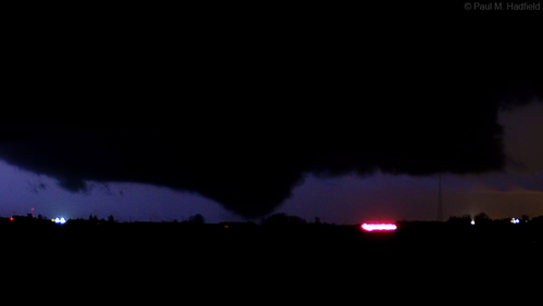
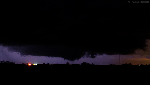
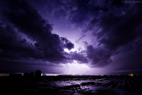
E9B9872B-9122-4B34-B587-5E6D58D5DC78.jpeg 97F6A42D-8BAE-4E1E-8C74-0BCBB29CFA0E.jpeg 878C0609-C82B-4DE3-9DAD-612D53C7F03A.jpeg I haven’t got a chance to edit all my images from this day owing to a hard drive issue on my computer (everything is backed up on multiple drives). Here are a few of my night time images from near Forest City and South Pekin IL. I started the day at my apartment in Macomb IL and headed south toward Mount Sterling. I crossed the warm front near Macomb noting the fog lift just south of the front and temperature soar into the upper 50s. It felt like a true chase day. I headed south with my friend Luke Saegar, we got on the storm southwest of Mount Sterling initially noting a funnel to our SW. The first tornado formed around 2:18pm 9W of Mount Sterling bear the Brown County line. This was a brief tornado with dust under a low funnel. The second was another brief tornado near Mound Station at 2:33pm which featured a funnel nearly fully condensed. Waiting on LSX to confirm these. As I headed north it produced a very nice tornado near Brooklyn IL which lasted for about 6-7 minutes and condensed several times. Saw a couple more brief touchdowns in the Industry area before heading east for the Beardstown storm. Initially saw a tornado south of Astoria IL looking due south before heading into some rough terrain. I saw a large cone/wedge tornado near Bluff City IL to my E where I stopped to film. This tornado was on the ground for nearly 30 min from my vantage point and even appeared to cycle a couple times in what I would consider new tornadoes. Several feeder bands were noted to the ESE of the tornado feeding into the main mesocyclone. Vorticity was very high on this day. I followed it to SE of Lewistown where it dissipated. I headed east and saw a few more tornadoes near Easton, Forest City, and Pekin. I noted a satellite tornado southeast of Forest City that handed off from the Easton tornado (pictured in my photos). I ended my chase in Tazewell county exhausted from what was an incredible chase. I counted at least 8 tornadoes based on my videos and photos. What a day!! Again sorry for the lack of pictures, I’m still working on my computer. Ordered a solid state should be here next week. Had a few more on my phone but it would only let me upload 3 for some reason‍♂️
 
This is obviously late, but I just went through some of my older stuff and just wanted to share my experience of the December 1 outbreak. Quality could´ve been better, but these are just snapshots within videos.

I got a late start because I had to get other things done earlier in the day. Could´ve called the chase off because it was already noon and I was still in Westville Illinois. The love of chasing got the best of me that day. In my head I was like ¨I was born for this stuff, there´s no chance I call this off¨. I knew daylight would become an issue, but it was either chase and give myself a chance, or stay home and have no chance. I took the bait and finally hit the road. At first, we were targeting the storm that produced the Havanna tornado, which was already producing tornadoes while we were still just in Champaign heading west. I knew catching up to that storm would be a tall task, so I pulled into a gas station in Clinton and use the restroom. That rest stop was the turning point in the chase because that is where we realized the a small cell to the southwest was heading in our general direction and I just thought it had all the moisture and instability to work with so we knew it would get stronger. We changed course and headed south and eventually found a country road just a mile or so southeast of Stonnington and sat there to let the storm come to us. I didn´t trust the terrain further south. That spot is where we saw the Taylorville tornado from a distance and eventually the one near Stonnington.

Some of my most memorable chases have been the one´s at night.

53005042_2077839948972385_1658937921308196864_o.jpg
Taylorville.

52803696_2074970775925969_5803958936818155520_n - Edited.jpg
Taylorville.

52940715_2074711835951863_1175589062094880768_n.jpg
Stonnington
52956383_2076343862455327_4514853386578821120_n - Edited.jpg
Multi-vortex, Stonnington.
 
First scene from just north and west of Jacksonville where I was more preoccupied with navigating hills and hollers to offer a more precise location (Meredosia?). Rather than gamble further NW into sketchy territory with poor service as that which is shown had quickly become out of reach, opted to head south down towards what was coming up from Carlinville. Regrettably knew better and should've focused on the latter for not only was it remarkably photogenic with sunset (as later seen via social media) but upon arriving at Taylorville in what could've been a perfect intercept around the back, I ended up falling behind due to downed trees where it crossed 48. Catching up at Stonington, that my pictures from this time are of poor quality seems only fitting for what was an embarrassingly frustrating backyard fail be that the HRRR UD helicity swath nailed this storm. The eventual squall line was a nice consolation. Lesson, don't get suckered into the Illinois River valley when an obvious secondary target exists over much better terrain.

IMG_6727a.png

IMG_6731a.png


Stonington
IMG_6754a.png

IMG_6755a.png

IMG_6760a.png

Post tornadic supercell squall line
IMG_6848a.png

IMG_6873a.png

IMG_6881a.png
 
Back
Top