2017-07-21 REPORTS: IA/IL

Joined
Jan 14, 2011
Messages
3,344
Location
St. Louis
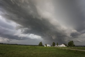
With my weekend starting, I decided to go up to Chicago on Friday to shoot lightning in the city overnight. Models had consistently shown a mature MCS moving over the city after dark, with a trailing stratiform region good for upward lightning strikes to the 3 tallest buildings. On the way there, an isolated storm developed near Dwight, with a visibly very strong, persistent updraft.

Since this storm was entering a diffuse warm frontal zone and the Chicago storms were about 3 hours away, I deviated from the original plan and headed east to intercept the storm. It exceeded my expectations, with a top-5 lightning barrage (many close strikes and about 15-20 wind turbine strikes). During one 10-minute interval, every CG was hitting the wind turbines! When the storm was over the wind farm, more bolts were hitting turbines than hitting the ground.
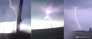
july2117a.jpg
Eventually, the storm began a sustained period of organization as inflow increased and a large RFD surge cut in. Low-level motion into the meso was very rapid, and as the RFD made its way around, a brief small tornado developed with condensation 3/4 of the way to the ground:
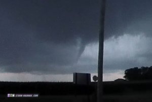
july2117d.jpg

The storm continued to show dramatic structure, though it was increasingly getting choked off by precip falling into the inflow region and increasingly rain-filled RFD.
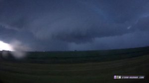
july2117f.jpg

The lightning produced by this storm was in my top 5 in terms of the number and frequency of close strikes. Two of the bolts were within 100 feet. This video is a compilation from the 4 dashcams:


After this storm crossed I-57 and weakened, I continued into Chicago per the original plan. While there were some upward lightning flashes to the buildings, southerly flow brought a thick layer of low clouds over the city that obscured most of the action.
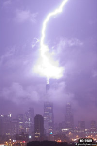
g-7689.jpg

Here is the video from this part of the event:

 
Last edited:
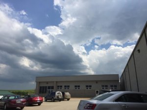
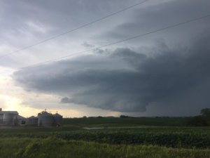
I initially targeted Marshalltown, IA with intent of intercepting supercells that were projected to initiate on a convectively reinforced warm front. I was expecting the warm front to continue to lift northward near hwy 30 as the day progressed, however the outflow from a persistent, large MCS over northeastern IA halted the northward drift and stalled the front along I80 instead. After checking observations in Marshalltown, it became apparent that I was too far northwest due to the aforementioned stall. So I adjusted southeast to the Victor I-80 exit and waited as an increasingly agitated cu field continued to bubble along the boundary and eventually a storm initiated about 5 miles to my south, so I was in prime position.
5a69939165da03de6851a3b094c223ab.jpg

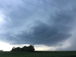
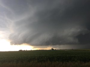
The storm rapidly acquired supercell characteristics aided by its prime position allowing it to ingest the boundary-enhanced vorticity. I got ahead of it and waited to the west of Millersburg as the storm developed a nice, healthy looking base. This picture was taken about 20-25 minutes after the one above.
e6de0a05299164eb133643d5f499575d.jpg

The storm continued to mature as it moved east. This picture was taken 15 minutes later.

921975f234facf29fa19e2f875433670.jpg

The scud under the base quickly consolidated into a healthy wall cloud under a beautifully striated updraft. The storm had picked up a tornado warning at this point and radar presentation continued to improve in sync with the visual presentation.

a8882cd425148eff752405d9908453e8.jpg

8d323b30826c08af53eef962cdfe9d7e.jpg

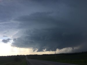
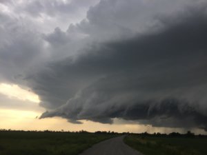
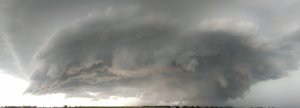
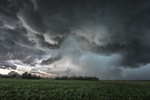
Eventually, a second meso developed behind the first one and fought for dominance and neither really won out. This could be one of the reasons that this storm did not produce a tornado given that it had pretty much everything else in it's favor with the boundary feeding right into the updraft and plenty of moisture to work with. Eventually the storm morphed into an HP supercell and became outflow dominant. I followed it to Muscatine and called the chase as an MCS developed and lacking time to follow deep into IL. First pic was east of Hills, IA as the storm was still inflow dominant with the second meso clearly visible behind it, second is a shelf kicked up by the outflow near Nichols as the storm was well outflow dominant at this point.

6fa7c628790b79e7eacb1910c3b1c741.jpg

bf852300df1eda9b93a42d218c3ecd07.jpg
 
I targeted Iowa City, which turned out to be pretty spot on with the supercell initiating just to the west. I had initially planned to set up further north, but noticed that the outflow from the crapvection to the north was quite robust which was going to keep the warm front from advancing much past I-80 and also decided to hang back further east as there was a ton of elevated convection going up to the WNW along with having a stronger cap in place.
683f43e69de87bdce1467a6ad3047d22.png

Storm organized into a classic supercell fairly quickly along the OFB and produced its first ragged wall cloud:
View attachment a6a91812bca50e32ef1a4eab137a5ed1.jpg

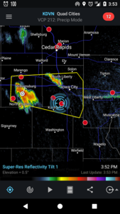
From then on the storm continued to strengthen and I waited patiently in position to intercept any tornado that could be produced by this fairly impressive storm that was quite easy to keep up with due to its storm motion being so slow.
3ce1ef7c6a07bdd72141055a2655a84a.png

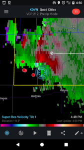
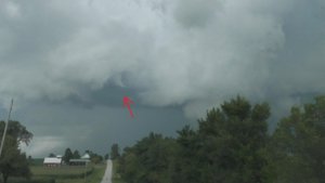
Shortly after that screenshot the storm began exhibiting cyclic supercell characteristics and was sporting two separate mesos for quite a while, but the first meso never quite handed off to the new meso and as a result the two meso's seemed to be fighting eachother for inflow, with neither seeming to be able to become dominant. The original meso did produce a brief funnel, but that was the closest the storm got to producing a tornado:
3eed7349654f2e4e6051942bf096fa59.jpg

Storm continued on to produce good number of very low hanging wall clouds througout the majority of its life.
View attachment ac4b6c5eb16524c297c9be8fb46743a9.jpg

The storm continued doing this for quite a while before becoming outflow dominant. Afterwards, the storm did attempt to reorganize one last time near Lone Tree, IA before its final gust out.
f4435539c15c7e0c5438b27584201e50.jpg
 

Attachments

Last edited:
I was a little behind this day & when I started looking into it there was already a severe warned storm west of Iowa City & decided to just go in blind & go for it. I could see the anvil my whole entire drive from Burlington but due to terrain I never got a good view of the storm until I was nearing Riverside Iowa where I saw an impressive looking wall cloud. I decided to head east of the Riverside Casino and set up for a timelapse & noticed there was a second meso so I tried my best to keep both in the frame & then after that I set up near Lone Tree but couldn't get very good framing due to being next to a grain bin. Here is the timelapse.
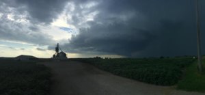
I then continued east & stopped east of Lone Tree where I visually saw the most impressive rotation as I was practically under it. I took a picture but stupidly didn't think to take video.
fb593.jpg
I then continued east & noticed it was gusting out so I decided to stop & start heading to work. I took this last pic south of Muscatine.
fb594.jpg
 
Back
Top