John Farley
Supporter
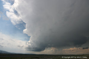
I targeted Las Vegas, NM and saw two nice supercells. The first, near there, began with an LP-ish look and gradually transitioned to classic before merging with other storms and eventually becoming part of a line. There were a couple reports of golfball hail with this storm. Here is a pic from early on:
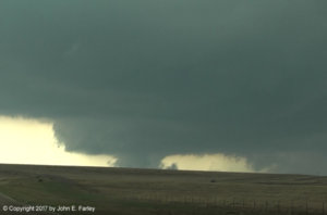
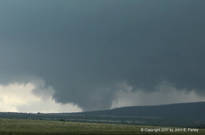
The second storm I was on moved south to the west of Wagon Mound, getting three tornado warnings as it moved from near Ocate to near Valmora, eventually transitioning to HP. I am pretty sure the second lowering posted below was NOT a tornado, as a couple minutes after this capture it broke apart and exhibited little rotation - though I was not so sure about that at the time of the capture. The first one I am less sure about - I think more likely not a tornado than a tornado, but I am not sure. The first capture was shortly after the first tornado warning, looking NW along route 120 between Wagon Mound and Ocate. The second one was during the second tornado warning, farther south looking NW from I-25.
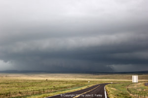
By the time the storm approached Valmora, it had transitioned to HP:
I will post a full report to my Web pages as time permits.

The second storm I was on moved south to the west of Wagon Mound, getting three tornado warnings as it moved from near Ocate to near Valmora, eventually transitioning to HP. I am pretty sure the second lowering posted below was NOT a tornado, as a couple minutes after this capture it broke apart and exhibited little rotation - though I was not so sure about that at the time of the capture. The first one I am less sure about - I think more likely not a tornado than a tornado, but I am not sure. The first capture was shortly after the first tornado warning, looking NW along route 120 between Wagon Mound and Ocate. The second one was during the second tornado warning, farther south looking NW from I-25.


By the time the storm approached Valmora, it had transitioned to HP:

I will post a full report to my Web pages as time permits.
