Quincy Vagell
EF4
My first storm chase of June and it only took eight days... Plus, it was expected to be a relatively low-end day and for the most part, and final observations essentially met expectations.
The target fluttered around between far southwestern Kansas and the Oklahoma/Texas panhandles and I concluded on a starting point of Perryton, TX. The near-term evolution suggested that discrete storm development would focus over the north-central portion of the Texas panhandle, which was somewhat disappointing, since the best low-level shear was displaced to the northeast. (Early CAM solutions favored isolated storm development here, though negligible large scale forcing seemed to write that potential off.)
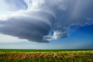
Early stages of an LP supercell near Spearman, TX.
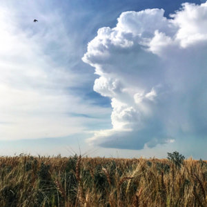
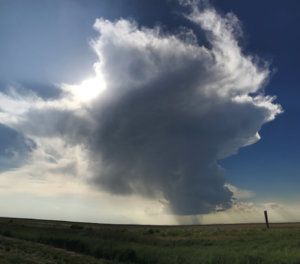
LP, mini-supercell, trying to mature.
A prominent cell developed just southeast of Dumas, but I only slowly made my way in that direction, as another discrete cell was forming closer to my target, near Spearman. The Spearman cell started off as an LP, mini-supercell and although it tried to better organize, it never grew much in size and I darted southwest toward the more robust cell.
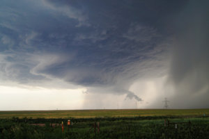
Cycling supercell near Fritch, TX.
On radar, the "better" cell certainly had a more classic look, but it kept cycling in a non-encouraging way (poor low-level rotation and it was outflow-dominant). The visual on the storm wasn't particularly interesting either, so I refrained from getting too excited. The chase did get mildly interesting when a transient horizontal funnel became visible, but the funnel was high-based and lifted only a few minutes later.
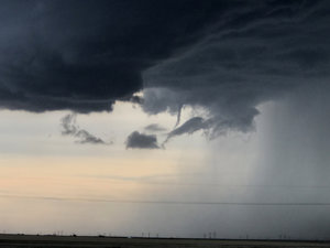
A brief, high-based funnel cloud, just north of Amarillo, TX.
I stayed with the storm into the Amarillo area, but due to city traffic and waning daylight, I called the chase off a bit early. This was around the time that the storm produced very large hail and prolific lightning in the city, but there was no reason to stay with the storm, as I had to return to Oklahoma City for work today.
Overall, the chase was iffy in the first place and I didn't expect to see anything too impressive, and at least I can say I got something this week. I won't be chasing again until next week, but the broken record keeps repeating: the climatological peak of chase season remains largely unimpressive, although there are signs of that changing in the near future.
The target fluttered around between far southwestern Kansas and the Oklahoma/Texas panhandles and I concluded on a starting point of Perryton, TX. The near-term evolution suggested that discrete storm development would focus over the north-central portion of the Texas panhandle, which was somewhat disappointing, since the best low-level shear was displaced to the northeast. (Early CAM solutions favored isolated storm development here, though negligible large scale forcing seemed to write that potential off.)

Early stages of an LP supercell near Spearman, TX.

LP, mini-supercell, trying to mature.
A prominent cell developed just southeast of Dumas, but I only slowly made my way in that direction, as another discrete cell was forming closer to my target, near Spearman. The Spearman cell started off as an LP, mini-supercell and although it tried to better organize, it never grew much in size and I darted southwest toward the more robust cell.

Cycling supercell near Fritch, TX.
On radar, the "better" cell certainly had a more classic look, but it kept cycling in a non-encouraging way (poor low-level rotation and it was outflow-dominant). The visual on the storm wasn't particularly interesting either, so I refrained from getting too excited. The chase did get mildly interesting when a transient horizontal funnel became visible, but the funnel was high-based and lifted only a few minutes later.

A brief, high-based funnel cloud, just north of Amarillo, TX.
I stayed with the storm into the Amarillo area, but due to city traffic and waning daylight, I called the chase off a bit early. This was around the time that the storm produced very large hail and prolific lightning in the city, but there was no reason to stay with the storm, as I had to return to Oklahoma City for work today.
Overall, the chase was iffy in the first place and I didn't expect to see anything too impressive, and at least I can say I got something this week. I won't be chasing again until next week, but the broken record keeps repeating: the climatological peak of chase season remains largely unimpressive, although there are signs of that changing in the near future.
Last edited:

