Ethan Schisler
EF5
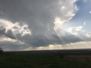
I originally was against chasing this day, so I wrote off the potential near the triple point/dry line in TX/OK/KS. I sat at home most of the day however monitoring radar, around 5 o'clock I noticed several storms firing up north of me near KDVN and further west. The HRRR had been hinting at a corridor of tornadic potential toward dusk in this region including a couple sizable helicity tracks west of Dubuque. So I decided to give it a shot. My first storm of target was just outside of Wilton, Iowa where I followed it to just north of Davenport, Iowa. It had some broad rotation and decent structure, I was able to get a couple still images. There was probably some large hail to the north in the core, I decided to stay out of it though....
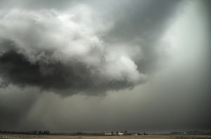
Supercell thunderstorm N of Davenport, IA with decent structure
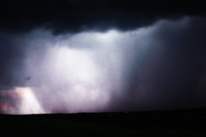
I eventually abandoned that storm in favor of another supercell out west toward DeWitt, Iowa. It literally sat in the same spot for about a half hour and cycled 3 times, producing several wall clouds and a couple funnels. The structure was pretty classic however and the lightning was excellent. I shot numerous still images and managed to get one of the powerful positively charged CG's in my shot as seen below....
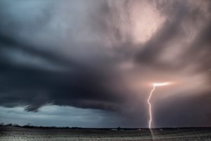
Electrically charged supercell near DeWitt, Iowa at dusk
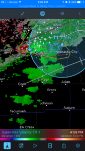
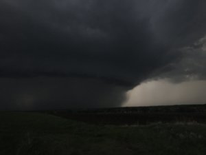
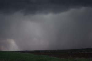
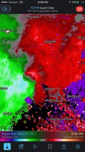
That storm eventually died as well and I headed northwest toward a now tornado warned complex of storms coming out of the Cedar Rapids area. I approached this tornadic circulation as it approached the small town of Anamosa, Iowa. Why it was not tornado warned at this point, I'm not sure, because the couplet and rotation were extremely strong as evidenced by the radarscope image below....
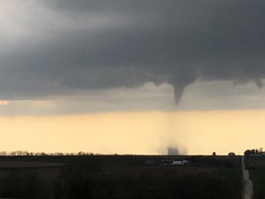
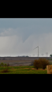
I got out of the car at this point and I could hear a waterfall type roar to the northwest along with HP supercell structure outside the town of Anamosa, Iowa. I got my tripod and sat up and got a few stills when I noticed a cone coming out of the rain. I watched it approach the road ahead of me with a faint debris cloud near the ground, we had a tornado on the ground, probably for a while before I arrived based on radar. Anyway I got hit with RFD winds in excess of 60 mph and had to move. I got caught in the rear flanking core of the supercell and didn't get back out ahead of it until I reached I-80 further east and made my way home.
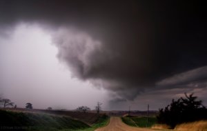
Partially condensed cone tornado with faint debris cloud east of Anamosa, Iowa around 8:55PM and classic RFD.
I tried to get some lightning stills from the complex moving up from the south and later at home around midnight, but that was a fail. Still for not leaving home until around 6 oclock, this was an excellent chase day in my opinion. 3 supercell thunderstorms and a tornado....while not the most picturesque I won't complain.

Supercell thunderstorm N of Davenport, IA with decent structure
I eventually abandoned that storm in favor of another supercell out west toward DeWitt, Iowa. It literally sat in the same spot for about a half hour and cycled 3 times, producing several wall clouds and a couple funnels. The structure was pretty classic however and the lightning was excellent. I shot numerous still images and managed to get one of the powerful positively charged CG's in my shot as seen below....

Electrically charged supercell near DeWitt, Iowa at dusk
That storm eventually died as well and I headed northwest toward a now tornado warned complex of storms coming out of the Cedar Rapids area. I approached this tornadic circulation as it approached the small town of Anamosa, Iowa. Why it was not tornado warned at this point, I'm not sure, because the couplet and rotation were extremely strong as evidenced by the radarscope image below....

I got out of the car at this point and I could hear a waterfall type roar to the northwest along with HP supercell structure outside the town of Anamosa, Iowa. I got my tripod and sat up and got a few stills when I noticed a cone coming out of the rain. I watched it approach the road ahead of me with a faint debris cloud near the ground, we had a tornado on the ground, probably for a while before I arrived based on radar. Anyway I got hit with RFD winds in excess of 60 mph and had to move. I got caught in the rear flanking core of the supercell and didn't get back out ahead of it until I reached I-80 further east and made my way home.

Partially condensed cone tornado with faint debris cloud east of Anamosa, Iowa around 8:55PM and classic RFD.
I tried to get some lightning stills from the complex moving up from the south and later at home around midnight, but that was a fail. Still for not leaving home until around 6 oclock, this was an excellent chase day in my opinion. 3 supercell thunderstorms and a tornado....while not the most picturesque I won't complain.

