2017-03-28 REPORTS: OK/TX

Joined
Jun 16, 2015
Messages
476
Location
Oklahoma City, OK
A long awaited chase day did not disappoint, as there was action in multiple corridors.

I started around Wichita Falls, TX at midday and quickly decided to shoot south into the warm sector. I saw a line of storms in West Texas, but was not thrilled by the tendency for storm mergers and upscale growth into an MCS.

A fairly isolated cell began to rapidly organize southwest of Abilene and that was the storm of my choosing. I was able to get really close, but only saw a ragged lowering upon arrival. The cloud base was very low, only a couple hundred meters AGL, but it barely resembled what most would consider a bonafide wall cloud.

I followed the cell for a bit and even though it looked less impressive on radar with time (at least with respect to tornado potential), a funnel suddenly appeared and briefly lowered to the ground. The tornado was very brief and lifted within seconds.

I stopped in Abilene to review footage and was torn on what to do next...either continue with a cluster of cells north of town (into a favorable environment), or drop south for something more conditional in a strongly unstable air-mass ahead of the dryline. Considering that the southern play was out of the way and would mean a very late arrival back home, I finally caved north. The momentary lapse of judgment probably cost me a tornado that occurred near Stamford. I saw some decent structure, but was not close enough to see anything conclusive.

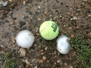
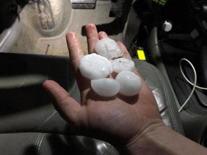
The active portion of the chase reached another peak when I was approaching Goree from the south and suddenly had stray golf balls banging on the car. I abruptly turned around and once the hail subsided, I got out to see what I could find. Little did I know that there were some roughly tennis ball size hailstones widely scattered about. I took a few photos and got back on the storm. I consider myself fortunate that one of the larger stones didn't smash my sunroof or windshield.
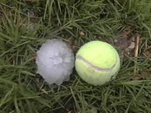
goree_hail_1.jpg goree_hail_2.jpg

The chase was essentially over after the hail investigation, although I did encounter a few icy overpasses that were lightly coated in hail on my way back north. The drive from Wichita Falls to Oklahoma City was very challenging, with constant heavy rain, areas of fog, occasional hail and flash flooding. I basically drove through an MCS for two hours straight before getting home shortly before midnight.
 
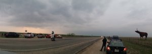
Mid –morning I drew some target forecasts based on both the HRRR and RAP and we left the Dallas area at 1:30 headed to my target of Electra, TX. We stopped in Wichita Falls and it seemed colder than ideal and so we checked surface obs and decided to head southwest to Seymour for better Td. By the time we got to Seymour a storm was TOR warned near Abilene and we moved south on US 183 to Throckmorton. Not wanting to wait for it, we continued to fall south on US 183 towards Albany to see the southern end of the storm. The road network was lacking in the area (really only one good east/west or north/south route every 30 miles). The storm ended up moving a little faster and more north than northeast, so we couldn’t see the action area and went back to Throckmorton and then took 380 west. We pulled off at the chaser convergence at the top of the hill at the World’s Largest Steel Bull statute at US 380 and 236. Sorry about the moving vehicle that messed up the middle of the pano shot – want to include this since it includes the 22 foot bull, the storm, and the chasers. Shot was taken looking west.

20170328_184138_small.jpg

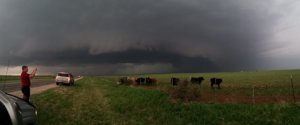
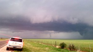
It was by the bull statue that we started to hear the rumors about chasers being killed. We went further west to see better (and get off the high spot given some lighting in the area) and stopped around the Haskell County line where we could see a wall cloud and several updrafts taking up scud. It produced a brief tornado that wasn’t very photogenic. The road network kept us from getting any closer.

20170328_185325_small.jpg

20170328_185400_small.jpg

As the storm moved northeast we went back to Throckmorton and then north on US 183 to Seymour (stopping along the way to measure 2.5 inch hail on the ground). It was dark by this point and we continued to watch several wall clouds to our west. We let them pass north of US 277 and went to Mabelle and then headed north on US 183 for a while. When then dropped back to Seymour and went west past Rock Springs to get a look at another cell. It was messy at this point and the sold line of storms was bearing down on us from the west, so we headed back to Seymour and took TX 114 back towards Dallas. The drive was hard given a very strong head wind or cross wind the entire way. We arrived home about 12:30 AM.

With all the chase adrenalin still in me I couldn’t sleep so I stayed up for a while reading about what had happened near Spur. As the line got into DFW, it got mean, and had 2 strong rotation signatures on radar that where quickly TOR warned to my southwest. Got my wife and kids up and had them get dressed and their shoes on in case we had to make a run for it or shelter in place. My wife wasn’t pleased. I checked into the local Skywarn net. My gut was it would go non tornadic before it got to my house and I was right. They both produced confirmed TOR (one rated EF-0 and the other EF-1) but it fizzled before it got to my house. Only got a brief 50 mph estimated gust at my house, but there was some wind damage just a few miles north of my house (not to mention major damage from 95 mph straight line winds 20 miles to my southeast). I still haven’t looked at my videos. After chasing 3 times in 5 days (over 1,500 miles), I need some rest.
 
A bit of a frustrating chase through a large data hole at one point, then some poor decision making, and difficulty staying with the storm, however I did manage to see the Stamford, TX tornado. Prior to this tornado, there was a strongly rotating wall cloud with an inflow tail developing, and a bowl funnel that looked like an imminent cone, then it just got ragged and dissipated. Seemed pretty odd, but a new wall cloud was forming to the NE, and it was solid. This had probably cut the inflow off to the initial wall cloud. Problem now was that I was behind it, and the road network was not ideal for catching back up. From my position probably 4-5 miles south of the tornado, I had the core of the storm behind the tornado, so my view was pretty low-contrast. It was a good looking tornado, however. Was my first March tornado.


https://huntfortornadoes.wordpress.com/2017/03/30/chase-log-march-28-2017-stamford-tx/
 
Going to cut short and fast with this report since I don't have a lot of time, with school work and everything else. Anyway this was a frustrating, but highly rewarding chase-day in Central Texas. Obviously we all know what happened with the car accident up north in Spur so I won't even get into that, but it had me feeling pretty low most of the day. We dropped south to every storm until we got just outside of Abilene, TX where a long lived cyclic supercell was getting going. I observed 3 tornadoes from this storm from outside Hawley to near Stamford, TX. One of which looked quite violent to me and was on the ground nearly 15 minutes and highly photogenic. Actually this was probably one of the best tornadoes from a photography standpoint that I've seen in my 9 seasons of storm chasing. The one near Hawley also looked strong as well with a horizontal vortex, multiple-vortices, and a lot of debris in the air. There was a brief tornado touchdown with a second mesocyclone between the Hawley and Stamford tornado cycles. I only had time to process a couple images for this report, so I figured I would leave them here. We managed to get quite close to both of the significant tornadoes, so an incredible chase day despite the circumstances that occurred just hours earlier.

9f7a10fa6810df35664589fa4df1c798.jpg
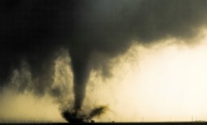
The strong-violent Stamford/Avoca, TX tornado that was on the ground for 10-15 minutes, during its beginning to mid stages. The near ground cyclonic motion was some of the more impressive I've seen along with the debris and dirt being centrifuged from the main vortex, similar to many other significant tornadoes.

d24c1cd95769c6e91fb75a20a49adee8.jpg
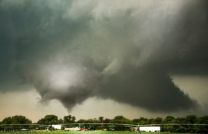
The start of a 5 minute tornado near Hawley, TX that also appeared quite strong with classic supercell structure. I have other images of this tornado showing the impressive multiple-vortex stage and horizontal vortices that it exhibited. It also lofted quite a bit of debris in the air.

We later observed 2-2.50" hail with a supercell near Seymour, TX after dark and a wall cloud, however it never produced any tornadoes.

b544d8894f43e5a769cdbd2af5ed0cfc.jpg

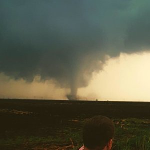
And just for the heck of it, a buddy of mine took a tornado photo with me in the foreground, I had my face turned from the camera because I was watching the tornado lol.

79145378531a588db5425b9199c8cd33.jpg
 
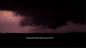
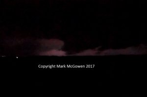
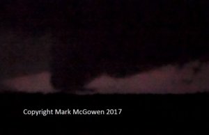
CRMab6.jpg CRMab10.jpg CRMab15.jpg I took these video stills later that evening. I saw this lightning-illuminated lowering and possible tornado from Seymour, TX, off Highway 82/277 looking towards Mabelle and Dundee. The stills were taken at the local times of 8:17, 8:19, and 8:21 p.m. respectively. I was wondering if any other spotter or chaser saw this that night.
 
I will have to go back through my photos and video. I saw on the Seymour storm at that particular storm and only remember seeing a low wall cloud and some very large hail. Interesting photos though!!
 
Back
Top