Robert Forry
EF3
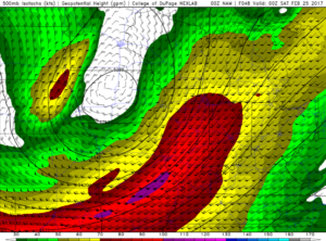
An early season severe weather event is on tap for much of the lower Great Lakes this Friday afternoon and evening. An upper level, positively tilted trough is progged to move out of the central Plains through the day Thursday with 90-100 kt jet core. A surface low will develop in advance of this over the MO/IA border with a warm front extending eastward into southeastern Ontario, and a trailing cold front and dryline extending south into the mid-MS Valley.
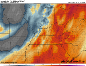
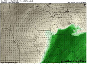
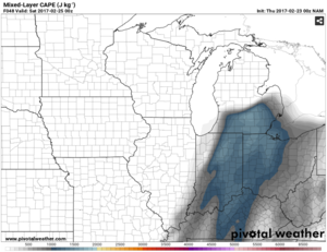
The area south of the warm front is forecast to have surface dews ranging from the mid to upper 50s in southern MI to the low 60s back into IN with MLCAPE values in the lower 1000 in places. SRH values are also modest in the warm sector in the low and mid levels with upwards of 50 kts of Bulk Shear.
SPC upgraded most of the warm sector from MRGL to EHN on Day 3 and mentions all storm modes possible in this mornings SWODY2.
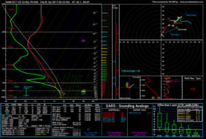
A concerning factor for me when looking at this system are the S shaped VBVish looking hodographs showing up in the areas east of where the CF will move through that I've reviewed the last several runs of the NAM and GFS. It wouldn't stop me from chasing as this in my back yard, but just something to consider seeing those effect some of the early season sever weather events last spring.
Things look to line out into a squall after dark as the CF pushes east into the the northern Appalachians.
Sounding (SE lower MI)
Surface Dews
MLCAPE
H5 winds

The area south of the warm front is forecast to have surface dews ranging from the mid to upper 50s in southern MI to the low 60s back into IN with MLCAPE values in the lower 1000 in places. SRH values are also modest in the warm sector in the low and mid levels with upwards of 50 kts of Bulk Shear.
SPC upgraded most of the warm sector from MRGL to EHN on Day 3 and mentions all storm modes possible in this mornings SWODY2.
A concerning factor for me when looking at this system are the S shaped VBVish looking hodographs showing up in the areas east of where the CF will move through that I've reviewed the last several runs of the NAM and GFS. It wouldn't stop me from chasing as this in my back yard, but just something to consider seeing those effect some of the early season sever weather events last spring.
Things look to line out into a squall after dark as the CF pushes east into the the northern Appalachians.
Sounding (SE lower MI)

Surface Dews

MLCAPE

H5 winds
